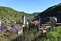
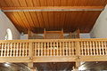
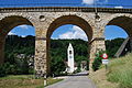
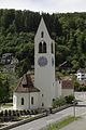
Category:Church of Rümlingen
| Object location | | View all coordinates using: OpenStreetMap |
|---|
church buildings in Rümlingen in the canton of Basel-Landschaft, Switzerland   | |||||
| Upload media | |||||
| Instance of | |||||
|---|---|---|---|---|---|
| Part of | |||||
| Location | Rümlingen, Sissach District, Basel-Landschaft, Switzerland | ||||
| Street address |
| ||||
| Has part(s) |
| ||||
| Heritage designation | |||||
 | |||||
Media in category "Church of Rümlingen"
The following 57 files are in this category, out of 57 total.
-
 Am Eisenbahnviadukt Rümlingen.jpg 2,304 × 3,456; 4.24 MB
-
 Blick auf Rümlingen.jpg 3,456 × 2,304; 4.31 MB
-
 Eisenbahnviadukt Rümlingen.jpg 3,456 × 2,304; 4.15 MB
-
 Ruemlingen preghejo 230.JPG 2,592 × 3,872; 2.93 MB
-
 Ruemlingen preghejo 233.JPG 2,592 × 3,872; 3.97 MB
-
 Ruemlingen preghejo 236.JPG 3,872 × 2,592; 3.18 MB
-
 Ruemlingen preghejo 237.JPG 3,872 × 2,592; 3.22 MB
-
 Ruemlingen preghejo 238.JPG 3,872 × 2,592; 4.09 MB
-
 Ruemlingen preghejo kaj viadukto 221.JPG 3,872 × 2,592; 4.66 MB
-
 Ruemlingen preghejo kaj viadukto 226.JPG 3,872 × 2,592; 4.56 MB
-
 Ruemlingen preghejo kaj viadukto 227.JPG 3,872 × 2,592; 4.58 MB
-
 Ruemlingen-Viadukt.jpg 800 × 533; 168 KB
-
 Rümlingen Kirche P6A8219.jpg 3,840 × 5,760; 6.8 MB
-
 Rümlingen Kirche P6A8221.jpg 3,840 × 5,760; 7.39 MB
-
 Rümlingen Kirche P6A8230.jpg 5,760 × 3,840; 8.64 MB
-
 Rümlingen Kirche P6A8287.jpg 3,840 × 5,760; 6.55 MB
-
 Rümlingen Kirche P6A8288.jpg 3,840 × 5,760; 6.59 MB
-
 Rümlingen Kirche P6A8303.jpg 3,840 × 5,760; 7.12 MB
-
 Rümlingen Kirche P6A8305.jpg 3,840 × 5,760; 7.32 MB
-
 Rümlingen Kirche P6A8306.jpg 3,840 × 5,760; 7.41 MB
-
 Rümlingen Kirche P6A8309.jpg 5,760 × 3,840; 4.75 MB
-
 Rümlingen Kirche P6A8311.jpg 3,840 × 5,760; 7.41 MB
-
 Rümlingen Kirche P6A8318.jpg 3,840 × 5,760; 7.56 MB
-
 Rümlingen Kirche P6A8320.jpg 3,840 × 5,760; 7.83 MB
-
 Rümlingen Kirche P6A8321.jpg 3,840 × 5,760; 7.39 MB
-
 Rümlingen Kirche P6A8325.jpg 3,840 × 5,760; 6.26 MB
-
 Rümlingen Kirche P6A8326.jpg 3,840 × 5,760; 6.49 MB
-
 Rümlingen Kirche P6A8330.jpg 3,840 × 5,760; 6.45 MB
-
 Rümlingen Kirche P6A8331.jpg 3,840 × 5,760; 6.58 MB
-
 Rümlingen Kirche P6A8333.jpg 3,840 × 5,760; 6.05 MB
-
 Rümlingen Kirche P6A8334.jpg 3,840 × 5,760; 5.88 MB
-
 Rümlingen Kirche P6A8336.jpg 3,840 × 5,760; 5.94 MB
-
 Rümlingen Kirche P6A8337.jpg 3,840 × 5,760; 5.99 MB
-
 Rümlingen Kirche P6A8339.jpg 3,840 × 5,760; 5.92 MB
-
 Rümlingen Kirche P6A8396.jpg 3,840 × 5,760; 7.7 MB
-
 Rümlingen Kirche P6A8399.jpg 3,840 × 5,760; 7.77 MB
-
 Rümlingen Kirche P6A8402.jpg 3,840 × 5,760; 7.74 MB
-
 Rümlingen Kirche P6A8403.jpg 3,840 × 5,760; 7.97 MB
-
 Rümlingen Kirche P6A8408.jpg 3,840 × 5,760; 6.76 MB
-
 Rümlingen Kirche P6A8409.jpg 3,840 × 5,760; 6.58 MB
-
 Rümlingen Kirche P6A8411.jpg 3,840 × 5,760; 7 MB
-
 Rümlingen Kirche P6A8412.jpg 3,840 × 5,760; 7.14 MB
-
 Rümlingen Kirche P6A8419.jpg 3,840 × 5,760; 7.97 MB
-
 Rümlingen Kirche P6A8438.jpg 3,840 × 5,760; 7.59 MB
-
 Rümlingen Kirche P6A8516.jpg 3,840 × 5,760; 7.38 MB
-
 Rümlingen Kirche P6A8517.jpg 3,840 × 5,760; 7.33 MB
-
 Rümlingen Kirche P6A8519.jpg 3,840 × 5,760; 7.29 MB
-
 Rümlingen Kirche P6A8520.jpg 3,840 × 5,760; 7.41 MB
-
 Rümlingen Kirche P6A8524.jpg 3,840 × 5,760; 6.84 MB
-
 Rümlingen Kirche Viadukt und IC2000 1K4A7747.jpg 8,688 × 5,792; 26.09 MB
-
 Rümlingen Viadukt 4075934.jpg 4,032 × 3,024; 6.76 MB
-
 Rümlingen Viadukt 4075937.jpg 4,032 × 3,024; 6.73 MB
-
 Rümlingen Viadukt 4075939.jpg 3,024 × 4,032; 7.35 MB
-
 Rümlingen Viadukt 4075942.jpg 4,032 × 3,024; 7.95 MB
-
 Rümlingen Viadukt 4075944.jpg 4,032 × 3,024; 7.31 MB
-
 Rümlingen Viadukt P6A8376.jpg 5,760 × 3,840; 5.98 MB
-
 SBB Historic A 3-5 705 Rümlingen Viaduct.jpg 5,526 × 3,410; 3.7 MB


