Category:City of New York Board of Estimate Height District Map
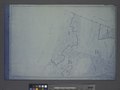
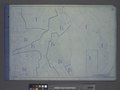
Pages from: City of New York. Board of Estimate and Apportionment. Height District Map. (New York: 1916 [date labeled "questionable" by source]), comprising the cover, "Designations and Rules" page, and map index (all missing from this category), plus 35 sections (maps) (two missing from this category); all are double-page except the index map.
Online at The New York Public Library Digital Collections website, Height district map [1916?].
Media in category "City of New York Board of Estimate Height District Map"
The following 33 files are in this category, out of 33 total.
-
 Height District Map Section No. 1 NYPL1637896.tiff 7,230 × 5,428; 112.28 MB
-
 Height District Map Section No. 2 NYPL1637897.tiff 7,230 × 5,428; 112.28 MB
-
 Height District Map Section No. 3 NYPL1637898.tiff 7,230 × 5,428; 112.28 MB
-
 Height District Map Section No. 4 NYPL1637899.tiff 7,230 × 5,428; 112.28 MB
-
 Height District Map Section No. 5 NYPL1637900.tiff 7,230 × 5,428; 112.28 MB
-
 Height District Map Section No. 6 NYPL1637901.tiff 7,230 × 5,428; 112.28 MB
-
 Height District Map Section No. 7 NYPL1637902.tiff 7,230 × 5,428; 112.28 MB
-
 Height District Map Section No. 10 NYPL1637905.tiff 7,230 × 5,428; 112.28 MB
-
 Height District Map Section No. 11 NYPL1637906.tiff 7,230 × 5,428; 112.28 MB
-
 Height District Map Section No. 12 NYPL1637907.tiff 7,230 × 5,428; 112.28 MB
-
 Height District Map Section No. 13 NYPL1637908.tiff 7,230 × 5,428; 112.28 MB
-
 Height District Map Section No. 14 NYPL1637909.tiff 7,230 × 5,428; 112.28 MB
-
 Height District Map Section No. 15 NYPL1637910.tiff 7,230 × 5,428; 112.28 MB
-
 Height District Map Section No. 16 NYPL1637911.tiff 7,230 × 5,428; 112.28 MB
-
 Height District Map Section No. 17 NYPL1637912.tiff 7,230 × 5,428; 112.28 MB
-
 Height District Map Section No. 18 NYPL1637913.tiff 7,230 × 5,428; 112.28 MB
-
 Height District Map Section No. 19 NYPL1637914.tiff 7,230 × 5,428; 112.28 MB
-
 Height District Map Section No. 20 NYPL1637915.tiff 7,230 × 5,428; 112.28 MB
-
 Height District Map Section No. 21 NYPL1637916.tiff 7,230 × 5,428; 112.28 MB
-
 Height District Map Section No. 22 NYPL1637917.tiff 7,230 × 5,428; 112.28 MB
-
 Height District Map Section No. 23 NYPL1637918.tiff 7,230 × 5,428; 112.28 MB
-
 Height District Map Section No. 24 NYPL1637919.tiff 7,230 × 5,428; 112.28 MB
-
 Height District Map Section No. 25 NYPL1637920.tiff 7,230 × 5,428; 112.28 MB
-
 Height District Map Section No. 26 NYPL1637921.tiff 7,230 × 5,428; 112.28 MB
-
 Height District Map Section No. 27 NYPL1637922.tiff 7,230 × 5,428; 112.28 MB
-
 Height District Map Section No. 28 NYPL1637923.tiff 7,230 × 5,428; 112.28 MB
-
 Height District Map Section No. 29 NYPL1637924.tiff 7,230 × 5,428; 112.28 MB
-
 Height District Map Section No. 30 NYPL1637925.tiff 7,230 × 5,428; 112.28 MB
-
 Height District Map Section No. 31 NYPL1637926.tiff 7,230 × 5,428; 112.28 MB
-
 Height District Map Section No. 32 NYPL1637927.tiff 7,230 × 5,428; 112.28 MB
-
 Height District Map Section No. 33 NYPL1637928.tiff 7,230 × 5,428; 112.28 MB
-
 Height District Map Section No. 34 NYPL1637929.tiff 7,230 × 5,428; 112.28 MB
-
 Height District Map Section No. 35 NYPL1637930.tiff 7,230 × 5,428; 112.28 MB