Category:Columbia River Basalt Group
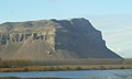
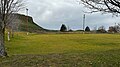
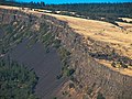
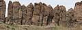
English: The Columbia River Basalt Group is a geological formation that occurs in the Columbia Plateau, in the U.S. states of Washington, Oregon, and Idaho.
continental flood basalt province in the Western United States | |||||
| Upload media | |||||
| Instance of |
| ||||
|---|---|---|---|---|---|
| Location |
| ||||
| Has part(s) |
| ||||
| |||||
Subcategories
This category has the following 15 subcategories, out of 15 total.
Pages in category "Columbia River Basalt Group"
This category contains only the following page.
Media in category "Columbia River Basalt Group"
The following 45 files are in this category, out of 45 total.
-
 3-Devils-grade-Moses-Coulee-Cattle-Feed-Lot-PB110016.JPG 1,694 × 1,409; 670 KB
-
 Agatha Tower at Frenchman Coulee.jpg 1,500 × 1,000; 1.79 MB
-
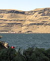
 Basalt Bluff near Wanapum Dam, WA.jpg 2,479 × 1,479; 1.8 MB
-
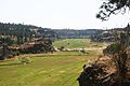
 Butte Park soccer field.jpeg 4,032 × 2,268; 3.84 MB
-
 Cobble Beach at Yaquina Head in Oregon 2.jpg 2,048 × 1,536; 2.7 MB
-
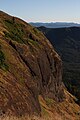
 Columbia Gorge, Washington side (4332510177).jpg 1,024 × 770; 438 KB
-
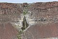
 Columbia River Basalt Group 1805.JPG 4,272 × 2,848; 5.44 MB
-
 Columbia River Basalt Group 1806.JPG 4,272 × 2,848; 6.16 MB
-
 Columbia River Basalt Group 1808.JPG 4,272 × 2,848; 6.35 MB
-
 Columbia River Basalt Group 1930.JPG 2,848 × 4,272; 6.41 MB
-
 Columbia River Basalt Group 1935.JPG 4,272 × 2,848; 5.76 MB
-
 Columbia River Basalt Group 1943-4 panorama.jpg 7,113 × 2,655; 6.35 MB
-
 Columbia River Basalt Group 1943.JPG 4,272 × 2,848; 6.32 MB
-
 Columbia River Basalt Group 1944.JPG 4,272 × 2,848; 6.52 MB
-
 Columbia River Basalt Group 1946.JPG 4,272 × 2,848; 5.05 MB
-
 Columbia River Basalt Group 1948.JPG 4,272 × 2,848; 7.28 MB
-
 Columbia River Basalt Group 1989.JPG 4,272 × 2,848; 5.88 MB
-
 Columbia River Basalt Group 2094.JPG 4,272 × 2,848; 5.92 MB
-
 Columbia River Basalt Group 2641.JPG 4,272 × 2,848; 8.75 MB
-
 Columbia River Basalt Group 3410.JPG 4,272 × 2,848; 6.64 MB
-
 Columbia River Basalt Group 3601.JPG 4,272 × 2,848; 6.93 MB
-
 Columbia River Basalt Group 3602.JPG 2,848 × 4,272; 6.99 MB
-
 Columbia River Basalt Group 3605.JPG 4,272 × 2,848; 5.28 MB
-
 Columbia River Basalt Group 3606.JPG 2,848 × 4,272; 5.45 MB
-
 Columbia River Basalt Group 3607.JPG 2,848 × 4,272; 6.61 MB
-
 Columbia River Basalt Group 3611.JPG 4,272 × 2,848; 6.99 MB
-
 Columbia River Basalt Group 3612.JPG 4,272 × 2,848; 6.34 MB
-
 Columbia River Basalt Group 3634.JPG 4,272 × 2,848; 5.9 MB
-
 Columbia River Basalt Group 7942.JPG 4,272 × 2,848; 6.42 MB
-
 Columbia River Basalt Group 7949.JPG 4,272 × 2,848; 5.28 MB
-
 Dikes above Basalt as bridge over Grande Ronde IMG 4556.jpg 3,888 × 2,592; 4.62 MB
-
 Echo Basin & camera.jpg 1,500 × 1,000; 1.42 MB
-
Echo Basin.ogv 18 s, 1,920 × 1,088; 32.82 MB
-
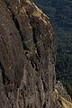
 Flickr - brewbooks - Cliff near Vantage, Washington.jpg 2,048 × 1,536; 739 KB
-
 Flood Basalt Map.jpg 1,152 × 720; 138 KB
-
 Frenchman Coulee banner.JPG 4,272 × 614; 1.38 MB
-
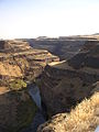
 Hole in the Ground Coulee.jpg 3,888 × 2,592; 3.75 MB
-
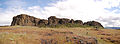 Horsethief Butte Panorama.jpg 4,655 × 1,722; 4.08 MB
-
 Multnomah Falls at Columbia River Gorge National Scenic Area in Oregon 1.jpg 2,048 × 1,536; 3.34 MB
-
 Palouse Falls (18022167611) (2).jpg 6,000 × 3,376; 3.4 MB
-
 Palouse Falls (2009-05-30).jpg 1,800 × 1,200; 2.69 MB
-
 Palouse Falls (5922078877).jpg 5,173 × 3,432; 12.72 MB
-
 Palouse Falls in Eastern Washington.jpg 2,816 × 2,112; 1.13 MB
-
 Palouse-Canyon-Washington-State.jpg 1,488 × 1,984; 674 KB
-
 Wallula-Gap-Looking-West.JPG 1,326 × 1,601; 595 KB


.jpg)


_(2).jpg)
.jpg)
.jpg)


