Category:Cominotto (island)
| Object location | | View all coordinates using: OpenStreetMap |
|---|
island  | |||||
| Upload media | |||||
| Instance of | |||||
|---|---|---|---|---|---|
| Part of | |||||
| Location | Sicily, Italy | ||||
| Located in or next to body of water | |||||
| Width |
| ||||
| Length |
| ||||
| Population |
| ||||
| Area |
| ||||
| Elevation above sea level |
| ||||
 | |||||
Media in category "Cominotto (island)"
The following 50 files are in this category, out of 50 total.
-
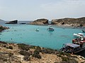
 Blue Lagoon - panoramio - pudina.jpg 3,488 × 2,616; 2.17 MB
-
 Blue Lagoon and Cominotto.JPG 2,592 × 1,944; 866 KB
-
 Blue Lagoon Comino - panoramio.jpg 2,816 × 2,112; 2.7 MB
-
 Blue Lagoon, Comino.jpg 2,816 × 2,112; 2.07 MB
-
 Catamaran-Spirit-of-Malta-DSC 0362.jpg 2,000 × 3,008; 2.97 MB
-
 Comino Island (52625876658).jpg 5,184 × 3,456; 7.28 MB
-
 Comino-Kavernoj 006.jpg 1,200 × 1,600; 552 KB
-
 Comino-Kavernoj 992.jpg 1,200 × 1,600; 566 KB
-
 Comino-Kavernoj 995.jpg 1,200 × 1,600; 593 KB
-
 Comino-Kavernoj 996.jpg 1,200 × 1,600; 576 KB
-
 CominoBlueLagoon.jpg 13,520 × 2,716; 9.72 MB
-
 Cominotto2007.jpg 1,000 × 750; 731 KB
-
 DIMG 0959 (4996486109).jpg 5,616 × 2,796; 12.08 MB
-
 DIMG 0981 (4997103586).jpg 4,424 × 2,344; 7.93 MB
-
 Get Out and Kayak Malta Resting at Kemmunett Beach, Kemmuna, Malta.jpg 2,048 × 1,797; 2.87 MB
-
Malta - Cominotto + Small Blue Lagoon Rock + Blue Lagoon (Comino) 01 (0) ies.webm 26 s, 1,920 × 1,080; 17.66 MB
-
 Malta - Ghajnsielem - Comino (Keppel) 02 ies.jpg 5,616 × 3,744; 16.91 MB
-

-

-

-
 Malta - Ghajnsielem - Comino + St. Mary's Tower + Blue Lagoon + Cominotto (Keppel) 01 ies.jpg 5,616 × 3,744; 21.46 MB
-
 Malta - Ghajnsielem - Cominotto (Keppel) 01 ies.jpg 5,616 × 3,744; 20.74 MB
-
 Malta - Ghajnsielem - Cominotto (Keppel) 02 ies.jpg 5,616 × 3,744; 18.34 MB
-
 Malta - Ghajnsielem - Cominotto (Keppel) 03 ies.jpg 5,616 × 3,744; 19.17 MB
-
 Malta - Ghajnsielem - Cominotto (Keppel) 04 ies.jpg 5,616 × 3,744; 15.48 MB
-
 Malta - Ghajnsielem - Cominotto (Keppel) 05 ies.jpg 5,616 × 3,744; 11.94 MB
-
 Malta - Ghajnsielem - Cominotto (Keppel) 06 ies.jpg 5,616 × 3,744; 17.42 MB
-
 Malta - Ghajnsielem - Cominotto (Keppel) 07 ies.jpg 5,616 × 3,744; 20.28 MB
-
 Malta - Ghajnsielem - Cominotto (Keppel) 08 ies.jpg 5,616 × 3,744; 16.43 MB
-
 Malta - Ghajnsielem - Cominotto + Blue Lagoon (Comino) 01 ies.jpg 5,616 × 3,744; 14.74 MB
-
 Malta - Ghajnsielem - Cominotto + Blue Lagoon (Comino) 02 ies.jpg 5,616 × 3,744; 17.45 MB
-
 Malta - Ghajnsielem - Cominotto + Blue Lagoon (Comino) 03 ies.jpg 5,616 × 3,744; 15.94 MB
-
 Malta - Ghajnsielem - Cominotto + Blue Lagoon (Comino) 04 ies.jpg 5,616 × 3,744; 14 MB
-
 Malta - Ghajnsielem - Cominotto + Blue Lagoon (Comino) 05 ies.jpg 5,616 × 3,744; 15.22 MB
-
 Malta - Ghajnsielem - Cominotto + Small Blue Lagoon Rock + Blue Lagoon (Keppel) 01 ies.jpg 5,616 × 3,744; 11.28 MB
-
 Malta - Mellieha - Cirkewwa Harbour + Gozo + Cominotto + Comino (St. Agatha's Tower) 01 ies.jpg 5,616 × 3,744; 11.35 MB
-
 Malta - Mellieha - Cirkewwa Harbour + Gozo + Cominotto + Comino (St. Agatha's Tower) 02 ies.jpg 5,616 × 3,744; 12.24 MB
-
 Malta - Mellieha - Cirkewwa Harbour + Gozo + Cominotto + Comino (Triq tad-Dahar) 01 ies.jpg 5,616 × 3,744; 9.83 MB
-
 Malta Blue Lagoon.JPG 2,048 × 1,536; 665 KB
-
 Malta-Blue-Lagoon-DSC 0369.jpg 3,008 × 2,000; 4.95 MB
-
 Mt comino blue.jpg 674 × 459; 70 KB
-
 Sudika Kemmunet.jpg 1,600 × 800; 458 KB
-
 The Blue Lagoon, Malta 07.jpg 4,032 × 3,024; 2.27 MB
-
 Triq Kemmuneti, Malta - panoramio (1).jpg 3,648 × 2,736; 4.16 MB
-
 Triq Kemmuneti, Malta - panoramio (2).jpg 4,912 × 1,080; 2.41 MB
-
 Triq Kemmuneti, Malta - panoramio (3).jpg 4,912 × 1,080; 2.59 MB
-
 Triq Kemmuneti, Malta - panoramio (4).jpg 2,592 × 1,936; 1.7 MB
-
 Triq Kemmuneti, Malta - panoramio (5).jpg 2,592 × 1,936; 2.05 MB
-
 Triq Kemmuneti, Malta - panoramio.jpg 3,648 × 2,736; 4.2 MB
-
 View-Gozo-DSC 0156.jpg 3,008 × 2,000; 5.55 MB


.jpg)


.jpg)
.jpg)

_02_ies.jpg)
_01_ies.jpg)


_01_ies.jpg)
_01_ies.jpg)
_02_ies.jpg)
_03_ies.jpg)
_04_ies.jpg)
_05_ies.jpg)
_06_ies.jpg)
_07_ies.jpg)
_08_ies.jpg)
_01_ies.jpg)
_02_ies.jpg)
_03_ies.jpg)
_04_ies.jpg)
_05_ies.jpg)
_01_ies.jpg)
_01_ies.jpg)
_02_ies.jpg)
_01_ies.jpg)


.jpg)
.jpg)
.jpg)


.jpg)
.jpg)