Category:Creeks in Virginia
States of the United States: Alabama · Alaska · Arizona · Arkansas · California · Colorado · Delaware · Florida · Georgia · Idaho · Illinois · Indiana · Iowa · Kansas · Kentucky · Louisiana · Maine · Maryland · Minnesota · Mississippi · Missouri · Montana · Nevada · New Jersey · New York · North Carolina · Ohio · Oklahoma · Oregon · Pennsylvania · South Dakota · Tennessee · Texas · Utah · Virginia · Washington · West Virginia · Wisconsin · Wyoming
Subcategories
This category has the following 9 subcategories, out of 9 total.
B
- Barbours Creek (2 F)
C
- Craig Creek (2 F)
L
- Little Stony Creek (1 F)
M
- Maps of creeks in Virginia (6 F)
P
S
- Stroubles Creek (5 F)
W
- Wilson Creek (Virginia) (7 F)
Media in category "Creeks in Virginia"
The following 31 files are in this category, out of 31 total.
-
 130423-A-ON889-007 (Bennett’s Creek dredging) (12289470324).jpg 3,456 × 5,184; 7.79 MB
-
 130423-A-ON889-031 (Bennetts Creek dredging) (12289471484).jpg 5,184 × 3,456; 8.16 MB
-
 Allens Branch watercourse.jpg 3,264 × 2,448; 4.03 MB
-
 American malacological bulletin (1987) (17533779904).jpg 2,382 × 1,026; 190 KB
-
 Anderson Creek, Goochland.jpg 3,200 × 2,400; 1,022 KB
-
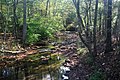 Barbours Creek, near Va 617, 15 oct 15.jpg 5,616 × 3,744; 8.62 MB
-
 Battery Creek Virginia.jpg 3,264 × 2,448; 2.91 MB
-
 Benges Branch.jpg 4,032 × 3,024; 5.06 MB
-
 Bloody Run creek.jpg 3,872 × 2,125; 1 MB
-
 Brandy Branch.jpg 2,964 × 2,300; 1,024 KB
-
 C & O canal.jpg 4,032 × 2,268; 5.09 MB
-
 Catie & Jessica on Taskinas (6021945359) (2).jpg 4,288 × 3,216; 2.98 MB
-

-
 Deep Creek Locks (9817627056).jpg 1,200 × 1,600; 461 KB
-
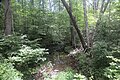
 Dry Run, near Little Dry Run Wilderness on State Route 21, south of Speedwell, Virginia.jpg 4,336 × 3,743; 3.89 MB
-
 Falling Creek Chesterfield.jpg 1,846 × 1,020; 1.56 MB
-
 Flippen Creek.jpg 3,155 × 2,330; 1,022 KB
-

-
 I 81 Interstate 81 - Virginia (6321659545).jpg 2,816 × 2,112; 421 KB
-
 Lick Creek, Virginia.jpg 5,616 × 3,744; 6.74 MB
-
 Little Tomahawk Creek.jpg 4,032 × 3,024; 975 KB
-
 Little Wolf Creek footbridge on the Appalachian Trail near Bastian, Virginia LCCN2011631217.tif 7,431 × 5,927; 126.04 MB
-
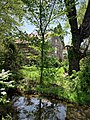 Opequon Creek and the Glass-Rinker-Cooper Mill.jpg 1,536 × 2,048; 1.86 MB
-
 Pocoshock Creek.jpg 3,657 × 2,566; 1,002 KB
-
 Shawvers Run, from Va 607, 15 oct 17.jpg 5,616 × 3,744; 8.27 MB
-
 Swamp skimboarding - Black Haw Branch.jpg 5,472 × 3,648; 6.25 MB
-
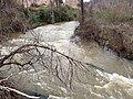 Swollen Falling Creek.jpg 4,032 × 3,024; 3.83 MB
-
-
 Tuckahoe Creek (Henrico and Goochland Counties, Virginia).jpg 3,024 × 3,024; 1.67 MB
-
 Fisherman walking up the creek at Douthat State Park Virginia (18953997315).jpg 2,464 × 1,632; 3.24 MB
-
 York River marsh and Taskinas Creek.jpg 5,472 × 3,648; 10.53 MB
_(12289470324).jpg)
_(12289471484).jpg)

_(17533779904).jpg)


_(2).jpg)

.jpg)


.jpg)


_(14782549773).jpg)
.jpg)
.jpg)
