Category:Cycling maps of the United States
Media in category "Cycling maps of the United States"
The following 21 files are in this category, out of 21 total.
-
 Atlantic Coast Bicycle Route.png 1,000 × 2,000; 192 KB
-
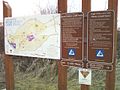 BCLPTrails.jpg 640 × 480; 71 KB
-
 BCTBCGmap.JPG 640 × 480; 50 KB
-
 Bikeable-map-3.jpg 2,000 × 1,424; 195 KB
-
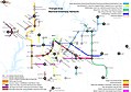 BikeMetroMapResearchTriangle2017.jpg 7,950 × 5,596; 3.03 MB
-
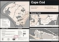 Cape Cod National Seashore, Massachusetts, bicycle trails LOC 97687169.jpg 4,924 × 3,544; 2.28 MB
-
 Colorado bicycle route map - DPLA - 8ed5fe8500354e1a21d4cbce3c37a53b.jpg 9,000 × 6,805; 4.97 MB
-
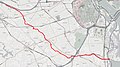
 CustisTrail.jpg 706 × 590; 453 KB
-
 Cycle Oregon 2012 (7967879988).jpg 3,000 × 4,000; 2.6 MB
-
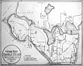
 DC Cycling Map 1884.jpg 1,666 × 1,085; 323 KB
-
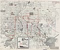 Denver bicycle map - DPLA - ca4d95ee97434bc4a5738bac2271dce7.jpg 9,000 × 7,505; 10.16 MB
-
 Denver bikeway system - DPLA - 7924eae90a3c72a2e9115f70f03401c6.jpg 9,000 × 5,778; 7.64 MB
-
 FourMileRunTrail.jpg 1,703 × 954; 661 KB
-
 Guide map to Seattle bicycle paths, probably 1900 (SEATTLE 5895).jpg 768 × 613; 86 KB
-
 HolmesRunTrail.jpg 1,047 × 845; 637 KB
-
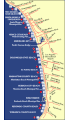 Lasouthbaybiketrail.gif 285 × 527; 46 KB
-
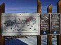
 NPS cape-cod-biking-nauset-trail.jpg 1,194 × 594; 111 KB
-
 NPS national-mall-bike-map.jpg 3,810 × 2,303; 2.49 MB
-
 OpenStreetMap bike layer.png 1,291 × 834; 1.13 MB
-

-
 Vancouver Bike Lanes.svg 418 × 650; 758 KB


.jpg)


.jpg)


