Category:De Brak
| Object location | | View all coordinates using: OpenStreetMap |
|---|
windmill in Sluis, Netherlands  | |||||
| Upload media | |||||
| Instance of | |||||
|---|---|---|---|---|---|
| Location | Sluis, Zeeland, Netherlands | ||||
| Street address |
| ||||
| Located on street |
| ||||
| Has use | |||||
| Heritage designation |
| ||||
| Source of energy | |||||
 | |||||
|
This is a category about rijksmonument number 33892
|
| Address |
|
Media in category "De Brak"
The following 51 files are in this category, out of 51 total.
-
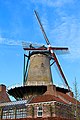
 "IMG 3622" De Molen Van Sluis.jpg 3,024 × 4,032; 2.89 MB
-
 0 Sluis - Stellingmolen - De Brak (1).JPG 3,456 × 5,184; 8.24 MB
-
 0 Sluis - Stellingmolen - De Brak (2).JPG 5,068 × 3,379; 7.8 MB
-
 Begane grond- restaurant, schuur- keuken - Sluis - 20201544 - RCE.jpg 1,199 × 1,200; 212 KB
-
 Belfort Sluis 008.jpg 5,472 × 3,648; 6.65 MB
-
 Belgium 2013 (11622460985).jpg 4,608 × 3,072; 1.32 MB
-
 De Brak 01.jpg 5,472 × 3,648; 5.39 MB
-
 De Brak 02.jpg 5,472 × 3,648; 6.19 MB
-
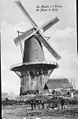
 De colonne van koningin Wilhelmina onderweg, Bestanddeelnr 900-4005.jpg 2,869 × 2,891; 1.7 MB
-
 Exterieur TIJDENS RESTAURATIE - Sluis - 20290150 - RCE.jpg 1,200 × 1,200; 262 KB
-
 Exterieur TIJDENS RESTAURATIE - Sluis - 20290151 - RCE.jpg 1,200 × 1,200; 275 KB
-
 Gevelsteen, (een brak is een snel lopende jacht)hond - Sluis - 20201545 - RCE.jpg 1,188 × 1,200; 352 KB
-
 Korenmolen "De Brak", exterieur - Sluis - 20201564 - RCE.jpg 1,193 × 1,200; 270 KB
-

-

-
 Korenmolen - Sluis - 20201556 - RCE.jpg 806 × 1,200; 173 KB
-

-
 Korenmolen, Het Brok, aanzicht - Sluis - 20201551 - RCE.jpg 1,200 × 1,186; 221 KB
-
 Korenmolen, Het Brok, aanzicht - Sluis - 20201552 - RCE.jpg 1,200 × 1,189; 249 KB
-
 Korenmolen, reproductie van oude foto - Sluis - 20201559 - RCE.jpg 786 × 1,200; 252 KB
-
 Korenmolen, reproductie van oude foto - Sluis - 20201560 - RCE.jpg 770 × 1,200; 219 KB
-
 Korenmolen, vanuit het zuid-oosten - Sluis - 20201558 - RCE.jpg 1,200 × 952; 280 KB
-
 Molen te Sluis, Nederland.jpg 3,492 × 4,656; 7.01 MB
-
 Nieuwe ramen in romp - Sluis - 20201541 - RCE.jpg 1,200 × 1,186; 239 KB
-
 Overzicht van de voorkant - Sluis - 20421277 - RCE.jpg 803 × 1,200; 178 KB
-
 Overzicht van de zijkant - Sluis - 20421276 - RCE.jpg 803 × 1,200; 162 KB
-
 Photos104 moulin de Brak en hiver.jpg 1,242 × 1,656; 405 KB
-
 Ramen in romp - Sluis - 20201540 - RCE.jpg 1,200 × 1,123; 309 KB
-
 Restaurant - Sluis - 20201543 - RCE.jpg 1,200 × 1,189; 196 KB
-

-

-

-

-

-

-

-
 Schuur- keuken - Sluis - 20201542 - RCE.jpg 1,200 × 1,189; 164 KB
-
 Sluis - molen De Brak - brasserie.jpg 1,000 × 1,500; 1.04 MB
-
 Sluis - molen De Brak - gevelsteen.jpg 1,200 × 1,196; 1.12 MB
-
 Sluis - molen De Brak - omgeving.jpg 1,500 × 1,000; 879 KB
-
 Sluis - molen De Brak - steenzolder.jpg 1,000 × 1,500; 1,021 KB
-
 Sluis - molen De Brak vanaf parkeerplaats.jpg 1,000 × 1,500; 999 KB
-
 SLUIS - NL DSC03156 (25675988306).jpg 929 × 1,400; 320 KB
-
 SLUIS - NL DSC03172 (25075401443).jpg 929 × 1,400; 307 KB
-
 SLUIS - NL DSC03175 (25075401153).jpg 929 × 1,400; 300 KB
-
 Sluis Molen De Brak R01.jpg 2,712 × 2,652; 4.69 MB
-
 Sluis Molen De Brak R02.jpg 2,582 × 3,888; 7.19 MB
-
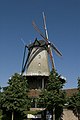
 Sluis, de Brak, stellingmolen a.JPG 800 × 1,200; 532 KB
-

-
 Windmolen De Brak - Sluis.jpg 2,560 × 1,920; 1.12 MB
-
 Zitje - Sluis - 20201539 - RCE.jpg 1,200 × 1,189; 257 KB

.JPG)
.JPG)


.jpg)


hond_-_Sluis_-_20201545_-_RCE.jpg)


.jpg)
.jpg)
.jpg)


