Category:Dominican Republic photographs taken on 2009-09-17
Countries of North America: Canada · Dominican Republic · Mexico · United States of America‡
‡: partly located in North America
‡: partly located in North America
| ← | 17 September 2009 | → | ||
| ← | September 2009 | → | ||

Dominican Republic photographs taken on 17 September 2009.
Image files should be categorized here automatically using {{taken on}} template. Direct categorisation is also possible, if automatic is impossible.
Media in category "Dominican Republic photographs taken on 2009-09-17"
The following 26 files are in this category, out of 26 total.
-
 A beautiful house with windmill, looking south, September 2009 - panoramio.jpg 1,600 × 1,200; 1.18 MB
-
 Access road going down and east toward the greenhouses, September 2009 - panoramio.jpg 1,600 × 1,200; 1.59 MB
-
 Closeup of the slopes, looking southwest, September 2009 - panoramio.jpg 1,600 × 1,200; 1.22 MB
-
 Early morning work in the fields, looking west, September 2009 - panoramio.jpg 1,600 × 1,200; 945 KB
-
 Greenhouse and field, looking west, September 2009 - panoramio.jpg 1,600 × 1,200; 1.18 MB
-
 Greenhouses and hills, looking southeast, September 2009 - panoramio.jpg 1,600 × 1,200; 1.28 MB
-
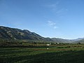
 Hills and valleys, looking southeast, September 2009 - panoramio.jpg 1,600 × 1,200; 972 KB
-

-
 Loma Mogote, looking southwest, September 2009 - panoramio.jpg 1,600 × 1,200; 1.19 MB
-
 Looking north toward Yerba Buena, September 2009 - panoramio.jpg 1,600 × 1,200; 960 KB
-
 Looking south along the aqueduct, September 2009 - panoramio.jpg 1,200 × 1,600; 1.39 MB
-
 Looking south toward Baiguate, September 2009 - panoramio.jpg 1,600 × 1,200; 1.3 MB
-
 Looking west across fields to the distant hills, September 2009 - panoramio.jpg 1,600 × 1,200; 844 KB
-
 Tall tree and cacti, looking north toward the intersection, September 2009 - panoramio.jpg 1,200 × 1,600; 1.31 MB
-
 The aqueduct access road, looking north, September 2009 - panoramio.jpg 1,600 × 1,200; 1.65 MB
-
 The aqueduct access road, looking south, September 2009 - panoramio.jpg 1,600 × 1,200; 1.3 MB
-
 The aqueduct access road, looking southwest, September 2009 - panoramio.jpg 1,600 × 1,200; 1.61 MB
-
 The aqueduct continues without a road, looking southeast, September 2009 - panoramio.jpg 1,600 × 1,200; 1.68 MB
-
 The aqueduct through Villa Baiguate, looking north, September 2009 - panoramio.jpg 1,600 × 1,200; 1.74 MB
-
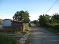
 The curve in the road at Villa Baiguate, September 2009 - panoramio.jpg 1,600 × 1,200; 1.31 MB
-
 The road north to Yerba Buena, September 2009 - panoramio.jpg 1,600 × 1,200; 964 KB
-
 The road south to Baiguate, September 2009 - panoramio.jpg 1,600 × 1,200; 1.28 MB
-
 The road to Salto Baiguate, looking east, September 2009 - panoramio.jpg 1,600 × 1,200; 1.23 MB
-
 Very tall cacti, looking west, September 2009 - panoramio.jpg 1,600 × 1,200; 1.3 MB
-
 Villa Baiguate, looking north, September 2009 - panoramio.jpg 1,600 × 1,200; 1.3 MB
-
 Welcome to Villa Baiguate, looking south, September 2009 - panoramio.jpg 1,600 × 1,200; 1.5 MB


