Category:Dorfkirche Karwe, Neuruppin
| Object location | | View all coordinates using: OpenStreetMap |
|---|
church building in Brandenburg state, Germany  | |||||
| Upload media | |||||
| Instance of | |||||
|---|---|---|---|---|---|
| Location | Neuruppin, Ostprignitz-Ruppin District, Brandenburg, Germany | ||||
| Heritage designation | |||||
 | |||||
This is the category of the Brandenburger Baudenkmal (cultural heritage monument) with the ID 09170283 (Wikidata)
|
Deutsch: Dorfkirche Karwe, Stadt Neuruppin, Landkreis Ostprignitz-Ruppin, Land Brandenburg, Deutschland
English: Karwe church, Neuruppin city, Ostprignitz-Ruppin district, Brandenburg state, Germany
Français : Église de Karwe, ville de Neuruppin, arrondissement Prignitz-de-l'Est-Ruppin, état fédéral de Brandebourg, Allemagne
Media in category "Dorfkirche Karwe, Neuruppin"
The following 11 files are in this category, out of 11 total.
-
 Dorfkirche Karwe, Neuruppin 2018 E.jpg 3,436 × 4,712; 5.88 MB
-
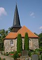
 Dorfkirche Karwe, Neuruppin 2018 N.jpg 4,090 × 4,379; 6.14 MB
-
 Dorfkirche Karwe, Neuruppin 2018 NNE.jpg 3,922 × 4,292; 5.84 MB
-
 Dorfkirche Karwe, Neuruppin 2018 SW.jpg 3,826 × 4,703; 6.54 MB
-
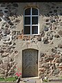 Dorfkirche Karwe, Neuruppin 2018 Südportal.jpg 3,648 × 4,864; 6.63 MB
-
 Dorfkirche Karwe, Neuruppin 2018 Westportal.jpg 3,648 × 4,864; 6.2 MB
-
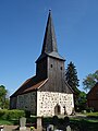 Dorfkirche Karwe, Neuruppin 2018 WNW.jpg 3,648 × 4,864; 4.93 MB
-
 Neuruppin Karwe Lange Straße Dorfkirche (Baustelle).JPG 3,744 × 4,357; 6.87 MB
-
 Neuruppin Karwe Portal.jpg 1,128 × 819; 402 KB
-
 Neuruppin Karwe Church.jpg 780 × 1,100; 213 KB
-
 Neuruppin Karwe Knesebeck.jpg 1,280 × 960; 680 KB


.JPG)

