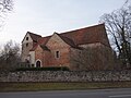
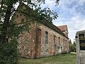
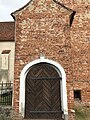
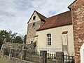
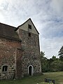
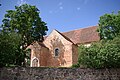
Category:Dorfkirche Kotzen (Havelland)
| Object location | | View all coordinates using: OpenStreetMap |
|---|
 | |||||
| Upload media | |||||
| Instance of | |||||
|---|---|---|---|---|---|
| Location | Kotzen, Havelland District, Brandenburg, Germany | ||||
| Heritage designation | |||||
 | |||||
This is the category of the Brandenburger Baudenkmal (cultural heritage monument) with the ID 09150142 (Wikidata)
|
Français : Église de Kotzen, arrondissement Pays de la Havel, état fédéral de Brandebourg, Allemagne
Media in category "Dorfkirche Kotzen (Havelland)"
The following 28 files are in this category, out of 28 total.
-
 Dorfkirche Kotzen (Havelland) 2017 N.jpg 5,427 × 3,822; 8.16 MB
-
 Dorfkirche Kotzen (Havelland) 2017 NE.jpg 2,628 × 3,085; 4.36 MB
-
 Dorfkirche Kotzen (Havelland) 2017 Portal N.jpg 3,602 × 4,830; 6.76 MB
-
 Dorfkirche Kotzen (Havelland) 2017 Portal vermauert.jpg 3,648 × 4,864; 6.29 MB
-
 Dorfkirche Kotzen (Havelland) 2017 S.jpg 6,910 × 4,565; 9.72 MB
-
 Dorfkirche Kotzen (Havelland) 2017 SW.jpg 4,864 × 3,648; 4.99 MB
-
 Dorfkirche Kotzen (Havelland) 2017 WNW.jpg 4,864 × 3,648; 5.33 MB
-
 Dorfkirche Kotzen Chor Nordansicht.jpg 4,032 × 3,024; 4.98 MB
-
 Dorfkirche Kotzen Chor Ostansicht.jpg 3,024 × 4,032; 4.61 MB
-
 Dorfkirche Kotzen Kirchenschiff Nordansicht Epitaph.jpg 3,024 × 4,032; 5.67 MB
-
 Dorfkirche Kotzen Kirchenschiff Nordansicht.jpg 4,032 × 3,024; 5.21 MB
-
 Dorfkirche Kotzen Kirchenschiff Südansicht.jpg 4,032 × 3,024; 3.48 MB
-
 Dorfkirche Kotzen Kirchenschiff Südseite Gräber Stechow.jpg 4,032 × 3,024; 4.17 MB
-
 Dorfkirche Kotzen Nordansicht.jpg 4,032 × 3,024; 3.55 MB
-
 Dorfkirche Kotzen Nordostansicht.jpg 4,032 × 3,024; 3.94 MB
-
 Dorfkirche Kotzen Ostansicht.jpg 3,024 × 4,032; 5.07 MB
-
 Dorfkirche Kotzen Patronatsloge Ostansicht.jpg 3,024 × 4,032; 4.16 MB
-
 Dorfkirche Kotzen Patronatsloge Südportal.jpg 3,024 × 4,032; 4.23 MB
-
 Dorfkirche Kotzen Südostansicht.jpg 4,032 × 3,024; 3.17 MB
-
 Dorfkirche Kotzen Westturm Nordansicht.jpg 3,024 × 4,032; 2.47 MB
-
 Dorfkirche Kotzen Westturm Südansicht.jpg 3,024 × 4,032; 3.39 MB
-
 Dorfkirche Kotzen Westturm Westansicht.jpg 3,024 × 4,032; 3.06 MB
-
 Dorfkirche Kotzen WK-Denkmal linke Seite.jpg 3,024 × 4,032; 2.82 MB
-
 Dorfkirche Kotzen WK-Denkmal rechte Seite.jpg 3,024 × 4,032; 3.92 MB
-
 Dorfkirche Kotzen WK-Denkmal Rückseite.jpg 3,024 × 4,032; 3.95 MB
-
 Dorfkirche Kotzen WK-Denkmal Vorderseite.jpg 3,024 × 4,032; 3.29 MB
-
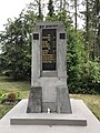
 Gefallenendenkmal Kotzen (Havelland) 2017.jpg 3,648 × 4,864; 7.09 MB
-
 Kirche Kotzen.jpg 3,872 × 2,592; 1.57 MB
_2017_N.jpg)
_2017_NE.jpg)
_2017_Portal_N.jpg)
_2017_Portal_vermauert.jpg)
_2017_S.jpg)
_2017_SW.jpg)
_2017_WNW.jpg)


_2017.jpg)
