Category:Dorfkirche Rühstädt
| Object location | | View all coordinates using: OpenStreetMap |
|---|
This is the category of the Brandenburger Baudenkmal (cultural heritage monument) with the ID 09160541 (Wikidata)
|
church building in Brandenburg state, Germany  .jpg) | |||||
| Upload media | |||||
| Instance of | |||||
|---|---|---|---|---|---|
| Location | Rühstädt, Prignitz District, Brandenburg, Germany | ||||
| Street address |
| ||||
| Heritage designation | |||||
| Inception |
| ||||
| Religion or worldview | |||||
 | |||||
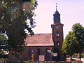
English: Village church in Rühstädt, Rühstädt municipality, Prignitz district, Brandenburg state, Germany
Deutsch: Dorfkirche in Rühstädt, Gemeinde Rühstädt, Landkreis Prignitz, Land Brandenburg, Deutschland.
Français : Église du village de Rühstädt, commune de Rühstädt, arrondissement Prignitz, état fédéral de Brandebourg, Allemagne
Subcategories
This category has only the following subcategory.
I
Media in category "Dorfkirche Rühstädt"
The following 4 files are in this category, out of 4 total.
-
 Kirche Rühstädt.jpg 3,872 × 2,592; 5.52 MB
-
 Rühstädt - Kirche Nordseite 2015-07.jpg 5,472 × 3,648; 4.75 MB
-
 Rühstädt - Kirche Ostseite 2015-07.jpg 3,227 × 4,305; 3.96 MB
-
 Rühstädt kirche.JPG 2,816 × 2,112; 2.9 MB


