Category:Dorfkirche Ruhlsdorf
| Object location | | View all coordinates using: OpenStreetMap |
|---|
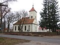
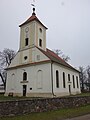
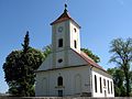
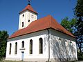
Church building in Barnim district, Brandenburg state, Germany  | |||||
| Upload media | |||||
| Instance of | |||||
|---|---|---|---|---|---|
| Location | Ruhlsdorf (Marienwerder), Marienwerder, Amt Biesenthal-Barnim, Barnim District, Brandenburg, Germany | ||||
| Street address |
| ||||
| Heritage designation | |||||
| Inception |
| ||||
| Width |
| ||||
| Length |
| ||||
| Area |
| ||||
| Religion or worldview | |||||
 | |||||
This is the category of the Brandenburger Baudenkmal (cultural heritage monument) with the ID 09175379 (Wikidata)
|
Deutsch: Kirche Ruhlsdorf, Gemeinde Marienwerder, Landkreis Barnim, Land Brandenburg, Deutschland
English: Church of Ruhlsdorf, Marienwerder municipality, Barnim district, Brandenburg state, Germany
Pages in category "Dorfkirche Ruhlsdorf"
This category contains only the following page.
Media in category "Dorfkirche Ruhlsdorf"
The following 20 files are in this category, out of 20 total.
-
 Dorfkirche Ruhlsdorf (Marienwerder) 2022 Blind windows.jpg 4,820 × 3,615; 2.06 MB
-
 Dorfkirche Ruhlsdorf (Marienwerder) 2022 E.jpg 3,648 × 4,864; 6.48 MB
-
 Dorfkirche Ruhlsdorf (Marienwerder) 2022 Fenster.jpg 3,648 × 4,864; 2.81 MB
-
 Dorfkirche Ruhlsdorf (Marienwerder) 2022 NE.jpg 4,864 × 3,648; 4.17 MB
-
 Dorfkirche Ruhlsdorf (Marienwerder) 2022 Nordportal.jpg 3,648 × 4,864; 2.36 MB
-
 Dorfkirche Ruhlsdorf (Marienwerder) 2022 NW.jpg 4,864 × 3,648; 3.85 MB
-
 Dorfkirche Ruhlsdorf (Marienwerder) 2022 S.jpg 3,648 × 4,864; 4.82 MB
-
 Dorfkirche Ruhlsdorf (Marienwerder) 2022 SE.jpg 4,864 × 3,648; 6.34 MB
-
 Dorfkirche Ruhlsdorf (Marienwerder) 2022 SW.jpg 3,648 × 4,864; 2.57 MB
-
 Dorfkirche Ruhlsdorf (Marienwerder) 2022 Turm.jpg 3,509 × 4,679; 1.9 MB
-
 Dorfkirche Ruhlsdorf (Marienwerder) 2022 W.jpg 3,024 × 4,032; 4.45 MB
-
 Dorfkirche Ruhlsdorf (Marienwerder) 2022 Westportal.jpg 3,306 × 4,864; 2.42 MB
-
 Dorfkirche Ruhlsdorf (Marienwerder) 2022 WSW Panorama.jpg 3,648 × 4,864; 4.68 MB
-
 Dorfkirche Ruhlsdorf (Marienwerder) 2022 WSW.jpg 3,648 × 4,864; 2.98 MB
-
 Ruhlsdorf 04.jpg 3,349 × 2,514; 1.52 MB
-
 Ruhlsdorf 05.jpg 3,203 × 2,403; 1.58 MB
-
 Ruhlsdorf 06.jpg 3,340 × 2,505; 1.93 MB
-
 Ruhlsdorf 07.jpg 3,472 × 2,604; 1.8 MB
-
 Ruhlsdorf 10.jpg 2,632 × 3,509; 1.78 MB
-
 Ruhlsdorf 11.jpg 3,545 × 2,659; 1.77 MB
_2022_Blind_windows.jpg)
_2022_E.jpg)
_2022_Fenster.jpg)
_2022_NE.jpg)
_2022_Nordportal.jpg)
_2022_NW.jpg)
_2022_S.jpg)
_2022_SE.jpg)
_2022_SW.jpg)
_2022_Turm.jpg)
_2022_W.jpg)
_2022_Westportal.jpg)
_2022_WSW_Panorama.jpg)
_2022_WSW.jpg)


