Category:Dorfkirche Wansdorf
| Object location | | View all coordinates using: OpenStreetMap |
|---|
.JPG) | |||||
| Upload media | |||||
| Instance of | |||||
|---|---|---|---|---|---|
| Location | Wansdorf, Schönwalde-Glien, Havelland District, Brandenburg, Germany | ||||
| Heritage designation | |||||
 | |||||
This is the category of the Brandenburger Baudenkmal (cultural heritage monument) with the ID 09150385 (Wikidata)
|
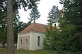
English: Church in Wansdorf, Schönwalde-Glien municipality, Havelland district, Brandenburg state, Germany
Deutsch: Dorfkirche in Wansdorf, Gemeinde Schönwalde-Glien, Landkreis Havelland, Land Brandenburg, Deutschland.
Français : Église de Wansdorf, commune de Schönwalde-Glien, arrondissement Pays de la Havel, état fédéral de Brandebourg, Allemagne
Media in category "Dorfkirche Wansdorf"
The following 3 files are in this category, out of 3 total.
-
 Wansdorf Dorfkirche (22).JPG 3,648 × 2,736; 2.35 MB
-
 Wansdorf-Kirche-1.jpg 3,180 × 2,120; 1.96 MB
-
 Wansdorf-Kirche-2.jpg 3,295 × 2,643; 1.84 MB

