Category:Drainage basin maps of Germany
Countries of Europe: Armenia‡ · Azerbaijan‡ · Bosnia and Herzegovina · Czech Republic · Finland · France‡ · Georgia‡ · Germany · Italy · Latvia · Lithuania · Norway · Poland · Portugal‡ · Romania · Slovakia · Spain‡ · Sweden · Switzerland · Turkey‡ · Ukraine · United Kingdom
‡: partly located in Europe
‡: partly located in Europe
Subcategories
This category has the following 3 subcategories, out of 3 total.
Media in category "Drainage basin maps of Germany"
The following 17 files are in this category, out of 17 total.
-
 Becken der südlichen Ostsee.png 1,542 × 1,039; 272 KB
-
 Becken der südlichen südöstliche Ostsee (deutsch).png 1,542 × 1,039; 296 KB
-
 Becken entlang Warnow Peene Oder-Mündung Weichsel-Mündung.png 1,543 × 1,038; 271 KB
-
 Deutschland Flussgebietseinheiten.png 1,718 × 2,309; 4.96 MB
-
 Elbe basin.png 1,309 × 1,381; 1.8 MB
-
 Elbe Einzugsgebiet.png 1,309 × 1,381; 1.96 MB
-
 Spree-Havel in Elbe basin, cut.png 787 × 863; 723 KB
-
 Spree-Havel in Elbe basin.png 1,309 × 1,381; 1.79 MB
-
 Flussgebietseinheiten Warnow Peene.png 662 × 467; 339 KB
-
 Wasser Gera.PNG 415 × 470; 20 KB
-
 Karte einzugsbereich iller.png 800 × 1,397; 149 KB
-
 Karte Nahe Einzugsgebiet.png 1,127 × 1,200; 125 KB
-
 Flusssystemkarte Rhein 01.svg 861 × 1,186; 7.81 MB
-
 Flusssystemkarte Rhein 02.jpg 3,197 × 4,342; 11.75 MB
-
 Verlaufskarte Nidda.png 1,097 × 1,164; 1.93 MB
-
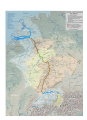
 Weser Einzugsgebiet+Nr.png 791 × 886; 189 KB
-
 Weser Einzugsgebiet.png 791 × 886; 594 KB

.png)


