Category:Dry Mountain (Utah County, Utah)
mountain in Utah County, Utah, United States _in_Lake_Shore,_Utah,_May_16.jpg) | |||||
| Upload media | |||||
| Instance of | |||||
|---|---|---|---|---|---|
| Location | Utah County, Utah | ||||
| Mountain range | |||||
 | |||||
English: Media related to Dry Mountain (Utah County, Utah), a 9,849-foot (3,002 m) mountain in the Uinta-Wasatch-Cache National Forest in the southern Wasatch Range (southeast of Santaquin) in Utah County, Utah, United States.
Media in category "Dry Mountain (Utah County, Utah)"
The following 17 files are in this category, out of 17 total.
-
 East at US-6 & SR-68 junction, Elberta, Utah, May 16.jpg 2,592 × 1,944; 2.44 MB
-
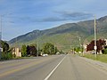 East on Main Street, Santaquin, Utah, May 16.jpg 2,592 × 1,944; 2.36 MB
-
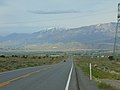 East on US-6 across Goshen Valley from Big Canyon, May 16.jpg 2,592 × 1,944; 2.37 MB
-
 East on US-6 at Goshen, Utah, May 16.jpg 2,592 × 1,944; 2.36 MB
-
 Former gas station along US-6 & SR-68 in Elberta, May 16.jpg 2,592 × 1,944; 2.38 MB
-
 Looking down on west Mapleton, Utah, Jun 04.jpg 1,280 × 960; 305 KB
-
 One Man Band in Payson, Utah, May 16.jpg 2,592 × 1,944; 2.42 MB
-
 South across Spring Lake, Spring Lake, Utah, May 16.jpg 2,592 × 1,944; 2.35 MB
-
 South along 100 W (SR-198) in Payson, Utah, May 16.jpg 2,592 × 1,944; 2.41 MB
-
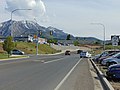
 South along S 3200 West (SR-77) in Lake Shore, Utah, May 16.jpg 2,592 × 1,944; 2.47 MB
-
 South at Palmyra Dr & W 4400 S intersection Palmyra, Utah, May 16.jpg 2,592 × 1,944; 2.34 MB
-
 South at SR-198 in Salem, May 16.jpg 2,592 × 1,944; 2.45 MB
-
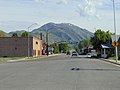
 South on SR-198 in Santaquin, Utah, May 16.jpg 2,592 × 1,944; 2.39 MB
-
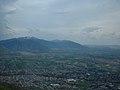
 Southeast across southern Utah Valley at Wasatch Range, Jun 17.jpg 2,592 × 1,944; 2.35 MB
-
 SR-115 & Benjamin Cemetery, Benjamin, Utah, Jun 16.jpg 2,592 × 1,944; 2.36 MB
-
 Utah (2808013712).jpg 3,872 × 2,306; 4.28 MB
-
 Utah (2808015566).jpg 3,872 × 2,592; 4.79 MB


_in_Payson,_Utah,_May_16.jpg)


.jpg)
.jpg)