Category:Dry stone walls in Gloucestershire
Ceremonial counties of England: Cambridgeshire · Cheshire · Cornwall · Cumbria · Derbyshire · Devon · Dorset · Durham · Gloucestershire · Greater Manchester · Herefordshire · Lancashire · Leicestershire · Lincolnshire · North Yorkshire · Northamptonshire · Northumberland · Oxfordshire · Rutland · Somerset · South Yorkshire · Staffordshire · West Sussex · West Yorkshire · Wiltshire · Worcestershire
City-counties:
Former historic counties:
Other former counties:
City-counties:
Former historic counties:
Other former counties:
Media in category "Dry stone walls in Gloucestershire"
The following 40 files are in this category, out of 40 total.
-
 A strange convergence of walls - geograph.org.uk - 240839.jpg 640 × 480; 149 KB
-
 Church sign and church - geograph.org.uk - 1571258.jpg 640 × 480; 159 KB
-
 Bledington - geograph.org.uk - 108670.jpg 640 × 480; 141 KB
-
 Cotswold Dry Stone Wall - Flickr - judy dean.jpg 6,000 × 4,000; 35.76 MB
-

-

-
 Cotswold Vine Cottage Gate.jpg 3,589 × 2,224; 4.7 MB
-
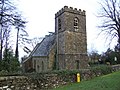
 Church of St James at Cutsdean - geograph.org.uk - 846768.jpg 426 × 640; 91 KB
-
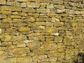
 Dry stone wall - geograph.org.uk - 193122.jpg 640 × 480; 132 KB
-

-
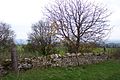
 Dry Stone Wall at Salperton - geograph.org.uk - 53353.jpg 640 × 480; 124 KB
-
 Dry stone wall building, Farmington - geograph.org.uk - 257675.jpg 640 × 480; 164 KB
-
 Dry stone wall, cross-section - geograph.org.uk - 399214.jpg 640 × 480; 168 KB
-
 Dry stone walling at Dartley Farm - geograph.org.uk - 461922.jpg 640 × 477; 99 KB
-
 Dry-stone.jpg 2,048 × 1,536; 1.61 MB
-
 Drystone wall as soundwall - geograph.org.uk - 1439442.jpg 640 × 370; 187 KB
-
 Drystone.jpg 2,048 × 1,536; 1.43 MB
-
 DrystoneWall.jpg 2,048 × 1,536; 1.76 MB
-

-
 Bethesda Chapel, Hawkesbury Upton.jpg 4,003 × 2,857; 6.12 MB
-
 Church of St Peter Leckhampton.jpg 3,233 × 2,587; 2.02 MB
-
 Letterbox^ or Postbox^ - geograph.org.uk - 61206.jpg 640 × 488; 188 KB
-
 St James' church, Longborough - geograph.org.uk - 1579759.jpg 640 × 480; 93 KB
-
 Longborough Church - geograph.org.uk - 1445801.jpg 426 × 640; 88 KB
-
 Moutons-01.JPG 2,592 × 1,944; 2.61 MB
-
 Oolite.png 2,048 × 1,536; 5.87 MB
-
 Church of St John the Evangelist, Purton.jpg 3,585 × 2,831; 3.92 MB
-
 Rebuilt dry stone wall - geograph.org.uk - 221726.jpg 640 × 480; 119 KB
-
 Restoration of Dry Stone Wall - geograph.org.uk - 343708.jpg 640 × 480; 171 KB
-

-
 Saintbury Church - geograph.org.uk - 237964.jpg 640 × 480; 96 KB
-
 Sheep pasture near Stowell Mill - geograph.org.uk - 777481.jpg 640 × 426; 113 KB
-
 Road at Stanton - geograph.org.uk - 1468558.jpg 640 × 479; 68 KB
-
 Stone stile - geograph.org.uk - 342772.jpg 640 × 480; 108 KB
-
 Stone wall and fields - geograph.org.uk - 296617.jpg 640 × 427; 90 KB
-
 Stone wall on Icomb Hill - geograph.org.uk - 280053.jpg 640 × 427; 117 KB
-
 Straight Cotswold stone wall - geograph.org.uk - 240836.jpg 640 × 480; 102 KB
-
 Tarlton Church - geograph.org.uk - 132526.jpg 480 × 640; 129 KB
-
 Staddle Stone, Througham - geograph.org.uk - 192374.jpg 640 × 480; 135 KB
-
 St Mary's Church Westcote - geograph.org.uk - 308982.jpg 640 × 480; 122 KB


_St_Peter%27s_Church_-_geograph.org.uk_-_67865.jpg)


