Category:Dulas, Herefordshire
hamlet and civil parish in Herefordshire, England, UK | |||||
| Upload media | |||||
| Instance of | |||||
|---|---|---|---|---|---|
| Location | Herefordshire, West Midlands, England | ||||
| Population |
| ||||
 | |||||

Media in category "Dulas, Herefordshire"
The following 57 files are in this category, out of 57 total.
-
 Church of St Michael at Dulas - geograph.org.uk - 6573652.jpg 1,024 × 768; 280 KB
-
 Driveway and stile - geograph.org.uk - 1815016.jpg 426 × 640; 79 KB
-
 Driveway to Platch Farm - geograph.org.uk - 6592729.jpg 640 × 480; 291 KB
-
 Dulas Brook and Cockshoot Wood - geograph.org.uk - 448884.jpg 640 × 427; 231 KB
-
 Dulas Brook past Dulas Court - geograph.org.uk - 6475663.jpg 1,600 × 1,199; 601 KB
-
 Dulas Court - geograph.org.uk - 6475672.jpg 1,600 × 1,297; 392 KB
-
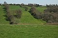
 Dulas valley - geograph.org.uk - 2288380.jpg 1,024 × 680; 288 KB
-
 Farm near Dulas - geograph.org.uk - 2290655.jpg 1,024 × 680; 202 KB
-
 Farm track and public footpath - geograph.org.uk - 4710156.jpg 800 × 451; 171 KB
-
 Field edge path near Dulas Court - geograph.org.uk - 3070581.jpg 640 × 480; 109 KB
-
 Field edge path near Old Wigau Farm - geograph.org.uk - 3070555.jpg 640 × 480; 86 KB
-
 Field with hay bales - geograph.org.uk - 3572226.jpg 1,024 × 680; 215 KB
-
 Fields and bales near Cwm Barn - geograph.org.uk - 6593077.jpg 640 × 480; 282 KB
-
 Footpath with new signage and gates - geograph.org.uk - 3070585.jpg 640 × 480; 131 KB
-
 Ford at Cwm Dulas Mill - geograph.org.uk - 4293852.jpg 3,872 × 2,592; 5.07 MB
-
 Ford near Cwm Dulas Mill - geograph.org.uk - 3682232.jpg 640 × 480; 125 KB
-
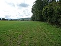
 Herefordshire countryside - geograph.org.uk - 2288733.jpg 1,024 × 680; 218 KB
-
 Hill top pasture - geograph.org.uk - 2775465.jpg 1,024 × 768; 450 KB
-
 Hill top pond - geograph.org.uk - 2775428.jpg 1,024 × 768; 462 KB
-
 Home Farm farmhouse - geograph.org.uk - 5391174.jpg 5,184 × 3,456; 5.93 MB
-
 Home Farm Mill, Dulas - geograph.org.uk - 2408714.jpg 640 × 427; 74 KB
-
 Home Farm Mill, Dulas - geograph.org.uk - 2408727.jpg 427 × 640; 97 KB
-
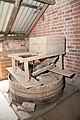 Home Farm Mill, Dulas - the stones - geograph.org.uk - 2408742.jpg 427 × 640; 77 KB
-
 Home Farm Mill, Dulas, machinery - geograph.org.uk - 2408735.jpg 427 × 640; 80 KB
-
 Home Farm, Dulas - geograph.org.uk - 448873.jpg 640 × 397; 228 KB
-

-
 Lane in the Dulas Valley - geograph.org.uk - 3682228.jpg 640 × 480; 66 KB
-

-
 Middle Cefn farm - geograph.org.uk - 3707130.jpg 640 × 480; 54 KB
-
 Middle Cefn Farm - geograph.org.uk - 451075.jpg 640 × 313; 167 KB
-
 Mill Lane at Tremorithic Road - geograph.org.uk - 4710130.jpg 800 × 451; 206 KB
-
 Notice board at St. Michael's, 1 - geograph.org.uk - 4709216.jpg 600 × 800; 322 KB
-
 Notice board at St. Michael's, 2 - geograph.org.uk - 4709220.jpg 1,600 × 1,200; 1.2 MB
-
 Oaks by Tremorithic Road - geograph.org.uk - 4710146.jpg 800 × 451; 237 KB
-
 Old Milepost by the B4347, Dore, Dulas parish (geograph 6051463).jpg 1,253 × 1,704; 459 KB
-
 Outbuildings at Dulas Court - geograph.org.uk - 6475670.jpg 1,600 × 1,101; 255 KB
-

-
 Part of Plash Farm - geograph.org.uk - 3070570.jpg 640 × 480; 80 KB
-
 Path approaching Cot Farm - geograph.org.uk - 3070603.jpg 640 × 480; 82 KB
-
 Pond near Plash Farm - geograph.org.uk - 2288392.jpg 1,024 × 680; 331 KB
-
 Road in the Dulas valley - geograph.org.uk - 4709221.jpg 800 × 600; 260 KB
-
 Road passing Dulas Court - geograph.org.uk - 2288728.jpg 1,024 × 680; 353 KB
-
 Road to Newton - geograph.org.uk - 1815011.jpg 426 × 640; 83 KB
-
 Road up from the ford - geograph.org.uk - 4236700.jpg 1,600 × 1,200; 1,010 KB
-
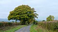
 Rural lane above the Golden Valley - geograph.org.uk - 3707185.jpg 640 × 480; 75 KB
-
 Seat on Ewyas Harold Common - geograph.org.uk - 1814587.jpg 640 × 426; 77 KB
-
 Sheep in field near Old Wigau Farm - geograph.org.uk - 6593082.jpg 640 × 480; 302 KB
-

-
 Silage bales near Upper Cefn Farm - geograph.org.uk - 1815004.jpg 640 × 426; 101 KB
-
 The Dulas valley - geograph.org.uk - 4997685.jpg 1,600 × 901; 673 KB
-
 The Golden Valley - geograph.org.uk - 1814581.jpg 640 × 426; 89 KB
-
 The Valley of Dulas Brook - geograph.org.uk - 448602.jpg 640 × 427; 264 KB
-
 Trees and silage bales - geograph.org.uk - 1814995.jpg 640 × 426; 75 KB
-
 View to Upper Cefn Farm - geograph.org.uk - 1816384.jpg 640 × 426; 77 KB
-
 View west to the Black Mountains, near Upper Cefn - geograph.org.uk - 2946074.jpg 1,600 × 1,067; 254 KB
-
 West Herefordshire countryside - geograph.org.uk - 2775468.jpg 1,024 × 768; 379 KB
-


.jpg)


_from_near_Abbey_Dore_-_geograph.org.uk_-_263537.jpg)