Category:Dunes of England
Wikimedia category | |||||
| Upload media | |||||
| Instance of | |||||
|---|---|---|---|---|---|
| Category combines topics | |||||
| England | |||||
country in north-west Europe, part of the United Kingdom  someja satełitar in avril      | |||||
| Spoken text audio | |||||
| Pronunciation audio | |||||
| Instance of | |||||
| Name in native language |
| ||||
| Named after | |||||
| Patron saint | |||||
| Location |
| ||||
| Capital | |||||
| Basic form of government |
| ||||
| Official language | |||||
| Anthem |
| ||||
| Currency | |||||
| Head of state |
| ||||
| Head of government |
| ||||
| Highest point | |||||
| Population |
| ||||
| Area |
| ||||
| Replaces |
| ||||
| Different from | |||||
| official website | |||||
 | |||||
Subcategories
This category has the following 11 subcategories, out of 11 total.
- Vegetated dunes in England (2 F)
B
- Bamburgh Dunes (13 F)
C
D
- Dunes of Dorset (1 F)
E
L
M
- Dunes of Merseyside (30 F)
N
- North Walney Nature Reserve (4 F)
R
- Red Rocks Marsh, Hoylake (4 F)
Media in category "Dunes of England"
The following 175 files are in this category, out of 175 total.
-
 Alnmouth Bay - geograph.org.uk - 17602.jpg 640 × 480; 100 KB
-
 Alnmouth Beach - geograph.org.uk - 185249.jpg 640 × 480; 99 KB
-
 Beach, Hengistbury Head - geograph.org.uk - 1444657.jpg 640 × 455; 68 KB
-
 Beadnell Dunes - geograph.org.uk - 69667.jpg 640 × 480; 126 KB
-
 Bird Hide and Tern Colony - geograph.org.uk - 189144.jpg 640 × 480; 92 KB
-
 Blow out - geograph.org.uk - 455393.jpg 640 × 480; 121 KB
-
 Bob Hall's Sands - geograph.org.uk - 1495526.jpg 640 × 480; 173 KB
-
 Camber Sands - geograph.org.uk - 1427677.jpg 640 × 480; 86 KB
-
 Cattle, Cocklawburn dunes - geograph.org.uk - 79244.jpg 640 × 480; 62 KB
-
 Chibburn Links - geograph.org.uk - 149363.jpg 640 × 480; 77 KB
-
 Cockly Knowes - geograph.org.uk - 227062.jpg 640 × 506; 96 KB
-
 Druridge Links - geograph.org.uk - 149561.jpg 640 × 480; 60 KB
-
 Dune damage - geograph.org.uk - 599921.jpg 640 × 426; 35 KB
-
 Dune Slack - geograph.org.uk - 179986.jpg 640 × 480; 156 KB
-
 Dune slack - geograph.org.uk - 733439.jpg 640 × 427; 77 KB
-
 Dune slack at Raven Meols - geograph.org.uk - 2369583.jpg 1,600 × 1,060; 1.02 MB
-
 Dune start.JPG 2,288 × 1,712; 824 KB
-
 Dune Vegetation on Northam Burrows - geograph.org.uk - 30599.jpg 640 × 621; 192 KB
-
 Dune-ridge view - geograph.org.uk - 581852.jpg 640 × 480; 62 KB
-
 Dunes @ Holywell Bay - panoramio.jpg 3,264 × 2,448; 3.97 MB
-
 Dunes and beach at Greatstone-on-Sea - geograph.org.uk - 398749.jpg 640 × 480; 213 KB
-
 Dunes at Chapel St Leonards - geograph.org.uk - 154869.jpg 640 × 427; 95 KB
-
 Dunes at Cuckmere Haven (2253).jpg 4,288 × 2,848; 6.74 MB
-
 Dunes at Ross Back Sands - geograph.org.uk - 632980.jpg 428 × 640; 90 KB
-
 Dunes at Sand Bay, Somerset - geograph.org.uk - 341797.jpg 640 × 473; 65 KB
-
 Dunes at Seaton Sands - geograph.org.uk - 164274.jpg 640 × 427; 83 KB
-
 Dunes at Titchwell - geograph.org.uk - 568479.jpg 640 × 480; 39 KB
-
 Dunes at Winterton-at-Sea - geograph.org.uk - 376915.jpg 640 × 480; 92 KB
-
 Dunes, Theddlethorpe St. Helen - geograph.org.uk - 217275.jpg 640 × 480; 73 KB
-
 Dunes2.JPG 2,288 × 1,712; 849 KB
-

-
 East Head - geograph.org.uk - 522885.jpg 640 × 479; 115 KB
-
 Embryo Dunes, Beadnell dunes - geograph.org.uk - 69663.jpg 640 × 480; 201 KB
-
 Embryodune.JPG 2,288 × 1,712; 793 KB
-
 Footpath junction in the dunes - geograph.org.uk - 581886.jpg 480 × 640; 100 KB
-
 Formby, view from the sanddunes (6395834555).jpg 3,759 × 2,517; 5.96 MB
-
 Goswick Dunes - geograph.org.uk - 211643.jpg 640 × 439; 70 KB
-
 Greatstone Beach (14820060120).jpg 2,592 × 1,944; 494 KB
-
 Grey dunes - geograph.org.uk - 733431.jpg 640 × 427; 82 KB
-
 Historic sand dune system - geograph.org.uk - 405077.jpg 640 × 480; 66 KB
-
 Holkham Bay - geograph.org.uk - 177543.jpg 640 × 428; 115 KB
-
 Holy Island Sands - geograph.org.uk - 180004.jpg 640 × 480; 89 KB
-
 Holywell Bay Beach - panoramio.jpg 768 × 1,024; 91 KB
-
 Holywell Bay Dunes - panoramio.jpg 3,264 × 2,448; 3.47 MB
-

-
 Jaywick Dunes - geograph.org.uk - 538571.jpg 640 × 426; 108 KB
-
 Looking inland from Ross Links - geograph.org.uk - 153483.jpg 640 × 480; 133 KB
-
 Main entrance to a beach near Rye (2012) - panoramio.jpg 2,174 × 1,440; 755 KB
-

-
 Marram Grass, Snook - geograph.org.uk - 426898.jpg 640 × 427; 75 KB
-
 Marram shadows - geograph.org.uk - 153486.jpg 640 × 480; 164 KB
-
 Mature dunes - geograph.org.uk - 582649.jpg 640 × 426; 48 KB
-
 Newton Links - geograph.org.uk - 181171.jpg 640 × 480; 136 KB
-
 Newton Links and Beadnell Bay - geograph.org.uk - 498361.jpg 640 × 480; 54 KB
-
 Newton Links sand Dunes - geograph.org.uk - 179663.jpg 640 × 480; 152 KB
-
 Newton Links, Beadnell Bay - geograph.org.uk - 1059886.jpg 640 × 480; 65 KB
-
 North Promenade in St Annes - geograph.org.uk - 1587715.jpg 640 × 427; 52 KB
-
 Old Law Dunes - geograph.org.uk - 226983.jpg 640 × 418; 51 KB
-
 OrmsgillFromNorthScale 20070529.jpg 1,600 × 1,200; 291 KB
-
 Path to Ross Back Sands - geograph.org.uk - 153475.jpg 640 × 480; 139 KB
-
 Remains of Dunes, Newton Links - geograph.org.uk - 428688.jpg 640 × 384; 44 KB
-
 Ross Point - geograph.org.uk - 226969.jpg 640 × 419; 57 KB
-
 Sand dune - inland.JPG 2,288 × 1,712; 815 KB
-
 Sand Dunes - geograph.org.uk - 179983.jpg 640 × 480; 131 KB
-
 Sand dunes and beach at St Annes - geograph.org.uk - 1587709.jpg 640 × 416; 51 KB
-
 Sand dunes and beach at St Annes - geograph.org.uk - 1587711.jpg 640 × 417; 57 KB
-
 Sand dunes at St Annes - geograph.org.uk - 1587714.jpg 640 × 417; 78 KB
-
 Sand Dunes on Goswick Beach - geograph.org.uk - 152835.jpg 640 × 424; 87 KB
-
 Sand Dunes, East Head - geograph.org.uk - 522895.jpg 640 × 485; 109 KB
-
 Sand Dunes, East Head - geograph.org.uk - 522934.jpg 640 × 479; 110 KB
-
 Sand Dunes, Greatstone on Sea - geograph.org.uk - 445384.jpg 479 × 640; 163 KB
-
 Sand Dunes, West Beach - geograph.org.uk - 638124.jpg 640 × 479; 84 KB
-
 Sand encroachment - geograph.org.uk - 576652.jpg 640 × 425; 140 KB
-
 Skegness beacon - geograph.org.uk - 1096428.jpg 640 × 477; 44 KB
-

-
 Studland Beach , Sand Dune and Beach Hut - geograph.org.uk - 1707172.jpg 3,264 × 2,448; 3.46 MB
-
 Studland Beach , Sand Dunes and Studland Bay - geograph.org.uk - 1712587.jpg 3,264 × 2,448; 2.95 MB
-
 Studland fore dune.jpg 426 × 165; 19 KB
-

-
 Studlandfencing.jpg 2,048 × 1,536; 1.5 MB
-
 Teesmouth National Nature Reserve - geograph.org.uk - 568561.jpg 640 × 427; 54 KB
-
 Through the Dunes to the Beach - geograph.org.uk - 1323347.jpg 640 × 480; 65 KB
-
 To the Beach - geograph.org.uk - 1322799.jpg 480 × 640; 79 KB
-
 Tughall Mill Links - geograph.org.uk - 428684.jpg 427 × 640; 79 KB
-
 Tughall sand dunes - geograph.org.uk - 180289.jpg 640 × 480; 153 KB
-
 View from the Dunes - geograph.org.uk - 42472.jpg 640 × 427; 65 KB
-
 View southeast from the Dunes - geograph.org.uk - 412001.jpg 640 × 480; 87 KB
-

-
 A Veritable Dune - geograph.org.uk - 291469.jpg 640 × 480; 101 KB
-
 Amble Links - geograph.org.uk - 304929.jpg 640 × 480; 103 KB
-

-
 Back edge of dunes - geograph.org.uk - 733427.jpg 640 × 427; 93 KB
-
 Back to the car - geograph.org.uk - 730797.jpg 640 × 428; 75 KB
-
 Boardwalk through dunes - geograph.org.uk - 564670.jpg 640 × 480; 65 KB
-
 Burnham Overy Dunes - geograph.org.uk - 599672.jpg 426 × 640; 44 KB
-
 Buston Links - geograph.org.uk - 242322.jpg 480 × 640; 68 KB
-
 Coatenhill, Spartylea - geograph.org.uk - 443595.jpg 640 × 480; 95 KB
-
 Coatham Dunes - geograph.org.uk - 30152.jpg 360 × 480; 33 KB
-
 Coatham Sands from the dunes - geograph.org.uk - 411315.jpg 640 × 468; 72 KB
-

-
 Dried Out Dune Slack - geograph.org.uk - 205030.jpg 640 × 480; 312 KB
-
 Drumlin - geograph.org.uk - 274095.jpg 640 × 479; 99 KB
-
 Dune damage - geograph.org.uk - 562478.jpg 640 × 480; 51 KB
-
 Dune damage recovering - geograph.org.uk - 562468.jpg 640 × 480; 71 KB
-
 Dune edge - geograph.org.uk - 582650.jpg 640 × 426; 25 KB
-
 Dune grass - geograph.org.uk - 735778.jpg 640 × 427; 332 KB
-
 Dune slack - geograph.org.uk - 564656.jpg 640 × 480; 45 KB
-
 Dune system at Formby Point - geograph.org.uk - 357094.jpg 640 × 480; 59 KB
-
 Dunes and Beach - Caister - geograph.org.uk - 467004.jpg 640 × 425; 104 KB
-
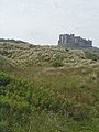
 Dunes and castle - geograph.org.uk - 728172.jpg 640 × 406; 46 KB
-
 Dunes at Bamburgh - geograph.org.uk - 728166.jpg 640 × 422; 49 KB
-
 Dunes at Burnham Harbour - geograph.org.uk - 369459.jpg 640 × 480; 72 KB
-
 Dunes at Formby Point - geograph.org.uk - 717286.jpg 406 × 640; 122 KB
-
 Dunes at Humberston - geograph.org.uk - 239988.jpg 640 × 427; 41 KB
-
 Dunes from viewing platform - geograph.org.uk - 690112.jpg 594 × 378; 97 KB
-
 Dunes near Haverigg - geograph.org.uk - 643466.jpg 640 × 480; 104 KB
-
 Dunes near Holkham - geograph.org.uk - 11521.jpg 640 × 480; 76 KB
-

-
 Dunes on the edge of Warkworth Beach - geograph.org.uk - 1412149.jpg 640 × 480; 107 KB
-
 Dunes, East Head - geograph.org.uk - 522926.jpg 640 × 479; 179 KB
-
 Dunes, South Gare - geograph.org.uk - 330659.jpg 640 × 426; 83 KB
-
 East Hills - geograph.org.uk - 582646.jpg 640 × 426; 40 KB
-
 East of Gun Hill - geograph.org.uk - 242321.jpg 600 × 450; 27 KB
-
 Embryo dunes - geograph.org.uk - 564699.jpg 640 × 480; 66 KB
-
 End of the Fisherman's Path - geograph.org.uk - 671609.jpg 640 × 428; 45 KB
-
 Eroding dune - geograph.org.uk - 733443.jpg 640 × 427; 71 KB
-
 Everything has to start somewhere - geograph.org.uk - 599895.jpg 640 × 430; 27 KB
-
 First dune ridge - geograph.org.uk - 733442.jpg 640 × 426; 55 KB
-
 Footpath across the Dunes, East Head - geograph.org.uk - 522929.jpg 640 × 479; 157 KB
-
 Formby Point and drilling rig - geograph.org.uk - 717269.jpg 640 × 386; 46 KB
-
 Freshfield Dune Slack Heath - geograph.org.uk - 96207.jpg 640 × 480; 136 KB
-
 Grassland on Dunes Beside New Downs Farm - geograph.org.uk - 347674.jpg 640 × 480; 123 KB
-
 Hart Warren Dunes Nature Reserve - geograph.org.uk - 482876.jpg 640 × 480; 94 KB
-
 Heather Walk - geograph.org.uk - 436611.jpg 640 × 430; 235 KB
-
 Hemsby sand dunes - geograph.org.uk - 477503.jpg 640 × 377; 92 KB
-
 Holkham Meals - geograph.org.uk - 543979.jpg 640 × 478; 250 KB
-
 Horsey Gap - geograph.org.uk - 223016.jpg 480 × 640; 96 KB
-
 Isolated Tree on Newton Links - geograph.org.uk - 428679.jpg 640 × 427; 74 KB
-
 Kite on Holkham Beach - geograph.org.uk - 543987.jpg 640 × 478; 193 KB
-
 Mawbray Bank - geograph.org.uk - 65421.jpg 480 × 640; 124 KB
-
 Mawbray Bank, looking north - geograph.org.uk - 65425.jpg 640 × 480; 96 KB
-
 Natterjack Toads live here^ - geograph.org.uk - 5719.jpg 631 × 640; 112 KB
-
 New Dunes - geograph.org.uk - 598180.jpg 640 × 516; 48 KB
-
 North along Heacham South Beach - geograph.org.uk - 583985.jpg 640 × 480; 80 KB
-
 North End Dunes - geograph.org.uk - 485107.jpg 640 × 480; 145 KB
-
 North End Dunes - geograph.org.uk - 485111.jpg 640 × 480; 116 KB
-
 Old dune damage - geograph.org.uk - 562465.jpg 640 × 480; 92 KB
-
 On The Dunes - geograph.org.uk - 549236.jpg 640 × 470; 130 KB
-
 Path to Holkham Beach - geograph.org.uk - 544078.jpg 640 × 478; 283 KB
-

-

-
 Raven Meols Hills - sand dunes in Formby - geograph.org.uk - 96400.jpg 640 × 480; 104 KB
-
 Roanhead Sands from the dunes - geograph.org.uk - 480901.jpg 640 × 426; 64 KB
-

-

-
 Sand Dunes - geograph.org.uk - 28849.jpg 640 × 480; 76 KB
-
 Sand Dunes - geograph.org.uk - 558222.jpg 640 × 427; 54 KB
-
 Sand Dunes and Beach, Freshfield - geograph.org.uk - 193459.jpg 640 × 480; 60 KB
-

-
 Sand Dunes at Sandscale Haws - geograph.org.uk - 167143.jpg 640 × 480; 97 KB
-
 Sand Dunes North Prom St Anne's. - geograph.org.uk - 95618.jpg 640 × 426; 127 KB
-

-

-
 Sand Dunes, Formby - geograph.org.uk - 89211.jpg 640 × 479; 85 KB
-
 Seals at Donna Nook - geograph.org.uk - 678821.jpg 640 × 480; 65 KB
-
 Small pine clump - geograph.org.uk - 582668.jpg 640 × 426; 42 KB
-
 St Aidan's Dunes - geograph.org.uk - 48578.jpg 640 × 479; 129 KB
-
 The Dunes and Bamburgh Castle - geograph.org.uk - 90281.jpg 480 × 640; 77 KB
-
 The Dunes At Saltfleet - geograph.org.uk - 549239.jpg 640 × 469; 120 KB
-
 The Dunes off The Wynding - geograph.org.uk - 428603.jpg 640 × 427; 65 KB
-
 Track Through the Dunes - geograph.org.uk - 234908.jpg 640 × 480; 102 KB
-
 Tughall Mill Links - geograph.org.uk - 428689.jpg 640 × 427; 77 KB
-
 View to North end of Walney Island - geograph.org.uk - 268445.jpg 640 × 480; 82 KB
-
 Waxham Hills - geograph.org.uk - 34252.jpg 640 × 448; 64 KB
-
 Winterton Dunes - geograph.org.uk - 388127.jpg 640 × 480; 90 KB


.jpg)


.jpg)

.jpg)


_-_panoramio.jpg)


