Category:East Tintic Mountains
mountain range in Juab, Utah, and Tooele counties in Utah, United States  | |||||
| Upload media | |||||
| Instance of | |||||
|---|---|---|---|---|---|
| Location |
| ||||
| Highest point |
| ||||
| Elevation above sea level |
| ||||
 | |||||
English: Media related to the East Tintic Mountains, a mountain range west of southern end of the Wasatch Front in Juab, Utah, and Tooele counties in Utah, United States.
(The south terminus region of the range, (and southwest trending Tintic Valley), is part of the northeast perimeter of the Sevier Desert. The northeast of the range borders the Goshen Valley, at south Utah Lake.)
(The south terminus region of the range, (and southwest trending Tintic Valley), is part of the northeast perimeter of the Sevier Desert. The northeast of the range borders the Goshen Valley, at south Utah Lake.)
Subcategories
This category has the following 18 subcategories, out of 18 total.
A
- Ajax Mine (3 F)
B
C
- Centennial Eureka Mine (10 F)
D
- Diamond, Utah (empty)
E
- Eureka Lilly Headframe (1 F)
G
- Godiva Mountain (3 F)
- Grand Central Mine (1 F)
H
- Homansville, Utah (2 F)
K
- Knightsville, Utah (2 F)
M
- Mammoth Mine, Tintic District (16 F)
P
S
T
- Tintic Branch Line (22 F)
Media in category "East Tintic Mountains"
The following 40 files are in this category, out of 40 total.
-

-

-
-
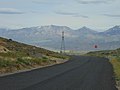
 East at Dividend Road (about mm 0.5) in Utah County, Utah, May 16.jpg 2,592 × 1,944; 2.41 MB
-
 East at US-6 & Dividend Rd intersection from Dividend Rd, May 16.jpg 2,592 × 1,944; 2.36 MB
-
 East at US-6 & Dividend Rd intersection from US-6, May 16.jpg 2,592 × 1,944; 2.36 MB
-
 East at US-6, Elberta Slant Rd, & Dividend Fork Rd intersection, May 16.jpg 2,592 × 1,944; 2.32 MB
-
 East from Dividend Road (about mm 1.2) in Utah County, Utah, May 16.jpg 2,592 × 1,944; 2.34 MB
-
 East on Dividend Road (about mm 0.4) in Utah County, Utah, May 16.jpg 2,592 × 1,944; 2.38 MB
-
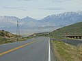
 East on Dividend Road from US-6, May 16.jpg 2,592 × 1,944; 2.43 MB
-
 East Tintic Mountains, Utah (7186838752).jpg 3,730 × 3,000; 1.74 MB
-
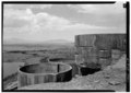
 Harold mill1.jpg 3,872 × 2,592; 5.2 MB
-
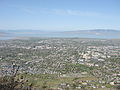
 Looking down on central Springville, Jun 04.jpg 1,280 × 960; 305 KB
-
 Looking down on north Springville, Jun 04.jpg 1,280 × 960; 306 KB
-
 NO sign on Dividend Fork Road, May 16.jpg 2,592 × 1,944; 2.36 MB
-
 North at Dividend Fork Road in Dividend, Utah, May 16.jpg 2,592 × 1,944; 2.4 MB
-
 North at US-6, Elberta Slant Rd, & Dividend Fork Rd intersection, May 16.jpg 2,592 × 1,944; 2.34 MB
-
 North Provo from the Y, May 2008.JPG 2,816 × 2,112; 2.56 MB
-
 North-northeast on Dividend Road (about mm 2.8) in Dividend, Utah, May 16.jpg 2,592 × 1,944; 2.41 MB
-
 Northeast at US-6 & Dividend Rd west junction, May 16.jpg 2,592 × 1,944; 2.4 MB
-
 Northwest along US-6 in west Santaquin, Utah, May 16.jpg 2,592 × 1,944; 2.35 MB
-
 Observatorywmutah.jpg 351 × 191; 45 KB
-
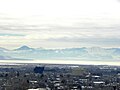 Provo skyline winter.jpg 1,000 × 750; 151 KB
-
 Provo utah 2009.jpg 1,000 × 750; 122 KB
-
 South at US-6, Elberta Slant Rd, & Dividend Fork Rd intersection, May 16.jpg 2,592 × 1,944; 2.37 MB
-
 South Provo from the Y, May 2008.JPG 2,816 × 2,112; 2.55 MB
-
 South-southwest at Dividend Road (from about mm 3.3) in Dividend, Utah, May 16.jpg 2,592 × 1,944; 2.3 MB
-
 Southeast along Dividend Road at Mount Nebo, May 16.jpg 2,592 × 1,944; 2.34 MB
-
 Southwest at US-6 & SR-141 junction, Genola, Utah, May 16.jpg 2,592 × 1,944; 2.36 MB
-
 Tintic Mining District geologic map and mine locations.jpg 973 × 910; 263 KB
-
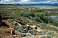
 Tintic Standard Reduction Mill with view of Goshen Warm Springs dyeclan.com - panoramio.jpg 2,748 × 3,664; 2.07 MB
-
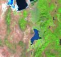 Utah Lake Landsat.png 566 × 529; 652 KB
-
 Utah Lake satellite view.JPG 639 × 423; 168 KB
-
 Utah regional geology.PNG 472 × 613; 64 KB
-
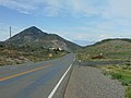
 Utah State Route 132 between Nephi and Lynndyl.jpg 1,280 × 960; 113 KB
-
 Utah West Desert near Railroad - panoramio.jpg 3,264 × 2,448; 2.52 MB
-
 West at US-6 & Dividend Rd intersection, May 16.jpg 2,592 × 1,944; 2.4 MB
-
 West at US-6, Elberta Slant Rd, & Dividend Fork Rd intersection, May 16.jpg 2,592 × 1,944; 2.4 MB
-
 West Mountain Observatory, Jun 17.jpg 2,592 × 1,944; 2.44 MB
-
 West on US-6 from Goshen, Utah, May 16.jpg 2,592 × 1,944; 2.39 MB
_in_Utah_County,_Utah,_May_16.jpg)


_in_Utah_County,_Utah,_May_16.jpg)
_in_Utah_County,_Utah,_May_16.jpg)

.jpg)


_in_Dividend,_Utah,_May_16.jpg)


_in_Dividend,_Utah,_May_16.jpg)


