Category:Election maps of Djibouti
Countries of Africa: Algeria · Angola · Benin · Botswana · Burkina Faso · Burundi · Cameroon · Cape Verde · Chad · Democratic Republic of the Congo · Djibouti · Egypt‡ · Equatorial Guinea · Ethiopia · Gabon · The Gambia · Ghana · Guinea · Guinea-Bissau · Ivory Coast · Kenya · Lesotho · Liberia · Libya · Madagascar · Malawi · Mali · Mauritania · Mauritius · Morocco · Mozambique · Namibia · Niger · Nigeria · São Tomé and Príncipe · Senegal · Seychelles · Sierra Leone · South Africa · South Sudan · Sudan · Tanzania · Togo · Tunisia · Uganda · Zambia · Zimbabwe
Limited recognition: Sahrawi Arab Democratic Republic · Somaliland – Other areas: Canary Islands · Madeira · Mayotte · Réunion
‡: partly located in Africa
Limited recognition: Sahrawi Arab Democratic Republic · Somaliland – Other areas: Canary Islands · Madeira · Mayotte · Réunion
‡: partly located in Africa
Media in category "Election maps of Djibouti"
The following 3 files are in this category, out of 3 total.
-
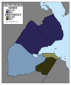 1967 French Somaliland independence referendum by district.png 1,023 × 1,224; 54 KB
-
 2013 Djiboutian parliamentary election results map.svg 1,214 × 1,471; 348 KB
-
 Territoire français des Afars et des Issas législatives 1973.svg 1,052 × 744; 2 KB


