Category:Election maps of Kenya
Countries of Africa: Algeria · Angola · Benin · Botswana · Burkina Faso · Burundi · Cameroon · Cape Verde · Chad · Democratic Republic of the Congo · Djibouti · Egypt‡ · Equatorial Guinea · Ethiopia · Gabon · The Gambia · Ghana · Guinea · Guinea-Bissau · Ivory Coast · Kenya · Lesotho · Liberia · Libya · Madagascar · Malawi · Mali · Mauritania · Mauritius · Morocco · Mozambique · Namibia · Niger · Nigeria · São Tomé and Príncipe · Senegal · Seychelles · Sierra Leone · South Africa · South Sudan · Sudan · Tanzania · Togo · Tunisia · Uganda · Zambia · Zimbabwe
Limited recognition: Sahrawi Arab Democratic Republic · Somaliland – Other areas: Canary Islands · Madeira · Mayotte · Réunion
‡: partly located in Africa
Limited recognition: Sahrawi Arab Democratic Republic · Somaliland – Other areas: Canary Islands · Madeira · Mayotte · Réunion
‡: partly located in Africa
Subcategories
This category has only the following subcategory.
M
Media in category "Election maps of Kenya"
The following 15 files are in this category, out of 15 total.
-
 2002 Kenya Presidential election.svg 435 × 524; 27 KB
-
 2013 Kenyan Presidential Elections by county.svg 626 × 790; 1.34 MB
-
 2013 Kenyan Presidential Elections.svg 1,052 × 790; 4.12 MB
-
 2017 Kenyan Presidential Elections.svg 886 × 793; 2.11 MB
-
 Blank Kenya Electoral Map.png 613 × 784; 21 KB
-
 Kenya 1997 Presidential Election Results by Province.svg 532 × 617; 433 KB
-
 Kenya 2013 elections results.gif 519 × 603; 124 KB
-
 Kenya Provinces 2007 elections.PNG 300 × 348; 20 KB
-
 Kenya Provinces referendum 2005.svg 720 × 642; 335 KB
-
 Kenya Provinces referendum 2010.png 300 × 348; 22 KB
-
 Kenya Provinces referendum 2010.svg 720 × 642; 335 KB
-
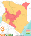
 Kenya's vote-rich counties.png 563 × 720; 78 KB
-
 Kenyan presidential election, 1992 Results by province.png 910 × 1,047; 37 KB
-
 Kenyan presidential election, 1997 Results by province.png 910 × 1,047; 37 KB
-
 Kenyan presidential election, 2002 Results by province.png 910 × 1,047; 37 KB


