Category:Election maps of Liechtenstein
Countries of Europe: Albania · Andorra · Armenia‡ · Austria · Azerbaijan‡ · Belarus · Belgium · Bosnia and Herzegovina · Bulgaria · Croatia · Cyprus‡ · Czech Republic · Denmark · Estonia · Finland · France‡ · Georgia‡ · Germany · Greece · Hungary · Iceland · Republic of Ireland · Italy · Kazakhstan‡ · Latvia · Liechtenstein · Lithuania · Luxembourg · Malta · Moldova · Montenegro · Netherlands‡ · North Macedonia · Norway · Poland · Portugal‡ · Romania · Russia‡ · San Marino · Serbia · Slovakia · Slovenia · Spain‡ · Sweden · Switzerland · Turkey‡ · Ukraine · United Kingdom
Specific status: Faroe Islands · Gibraltar · Isle of Man · Jersey – Limited recognition: Kosovo · Northern Cyprus‡
‡: partly located in Europe
Specific status: Faroe Islands · Gibraltar · Isle of Man · Jersey – Limited recognition: Kosovo · Northern Cyprus‡
‡: partly located in Europe
Subcategories
This category has only the following subcategory.
R
- Referendum maps of Liechtenstein (18 F)
Media in category "Election maps of Liechtenstein"
The following 12 files are in this category, out of 12 total.
-
 1918 liechtenstein election map.png 1,468 × 2,047; 141 KB
-
 1932 Liechtenstein general election map.png 1,044 × 2,048; 225 KB
-
 1936 Liechtenstein general election map.png 1,044 × 2,048; 228 KB
-
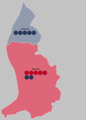
 2009 Liechtenstein general election - Results by constituency.svg 369 × 516; 118 KB
-
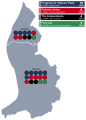 2013 Liechtenstein general election - Results by constituency.svg 370 × 516; 152 KB
-
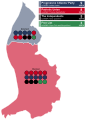 2017 Liechtenstein general election - Results by constituency.svg 370 × 516; 153 KB
-
 2017 Liechtenstein general election map.svg 260 × 510; 27 KB
-
 2021 Liechtenstein Election Results.png 4,799 × 3,577; 474 KB
-
 2021 Liechtenstein general election map.svg 1,866 × 1,789; 1.16 MB
-
 2023 Liechtenstein Municipal Election Map.svg 568 × 603; 176 KB
-
 Mayors.png 800 × 1,299; 29 KB
-
 Municipalities by party.png 800 × 1,299; 29 KB


