Category:Election maps of the Isle of Man
Countries of Europe: Albania · Andorra · Armenia‡ · Austria · Azerbaijan‡ · Belarus · Belgium · Bosnia and Herzegovina · Bulgaria · Croatia · Cyprus‡ · Czech Republic · Denmark · Estonia · Finland · France‡ · Georgia‡ · Germany · Greece · Hungary · Iceland · Republic of Ireland · Italy · Kazakhstan‡ · Latvia · Liechtenstein · Lithuania · Luxembourg · Malta · Moldova · Montenegro · Netherlands‡ · North Macedonia · Norway · Poland · Portugal‡ · Romania · Russia‡ · San Marino · Serbia · Slovakia · Slovenia · Spain‡ · Sweden · Switzerland · Turkey‡ · Ukraine · United Kingdom
Specific status: Faroe Islands · Gibraltar · Isle of Man · Jersey – Limited recognition: Kosovo · Northern Cyprus‡
‡: partly located in Europe
Specific status: Faroe Islands · Gibraltar · Isle of Man · Jersey – Limited recognition: Kosovo · Northern Cyprus‡
‡: partly located in Europe
Media in category "Election maps of the Isle of Man"
The following 10 files are in this category, out of 10 total.
-
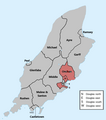 1991 IOM Election Map.png 733 × 828; 68 KB
-
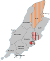
 1996 IOM Election Map.png 733 × 828; 70 KB
-
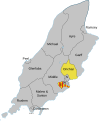
 2016 Manx general election results map.png 1,280 × 1,070; 140 KB
-
 2021 Douglas Borough Council Election Map (with Names).png 331 × 331; 21 KB
-
 2021 Manx general election - Results.svg 525 × 439; 63 KB
-
 Isle of Man constituencies-en.svg 1,200 × 1,100; 315 KB
-
 Map of the Manx general election, 2001.svg 754 × 916; 74 KB
-
 Map of the Manx general election, 2006.svg 754 × 916; 72 KB
-
 Map of the Manx general election, 2011.svg 754 × 916; 66 KB
-
 Map of the Manx general election, 2016.svg 754 × 916; 68 KB


.png)


