Category:Erskine Bridge

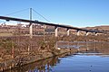
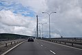
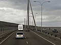
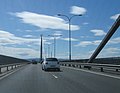
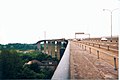
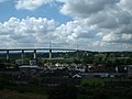
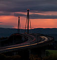
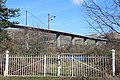
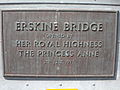
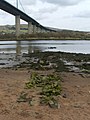
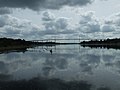
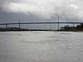
English: The Erskine Bridge is a cable-stayed box girder bridge spanning the River Clyde in west central Scotland, connecting West Dunbartonshire with Renfrewshire
bridge between Renfrewshire and West Dunbartonshire, Scotland, UK, carries the A898 road across River Clyde  | |||||
| Upload media | |||||
| Instance of | |||||
|---|---|---|---|---|---|
| Location |
| ||||
| Maintained by |
| ||||
| Crosses | |||||
| Carries |
| ||||
| Heritage designation |
| ||||
| Date of official opening |
| ||||
| Significant event |
| ||||
 | |||||
Subcategories
This category has the following 3 subcategories, out of 3 total.
D
- Distant views of Erskine Bridge (19 F)
M
- Mine Watcher's Shelter (1 F)
V
- Views from Erskine Bridge (10 F)
Media in category "Erskine Bridge"
The following 72 files are in this category, out of 72 total.
-
 2011 - Walk along the Clyde (6227408625).jpg 4,928 × 3,264; 2.68 MB
-
 3rd Hole, Earl Of Mar Course.jpg 3,363 × 2,242; 3.03 MB
-
 A totem pole in the Saltings - geograph.org.uk - 912726.jpg 640 × 480; 104 KB
-
 A wet crossing of the Erskine Bridge - geograph.org.uk - 2639648.jpg 1,600 × 1,010; 160 KB
-
 Abandoned Erskine Ferry Slipway - geograph.org.uk - 1734075.jpg 3,512 × 2,348; 2.63 MB
-
 Aerial view of Erskine Bridge, 2009-02-01.jpg 3,888 × 2,592; 7.13 MB
-
 Along the Clyde, near the Erskine bridge (6227414099).jpg 4,928 × 3,264; 3.77 MB
-

-
 Barclay Street, Old Kilpatrick - geograph.org.uk - 444821.jpg 640 × 480; 76 KB
-
 Bodinbo Island summit & the Erskine Bridge, Erskine, Renfrewshire, Scotland.jpg 1,920 × 1,080; 1.03 MB
-
 Bodinbo Island view north at low tide, Erskine, Renfrewshire.jpg 1,920 × 1,080; 945 KB
-
 Bowling Harbour Wreck (14945864080).jpg 4,449 × 2,966; 4.06 MB
-
 Bridge over the Clyde on 2013 11 16 -a.jpg 3,008 × 2,000; 1.22 MB
-

-
 Crossing the Erskine Bridge - geograph.org.uk - 2782301.jpg 640 × 430; 38 KB
-
 Crossing the Erskine Bridge - geograph.org.uk - 2915366.jpg 640 × 480; 345 KB
-

-

-
 Doon The Watter - 25th June 2011 , The Erskine Bridge - geograph.org.uk - 2954867.jpg 1,200 × 1,600; 185 KB
-
 Doon The Watter - 25th June 2011 , The Erskine Bridge - geograph.org.uk - 2954906.jpg 1,600 × 1,200; 299 KB
-

-
 Erskine Bridge & Old Kilpatrick, River Clyde.jpg 1,129 × 509; 217 KB
-
 Erskine Bridge - geograph.org.uk - 1472493.jpg 480 × 640; 46 KB
-
 Erskine Bridge - geograph.org.uk - 1472494.jpg 640 × 480; 75 KB
-
 Erskine Bridge - geograph.org.uk - 3470163.jpg 640 × 494; 44 KB
-
 Erskine Bridge - geograph.org.uk - 43980.jpg 640 × 427; 43 KB
-
 Erskine Bridge - geograph.org.uk - 58249.jpg 640 × 480; 70 KB
-
 Erskine Bridge from Erskine ferry beach, Renfrewshire.jpg 1,920 × 1,080; 602 KB
-
 Erskine Bridge from the air.jpg 1,024 × 768; 437 KB
-
 Erskine Bridge from The Saltings - geograph.org.uk - 1263737.jpg 640 × 480; 109 KB
-
 Erskine Bridge in 1971 (geograph 2199540).jpg 800 × 533; 95 KB
-
 Erskine Bridge, looking Northeast - geograph.org.uk - 444781.jpg 640 × 480; 67 KB
-
 Erskine Bridge.jpg 2,048 × 1,536; 1.11 MB
-
 Erskine bridge.jpg 860 × 900; 439 KB
-
 Erskine Ferry ramp, bridge & the River Clyde, Renfrewshire.jpg 1,920 × 1,080; 725 KB
-
 Erskine, the Erskine Bridge - geograph.org.uk - 3287754.jpg 640 × 480; 70 KB
-
 Erskine-bridge-below.jpg 503 × 900; 427 KB
-
 Erskine-bridge-south.jpg 900 × 610; 522 KB
-
 Erskine-bridge.jpg 900 × 598; 475 KB
-
 Erskine-bridge2.jpg 497 × 386; 263 KB
-
 Gates at abandoned Erskine Ferry slipway (geograph 3903584).jpg 1,600 × 1,067; 735 KB
-
 Gates at Abandoned Erskine Ferry Slipway - geograph.org.uk - 1735558.jpg 3,648 × 2,736; 4.4 MB
-
 Harbour Wall and Erskine Bridge (5659589694).jpg 4,928 × 3,264; 3.54 MB
-

-
 Old Dalnottar Road - geograph.org.uk - 904035.jpg 640 × 480; 128 KB
-
 Old Erskine Ferry Slipway - geograph.org.uk - 1734038.jpg 3,648 × 2,736; 4.14 MB
-
 Old Kilpatrick and the Clyde from Erskine Bridge (geograph 3440153).jpg 1,024 × 576; 106 KB
-
 Old Kilpatrick recycling centre - geograph.org.uk - 1472488.jpg 640 × 480; 84 KB
-

-
 Old Kilpatrick slipway, old Erskine Ferry across the River Clyde, Scotland.jpg 4,602 × 2,668; 6.11 MB
-
 Plaque at Erskine Bridge.jpeg 4,608 × 3,456; 2.64 MB
-
 PS Waverley (8704325375).jpg 1,024 × 683; 512 KB
-
 Remains of the south jetty - geograph.org.uk - 1804661.jpg 480 × 640; 68 KB
-
 River Clyde and Erskine Bridge - geograph.org.uk - 1587814.jpg 422 × 640; 68 KB
-
 River Clyde and Erskine Bridge - geograph.org.uk - 1587840.jpg 436 × 640; 76 KB
-
 River Clyde and Erskine Bridge - geograph.org.uk - 907619.jpg 640 × 480; 140 KB
-
 River Clyde from Erskine Bridge.jpg 640 × 480; 60 KB
-
 Samaritans sign at Erskine Bridge.jpeg 4,608 × 3,456; 2.35 MB
-
 Shops beside the Erskine Bridge (geograph 5860220).jpg 1,115 × 1,600; 325 KB
-
 St Patrick Light & Rock, Erskine Bridge & the River Clyde, Erskine.jpg 1,920 × 1,080; 565 KB
-
 St Patrick's Rock, Light & Erskine Bridge, River Clyde - low tide.jpg 1,920 × 1,080; 629 KB
-
 St. Patrick's Catholic Church - geograph.org.uk - 904038.jpg 640 × 480; 109 KB
-
 Suicide barriers @ Erskine Bridge.jpeg 4,608 × 3,456; 2.34 MB
-
 The Erskine Bridge - geograph.org.uk - 2005073.jpg 640 × 480; 71 KB
-
 The Erskine Bridge - geograph.org.uk - 2782304.jpg 640 × 430; 48 KB
-
 The Erskine Bridge - geograph.org.uk - 806328.jpg 640 × 480; 46 KB
-
 The Erskine Bridge from Greenock - geograph.org.uk - 5777138.jpg 1,024 × 628; 288 KB
-
 The Glen Lusset bar - geograph.org.uk - 904036.jpg 640 × 480; 128 KB
-
 The north jetty and its beacon - geograph.org.uk - 1804669.jpg 640 × 480; 68 KB
-
 Toll booths - geograph.org.uk - 37830.jpg 640 × 480; 81 KB
-
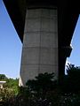 Underside of the Erskine Bridge - geograph.org.uk - 907673.jpg 480 × 640; 100 KB
-
 Wreck at Bowling Harbour - geograph.org.uk - 712842.jpg 640 × 480; 81 KB
.jpg)


.jpg)


.jpg)


.jpg)


.jpg)

.jpg)
.jpg)


.jpg)


.jpg)


.jpg)


