Category:Farms in Devon
Wikimedia category | |||||
| Upload media | |||||
| Instance of | |||||
|---|---|---|---|---|---|
| |||||
Ceremonial counties of England: Bedfordshire · Berkshire · Buckinghamshire · Cambridgeshire · Cheshire · Cornwall · Cumbria · Derbyshire · Devon · Dorset · Durham · East Riding of Yorkshire · East Sussex · Essex · Gloucestershire · Greater London · Greater Manchester · Hampshire · Herefordshire · Hertfordshire · Kent · Lancashire · Leicestershire · Lincolnshire · Merseyside · Norfolk · North Yorkshire · Northamptonshire · Northumberland · Nottinghamshire · Oxfordshire · Rutland · Shropshire · Somerset · South Yorkshire · Staffordshire · Suffolk · Surrey · Tyne and Wear · Warwickshire · West Midlands · West Sussex · West Yorkshire · Wiltshire · Worcestershire
City-counties: Bristol ·
Former historic counties: Yorkshire
Other former counties:
City-counties: Bristol ·
Former historic counties: Yorkshire
Other former counties:
Subcategories
This category has the following 18 subcategories, out of 18 total.
A
- Acland Barton (4 F)
B
- Brickhouse Farm, Devon (2 F)
D
E
- Elberry Farm, Broadsands (5 F)
F
- Freathingcott Farm (5 F)
G
- Gateshayes Farm (8 F)
L
- Laployd Barton (4 F)
O
- Occombe Farm (7 F)
P
- Pennywell Farm (2 F)
S
- Shutterton Farm (5 F)
- Slade House Farm (7 F)
- South Stoodleigh (4 F)
- Stallenge-Thorne Farm (8 F)
T
- Tucketts Farm (12 F)
W
- Windout Farm (3 F)
Y
- Yellam, Devon (7 F)
Media in category "Farms in Devon"
The following 200 files are in this category, out of 1,366 total.
(previous page) (next page)-
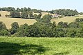
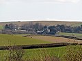
 A Devon farm viewed from Calstock, Cornwall, 11 June 2010.jpg 2,816 × 2,112; 1.04 MB
-
 A few miles east of Woolacombe. - geograph.org.uk - 1381077.jpg 640 × 427; 56 KB
-
 A few miles east of Woolacombe. - geograph.org.uk - 1381099.jpg 640 × 427; 48 KB
-
 A panoramic view of Churchill. - geograph.org.uk - 1254514.jpg 640 × 480; 69 KB
-
 Abbot's Marsh - geograph.org.uk - 554740.jpg 640 × 480; 102 KB
-
 Abbot's Marsh - geograph.org.uk - 555001.jpg 640 × 480; 100 KB
-
 Across the Valley - geograph.org.uk - 970591.jpg 640 × 427; 73 KB
-
 Across the Valley at Horsham - geograph.org.uk - 84160.jpg 640 × 444; 103 KB
-
 Across the Valley to Southdown Farm - geograph.org.uk - 1438494.jpg 640 × 426; 102 KB
-
 Afton - geograph.org.uk - 1588862.jpg 640 × 480; 112 KB
-
 Aller Farm, near Dawlish - geograph.org.uk - 139211.jpg 640 × 480; 78 KB
-
 Alpaca manure for sale - geograph.org.uk - 1141894.jpg 640 × 480; 129 KB
-
 Alpacas at Lower Mullacott Farm. - geograph.org.uk - 1177118.jpg 640 × 427; 48 KB
-
 Alscott Farm - geograph.org.uk - 575318.jpg 640 × 480; 112 KB
-
 Appledore Farm - geograph.org.uk - 121441.jpg 640 × 480; 129 KB
-
 Approach to Newton Tracey - geograph.org.uk - 964779.jpg 640 × 480; 139 KB
-
 Approaching Deneridge Cross - geograph.org.uk - 1193836.jpg 640 × 426; 91 KB
-
 Approaching East Bridge Farm - geograph.org.uk - 697787.jpg 640 × 451; 70 KB
-
 Aptor - geograph.org.uk - 1014255.jpg 640 × 427; 97 KB
-
 Arlington, Middle Beccott Farm - geograph.org.uk - 177028.jpg 640 × 427; 240 KB
-
 Ash Barton Farm - geograph.org.uk - 685663.jpg 640 × 426; 74 KB
-
 Ash Farm - geograph.org.uk - 1574371.jpg 640 × 465; 65 KB
-
 Ash Farm from Haydon Common - geograph.org.uk - 158510.jpg 640 × 480; 99 KB
-
 Ashbury, above Melbury - geograph.org.uk - 88268.jpg 640 × 435; 126 KB
-
 Ashbury, by Ten Acre Plantation - geograph.org.uk - 203160.jpg 640 × 427; 202 KB
-
 Ashbury, on Scobchester Down - geograph.org.uk - 204776.jpg 640 × 427; 194 KB
-
 Ashbury, towards Wadland Barton - geograph.org.uk - 198475.jpg 640 × 427; 159 KB
-
 Ashelford - geograph.org.uk - 1252992.jpg 640 × 427; 76 KB
-
 Ashley Farm - geograph.org.uk - 1090967.jpg 640 × 480; 169 KB
-
 Awliscombe, Culverhayes - geograph.org.uk - 187214.jpg 640 × 427; 199 KB
-
 Awliscombe, Pomhayes Farm - geograph.org.uk - 187203.jpg 640 × 427; 192 KB
-
 Awliscombe, towards Hunthayes Farm - geograph.org.uk - 191095.jpg 640 × 427; 180 KB
-
 Axe Farm from the level crossing - geograph.org.uk - 132541.jpg 568 × 425; 61 KB
-
 Axmouth, Higher Bruckland Farm - geograph.org.uk - 294355.jpg 640 × 427; 192 KB
-
 Ayleston - geograph.org.uk - 1379292.jpg 640 × 480; 72 KB
-
 Ayshford , Chicken Coup and Countryside - geograph.org.uk - 1330972.jpg 640 × 480; 107 KB
-
 Babcombe - geograph.org.uk - 908053.jpg 640 × 436; 97 KB
-
 Baddaford - geograph.org.uk - 1204112.jpg 640 × 480; 85 KB
-
 Baddaford - geograph.org.uk - 1204124.jpg 640 × 480; 70 KB
-
 Balls - geograph.org.uk - 569969.jpg 640 × 480; 100 KB
-
 Balls Farm, between Alphington and Ide (geograph 6437516).jpg 1,600 × 1,200; 1.02 MB
-
 Bampfield Farm - geograph.org.uk - 140024.jpg 640 × 480; 130 KB
-
 Bampton, entrance to Wonham Barton - geograph.org.uk - 88755.jpg 640 × 424; 148 KB
-
 Bampton, near Raddington - geograph.org.uk - 61999.jpg 640 × 435; 129 KB
-
 Bampton, towards Hookways Farm - geograph.org.uk - 164771.jpg 640 × 427; 140 KB
-
 Barn Farm - geograph.org.uk - 53832.jpg 640 × 480; 158 KB
-
 Barns, at Hillgrounds Farm - geograph.org.uk - 1272481.jpg 640 × 480; 68 KB
-
 Battishorne Farm, Honiton - geograph.org.uk - 201154.jpg 640 × 480; 80 KB
-
 Beacon Farm - geograph.org.uk - 750017.jpg 640 × 480; 79 KB
-
 Beara - geograph.org.uk - 318781.jpg 480 × 640; 109 KB
-
 Bearah - geograph.org.uk - 905659.jpg 640 × 411; 74 KB
-
 Bearah - geograph.org.uk - 905666.jpg 640 × 429; 65 KB
-
 Beare Mill Farm - geograph.org.uk - 1749571.jpg 640 × 400; 70 KB
-
 Bearscombe - geograph.org.uk - 226484.jpg 480 × 640; 98 KB
-
 Beautiport Farm - geograph.org.uk - 143538.jpg 480 × 640; 108 KB
-
 Beautiport Farm - geograph.org.uk - 1737090.jpg 1,600 × 1,200; 748 KB
-
 Beaworthy, by the A3079 road - geograph.org.uk - 198446.jpg 640 × 427; 187 KB
-
 Beaworthy, towards Stoney - geograph.org.uk - 198464.jpg 640 × 427; 141 KB
-
 Beckwell and Borough - geograph.org.uk - 422065.jpg 640 × 480; 85 KB
-
 Beechcombe - geograph.org.uk - 247975.jpg 640 × 480; 99 KB
-
 Berrator Farm (geograph 4314291).jpg 1,920 × 1,440; 755 KB
-
 Berry Farm - geograph.org.uk - 567857.jpg 640 × 470; 120 KB
-
 Bickaton from Hunland Copse - geograph.org.uk - 1071814.jpg 640 × 474; 98 KB
-
 Biddlecombe and beyond - geograph.org.uk - 723590.jpg 640 × 505; 131 KB
-
 Birds and Breeding Pens - geograph.org.uk - 637674.jpg 640 × 480; 85 KB
-
 Bishop's Nympton, near Veraby - geograph.org.uk - 320021.jpg 640 × 427; 191 KB
-
 Bishop's Nympton, near Westwood - geograph.org.uk - 406357.jpg 640 × 427; 161 KB
-
 Bishop's Nympton, nearing South Port - geograph.org.uk - 382207.jpg 640 × 427; 148 KB
-
 Bishop's Nympton, towards Barton - geograph.org.uk - 406354.jpg 640 × 427; 157 KB
-

-

-
 Bishop's Tawton, Great Westacott - geograph.org.uk - 555033.jpg 640 × 427; 121 KB
-
 Blackbroom - geograph.org.uk - 373926.jpg 640 × 443; 95 KB
-
 Blackhayes farmyard - geograph.org.uk - 1417804.jpg 640 × 480; 112 KB
-
 Blackpool Farm - geograph.org.uk - 824492.jpg 640 × 430; 123 KB
-
 Bletherdon farm - Great Hill - geograph.org.uk - 1081477.jpg 640 × 480; 65 KB
-
 Bonehayne - geograph.org.uk - 422347.jpg 640 × 480; 86 KB
-
 Borough Farm - geograph.org.uk - 292739.jpg 640 × 480; 81 KB
-
 Borough Farm from Hembury Cross - geograph.org.uk - 291904.jpg 640 × 480; 91 KB
-
 Bountis Thorne - geograph.org.uk - 720946.jpg 640 × 480; 67 KB
-
 Bourna - geograph.org.uk - 569611.jpg 640 × 480; 120 KB
-
 Bourton Farm - geograph.org.uk - 982453.jpg 640 × 427; 111 KB
-
 Bourton Lane - geograph.org.uk - 803904.jpg 640 × 480; 113 KB
-
 Bourton valley - geograph.org.uk - 803885.jpg 640 × 480; 116 KB
-
 Bourton, Totnes - geograph.org.uk - 152387.jpg 640 × 480; 75 KB
-
 Bourton, Totnes - geograph.org.uk - 803802.jpg 640 × 514; 87 KB
-
 Bow, by Easterhill Farm - geograph.org.uk - 202103.jpg 640 × 427; 200 KB
-
 Bow, Hillerton Barton and East Barton - geograph.org.uk - 202098.jpg 640 × 427; 191 KB
-
 Bow, towards Higher Hampson - geograph.org.uk - 348442.jpg 640 × 427; 216 KB
-
 Bow, Treedown Farm - geograph.org.uk - 202088.jpg 640 × 427; 192 KB
-
 Bow, West Hillerton Farm - geograph.org.uk - 202093.jpg 640 × 427; 158 KB
-
 Bowden - geograph.org.uk - 210693.jpg 640 × 480; 108 KB
-
 Bowhill Farm, Bradninch - geograph.org.uk - 1123809.jpg 640 × 480; 100 KB
-
 Boycombe - geograph.org.uk - 201149.jpg 640 × 480; 76 KB
-
 Bozomzeal Pig Unit - geograph.org.uk - 191546.jpg 640 × 480; 104 KB
-
 Bradleigh from the east - geograph.org.uk - 1772118.jpg 640 × 399; 63 KB
-
-
 Bradninch, Garlandhayes Farm - geograph.org.uk - 43979.jpg 640 × 426; 157 KB
-
 Bradninch, Hele Payne - geograph.org.uk - 80483.jpg 640 × 427; 102 KB
-
 Bradninch, Stockwell Farm - geograph.org.uk - 122039.jpg 640 × 427; 138 KB
-
-
 Bremridge - geograph.org.uk - 576693.jpg 640 × 465; 123 KB
-
 Bremridge - geograph.org.uk - 618575.jpg 640 × 429; 67 KB
-
 Brendon Barton, Exmoor - geograph.org.uk - 1657990.jpg 640 × 480; 80 KB
-

-
 Bridewell - geograph.org.uk - 470649.jpg 640 × 480; 113 KB
-
 Bridewell - geograph.org.uk - 472243.jpg 640 × 441; 102 KB
-
 Bridge over the River Taw - geograph.org.uk - 1051949.jpg 640 × 426; 92 KB
-
-
 Bridge, Littlehempston - geograph.org.uk - 943088.jpg 640 × 480; 119 KB
-
 Bridleway at Greenacres Farm - geograph.org.uk - 468947.jpg 640 × 480; 142 KB
-
 Brindiwell - geograph.org.uk - 990548.jpg 640 × 480; 161 KB
-

-
 Broadmoor Farm - geograph.org.uk - 1128157.jpg 640 × 480; 91 KB
-
 Broadmoor Farm - geograph.org.uk - 295545.jpg 640 × 480; 89 KB
-
 Broadwoodkelly, Middlecott - geograph.org.uk - 329688.jpg 640 × 427; 198 KB
-
 Broadwoodkelly, south to Dartmoor - geograph.org.uk - 98395.jpg 640 × 423; 90 KB
-
 Broadwoodwidger, by Bears Farm - geograph.org.uk - 448041.jpg 640 × 427; 209 KB
-
 Broadwoodwidger, cottage and outbuildings - geograph.org.uk - 448055.jpg 640 × 427; 232 KB
-
 Bron Y Garth, Woodtown, Near Bideford - geograph.org.uk - 727449.jpg 640 × 480; 56 KB
-
 Brook Farm - geograph.org.uk - 285325.jpg 640 × 480; 103 KB
-
 Brooke Farm, Yalberton - geograph.org.uk - 945255.jpg 640 × 480; 81 KB
-
 Brookfield Farm, Offwell - geograph.org.uk - 205037.jpg 640 × 427; 209 KB
-
 Brookfield House, West Town - geograph.org.uk - 1433600.jpg 640 × 480; 77 KB
-
 Broomage - geograph.org.uk - 315261.jpg 640 × 480; 94 KB
-
 Brown's farm, near Kenn - geograph.org.uk - 1458138.jpg 640 × 480; 90 KB
-
 Brownscombe Farm - geograph.org.uk - 659980.jpg 640 × 362; 61 KB
-
 Brownston - geograph.org.uk - 240075.jpg 640 × 480; 112 KB
-
 Buckton Hill and Farm - geograph.org.uk - 186683.jpg 640 × 480; 111 KB
-
 Buildings at Home Farm, Haccombe - geograph.org.uk - 826272.jpg 640 × 480; 113 KB
-
 Buildings at Manor Farm - geograph.org.uk - 1376848.jpg 640 × 480; 91 KB
-

-
 Buildings on Old Haldon Hill - geograph.org.uk - 1218971.jpg 640 × 480; 77 KB
-
 Bullpark, near Princetown - geograph.org.uk - 183787.jpg 640 × 480; 121 KB
-
 Burlescombe, Ebear Farm - geograph.org.uk - 68665.jpg 640 × 427; 94 KB
-
 Burlescombe, Great Southdown Farm - geograph.org.uk - 98340.jpg 640 × 422; 112 KB
-
 Burlescombe, Houndaller Farm - geograph.org.uk - 69233.jpg 640 × 427; 118 KB
-
 Burlescombe, Lower Ebear - geograph.org.uk - 68674.jpg 640 × 427; 157 KB
-
 Burlescombe, muck spreading - geograph.org.uk - 49620.jpg 640 × 427; 141 KB
-
 Burnicombe - geograph.org.uk - 174845.jpg 640 × 480; 116 KB
-
 Burnshall Farm - geograph.org.uk - 1474012.jpg 640 × 480; 101 KB
-
 Burnshall Farm - geograph.org.uk - 421466.jpg 640 × 480; 98 KB
-
 Burnshall Farm - geograph.org.uk - 432376.jpg 640 × 480; 102 KB
-
 Burscombe Farm - geograph.org.uk - 753259.jpg 640 × 459; 98 KB
-
 Burscombe Farm, Sidbury - geograph.org.uk - 204993.jpg 640 × 427; 243 KB
-
 Burscott, with cattle - geograph.org.uk - 247050.jpg 640 × 480; 110 KB
-
 Butlas - geograph.org.uk - 294771.jpg 640 × 480; 65 KB
-
 Buttermeade Farm on Willingcott Hill - geograph.org.uk - 1412822.jpg 640 × 480; 98 KB
-
 By Home Farm, Haccombe - geograph.org.uk - 1301840.jpg 640 × 459; 89 KB
-
 By Home Farm, Haccombe - geograph.org.uk - 1595575.jpg 640 × 480; 74 KB
-
 Cadbury, towards Fursdon House - geograph.org.uk - 110570.jpg 640 × 427; 97 KB
-
 Cadbury, towards Wolland Farm - geograph.org.uk - 109551.jpg 640 × 427; 97 KB
-
 Caddaford - geograph.org.uk - 1075445.jpg 640 × 446; 85 KB
-
 Cadeleigh, Catlake - geograph.org.uk - 96307.jpg 640 × 427; 96 KB
-
 Cadeleigh, East Court - geograph.org.uk - 109472.jpg 640 × 427; 106 KB
-
 Cadeleigh, Gotham - geograph.org.uk - 109482.jpg 640 × 427; 106 KB
-
 Cadeleigh, Langley - geograph.org.uk - 109491.jpg 640 × 427; 96 KB
-
 Cadeleigh, Meadhayes Farm - geograph.org.uk - 109498.jpg 640 × 427; 119 KB
-
 Caen Park farm - geograph.org.uk - 523215.jpg 640 × 425; 99 KB
-
 Canterbury Green Farm - geograph.org.uk - 163094.jpg 640 × 480; 117 KB
-
 Captain's farm near Cadeleigh - geograph.org.uk - 990521.jpg 640 × 480; 180 KB
-
 Castle Barn - geograph.org.uk - 1767753.jpg 640 × 472; 96 KB
-
 Cattle at Awsland - geograph.org.uk - 577638.jpg 640 × 398; 87 KB
-
 Cattle at Weeke Farm - geograph.org.uk - 1759859.jpg 1,024 × 682; 155 KB
-
 Cattle near Firebeacon - geograph.org.uk - 1397641.jpg 640 × 446; 72 KB
-
 Cattle, at Higher Luxton Farm - geograph.org.uk - 1185455.jpg 640 × 480; 111 KB
-
 Cattle, at Pound Down Corner - geograph.org.uk - 1064864.jpg 640 × 480; 82 KB
-

-
 Centery farm - geograph.org.uk - 523201.jpg 640 × 425; 122 KB
-
 Challabrook Farm - geograph.org.uk - 1077787.jpg 640 × 464; 66 KB
-
 Challenger Farm - geograph.org.uk - 427228.jpg 640 × 480; 100 KB
-
 Challon's Combe from Prospect Cottage - geograph.org.uk - 282651.jpg 640 × 480; 99 KB
-

-
 Chapels and the B3227 - geograph.org.uk - 692210.jpg 640 × 499; 95 KB
-
 Chapple - geograph.org.uk - 1549992.jpg 640 × 445; 86 KB
-
 Chapplelands - geograph.org.uk - 1378956.jpg 640 × 459; 90 KB
-
 Chardstock, Churchill Farm - geograph.org.uk - 230794.jpg 640 × 427; 138 KB
-
 Chattafin - geograph.org.uk - 465030.jpg 640 × 480; 93 KB
-
 Cheriton Fitzpaine, entrance to Leys - geograph.org.uk - 364346.jpg 640 × 427; 285 KB
-
 Cheriton Fitzpaine, Furze - geograph.org.uk - 96320.jpg 640 × 420; 72 KB
-

-
 Cheriton Fitzpaine, near Redyeates Farm - geograph.org.uk - 364334.jpg 640 × 427; 218 KB
-

-
 Cheriton Fitzpaine, towards Leys Farm - geograph.org.uk - 364342.jpg 640 × 427; 152 KB
-
 Cheriton Fitzpaine, Trundlemoor Farm - geograph.org.uk - 89038.jpg 640 × 424; 132 KB
-

-

-

-
 Chicken housing near Rattery - geograph.org.uk - 1086307.jpg 640 × 421; 66 KB
-
 Chickens at Meadow Farm - geograph.org.uk - 640144.jpg 502 × 640; 91 KB
-
 Chickens at Shillingford - geograph.org.uk - 155637.jpg 640 × 480; 85 KB
-
 Chilley - geograph.org.uk - 229540.jpg 480 × 640; 125 KB
-
 Chittlehampton - towards Whitstone Farm - geograph.org.uk - 441528.jpg 640 × 427; 185 KB
-
 Chittlehampton Farm, near Hollocombe - geograph.org.uk - 146022.jpg 640 × 426; 119 KB
-
 Chiverstone Farm, Kenton - geograph.org.uk - 989538.jpg 640 × 480; 87 KB
-
 Choakford Farm - geograph.org.uk - 294278.jpg 640 × 480; 129 KB
-
 Cholwell Park - geograph.org.uk - 431918.jpg 640 × 480; 103 KB
-
 Cholwich Town - geograph.org.uk - 312027.jpg 640 × 480; 136 KB
-
 Chulmleigh, near Higher Dodyard - geograph.org.uk - 267540.jpg 640 × 427; 187 KB
-
 Church View Farm, Marldon - geograph.org.uk - 715698.jpg 640 × 471; 84 KB


.jpg)


.jpg)


