Category:Farms in Rutland
Ceremonial counties of England: Bedfordshire · Berkshire · Buckinghamshire · Cambridgeshire · Cheshire · Cornwall · Cumbria · Derbyshire · Devon · Dorset · Durham · East Riding of Yorkshire · East Sussex · Essex · Gloucestershire · Greater London · Greater Manchester · Hampshire · Herefordshire · Hertfordshire · Kent · Lancashire · Leicestershire · Lincolnshire · Merseyside · Norfolk · North Yorkshire · Northamptonshire · Northumberland · Nottinghamshire · Oxfordshire · Rutland · Shropshire · Somerset · South Yorkshire · Staffordshire · Suffolk · Surrey · Tyne and Wear · Warwickshire · West Midlands · West Sussex · West Yorkshire · Wiltshire · Worcestershire
City-counties: Bristol ·
Former historic counties: Yorkshire
Other former counties:
City-counties: Bristol ·
Former historic counties: Yorkshire
Other former counties:
Subcategories
This category has the following 3 subcategories, out of 3 total.
B
- Farm buildings in Rutland (16 F)
F
- Farmhouses in Rutland (2 F)
Media in category "Farms in Rutland"
The following 75 files are in this category, out of 75 total.
-
 Farm track near Wytchley Warren Farm - geograph.org.uk - 364880.jpg 640 × 427; 104 KB
-
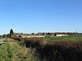
 Farmland near Oakham, Rutland - geograph.org.uk - 65954.jpg 640 × 480; 103 KB
-
 Farmland south of Kelby - geograph.org.uk - 394683.jpg 640 × 480; 72 KB
-
 Footpath junction - geograph.org.uk - 488109.jpg 640 × 477; 92 KB
-
 Holbeck Farm - geograph.org.uk - 145801.jpg 640 × 480; 73 KB
-
 Hooby Lodge Farm - geograph.org.uk - 169656.jpg 640 × 480; 51 KB
-

-
 Wright's Lodge near Langham - geograph.org.uk - 147226.jpg 640 × 427; 96 KB
-
 Arable land - geograph.org.uk - 216042.jpg 640 × 408; 26 KB
-
 Belton Ashes - geograph.org.uk - 361507.jpg 640 × 427; 112 KB
-
 Bridleway regeneration - geograph.org.uk - 458118.jpg 640 × 477; 86 KB
-
 Chapel Farm - geograph.org.uk - 588872.jpg 640 × 427; 94 KB
-
 Cotswold Farm - geograph.org.uk - 282055.jpg 640 × 480; 68 KB
-
 Countryside near Ketton - geograph.org.uk - 192281.jpg 640 × 427; 130 KB
-
 Crop below woodland - geograph.org.uk - 360140.jpg 619 × 438; 119 KB
-
 Cumberland Field, near Irnham - geograph.org.uk - 384822.jpg 640 × 427; 121 KB
-
 Dumpling Farm - geograph.org.uk - 282105.jpg 640 × 480; 82 KB
-
 Dunsby Fen - geograph.org.uk - 473024.jpg 640 × 427; 60 KB
-
 Easton Lodge - geograph.org.uk - 282072.jpg 640 × 480; 71 KB
-
 Farm track near Boothby Little Wood - geograph.org.uk - 341701.jpg 640 × 427; 86 KB
-
 Farmland at Belton Ashes - geograph.org.uk - 362218.jpg 640 × 427; 99 KB
-
 Farmland at Belton Ashes - geograph.org.uk - 362357.jpg 640 × 427; 85 KB
-
 Farmland at Chapel Farm - geograph.org.uk - 588961.jpg 640 × 427; 81 KB
-
 Farmland at Hanby - geograph.org.uk - 329768.jpg 640 × 427; 107 KB
-
 Farmland at Hanthorpe - geograph.org.uk - 314009.jpg 640 × 427; 97 KB
-
 Farmland between Tixover and Ketton - geograph.org.uk - 365003.jpg 640 × 427; 94 KB
-
 Farmland between Tixover and Ketton - geograph.org.uk - 365880.jpg 640 × 427; 91 KB
-
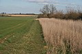
 Farmland by Barrowden Road - geograph.org.uk - 364991.jpg 640 × 427; 111 KB
-
 Farmland by Dunsby Wood - geograph.org.uk - 313204.jpg 640 × 427; 74 KB
-
 Farmland near Camp Farm-2 - geograph.org.uk - 412111.jpg 640 × 427; 115 KB
-
 Farmland near Corby Glen - geograph.org.uk - 628988.jpg 640 × 427; 74 KB
-
 Farmland near Corby Glen - geograph.org.uk - 628993.jpg 640 × 427; 65 KB
-
 Farmland near Folkingham - geograph.org.uk - 628727.jpg 640 × 427; 79 KB
-
 Farmland near Glaston - geograph.org.uk - 364645.jpg 640 × 480; 83 KB
-
 Farmland near Glaston - geograph.org.uk - 364671.jpg 640 × 427; 87 KB
-
 Farmland near Glaston - geograph.org.uk - 364693.jpg 640 × 427; 97 KB
-
 Farmland near Irnham - geograph.org.uk - 328264.jpg 640 × 427; 96 KB
-
 Farmland near Ketton - geograph.org.uk - 192275.jpg 640 × 427; 139 KB
-
 Farmland near Ketton - geograph.org.uk - 364986.jpg 640 × 427; 86 KB
-
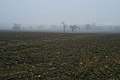
 Farmland near Old Somerby - geograph.org.uk - 341644.jpg 640 × 427; 78 KB
-
 Farmland near Ridlington, Rutland - geograph.org.uk - 599117.jpg 640 × 452; 93 KB
-
 Farmland near Stoke Tunnel Farm - geograph.org.uk - 367650.jpg 640 × 427; 106 KB
-
 Farmland north of Edmondthorpe Mere - geograph.org.uk - 779735.jpg 640 × 507; 89 KB
-
 Farmland off Hall Road - geograph.org.uk - 703065.jpg 640 × 427; 130 KB
-
 Farmland off Hough Road - geograph.org.uk - 281538.jpg 640 × 427; 119 KB
-
 Farmland off the A52 - geograph.org.uk - 341138.jpg 640 × 427; 112 KB
-
 Farmland off the A52 - geograph.org.uk - 341155.jpg 640 × 427; 83 KB
-
 Farmland off the B1176 - geograph.org.uk - 367708.jpg 640 × 427; 109 KB
-
 Farmland off Turnor Road - geograph.org.uk - 341104.jpg 640 × 427; 69 KB
-
 Farmland on Hougham Road - geograph.org.uk - 302130.jpg 640 × 427; 64 KB
-
 Farmland south of Edmondthorpe - geograph.org.uk - 779766.jpg 640 × 520; 79 KB
-
 Farmland south of the A52, Braceby - geograph.org.uk - 403474.jpg 640 × 480; 102 KB
-

-
 Field of Wheat, edge of Seaton village - geograph.org.uk - 484659.jpg 640 × 480; 126 KB
-
 Folly Farm from the Danelaw Way - geograph.org.uk - 358986.jpg 640 × 480; 142 KB
-
 Former farmland - geograph.org.uk - 488014.jpg 640 × 477; 100 KB
-
 Green tops - geograph.org.uk - 477041.jpg 640 × 392; 75 KB
-
 Greenfields Lane - geograph.org.uk - 628725.jpg 640 × 427; 93 KB
-
 Hack's Plantation - geograph.org.uk - 587946.jpg 640 × 427; 115 KB
-
 Lowfield Farm - geograph.org.uk - 344087.jpg 640 × 480; 61 KB
-
 Maidens' Farm - geograph.org.uk - 487328.jpg 640 × 477; 98 KB
-
 Muck heap and excavator - geograph.org.uk - 282140.jpg 640 × 480; 82 KB
-
 Oilseed rape field near Welby Lodge Farm - geograph.org.uk - 492651.jpg 640 × 427; 113 KB
-
-
 Poplar Tree Farm - geograph.org.uk - 437423.jpg 640 × 477; 98 KB
-
 Redhill Farm - geograph.org.uk - 461320.jpg 640 × 480; 125 KB
-
 Rutland farmland - geograph.org.uk - 599104.jpg 640 × 480; 81 KB
-
 Sign of things to come^ - geograph.org.uk - 386243.jpg 640 × 427; 170 KB
-
 Snowdrops at the entrance to Welby Warren - geograph.org.uk - 341129.jpg 640 × 427; 166 KB
-
 Spring wheat - geograph.org.uk - 449458.jpg 640 × 480; 95 KB
-
 Spring wheat - geograph.org.uk - 449459.jpg 640 × 480; 93 KB
-
 Stoke Tunnel Farm, Bassingthorpe - geograph.org.uk - 367639.jpg 640 × 427; 113 KB
-
 Straw storage - geograph.org.uk - 458106.jpg 640 × 477; 94 KB
-
 Two crops - geograph.org.uk - 429555.jpg 640 × 480; 65 KB
-
 View towards Nightingale Plantation - geograph.org.uk - 403470.jpg 640 × 480; 69 KB


