Category:Floods in North Yorkshire
Ceremonial counties of England: Berkshire · Cambridgeshire · Cornwall · Derbyshire · Devon · Dorset · East Riding of Yorkshire · Gloucestershire · Greater London · Hampshire · Lancashire · Leicestershire · Lincolnshire · Norfolk · North Yorkshire · Northamptonshire · Nottinghamshire · Oxfordshire · Shropshire · Somerset · South Yorkshire · Staffordshire · Surrey · Warwickshire · West Midlands · West Sussex · West Yorkshire · Worcestershire
City-counties:
Former historic counties:
Other former counties:
City-counties:
Former historic counties:
Other former counties:
Subcategories
This category has the following 4 subcategories, out of 4 total.
Media in category "Floods in North Yorkshire"
The following 39 files are in this category, out of 39 total.
-
 An unequal task^ - geograph.org.uk - 664913.jpg 640 × 480; 82 KB
-
 Bend around Gardener's Grounds - geograph.org.uk - 664295.jpg 640 × 480; 223 KB
-
 Boats on River Derwent - geograph.org.uk - 722875.jpg 1,744 × 1,308; 1.12 MB
-
 Bridleway to the river - geograph.org.uk - 668411.jpg 640 × 480; 65 KB
-
 Crops under Water near Rolling Bridge - geograph.org.uk - 326904.jpg 640 × 480; 74 KB
-
 Flash flood aftermath - geograph.org.uk - 276461.jpg 640 × 427; 83 KB
-
 Flood at Cattal - geograph.org.uk - 290982.jpg 640 × 427; 74 KB
-
 Flood at Gallows Green - geograph.org.uk - 1600954.jpg 640 × 480; 92 KB
-
 Flooded Field - geograph.org.uk - 312237.jpg 640 × 480; 79 KB
-
 Flooded field at Low Trenhouse - geograph.org.uk - 1583449.jpg 640 × 480; 88 KB
-
 Flooded field Stutton. - geograph.org.uk - 293005.jpg 640 × 480; 53 KB
-
 Flooded Fields in Bishopdale. - geograph.org.uk - 295444.jpg 640 × 480; 289 KB
-
-
 Flooded road - geograph.org.uk - 481057.jpg 640 × 480; 171 KB
-
 Flooded section of Wilstop Lane - geograph.org.uk - 290908.jpg 640 × 427; 80 KB
-
 Flooded wood - geograph.org.uk - 481053.jpg 640 × 480; 183 KB
-
 Flooding by River Wharfe - geograph.org.uk - 487154.jpg 640 × 415; 94 KB
-
 Floods at Colton in July 2007 - geograph.org.uk - 629493.jpg 640 × 429; 57 KB
-
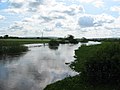
 Floods at Ozendyke Ings - geograph.org.uk - 159372.jpg 640 × 396; 48 KB
-
 Floodspickering.jpg 1,710 × 1,110; 2.62 MB
-
 Flood^ - geograph.org.uk - 474545.jpg 640 × 480; 72 KB
-
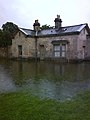 Golf Cottage - geograph.org.uk - 474551.jpg 480 × 640; 66 KB
-
 Heworth Holme - geograph.org.uk - 477657.jpg 640 × 480; 140 KB
-
 John Smith's Brewery - geograph.org.uk - 1611117.jpg 640 × 426; 70 KB
-
 Overflowing Aire - geograph.org.uk - 291786.jpg 640 × 480; 110 KB
-
 Picnickers should wear wellies - geograph.org.uk - 6392936.jpg 5,184 × 3,888; 4.59 MB
-
 River Aire in flood (geograph 6393230).jpg 2,928 × 2,196; 1.19 MB
-
 River Derwent Floods at Kexby - geograph.org.uk - 722906.jpg 1,744 × 1,308; 1.13 MB
-
 River Derwent in Flood - geograph.org.uk - 1205138.jpg 480 × 640; 76 KB
-
 River Nidd - geograph.org.uk - 1299039.jpg 640 × 480; 82 KB
-
 River Swale in flood at Topcliffe.jpg 3,230 × 1,632; 867 KB
-
 StormDennisfloodhull.jpg 1,920 × 947; 504 KB
-

-
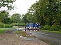
 The Nidd at Skip Bridge - geograph.org.uk - 1606625.jpg 640 × 329; 42 KB
-
 Upstream from Sutton Bridge - geograph.org.uk - 482399.jpg 640 × 478; 121 KB
-
 Wharfe in flood - geograph.org.uk - 292689.jpg 640 × 479; 41 KB
-
-
 Lawns Road - geograph.org.uk - 285484.jpg 640 × 384; 73 KB
-


.jpg)


_-_geograph.org.uk_-_173708.jpg)