Category:Fort Circle Parks
|
This is a category about a place or building that is listed on the National Register of Historic Places in the United States of America. Its reference number is 74000274. |
|
This is a category about a place or building that is listed on the National Register of Historic Places in the United States of America. Its reference number is 78003439. |
series of parks in Washington, D.C., Maryland, and Virginia, United States | |||||
| Upload media | |||||
| Instance of |
| ||||
|---|---|---|---|---|---|
| Part of | |||||
| Location |
| ||||
| Operator | |||||
| Has part(s) |
| ||||
| Heritage designation |
| ||||
 | |||||
Subcategories
This category has the following 16 subcategories, out of 16 total.
B
- Battery Kemble Park (4 F)
C
D
- Fort DeRussy (Washington, D.C.) (12 F)
F
- Fort Foote (25 F)
- Fort Slocum (Washington, D.C.) (21 F)
H
L
- Fort Lincoln (11 F)
M
R
- Fort Reno (Washington, D.C.) (22 F)
S
T
- Fort Totten (Washington, D.C.) (39 F)
Media in category "Fort Circle Parks"
The following 14 files are in this category, out of 14 total.
-
 Fort Driveway - (Washington D.C.). LOC 88690813.jpg 22,339 × 8,991; 29.28 MB
-
 Fort Dupont Park December 2017.jpg 4,032 × 3,024; 5.41 MB
-
 Fort Dupont Park Ice Rink.jpg 5,152 × 3,864; 7.92 MB
-

-
 Fort Stanton Crop.jpg 744 × 518; 458 KB
-

-
 History of the American Civil War (1867) (14762364862).jpg 1,532 × 2,568; 409 KB
-
 History of the American Civil War (1867) (14782557933).jpg 1,528 × 2,540; 610 KB
-
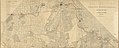
 Map of the District of Columbia - 1901 LOC 87694449.jpg 8,820 × 8,149; 13.14 MB
-

-

-
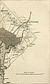
 Topographical map, 1st Brigade, defenses north of Potomac, Washington, D.C. (EAST).jpg 5,918 × 2,899; 1.85 MB
-
 Topographical map, 1st Brigade, defenses north of Potomac, Washington, D.C. (West).jpg 6,795 × 4,397; 2.89 MB
-
 Topographical map, 1st Brigade, defenses north of Potomac, Washington, D.C. LOC 88690656.jpg 23,675 × 11,597; 23.53 MB


.jpg)


_(14762364862).jpg)
_(14782557933).jpg)


.jpg)
.jpg)

._LOC_88690813.jpg)