Category:France photographs taken on 2015-06-19
Countries of Europe: Armenia‡ · Austria · Azerbaijan‡ · Belarus · Belgium · Bosnia and Herzegovina · Bulgaria · Croatia · Czech Republic · Denmark · Estonia · Finland · France‡ · Germany · Greece · Hungary · Italy · Kazakhstan‡ · Malta · Netherlands‡ · Norway · Poland · Portugal‡ · Romania · Russia‡ · Spain‡ · Sweden · Switzerland · Turkey‡ · Ukraine · United Kingdom
‡: partly located in Europe
‡: partly located in Europe
| ← | 19 June 2015 | → | ||
| ← | June 2015 | → | ||

France photographs taken on 19 June 2015.
Image files should be categorized here automatically using {{taken on}} template. Direct categorisation is also possible, if automatic is impossible.
Media in category "France photographs taken on 2015-06-19"
The following 200 files are in this category, out of 238 total.
(previous page) (next page)-
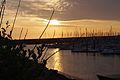 (Sunset Port Le Havre France) 2015.jpg 5,472 × 3,648; 7.75 MB
-
 34290 Servian, France - panoramio (1).jpg 5,472 × 3,648; 7.86 MB
-
 34290 Servian, France - panoramio (10).jpg 3,648 × 5,472; 7.44 MB
-
 34290 Servian, France - panoramio (11).jpg 3,648 × 5,472; 5.58 MB
-
 34290 Servian, France - panoramio (12).jpg 5,472 × 3,648; 9.66 MB
-
 34290 Servian, France - panoramio (13).jpg 5,472 × 3,648; 7.55 MB
-
 34290 Servian, France - panoramio (14).jpg 5,472 × 3,648; 6.77 MB
-
 34290 Servian, France - panoramio (15).jpg 5,472 × 3,648; 5.85 MB
-
 34290 Servian, France - panoramio (16).jpg 5,472 × 3,648; 4.9 MB
-
 34290 Servian, France - panoramio (17).jpg 5,472 × 3,648; 8.39 MB
-
 34290 Servian, France - panoramio (18).jpg 5,472 × 3,648; 6.91 MB
-
 34290 Servian, France - panoramio (19).jpg 5,472 × 3,648; 8.01 MB
-
 34290 Servian, France - panoramio (2).jpg 5,472 × 3,648; 6.43 MB
-
 34290 Servian, France - panoramio (20).jpg 5,472 × 3,648; 7.79 MB
-
 34290 Servian, France - panoramio (21).jpg 5,472 × 3,648; 8.53 MB
-
 34290 Servian, France - panoramio (22).jpg 5,472 × 3,648; 3.09 MB
-
 34290 Servian, France - panoramio (23).jpg 5,472 × 3,648; 4.15 MB
-
 34290 Servian, France - panoramio (24).jpg 5,472 × 3,648; 3.05 MB
-
 34290 Servian, France - panoramio (25).jpg 5,472 × 3,648; 3.22 MB
-
 34290 Servian, France - panoramio (26).jpg 5,472 × 3,648; 3.6 MB
-
 34290 Servian, France - panoramio (27).jpg 5,472 × 3,648; 3.09 MB
-
 34290 Servian, France - panoramio (28).jpg 5,472 × 3,648; 3.05 MB
-
 34290 Servian, France - panoramio (3).jpg 5,472 × 3,648; 7.98 MB
-
 34290 Servian, France - panoramio (4).jpg 5,472 × 3,648; 4.56 MB
-
 34290 Servian, France - panoramio (5).jpg 5,472 × 3,648; 6.16 MB
-
 34290 Servian, France - panoramio (6).jpg 5,472 × 3,648; 4.27 MB
-
 34290 Servian, France - panoramio (7).jpg 5,472 × 3,648; 9.09 MB
-
 34290 Servian, France - panoramio (8).jpg 5,472 × 3,648; 8.63 MB
-
 34290 Servian, France - panoramio (9).jpg 5,472 × 3,648; 8.62 MB
-
 34290 Servian, France - panoramio.jpg 5,472 × 3,648; 4.61 MB
-
 34440 Nissan-lez-Enserune, France - panoramio (1).jpg 5,472 × 3,648; 7.74 MB
-
 34440 Nissan-lez-Enserune, France - panoramio (10).jpg 5,472 × 3,648; 11.62 MB
-
 34440 Nissan-lez-Enserune, France - panoramio (11).jpg 5,472 × 3,648; 9.45 MB
-
 34440 Nissan-lez-Enserune, France - panoramio (12).jpg 5,472 × 3,648; 6.97 MB
-
 34440 Nissan-lez-Enserune, France - panoramio (13).jpg 5,472 × 3,648; 9.17 MB
-
 34440 Nissan-lez-Enserune, France - panoramio (14).jpg 5,472 × 3,648; 6.94 MB
-
 34440 Nissan-lez-Enserune, France - panoramio (15).jpg 5,472 × 3,648; 8.6 MB
-
 34440 Nissan-lez-Enserune, France - panoramio (16).jpg 5,472 × 3,648; 8.64 MB
-
 34440 Nissan-lez-Enserune, France - panoramio (17).jpg 5,472 × 3,648; 11.06 MB
-
 34440 Nissan-lez-Enserune, France - panoramio (18).jpg 5,472 × 3,648; 6.63 MB
-
 34440 Nissan-lez-Enserune, France - panoramio (19).jpg 5,472 × 3,648; 5.95 MB
-
 34440 Nissan-lez-Enserune, France - panoramio (2).jpg 5,472 × 3,648; 5.82 MB
-
 34440 Nissan-lez-Enserune, France - panoramio (20).jpg 5,472 × 3,648; 7.14 MB
-
 34440 Nissan-lez-Enserune, France - panoramio (21).jpg 5,472 × 3,648; 6.68 MB
-
 34440 Nissan-lez-Enserune, France - panoramio (22).jpg 5,472 × 3,648; 9.28 MB
-
 34440 Nissan-lez-Enserune, France - panoramio (23).jpg 3,648 × 5,472; 8.6 MB
-
 34440 Nissan-lez-Enserune, France - panoramio (24).jpg 3,648 × 5,472; 6.49 MB
-
 34440 Nissan-lez-Enserune, France - panoramio (25).jpg 5,472 × 3,648; 9.98 MB
-
 34440 Nissan-lez-Enserune, France - panoramio (26).jpg 5,472 × 3,648; 11.26 MB
-
 34440 Nissan-lez-Enserune, France - panoramio (27).jpg 5,472 × 3,648; 7.66 MB
-
 34440 Nissan-lez-Enserune, France - panoramio (28).jpg 5,472 × 3,648; 7.45 MB
-
 34440 Nissan-lez-Enserune, France - panoramio (29).jpg 5,472 × 3,648; 10.69 MB
-
 34440 Nissan-lez-Enserune, France - panoramio (3).jpg 3,648 × 5,472; 11.87 MB
-
 34440 Nissan-lez-Enserune, France - panoramio (30).jpg 5,472 × 3,648; 6.12 MB
-
 34440 Nissan-lez-Enserune, France - panoramio (31).jpg 5,472 × 3,648; 9.79 MB
-
 34440 Nissan-lez-Enserune, France - panoramio (32).jpg 5,472 × 3,648; 10.47 MB
-
 34440 Nissan-lez-Enserune, France - panoramio (33).jpg 5,472 × 3,648; 12.81 MB
-
 34440 Nissan-lez-Enserune, France - panoramio (34).jpg 5,472 × 3,648; 9.87 MB
-
 34440 Nissan-lez-Enserune, France - panoramio (35).jpg 5,472 × 3,648; 14.71 MB
-
 34440 Nissan-lez-Enserune, France - panoramio (36).jpg 5,472 × 3,648; 7.1 MB
-
 34440 Nissan-lez-Enserune, France - panoramio (37).jpg 5,472 × 3,648; 8.43 MB
-
 34440 Nissan-lez-Enserune, France - panoramio (38).jpg 3,648 × 5,472; 8.83 MB
-
 34440 Nissan-lez-Enserune, France - panoramio (4).jpg 5,472 × 3,648; 7.46 MB
-
 34440 Nissan-lez-Enserune, France - panoramio (5).jpg 5,472 × 3,648; 7.23 MB
-
 34440 Nissan-lez-Enserune, France - panoramio (6).jpg 5,472 × 3,648; 6.46 MB
-
 34440 Nissan-lez-Enserune, France - panoramio (7).jpg 5,472 × 3,648; 7.4 MB
-
 34440 Nissan-lez-Enserune, France - panoramio (8).jpg 5,472 × 3,648; 9.47 MB
-
 34440 Nissan-lez-Enserune, France - panoramio (9).jpg 5,472 × 3,648; 8.34 MB
-
 34440 Nissan-lez-Enserune, France - panoramio.jpg 5,472 × 3,648; 8.88 MB
-
 34500 Béziers, France - panoramio (1).jpg 5,472 × 3,648; 8.37 MB
-
 34500 Béziers, France - panoramio (2).jpg 5,472 × 3,648; 6.66 MB
-
 34500 Béziers, France - panoramio (3).jpg 5,472 × 3,648; 5.82 MB
-
 34500 Béziers, France - panoramio (4).jpg 5,472 × 3,648; 8.22 MB
-
 34500 Béziers, France - panoramio (5).jpg 5,472 × 3,648; 7.08 MB
-
 34500 Béziers, France - panoramio (6).jpg 5,472 × 3,648; 7.14 MB
-
 34500 Béziers, France - panoramio (7).jpg 5,472 × 3,648; 7.25 MB
-
 34500 Béziers, France - panoramio (8).jpg 5,472 × 3,648; 6.86 MB
-
 34500 Béziers, France - panoramio (9).jpg 5,472 × 3,648; 6.47 MB
-
 34500 Béziers, France - panoramio.jpg 5,472 × 3,648; 7.53 MB
-
 Ambleny (Aisne) city limit sign Le Soulier.JPG 3,648 × 2,736; 4.12 MB
-
 Ambleny (Aisne) city limit sign.JPG 3,648 × 2,736; 4.24 MB
-
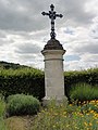
 Ambleny (Aisne) croix de chemin.JPG 2,736 × 3,648; 3.49 MB
-
 Ambleny (Aisne) croix de la Rue du Soulier.JPG 2,736 × 3,648; 3.33 MB
-
 Ambleny (Aisne) la tour (01).JPG 2,736 × 3,648; 3.29 MB
-
 Ambleny (Aisne) la tour (02).JPG 2,736 × 3,648; 3.34 MB
-
 Ambleny (Aisne) la tour (03).JPG 3,648 × 2,736; 4.13 MB
-
 Ambleny (Aisne) mairie.JPG 3,648 × 2,736; 4.36 MB
-
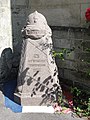
 Ambleny (Aisne) monument aux morts.JPG 2,736 × 3,648; 3.27 MB
-
 Ambleny (Aisne) mémorial de guerre, juin 1940.JPG 2,736 × 3,648; 3.1 MB
-
 Ambleny (Aisne) Pignons à échelons, caractéristiques dans l'Aisne.JPG 3,648 × 2,736; 4.24 MB
-
 Ambleny (Aisne) école.JPG 3,648 × 2,736; 4.34 MB
-
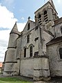
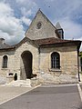
 Ambleny (Aisne) église (01).JPG 3,648 × 2,736; 4.03 MB
-
 Ambleny (Aisne) église (02).JPG 3,648 × 2,736; 3.9 MB
-
 Ambleny (Aisne) église (03).JPG 2,736 × 3,648; 3.63 MB
-
 Ambleny (Aisne) église (04).JPG 3,648 × 2,736; 4.21 MB
-
 Ambleny (Aisne) église (05).JPG 2,736 × 3,648; 3.35 MB
-
 Ambleny (Aisne) église (06).JPG 3,648 × 2,736; 4.33 MB
-
 Ambleny (Aisne) église (07).JPG 2,736 × 3,648; 3.39 MB
-
 Ambleny (Aisne) église (08).JPG 2,736 × 3,648; 3.3 MB
-
 Ambleny (Aisne) église (09).JPG 3,648 × 2,736; 3.61 MB
-
 Ambleny (Aisne) église (10).JPG 2,736 × 3,648; 3.18 MB
-
 Apartment Complex at the port of Le Havre @ Sunset - 2015-2.jpg 5,472 × 3,648; 10.44 MB
-
 Biscutella laevigata-Lunetière-Fleurs-20150609.jpg 3,000 × 3,000; 2.14 MB
-
 Black cows with a cow-Heron at Congenies - panoramio.jpg 3,894 × 2,596; 2.79 MB
-
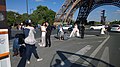 Brides at the Eiffel tower - panoramio (1).jpg 3,072 × 1,728; 1.75 MB
-
 Brides at the Eiffel tower - panoramio.jpg 3,072 × 1,728; 1.81 MB
-
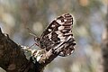 Brintesia circe-Silène (a)-20150609.jpg 1,800 × 1,200; 738 KB
-
 Brintesia circe-Silène (b)-20150609.jpg 1,800 × 1,200; 865 KB
-
 BW (Sunset Port Le Havre France) 2015.jpg 5,472 × 3,648; 4.44 MB
-
 Characteristic South France panoramaview. Here Boissieres and its castle - panoramio.jpg 4,288 × 2,848; 5.01 MB
-
 Chateau de Caveirac (the Caveiirac castle). Now the municipal building - panoramio.jpg 4,288 × 2,848; 6.08 MB
-
 Church of Caveirac at 19 June 2015, with nice clocktower of iron - panoramio.jpg 2,848 × 3,318; 2.48 MB
-
 Château de Castries-Et lucet et terret-20150525.jpg 5,472 × 3,648; 9.5 MB
-
 Episyrphus balteatus on Bellis perennis.jpg 2,475 × 2,431; 3.67 MB
-
 Fontenoy (Aisne) borne TCF de la limite de front.JPG 2,736 × 3,648; 3.51 MB
-
 Fontenoy (Aisne) city limit sign.JPG 3,648 × 2,736; 4.25 MB
-
 Gallargues le Montueux-Ancien Château-20150615.jpg 5,472 × 3,648; 5.24 MB
-
 Gallargues le Montueux-Ancien Hôpital Saint jacques-20150615.jpg 4,142 × 3,113; 4.13 MB
-
 Gallargues le Montueux-Ancienne Maison consulaire-20150615.jpg 4,000 × 4,000; 6.67 MB
-
 Gallargues le Montueux-Domaine Thomas Burnet-20150615.jpg 5,472 × 3,648; 9.31 MB
-
 Gallargues le Montueux-Tour médiévale-20150615.jpg 3,648 × 5,472; 4.81 MB
-
 Gallargues le Montueux-Télégraphe Chappe-20150615.jpg 5,472 × 3,648; 7.56 MB
-
 Gallargues le Montueux-Église Saint Martin-20150615.jpg 5,472 × 3,648; 7.71 MB
-
 L'Horloge - panoramio (1).jpg 2,592 × 1,944; 1.16 MB
-
 L'Horloge - panoramio.jpg 1,944 × 2,592; 1.28 MB
-
 Le Havre, Upper Normandy, at 10 Rue Frederick Lemaitre 76610, on June 19th 2015, Sunset.jpg 5,472 × 3,648; 2.21 MB
-
 MBDA MICA VL Lanceur terrestre Paris Air Show 2015.JPG 1,740 × 1,398; 614 KB
-
 Mercin-et-Vaux (Aisne) ancien chemin de fer.JPG 3,648 × 2,736; 4.21 MB
-
 Mercin-et-Vaux (Aisne) ancienne gare de Mercin-Pommiers.JPG 3,648 × 2,736; 4.31 MB
-
 Mercin-et-Vaux (Aisne) ancienne plaque d'entrée VAUX, transférée sur une maison.JPG 3,648 × 2,736; 4.29 MB
-
 Mercin-et-Vaux (Aisne) city limit sign.JPG 3,648 × 2,736; 4.31 MB
-
 Mercin-et-Vaux (Aisne) croix de chemin à Mercin.JPG 2,736 × 3,648; 3.5 MB
-
 Mercin-et-Vaux (Aisne) croix de chemin à Vaux.JPG 3,648 × 2,736; 4.25 MB
-
 Mercin-et-Vaux (Aisne) Jardin des Senteurs (01) à coté de la mairie.JPG 3,648 × 2,736; 4.23 MB
-
 Mercin-et-Vaux (Aisne) Jardin des Senteurs (02).JPG 3,648 × 2,736; 4.28 MB
-
 Mercin-et-Vaux (Aisne) Jardin des Senteurs (03).JPG 3,648 × 2,736; 4.23 MB
-
 Mercin-et-Vaux (Aisne) mairie.JPG 3,648 × 2,736; 3.87 MB
-
 Mercin-et-Vaux (Aisne) monument aux morts en 2015, après restauration.JPG 3,648 × 2,736; 4.24 MB
-
 Mercin-et-Vaux (Aisne) mémorial aviateurs.JPG 2,736 × 3,648; 3.48 MB
-
 Mercin-et-Vaux (Aisne) école.JPG 3,648 × 2,736; 3.77 MB
-
 Mercin-et-Vaux (Aisne) église Saint-Léger (01).JPG 3,648 × 2,736; 4.18 MB
-
 Mercin-et-Vaux (Aisne) église Saint-Léger (02).JPG 3,648 × 2,736; 4.03 MB
-
 Montady, France - panoramio.jpg 5,472 × 3,648; 7.6 MB
-
 Montigny-Lengrain (Aisne) city limit sign.JPG 3,648 × 2,736; 4.31 MB
-
 Montigny-Lengrain (Aisne) croix de chemin.JPG 2,736 × 3,648; 3.56 MB
-
 Montigny-Lengrain (Aisne) croix monumentale à l'ancien cimetière.JPG 2,736 × 3,648; 3.28 MB
-
 Montigny-Lengrain (Aisne) mairie-école.JPG 3,648 × 2,736; 4.05 MB
-
 Montigny-Lengrain (Aisne) monument aux morts.JPG 2,736 × 3,648; 3.46 MB
-
 Montigny-Lengrain (Aisne) portail de l'ancien cimetière.JPG 2,736 × 3,648; 3.32 MB
-
 Montigny-Lengrain (Aisne) église (01).JPG 2,736 × 3,648; 3.37 MB
-
 Montigny-Lengrain (Aisne) église (02).JPG 2,736 × 3,648; 3.47 MB
-
 Montigny-Lengrain (Aisne) église (03).JPG 2,736 × 3,648; 3.29 MB
-
 Montigny-Lengrain (Aisne) église (04).JPG 2,736 × 3,648; 3.48 MB
-
 Montigny-Lengrain (Aisne) église (05).JPG 2,736 × 3,648; 3.57 MB
-
 Montigny-Lengrain (Aisne) église (06).JPG 3,648 × 2,736; 4.26 MB
-
 Montigny-Lengrain (Aisne) église (07).JPG 2,736 × 3,648; 3.2 MB
-
 Montigny-Lengrain (Aisne) église (08).JPG 2,736 × 3,648; 3.53 MB
-
 Montigny-Lengrain (Aisne) église (09).JPG 3,648 × 2,736; 4.2 MB
-
 Montigny-Lengrain (Aisne) église (10).JPG 2,736 × 3,648; 3.44 MB
-
 Osly-Courtil (Aisne) city limit sign Courtil.JPG 3,648 × 2,736; 4.23 MB
-
 Osly-Courtil (Aisne) city limit sign.JPG 3,648 × 2,736; 4.3 MB
-
 Osly-Courtil (Aisne) mairie.JPG 3,648 × 2,736; 4.22 MB
-
 Osly-Courtil (Aisne) monument aux morts.JPG 2,736 × 3,648; 3.52 MB
-
 Osly-Courtil (Aisne) église Saint-Martin.JPG 2,736 × 3,648; 3.62 MB
-
 Panorama of Calvisson, built partially at the hill - panoramio.jpg 4,288 × 2,848; 4.53 MB
-
 Pernant (Aisne) borne TCF de la ligne de front.JPG 2,736 × 3,648; 3.58 MB
-
 Pernant (Aisne) chateau, MH, (01).JPG 2,736 × 3,648; 3.51 MB
-
 Pernant (Aisne) chateau, MH, (02).JPG 2,736 × 3,648; 3.43 MB
-
 Pernant (Aisne) chateau, MH, (03).JPG 2,736 × 3,648; 3.46 MB
-
 Pernant (Aisne) chateau, MH, (04) détail vu par un trou du portail.JPG 3,648 × 2,736; 4.24 MB
-
 Pernant (Aisne) chateau, MH, (05), détail vu par un trou du portail.JPG 3,648 × 2,736; 4.21 MB
-
 Pernant (Aisne) chateau, MH, (06).JPG 2,736 × 3,648; 3.53 MB
-
 Pernant (Aisne) château-d'eau (réservoir).JPG 3,648 × 2,736; 4.29 MB
-
 Pernant (Aisne) city limit sign.JPG 3,648 × 2,736; 4.23 MB
-
 Pernant (Aisne) croix de cimetière MH.JPG 2,736 × 3,648; 3.58 MB
-
 Pernant (Aisne) mairie.JPG 3,648 × 2,736; 3.67 MB
-
 Pernant (Aisne) monument aux morts.JPG 2,736 × 3,648; 3.48 MB
-
 Pernant (Aisne) oratoire.JPG 2,736 × 3,648; 3.64 MB
-
 Pernant (Aisne) tombes de guerre au cimietière.JPG 3,648 × 2,736; 4.25 MB
-
 Pernant (Aisne) église Saint-Léger (01).JPG 3,648 × 2,736; 4.14 MB
-
 Pernant (Aisne) église Saint-Léger (02).JPG 2,736 × 3,648; 3.61 MB
-
 Pernant (Aisne) église Saint-Léger (03).JPG 3,648 × 2,736; 4.17 MB
-
 Pommiers (Aisne) city limit sign.JPG 3,648 × 2,736; 4.18 MB
-
 Pommiers (Aisne) l'église en 2015 (01).JPG 2,736 × 3,648; 3.37 MB
-
 Pommiers (Aisne) l'église en 2015 (02).JPG 3,648 × 2,736; 3.67 MB
-
 Port at 127 Boulevard Clemenceau 76600 Le Havre Frankreich (SkyColoured).jpg 5,472 × 3,648; 2.55 MB
-
 Port at 127 Boulevard Clemenceau 76600 Le Havre in France (SkyOrigin).jpg 5,472 × 3,648; 1.67 MB
-
 Ressons-le-Long (Aisne) city limit sign.JPG 3,648 × 2,736; 4.15 MB
-
 Ressons-le-Long (Aisne) croix de chemin A (D 1160).JPG 2,736 × 3,648; 3.57 MB
-
 Ressons-le-Long (Aisne) croix de chemin B (D 1160).JPG 2,736 × 3,648; 3.31 MB
-
 Ressons-le-Long (Aisne) croix de chemin C (Place de la fontaine).JPG 2,736 × 3,648; 3.48 MB
-
 Ressons-le-Long (Aisne) Grand Rue, avec pignons à échelons.JPG 3,648 × 2,736; 3.79 MB
-
 Ressons-le-Long (Aisne) mairie-école.JPG 3,648 × 2,736; 4.05 MB
-
 Ressons-le-Long (Aisne) monument aux morts.JPG 2,736 × 3,648; 3.23 MB
-
 Ressons-le-Long (Aisne) vue sur le hameau de La Montagne.JPG 3,648 × 2,736; 4.25 MB
-
 Ressons-le-Long (Aisne) école-mairie.JPG 3,453 × 2,588; 2.18 MB
-
 Ressons-le-Long (Aisne) église (01).JPG 2,736 × 3,648; 3.38 MB
-
 Ressons-le-Long (Aisne) église (02).JPG 3,648 × 2,736; 4.24 MB
-
 Ressons-le-Long (Aisne) église (03).JPG 2,736 × 3,648; 3.42 MB
-
 Ressons-le-Long (Aisne) église (04).JPG 2,736 × 3,648; 3.46 MB
_2015.jpg)
.jpg)
.jpg)
.jpg)
.jpg)
.jpg)
.jpg)
.jpg)
.jpg)
.jpg)
.jpg)
.jpg)
.jpg)
.jpg)
.jpg)
.jpg)
.jpg)
.jpg)
.jpg)
.jpg)
.jpg)
.jpg)
.jpg)
.jpg)
.jpg)
.jpg)
.jpg)
.jpg)
.jpg)

.jpg)
.jpg)
.jpg)
.jpg)
.jpg)
.jpg)
.jpg)
.jpg)
.jpg)
.jpg)
.jpg)
.jpg)
.jpg)
.jpg)
.jpg)
.jpg)
.jpg)
.jpg)
.jpg)
.jpg)
.jpg)
.jpg)
.jpg)
.jpg)
.jpg)
.jpg)
.jpg)
.jpg)
.jpg)
.jpg)
.jpg)
.jpg)
.jpg)
.jpg)
.jpg)
.jpg)
.jpg)
.jpg)

.jpg)
.jpg)
.jpg)
.jpg)
.jpg)
.jpg)
.jpg)
.jpg)
.jpg)

_city_limit_sign_Le_Soulier.JPG)
_city_limit_sign.JPG)
_croix_de_chemin.JPG)
_croix_de_la_Rue_du_Soulier.JPG)
_la_tour_(01).JPG)
_la_tour_(02).JPG)
_la_tour_(03).JPG)
_mairie.JPG)
_monument_aux_morts.JPG)
_m%C3%A9morial_de_guerre,_juin_1940.JPG)
_Pignons_%C3%A0_%C3%A9chelons,_caract%C3%A9ristiques_dans_l%27Aisne.JPG)
_%C3%A9cole.JPG)
_%C3%A9glise_(01).JPG)
_%C3%A9glise_(02).JPG)
_%C3%A9glise_(03).JPG)
_%C3%A9glise_(04).JPG)
_%C3%A9glise_(05).JPG)
_%C3%A9glise_(06).JPG)
_%C3%A9glise_(07).JPG)
_%C3%A9glise_(08).JPG)
_%C3%A9glise_(09).JPG)
_%C3%A9glise_(10).JPG)


.jpg)

-20150609.jpg)
-20150609.jpg)
_2015.jpg)

._Now_the_municipal_building_-_panoramio.jpg)


_borne_TCF_de_la_limite_de_front.JPG)
_city_limit_sign.JPG)


.jpg)


_ancien_chemin_de_fer.JPG)
_ancienne_gare_de_Mercin-Pommiers.JPG)
_city_limit_sign.JPG)
_croix_de_chemin_%C3%A0_Mercin.JPG)
_croix_de_chemin_%C3%A0_Vaux.JPG)
_Jardin_des_Senteurs_(01)_%C3%A0_cot%C3%A9_de_la_mairie.JPG)
_Jardin_des_Senteurs_(02).JPG)
_Jardin_des_Senteurs_(03).JPG)
_mairie.JPG)
_monument_aux_morts_en_2015,_apr%C3%A8s_restauration.JPG)
_m%C3%A9morial_aviateurs.JPG)
_%C3%A9cole.JPG)
_%C3%A9glise_Saint-L%C3%A9ger_(01).JPG)
_%C3%A9glise_Saint-L%C3%A9ger_(02).JPG)

_city_limit_sign.JPG)
_croix_de_chemin.JPG)
_croix_monumentale_%C3%A0_l%27ancien_cimeti%C3%A8re.JPG)
_mairie-%C3%A9cole.JPG)
_monument_aux_morts.JPG)
_portail_de_l%27ancien_cimeti%C3%A8re.JPG)
_%C3%A9glise_(01).JPG)
_%C3%A9glise_(02).JPG)
_%C3%A9glise_(03).JPG)
_%C3%A9glise_(04).JPG)
_%C3%A9glise_(05).JPG)
_%C3%A9glise_(06).JPG)
_%C3%A9glise_(07).JPG)
_%C3%A9glise_(08).JPG)
_%C3%A9glise_(09).JPG)
_%C3%A9glise_(10).JPG)
_city_limit_sign_Courtil.JPG)
_city_limit_sign.JPG)
_mairie.JPG)
_monument_aux_morts.JPG)
_%C3%A9glise_Saint-Martin.JPG)

_borne_TCF_de_la_ligne_de_front.JPG)
_chateau,_MH,_(01).JPG)
_chateau,_MH,_(02).JPG)
_chateau,_MH,_(03).JPG)
_chateau,_MH,_(04)_d%C3%A9tail_vu_par_un_trou_du_portail.JPG)
_chateau,_MH,_(05),_d%C3%A9tail_vu_par_un_trou_du_portail.JPG)
_chateau,_MH,_(06).JPG)
_ch%C3%A2teau-d%27eau_(r%C3%A9servoir).JPG)
_city_limit_sign.JPG)
_croix_de_cimeti%C3%A8re_MH.JPG)
_mairie.JPG)
_monument_aux_morts.JPG)
_oratoire.JPG)
_tombes_de_guerre_au_cimieti%C3%A8re.JPG)
_%C3%A9glise_Saint-L%C3%A9ger_(01).JPG)
_%C3%A9glise_Saint-L%C3%A9ger_(02).JPG)
_%C3%A9glise_Saint-L%C3%A9ger_(03).JPG)
_city_limit_sign.JPG)
_l%27%C3%A9glise_en_2015_(01).JPG)
_l%27%C3%A9glise_en_2015_(02).JPG)
.jpg)
.jpg)
_city_limit_sign.JPG)
_croix_de_chemin_A_(D_1160).JPG)
_croix_de_chemin_B_(D_1160).JPG)
_croix_de_chemin_C_(Place_de_la_fontaine).JPG)
_Grand_Rue,_avec_pignons_%C3%A0_%C3%A9chelons.JPG)
_mairie-%C3%A9cole.JPG)
_monument_aux_morts.JPG)
_vue_sur_le_hameau_de_La_Montagne.JPG)
_%C3%A9cole-mairie.JPG)
_%C3%A9glise_(01).JPG)
_%C3%A9glise_(02).JPG)
_%C3%A9glise_(03).JPG)
_%C3%A9glise_(04).JPG)
_ancienne_plaque_d%27entr%C3%A9e_VAUX,_transf%C3%A9r%C3%A9e_sur_une_maison.JPG)