Category:Fryent Country Park

large greenspace in London | |||||
| Upload media | |||||
| Instance of | |||||
|---|---|---|---|---|---|
| Location | London Borough of Brent, Greater London, London, England | ||||
 | |||||
Media in category "Fryent Country Park"
The following 144 files are in this category, out of 144 total.
-
 A4140 - geograph.org.uk - 5461122.jpg 640 × 426; 57 KB
-
 A4140 - geograph.org.uk - 5461124.jpg 640 × 426; 75 KB
-
 Barn Hill by the railway line - geograph.org.uk - 3954869.jpg 2,304 × 1,728; 842 KB
-
 Barn Hill Open Space - geograph.org.uk - 5459141.jpg 640 × 426; 65 KB
-
 Barn Hill Open Space - geograph.org.uk - 5459143.jpg 640 × 426; 47 KB
-
 Barn Hill Open Space - geograph.org.uk - 5459146.jpg 640 × 426; 49 KB
-
 Barn Hill Open Space - geograph.org.uk - 5459151.jpg 640 × 425; 56 KB
-
 Barn Hill Open Space - geograph.org.uk - 5459153.jpg 640 × 426; 55 KB
-
 Barn Hill Open Space - geograph.org.uk - 5461084.jpg 640 × 426; 65 KB
-
 Barn Hill Open Space - geograph.org.uk - 5461094.jpg 640 × 426; 65 KB
-
 Barn Hill Open Space - geograph.org.uk - 5461095.jpg 640 × 426; 71 KB
-
 Barn Hill Open Space - geograph.org.uk - 5461100.jpg 640 × 426; 58 KB
-
 Barn Hill Open Space - geograph.org.uk - 5461102.jpg 640 × 426; 67 KB
-
 Barn Hill Open Space.jpg 11,934 × 2,951; 24.87 MB
-
 Barn Hill pond - geograph.org.uk - 476223.jpg 640 × 480; 106 KB
-
 Barn Hill Woodland - geograph.org.uk - 5461106.jpg 640 × 426; 57 KB
-
 Bench and berries on Fryent Park - geograph.org.uk - 4688770.jpg 2,304 × 1,728; 821 KB
-
 Capital Ring, Barn Hill Open Space - geograph.org.uk - 5459150.jpg 640 × 426; 69 KB
-
 Capital Ring, Barn Hill Open Space - geograph.org.uk - 5461111.jpg 640 × 426; 98 KB
-
 Capital Ring, Fryent Country Park - geograph.org.uk - 5459139.jpg 640 × 426; 120 KB
-
 Capital Ring, Fryent Country Park - geograph.org.uk - 5459140.jpg 640 × 426; 130 KB
-
 Capital Ring, Fryent Country Park - geograph.org.uk - 5461149.jpg 640 × 426; 56 KB
-
 Capital Ring, Fryent Country Park - geograph.org.uk - 5461158.jpg 640 × 426; 80 KB
-
 Capital Ring, Fryent Country Park - geograph.org.uk - 5461171.jpg 640 × 426; 114 KB
-
 Capital Ring, Fryent Country Park - geograph.org.uk - 5461204.jpg 640 × 426; 61 KB
-
 Capital Ring, Fryent Country Park - geograph.org.uk - 5461212.jpg 640 × 426; 89 KB
-
 Capital Ring, Fryent Country Park - geograph.org.uk - 5461216.jpg 640 × 426; 76 KB
-
 Capital Ring, Fryent Country Park - geograph.org.uk - 5461220.jpg 640 × 426; 61 KB
-
 Capital Ring, Fryent Country Park - geograph.org.uk - 5465687.jpg 640 × 426; 100 KB
-
 Capital Ring, Fryent Country Park - geograph.org.uk - 5465689.jpg 640 × 426; 52 KB
-
 Car Park, Fryent Country Park - geograph.org.uk - 2245260.jpg 1,600 × 1,200; 501 KB
-
 Entrance to Fryent Country Park from Valley Drive - geograph.org.uk - 3601499.jpg 1,600 × 1,200; 991 KB
-
 Fields in Fryent Country Park - geograph.org.uk - 4213850.jpg 1,600 × 1,123; 512 KB
-
 Footbridge over the Jubilee Line from Fryent Country Park - geograph.org.uk - 4549320.jpg 4,000 × 3,000; 4.13 MB
-
 Footbridge over the Jubilee Line from Fryent Country Park - geograph.org.uk - 4549377.jpg 4,000 × 3,000; 4.34 MB
-

-
 Fryent Country Park - geograph.org.uk - 1224435.jpg 640 × 480; 54 KB
-
 Fryent Country Park - geograph.org.uk - 4105556.jpg 2,304 × 1,728; 811 KB
-
 Fryent Country Park - geograph.org.uk - 4105559.jpg 2,304 × 1,728; 858 KB
-
 Fryent Country Park - geograph.org.uk - 4105726.jpg 2,304 × 1,728; 956 KB
-
 Fryent Country Park - geograph.org.uk - 5350313.jpg 640 × 480; 64 KB
-
 Fryent Country Park - geograph.org.uk - 5350320.jpg 640 × 480; 56 KB
-
 Fryent Country Park - geograph.org.uk - 5461112.jpg 640 × 426; 83 KB
-
 Fryent Country Park - geograph.org.uk - 5461133.jpg 640 × 426; 52 KB
-
 Fryent Country Park - geograph.org.uk - 5461138.jpg 640 × 426; 65 KB
-
 Fryent Country Park - geograph.org.uk - 5461147.jpg 640 × 426; 43 KB
-
 Fryent Country Park - geograph.org.uk - 5461155.jpg 640 × 426; 49 KB
-
 Fryent Country Park - geograph.org.uk - 5461160.jpg 640 × 426; 47 KB
-
 Fryent Country Park - geograph.org.uk - 5461164.jpg 640 × 426; 52 KB
-
 Fryent Country Park - geograph.org.uk - 5461174.jpg 640 × 426; 51 KB
-
 Fryent Country Park - geograph.org.uk - 5461178.jpg 640 × 426; 51 KB
-
 Fryent Country Park - geograph.org.uk - 5461181.jpg 640 × 426; 55 KB
-
 Fryent Country Park - geograph.org.uk - 5461185.jpg 640 × 426; 66 KB
-
 Fryent Country Park - geograph.org.uk - 5461186.jpg 640 × 426; 53 KB
-
 Fryent Country Park - geograph.org.uk - 5461191.jpg 640 × 426; 49 KB
-
 Fryent Country Park - geograph.org.uk - 5461196.jpg 640 × 426; 56 KB
-
 Fryent Country Park - geograph.org.uk - 5461200.jpg 640 × 426; 64 KB
-
 Fryent Country Park - geograph.org.uk - 5461202.jpg 640 × 426; 85 KB
-
 Fryent Country Park - geograph.org.uk - 5461207.jpg 640 × 426; 61 KB
-
 Fryent Country Park - geograph.org.uk - 5461223.jpg 640 × 426; 47 KB
-
 Fryent Country Park - geograph.org.uk - 5461230.jpg 640 × 426; 52 KB
-
 Fryent Country Park - geograph.org.uk - 5465688.jpg 640 × 426; 50 KB
-
 Fryent Country Park Barn Hill Pond.JPG 3,648 × 2,736; 3.12 MB
-
 Fryent Country Park clearing.JPG 3,648 × 2,736; 3.97 MB
-
 Fryent Country Park horses1.jpg 1,600 × 1,200; 546 KB
-
 Fryent Country Park next to the Jubilee Line - geograph.org.uk - 4549993.jpg 4,000 × 3,000; 4.33 MB
-
 Fryent Country Park next to the Jubilee Line - geograph.org.uk - 4550018.jpg 4,000 × 3,000; 4.23 MB
-
 Fryent Country Park view north.JPG 3,648 × 2,736; 2.25 MB
-
 Fryent Country Park view of Wembley Stadium.JPG 3,648 × 2,736; 1.78 MB
-
 Fryent Country Park wood.JPG 3,648 × 2,736; 4.52 MB
-
 Fryent Country Park, Kingsbury - geograph.org.uk - 3601520.jpg 1,600 × 1,200; 741 KB
-
 Fryent Country Park, Kingsbury - geograph.org.uk - 3601524.jpg 1,600 × 1,200; 566 KB
-
 Fryent Country Park, Kingsbury - geograph.org.uk - 3601528.jpg 1,200 × 1,600; 601 KB
-
 Fryent Country Park, London Borough of Brent, HA9 NW9 (2050774155).jpg 1,280 × 960; 294 KB
-
 Fryent farm.jpg 2,560 × 1,920; 1.23 MB
-
 Fryent field.jpg 1,600 × 1,200; 563 KB
-
 Fryent Park, Kingsbury - geograph.org.uk - 4688750.jpg 2,304 × 1,728; 811 KB
-
 Fryent Park, Kingsbury - geograph.org.uk - 4688777.jpg 2,304 × 1,728; 1.11 MB
-
 Fryent Park, Kingsbury - geograph.org.uk - 4688799.jpg 2,304 × 1,728; 814 KB
-
 Fryent trees.jpg 1,600 × 1,200; 456 KB
-
 Fryent Way - A4140 - geograph.org.uk - 1224437.jpg 640 × 480; 89 KB
-
 Fryent Way, Kingsbury - geograph.org.uk - 2245246.jpg 1,600 × 1,200; 640 KB
-
 Fryent Way, Kingsbury - geograph.org.uk - 2245252.jpg 1,600 × 1,200; 612 KB
-
 Fryent Way, Kingsbury - geograph.org.uk - 2245257.jpg 1,600 × 1,200; 568 KB
-
 Fryent Way, Kingsbury - geograph.org.uk - 2675096.jpg 1,600 × 1,200; 595 KB
-
 Fryent Way, Kingsbury - geograph.org.uk - 4688782.jpg 2,304 × 1,728; 829 KB
-
 Fryent way.jpg 1,600 × 1,200; 624 KB
-
 FryentCountryPark BarnHillPond 160 20220426 0938.jpg 3,882 × 2,183; 1.78 MB
-
 FryentCountryPark GadderBrook 20220426 0904.jpg 2,268 × 4,032; 2.81 MB
-
 FryentCountryPark hedgerow 20220426 0915.jpg 2,268 × 4,032; 3.38 MB
-
 FryentCountryPark Map Nature 20220426 0921.jpg 3,953 × 2,224; 1.41 MB
-
 FryentCountryPark Map Overview 20220426 0927.jpg 3,807 × 2,142; 1.67 MB
-
 FryentCountryPark SE CapitalRing 20220426 1003.jpg 2,268 × 4,032; 1.7 MB
-
 Gotfords Hill at Fryent Country Park - geograph.org.uk - 4549358.jpg 4,000 × 3,000; 4.05 MB
-
 Gotfords Hill, Fryent Country Park - geograph.org.uk - 2863020.jpg 2,560 × 1,920; 1.14 MB
-
 Harrow on the Hill from Fryent Country Park - geograph.org.uk - 3568540.jpg 1,600 × 1,200; 652 KB
-
 Harrow on the Hill from Fryent Park - geograph.org.uk - 4688761.jpg 2,304 × 1,728; 934 KB
-
 Hollow oak, Barn Hill - geograph.org.uk - 4038617.jpg 397 × 600; 141 KB
-
 Horse pasture, Fryent Country Park - geograph.org.uk - 3601475.jpg 1,600 × 1,200; 599 KB
-
 In Fryent Country Park - geograph.org.uk - 3177730.jpg 640 × 480; 95 KB
-
 In Fryent Country Park - geograph.org.uk - 4781717.jpg 640 × 480; 147 KB
-
 In Fryent Country Park - geograph.org.uk - 4781723.jpg 640 × 480; 122 KB
-

-
 Location map on Fryent Park - geograph.org.uk - 4688807.jpg 2,304 × 1,728; 842 KB
-
 On Gotfords Hill at Fryent Country Park - geograph.org.uk - 4549386.jpg 4,000 × 3,000; 4.09 MB
-
 Path to Ledway Drive from Fryent Country Park - geograph.org.uk - 3568530.jpg 1,600 × 1,200; 633 KB
-
 Path to Salmon Street in Fryent Country Park - geograph.org.uk - 4105538.jpg 2,304 × 1,728; 752 KB
-
 Pond on Barn Hill - geograph.org.uk - 3568577.jpg 2,560 × 1,920; 1.21 MB
-
 Pond on Barn Hill, Wembley - geograph.org.uk - 2549143.jpg 3,968 × 2,976; 3.21 MB
-
 Pond on Fryent Country Park - geograph.org.uk - 3601522.jpg 1,600 × 1,200; 567 KB
-
 Pond on top of Barn Hill - geograph.org.uk - 4225168.jpg 4,000 × 3,000; 2.38 MB
-
 Pond, Barn Hill Open Space - geograph.org.uk - 5461089.jpg 640 × 426; 80 KB
-
 Pond, Fryent Country Park - geograph.org.uk - 5461141.jpg 640 × 426; 89 KB
-
 Red berries on Fryent Park - geograph.org.uk - 4688767.jpg 1,728 × 2,304; 814 KB
-
 Signposts on Barn Hill, Wembley - geograph.org.uk - 2549147.jpg 3,968 × 2,976; 3.01 MB
-
 Silver birch on Fryent Way, Kingsbury - geograph.org.uk - 4688785.jpg 1,728 × 2,304; 1.4 MB
-
 The backs of houses on Valley Drive, Fryent Country Park - geograph.org.uk - 3601485.jpg 1,600 × 1,200; 609 KB
-
 The eastern edge of Fryent Country Park - geograph.org.uk - 4549372.jpg 4,000 × 3,000; 3.99 MB
-
 The eastern edge of Fryent Country Park - geograph.org.uk - 4549389.jpg 4,000 × 3,000; 4 MB
-
 The eastern edge of Fryent Country Park - geograph.org.uk - 4549394.jpg 4,000 × 3,000; 4.05 MB
-
 The exit from Fryent Country Park to Salmon Street - geograph.org.uk - 4105539.jpg 2,304 × 1,728; 755 KB
-
 The exit to Valley Drive in Fryent Park - geograph.org.uk - 4688803.jpg 2,298 × 1,720; 1.79 MB
-
 The fishpond on Barn Hill - geograph.org.uk - 4549309.jpg 4,000 × 3,000; 4.01 MB
-
 The fishpond on Barn Hill - geograph.org.uk - 4549380.jpg 4,000 × 3,000; 4.08 MB
-
 The fishpond on Barn Hill - geograph.org.uk - 4549382.jpg 4,000 × 3,000; 4.25 MB
-
 Train between Kingsbury and Wembley Park - geograph.org.uk - 3568565.jpg 1,600 × 1,200; 987 KB
-
 Train passing Fryent Country Park, Wembley Park - geograph.org.uk - 3568536.jpg 1,600 × 1,200; 557 KB
-
 Train running from Kingsbury to Wembley park - geograph.org.uk - 3568560.jpg 1,600 × 1,200; 615 KB
-
 Tree on Fryent Park - geograph.org.uk - 4688814.jpg 2,304 × 1,728; 821 KB
-
 Trees with black clouds behind, Fryent Country Park - geograph.org.uk - 3601469.jpg 1,600 × 1,200; 607 KB
-

-
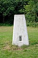
 Trig point on Barn Hill - geograph.org.uk - 5425476.jpg 1,600 × 1,200; 735 KB
-
-
 Two trees on Fryent Park - geograph.org.uk - 4688756.jpg 2,304 × 1,728; 828 KB
-
 View across Kenton from Fryent Country Park - geograph.org.uk - 3568541.jpg 1,600 × 1,200; 547 KB
-
 View from Gotfords Hill, Fryent Country Park (1) - geograph.org.uk - 2863019.jpg 2,560 × 1,920; 1.19 MB
-
 View from Gotfords Hill, Fryent Country Park (2) - geograph.org.uk - 2863021.jpg 2,560 × 1,920; 1.04 MB
-
 View from Gotfords Hill, Fryent Country Park (3) - geograph.org.uk - 2863023.jpg 2,560 × 1,920; 1.14 MB
-
 View from Gotfords Hill, Fryent Country Park (4) - geograph.org.uk - 2863027.jpg 2,560 × 1,920; 1.2 MB
-
 View west from Fryent Country Park - geograph.org.uk - 3179349.jpg 640 × 480; 80 KB
-
 Woodland edge, Barn Hill Open Space - geograph.org.uk - 5459152.jpg 640 × 426; 78 KB
-
 Woodland on Barn Hill - geograph.org.uk - 3954906.jpg 2,304 × 1,728; 781 KB
-
 Woodland on Barn Hill - geograph.org.uk - 3954909.jpg 2,304 × 1,728; 783 KB
-
 Woodland, Barn Hill Open Space - geograph.org.uk - 5461088.jpg 640 × 426; 54 KB


.jpg)


_-_geograph.org.uk_-_2863019.jpg)
_-_geograph.org.uk_-_2863021.jpg)
_-_geograph.org.uk_-_2863023.jpg)
_-_geograph.org.uk_-_2863027.jpg)


