Category:London Borough of Brent
Boroughs of London: City of London · City of Westminster · Barking and Dagenham · Barnet · Bexley · Brent · Bromley · Camden · Croydon · Ealing · Enfield · Greenwich · Hackney · Hammersmith and Fulham · Haringey · Harrow · Havering · Hillingdon · Hounslow · Islington · Kensington and Chelsea · Kingston · Lambeth · Lewisham · Merton · Newham · Redbridge · Richmond · Southwark · Sutton · Tower Hamlets · Waltham Forest · Wandsworth
borough in the London Region in England   | |||||
| Upload media | |||||
| Instance of | |||||
|---|---|---|---|---|---|
| Named after | |||||
| Location | Greater London, London, England | ||||
| Capital | |||||
| Legislative body |
| ||||
| Executive body |
| ||||
| Head of government |
| ||||
| Inception |
| ||||
| Population |
| ||||
| Area |
| ||||
| Replaces |
| ||||
| official website | |||||
 | |||||
Subcategories
This category has the following 24 subcategories, out of 24 total.
A
B
E
F
G
H
N
P
S
T
V
Media in category "London Borough of Brent"
The following 200 files are in this category, out of 2,766 total.
(previous page) (next page)-
-
 "Ghost sign", Salusbury Road, Queen's Park - geograph.org.uk - 4403635.jpg 1,600 × 1,166; 286 KB
-
-
 "The Corrib Rest" public house - geograph.org.uk - 4403649.jpg 3,264 × 3,846; 1.71 MB
-
 "The Grey House" public house, Kensal Green - geograph.org.uk - 4850191.jpg 2,333 × 2,762; 1.22 MB
-
 'Do not feed the birds' - geograph.org.uk - 4713762.jpg 640 × 480; 70 KB
-

-

-

-
 (Part of) Station Road, NW10 - geograph.org.uk - 2751078.jpg 480 × 640; 94 KB
-
 100 and 98, Nathans Road, South Kenton - geograph.org.uk - 2348216.jpg 3,456 × 2,304; 3.86 MB
-
 183 bus on Kenton Road - geograph.org.uk - 4782689.jpg 640 × 480; 152 KB
-
 2 new houses on Norton Road, Wembley - geograph.org.uk - 1997754.jpg 640 × 480; 59 KB
-
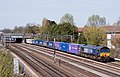 66301 at Conway Gardens - geograph.org.uk - 4433660.jpg 1,250 × 800; 1.06 MB
-
-
 A Concrete Works in Neasden - geograph.org.uk - 3928124.jpg 1,024 × 744; 247 KB
-
 A corner of Gladstone Park, Dollis Hill - geograph.org.uk - 5982732.jpg 1,024 × 768; 425 KB
-
 A fancy dress exception - geograph.org.uk - 3898161.jpg 640 × 480; 69 KB
-

-
 A large coffee cup - geograph.org.uk - 6005448.jpg 1,600 × 1,200; 255 KB
-
 A long walk - geograph.org.uk - 4742438.jpg 640 × 480; 174 KB
-
 A multitude of colours - geograph.org.uk - 6118908.jpg 1,920 × 1,280; 2.78 MB
-
 A multitude of lines - geograph.org.uk - 6002979.jpg 1,024 × 681; 205 KB
-

-

-
-

-
-

-

-

-

-
-

-

-

-

-
-
 A404 - geograph.org.uk - 4534780.jpg 640 × 426; 56 KB
-
 A406 - geograph.org.uk - 5376854.jpg 640 × 426; 42 KB
-
 A5, Kilburn - geograph.org.uk - 5337962.jpg 640 × 350; 58 KB
-
 Abbey Manor Park Royal - geograph.org.uk - 4713234.jpg 640 × 453; 62 KB
-
 Abbey Road at the junction of the North Circular Road - geograph.org.uk - 5225631.jpg 4,030 × 2,962; 4.31 MB
-
 Abbey Road flyover across the North Circular Road - geograph.org.uk - 3781185.jpg 2,304 × 1,728; 856 KB
-
 Abbey Road looking east along the North Circular Road - geograph.org.uk - 3781187.jpg 2,304 × 1,728; 860 KB
-
 Abbey Road Span - geograph.org.uk - 3045993.jpg 640 × 429; 84 KB
-
 Acacia Avenue - geograph.org.uk - 6187169.jpg 2,592 × 1,456; 1.15 MB
-
 Acacia Avenue, Wembley - geograph.org.uk - 6174005.jpg 4,032 × 3,024; 2.78 MB
-
 Access from Beresford Avenue to Grand Union Walk - geograph.org.uk - 2726737.jpg 2,298 × 2,496; 2.15 MB
-
 Access from Water Road to canal towpath - geograph.org.uk - 2726734.jpg 2,919 × 2,186; 2.63 MB
-
 Access self storage on Ealing Road, Alperton - geograph.org.uk - 4201485.jpg 2,304 × 1,728; 665 KB
-
 Access to Abbey Road from towpath - geograph.org.uk - 2726756.jpg 3,648 × 2,736; 4.22 MB
-
 Alayan Motors on Edgware Road, Colindale - geograph.org.uk - 5532796.jpg 2,304 × 1,728; 817 KB
-
 Albert Road, Paddington - geograph.org.uk - 3211479.jpg 480 × 640; 67 KB
-
 Albert Road, Paddington - geograph.org.uk - 3211481.jpg 480 × 640; 54 KB
-
 Aldershot Road, London NW6 - geograph.org.uk - 5316799.jpg 640 × 480; 84 KB
-
 Alderton Close, Neasden - geograph.org.uk - 3865035.jpg 2,304 × 1,728; 845 KB
-
 Aldi by night - geograph.org.uk - 5028073.jpg 2,048 × 1,152; 606 KB
-
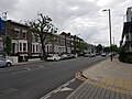
 Algernon Road, NW6 - geograph.org.uk - 2547995.jpg 640 × 480; 88 KB
-

-
 Allendale Road, Greenford (2) - geograph.org.uk - 5482556.jpg 640 × 480; 96 KB
-
 Allendale Road, Greenford - geograph.org.uk - 5482553.jpg 640 × 480; 93 KB
-
 Alley behind Church Lane, Kingsbury - geograph.org.uk - 5079753.jpg 2,048 × 1,152; 794 KB
-
 Alley behind the shops in Church Lane - geograph.org.uk - 5684822.jpg 3,264 × 2,448; 2.23 MB
-
 Alleyway off Church Lane, Kingsbury - geograph.org.uk - 5684812.jpg 3,264 × 2,448; 2.1 MB
-
 Alleyway off High Road, Wembley - geograph.org.uk - 6015433.jpg 1,024 × 768; 151 KB
-
 Allied House, Burnt Oak - geograph.org.uk - 2198150.jpg 4,320 × 3,240; 3.76 MB
-
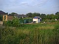
 Allotment gardens, disused - geograph.org.uk - 4187652.jpg 640 × 480; 111 KB
-
 Allotments by Gladstone Park - geograph.org.uk - 3624534.jpg 1,600 × 1,200; 605 KB
-
 Allotments on Townsend Lane, Kingsbury - geograph.org.uk - 4233793.jpg 2,304 × 1,728; 793 KB
-
 Along Kilburn Park Road - geograph.org.uk - 6149889.jpg 1,024 × 768; 555 KB
-
 Alperton - Bridgewater Road - geograph.org.uk - 2881140.jpg 640 × 480; 153 KB
-
 Alperton - Mount Pleasant - geograph.org.uk - 2881138.jpg 640 × 480; 155 KB
-
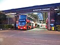 Alperton bus garage - geograph.org.uk - 5843460.jpg 2,048 × 1,536; 1.44 MB
-
 Alperton Community School Upper School - geograph.org.uk - 4713702.jpg 640 × 453; 109 KB
-
 Alperton House - geograph.org.uk - 2864441.jpg 640 × 469; 72 KB
-
 Alperton Station Bridge - geograph.org.uk - 6133212.jpg 3,264 × 2,448; 1.59 MB
-
 Alperton, Bridge No 11 - geograph.org.uk - 4890875.jpg 1,024 × 768; 149 KB
-
 Alperton, Bridge No 11a - geograph.org.uk - 4900470.jpg 1,024 × 745; 218 KB
-
 Alperton, Bridge No 11b - geograph.org.uk - 4900485.jpg 1,024 × 768; 167 KB
-
 Alperton, Bridge No 11c - geograph.org.uk - 4900494.jpg 1,024 × 768; 140 KB
-
 Alperton, Bridge No 12 - geograph.org.uk - 4891074.jpg 1,024 × 768; 156 KB
-
 Alperton, footbridge - geograph.org.uk - 4900478.jpg 1,024 × 768; 174 KB
-
 Alric Avenue, NW10 - geograph.org.uk - 2911179.jpg 640 × 480; 74 KB
-
 Alto Stratus^ - geograph.org.uk - 4895336.jpg 3,900 × 2,800; 1.74 MB
-

-
 Angular building - geograph.org.uk - 2143095.jpg 640 × 480; 83 KB
-
 Another lost petrol station - geograph.org.uk - 3766946.jpg 2,276 × 1,690; 1.27 MB
-

-
 Anson Road (near Oman Avenue), NW2 - geograph.org.uk - 2583215.jpg 640 × 480; 100 KB
-
 Anson Road at the junction of Oman Avenue - geograph.org.uk - 4310943.jpg 2,304 × 1,728; 821 KB
-
 Anson Road Cricklewood - geograph.org.uk - 2222389.jpg 1,600 × 1,200; 462 KB
-

-
 Apartment block, Kingsbury Circle - geograph.org.uk - 2880651.jpg 640 × 480; 201 KB
-
 Apartment block, Pitfield Way - geograph.org.uk - 5615530.jpg 1,600 × 1,200; 753 KB
-
 Apartment block, Stafford Road - geograph.org.uk - 4752550.jpg 1,600 × 1,200; 1.86 MB
-
 Apartment block, Winchester Avenue, NW6 - geograph.org.uk - 4753339.jpg 1,600 × 1,200; 1.4 MB
-
 Apartments on The Mall - geograph.org.uk - 6293744.jpg 4,890 × 3,468; 3.33 MB
-
 Aplerton Sports Ground - geograph.org.uk - 6239779.jpg 3,648 × 2,736; 3.11 MB
-
 Approach to the North Circular Road - geograph.org.uk - 4098734.jpg 4,000 × 3,000; 3.96 MB
-
 Approaching Neasden Junction - geograph.org.uk - 3072566.jpg 640 × 495; 79 KB
-
 Approaching Queens Park - geograph.org.uk - 6189686.jpg 1,024 × 768; 198 KB
-
 Aqueduct, Grand Union Canal - geograph.org.uk - 3804295.jpg 640 × 430; 83 KB
-
 Aqueduct, Grand Union Canal - geograph.org.uk - 3804323.jpg 640 × 430; 55 KB
-
 Architectural salvage business, Willesden - geograph.org.uk - 4764125.jpg 1,200 × 1,600; 1.3 MB
-
 Archway in the Asda car park, Wembley Park - geograph.org.uk - 6246534.jpg 1,920 × 1,280; 1.45 MB
-
 Argenta House, London NW10 - geograph.org.uk - 3097731.jpg 640 × 563; 85 KB
-

-
 ARK Franklin Primary Academy School - geograph.org.uk - 6228853.jpg 800 × 493; 99 KB
-
 Art deco bungalows on Donnington Road, Kenton - geograph.org.uk - 2246073.jpg 1,600 × 1,200; 675 KB
-
 Art Deco factory off East Lane, Wembley - geograph.org.uk - 2246471.jpg 1,600 × 1,200; 538 KB
-
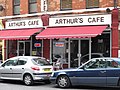 Arthur's Cafe, Station Terrace, NW10 - geograph.org.uk - 2639622.jpg 640 × 480; 87 KB
-
 Asda petrol station and car park, Colindale - geograph.org.uk - 4762414.jpg 2,304 × 1,728; 762 KB
-
 Asda petrol station and car park, Colindale - geograph.org.uk - 4762417.jpg 2,304 × 1,728; 836 KB
-
 Asda petrol station, Colindale - geograph.org.uk - 4762415.jpg 2,304 × 1,728; 838 KB
-
 Asda petrol station, Colindale - geograph.org.uk - 4762416.jpg 2,304 × 1,728; 784 KB
-
 Asda Supermarket, Wembley Park - geograph.org.uk - 4249400.jpg 2,442 × 1,756; 1.19 MB
-
 Asda supermarket, Wembley Park - geograph.org.uk - 4342099.jpg 2,304 × 1,728; 787 KB
-
 Asda supermarket, Wembley Park - geograph.org.uk - 4342100.jpg 2,304 × 1,728; 1.42 MB
-
 Asda supermarket, Wembley Park - geograph.org.uk - 5212678.jpg 2,048 × 1,152; 722 KB
-
 Asda Wembley Park - geograph.org.uk - 3785399.jpg 2,304 × 1,728; 1.25 MB
-
 Asda, Wembley Park - geograph.org.uk - 5843961.jpg 2,048 × 1,536; 1.47 MB
-
 Asda, Wembley Park - geograph.org.uk - 6246535.jpg 1,920 × 1,280; 1,024 KB
-
 Asda, Wembley Park - geograph.org.uk - 6246536.jpg 1,832 × 1,130; 1.2 MB
-
 Asda, Wembley Park - geograph.org.uk - 6246537.jpg 1,880 × 1,216; 1.25 MB
-
 Ashburnham Road, NW10 (2) - geograph.org.uk - 2639527.jpg 640 × 480; 84 KB
-
 Ashburnham Road, NW10 - geograph.org.uk - 2639520.jpg 640 × 480; 84 KB
-
 Ashburnham Road, NW10 - geograph.org.uk - 2639524.jpg 640 × 480; 89 KB
-
 Ashton Lodge care home, The Hyde - geograph.org.uk - 6302660.jpg 1,696 × 1,280; 1,016 KB
-
 At Neasden Junction - geograph.org.uk - 5661528.jpg 640 × 426; 56 KB
-
 At Willesden Junction - geograph.org.uk - 4996500.jpg 640 × 480; 137 KB
-
 Atlantic House London NW2 - geograph.org.uk - 3071239.jpg 640 × 453; 74 KB
-
 Atlip Road extended through Alperton Village - geograph.org.uk - 2726608.jpg 3,648 × 2,736; 2.57 MB
-
 Atlip Road with new flats of Alperton Village - geograph.org.uk - 2726621.jpg 2,861 × 2,143; 1.56 MB
-
 Autumn by the Jubilee Line - geograph.org.uk - 5312406.jpg 640 × 426; 84 KB
-
 Autumn colour by the canal, Alperton - geograph.org.uk - 3756176.jpg 3,048 × 2,731; 5.05 MB
-
 Autumn colour in Brent River Park - geograph.org.uk - 5613993.jpg 1,600 × 1,200; 884 KB
-
 Autumn colour on The Mall - geograph.org.uk - 3177773.jpg 640 × 480; 153 KB
-
 Autumn colour, John Billam Sports Ground - geograph.org.uk - 3179381.jpg 640 × 480; 177 KB
-
 Autumn colours - geograph.org.uk - 6046443.jpg 1,024 × 681; 280 KB
-
 Avenue Mansions - geograph.org.uk - 4702663.jpg 640 × 360; 60 KB
-
 Avenue Road, NW10 - geograph.org.uk - 2751067.jpg 480 × 640; 93 KB
-
 Avery House on Carlisle Road - geograph.org.uk - 5322387.jpg 2,304 × 1,728; 859 KB
-
 Aylesbury Street, Neasden - geograph.org.uk - 3119749.jpg 1,600 × 1,200; 548 KB
-
 Aylestone - narrow boat on Paddington Arm, Grand Union Canal - geograph.org.uk - 4445671.jpg 3,471 × 2,603; 1.51 MB
-
 Aziz Esseghir.jpg 3,024 × 4,032; 1.77 MB
-
 B4492 Bridge, Grand Union Canal - geograph.org.uk - 3807288.jpg 640 × 430; 75 KB
-
 B454 - geograph.org.uk - 5465705.jpg 640 × 426; 70 KB
-
 B454 - geograph.org.uk - 5465707.jpg 640 × 426; 65 KB
-
 B454 - geograph.org.uk - 5465720.jpg 640 × 426; 92 KB
-
 Back view of buildings close to North Wembley Station - geograph.org.uk - 3500528.jpg 1,600 × 1,200; 371 KB
-
 Bacon Lane, Kingsbury - geograph.org.uk - 6015457.jpg 1,600 × 1,200; 209 KB
-
 Bacon Lane, Kingsbury - geograph.org.uk - 6194375.jpg 1,600 × 1,200; 402 KB
-
 Bacon Lane, Kingsbury - geograph.org.uk - 6194383.jpg 1,600 × 1,200; 348 KB
-
 Bacon Lane, Kingsbury - geograph.org.uk - 6194384.jpg 1,600 × 1,200; 343 KB
-
 Balconies, Granville Road - geograph.org.uk - 4992363.jpg 1,600 × 1,129; 447 KB
-
 Ballogie Avenue, NW10 (2) - geograph.org.uk - 2834430.jpg 640 × 480; 75 KB
-
 Ballogie Avenue, NW10 - geograph.org.uk - 2834423.jpg 640 × 480; 85 KB
-
 Balnacraig Avenue, Neasden - geograph.org.uk - 5225667.jpg 4,128 × 3,096; 1.47 MB
-
 Balnacraig Avenue, NW10 (2) - geograph.org.uk - 2834410.jpg 640 × 480; 68 KB
-
 Balnacraig Avenue, NW10 (3) - geograph.org.uk - 2834416.jpg 640 × 480; 84 KB
-
 Balnacraig Avenue, NW10 - geograph.org.uk - 2834398.jpg 640 × 480; 82 KB
-
 Bare trees by the Brent River - geograph.org.uk - 5613995.jpg 1,600 × 1,200; 754 KB
-

-
 Barham Close, Wembley - geograph.org.uk - 5482564.jpg 640 × 480; 113 KB
-
 Barham Park - geograph.org.uk - 6292720.jpg 1,280 × 960; 560 KB
-
 Barham Park - geograph.org.uk - 6292741.jpg 1,280 × 960; 633 KB
-
 Barn Hill, Wembley - geograph.org.uk - 4549289.jpg 4,000 × 3,000; 4.23 MB
-
 Barn Hill, Wembley Park - geograph.org.uk - 2246479.jpg 1,600 × 1,200; 629 KB
-
 Barn Rise, Wembley Park - geograph.org.uk - 5212681.jpg 2,048 × 1,152; 796 KB
-
 Barretts Green Rd - geograph.org.uk - 3807300.jpg 640 × 430; 78 KB
-
 Base of former Bowling Club building - geograph.org.uk - 1997749.jpg 640 × 480; 90 KB
-
 Bathurst Gardens, NW10 - geograph.org.uk - 2639927.jpg 640 × 480; 91 KB
-
 Bathurst Gardens, NW10 - geograph.org.uk - 2664244.jpg 640 × 480; 66 KB
-
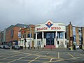 Beacon Bingo, Cricklewood - geograph.org.uk - 5317211.jpg 640 × 480; 63 KB
-
 Beaconsfield Road, Willesden - geograph.org.uk - 4430337.jpg 2,304 × 1,728; 874 KB
-
 Beechcroft Gardens at the junction of Wembley Hill Road - geograph.org.uk - 4336906.jpg 2,304 × 1,728; 826 KB
-
 Bench outside St Mark's Hospital Northwick Park - geograph.org.uk - 1951914.jpg 4,000 × 3,000; 3.82 MB
-
 Berens Road - geograph.org.uk - 2143056.jpg 640 × 460; 84 KB
-
 Berens Road and The Georgian House - geograph.org.uk - 2421806.jpg 800 × 600; 491 KB
-
 Berens Road at the junction of Harrow Road - geograph.org.uk - 3927478.jpg 2,560 × 1,920; 2.09 MB
-

-
 Bertie Road, Willesden - geograph.org.uk - 4647825.jpg 640 × 480; 76 KB
-
 Birse Crescent, Neasden - geograph.org.uk - 5314286.jpg 3,264 × 2,448; 2.72 MB
-
 Birse Crescent, NW10 - geograph.org.uk - 2834371.jpg 640 × 480; 65 KB
-
 Blackbird Cross, Kingsbury - geograph.org.uk - 5291132.jpg 3,264 × 2,448; 2.42 MB
-
 Blackbird Hill, Kingsbury - geograph.org.uk - 4249398.jpg 2,514 × 1,856; 1.3 MB
-
 Blair Avenue, Kingsbury - geograph.org.uk - 2456679.jpg 1,600 × 1,200; 675 KB
-
-
 Blenheim Gardens, NW2 (2) - geograph.org.uk - 2586524.jpg 640 × 480; 76 KB
-
 Blenheim Gardens, NW2 - geograph.org.uk - 2586507.jpg 640 × 480; 132 KB
-
 Blenheim Gardens, Willesden Green - geograph.org.uk - 3683445.jpg 1,600 × 1,200; 355 KB
-

-
 Block of flats by Gladstone Park - geograph.org.uk - 4188163.jpg 2,304 × 1,728; 816 KB
-
 Block of flats on Chalkhill Road, Wembley Park - geograph.org.uk - 4098833.jpg 2,304 × 1,728; 827 KB
-
 Block of flats on Gloucester Close, Stonebridge Park - geograph.org.uk - 3766949.jpg 2,304 × 1,728; 837 KB
-
 Block on the corner of Harrow Road, Sudbury - geograph.org.uk - 5655797.jpg 1,600 × 1,200; 224 KB
-
 Block on Wembley Hill Road - geograph.org.uk - 5129853.jpg 4,042 × 2,156; 2.61 MB
-

-
 Blossom by the Metropolitan Line - geograph.org.uk - 5435540.jpg 640 × 352; 65 KB


_plaque_on_the_building_at_the_western_end_of_Park_Parade,_NW10_-_geograph.org.uk_-_2751757.jpg)
_sign_for_The_Royal_Oak,_High_Street_-_Park_Parade,_NW10_-_geograph.org.uk_-_2751753.jpg)
_King_Edward_VII_Recreation_Ground,_Doyle_Gardens,_NW10_-_geograph.org.uk_-_2645832.jpg)
_Station_Road,_NW10_-_geograph.org.uk_-_2751078.jpg)


_-_geograph.org.uk_-_3899690.jpg)
_-_geograph.org.uk_-_3902948.jpg)
_-_geograph.org.uk_-_3902953.jpg)
_-_geograph.org.uk_-_3902958.jpg)
_-_geograph.org.uk_-_3904004.jpg)
_-_geograph.org.uk_-_3904007.jpg)
_-_geograph.org.uk_-_3899695.jpg)
_-_geograph.org.uk_-_3899699.jpg)
_-_geograph.org.uk_-_3899703.jpg)
_-_geograph.org.uk_-_3901677.jpg)
_-_geograph.org.uk_-_3901680.jpg)
_-_geograph.org.uk_-_3901683.jpg)
_-_geograph.org.uk_-_3902942.jpg)


_-_geograph.org.uk_-_5482556.jpg)


,_NW2_(2)_-_geograph.org.uk_-_2583220.jpg)
,_NW2_-_geograph.org.uk_-_2583215.jpg)


_-_geograph.org.uk_-_2576153.jpg)


_-_geograph.org.uk_-_2639527.jpg)


_-_geograph.org.uk_-_2834430.jpg)


_-_geograph.org.uk_-_2834410.jpg)
_-_geograph.org.uk_-_2834416.jpg)


_-_geograph.org.uk_-_2586524.jpg)


