Category:London Borough of Sutton
Boroughs of London: City of London · City of Westminster · Barking and Dagenham · Barnet · Bexley · Brent · Bromley · Camden · Croydon · Ealing · Enfield · Greenwich · Hackney · Hammersmith and Fulham · Haringey · Harrow · Havering · Hillingdon · Hounslow · Islington · Kensington and Chelsea · Kingston · Lambeth · Lewisham · Merton · Newham · Redbridge · Richmond · Southwark · Sutton · Tower Hamlets · Waltham Forest · Wandsworth
borough in the London Region in England    | |||||
| Upload media | |||||
| Instance of | |||||
|---|---|---|---|---|---|
| Location | Greater London, London, England | ||||
| Located in or next to body of water | |||||
| Capital | |||||
| Legislative body |
| ||||
| Executive body |
| ||||
| Head of government |
| ||||
| Inception |
| ||||
| Population |
| ||||
| Area |
| ||||
| Different from | |||||
| official website | |||||
 | |||||
Subcategories
This category has the following 20 subcategories, out of 20 total.
A
E
F
G
H
N
P
S
T
V
Media in category "London Borough of Sutton"
The following 200 files are in this category, out of 1,324 total.
(previous page) (next page)-
 "Logs for sale" - geograph.org.uk - 3956626.jpg 4,000 × 3,000; 4.21 MB
-
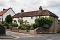
 'The Cottage', Carew Road, Wallington - geograph.org.uk - 3880961.jpg 1,024 × 733; 175 KB
-
 10 Alfred Road, Sutton - geograph.org.uk - 4466514.jpg 1,024 × 768; 134 KB
-
 282 London Road - geograph.org.uk - 4427571.jpg 640 × 496; 260 KB
-
 283 Stafford Rd - geograph.org.uk - 2328251.jpg 640 × 430; 52 KB
-
 283 Stafford Road, Beddington - geograph.org.uk - 3454468.jpg 1,067 × 1,600; 286 KB
-
 30 limit for Carshalton Beeches - geograph.org.uk - 2874410.jpg 640 × 480; 162 KB
-
 39 - 49 (odds) Garendon Road - geograph.org.uk - 4136178.jpg 640 × 480; 121 KB
-
 41 ^ 43, Marchmont Road - geograph.org.uk - 4255437.jpg 979 × 734; 202 KB
-
 44, Sandy Lane South, Wallington - geograph.org.uk - 4258091.jpg 913 × 684; 216 KB
-
 44, Sandy Lane South, Wallington - geograph.org.uk - 4258104.jpg 684 × 912; 187 KB
-
 45 ^ 47, Marchmont Road - geograph.org.uk - 4255447.jpg 979 × 734; 209 KB
-
 50 Shades of Green - geograph.org.uk - 4379893.jpg 4,401 × 2,934; 4.01 MB
-
 777 Group Offices - geograph.org.uk - 4936504.jpg 6,000 × 4,000; 7.43 MB
-
 79 Beddington Lane - geograph.org.uk - 5278431.jpg 640 × 480; 101 KB
-
 79 Beddington Lane - geograph.org.uk - 5278434.jpg 640 × 480; 129 KB
-
 A bumper crop of acorns - geograph.org.uk - 2592684.jpg 480 × 640; 168 KB
-
 A fox cub on the allotments - geograph.org.uk - 2446687.jpg 640 × 480; 150 KB
-
 A frosty Woodcote Green - geograph.org.uk - 2176719.jpg 640 × 480; 155 KB
-
 A grove of trees - geograph.org.uk - 2874346.jpg 640 × 480; 172 KB
-
 A house undergoing refurbishment on Tudor Avenue - geograph.org.uk - 2556354.jpg 3,872 × 2,592; 4.96 MB
-
 A junction of paths in Roundshaw Recreational Ground - geograph.org.uk - 2698693.jpg 4,288 × 3,216; 3.7 MB
-
 A picnic in the park - geograph.org.uk - 2873632.jpg 640 × 428; 108 KB
-
 A sewage works was once here - geograph.org.uk - 3439094.jpg 4,000 × 3,000; 3.99 MB
-
 A veiled Beddington Farm - geograph.org.uk - 5278429.jpg 640 × 480; 85 KB
-
 A2043 - A232 junction, Cheam - geograph.org.uk - 5742620.jpg 640 × 426; 66 KB
-
 A217 Reigate Road - geograph.org.uk - 4136146.jpg 640 × 480; 97 KB
-
 A232 - geograph.org.uk - 5672493.jpg 640 × 426; 68 KB
-
 A232 - geograph.org.uk - 5672689.jpg 640 × 426; 80 KB
-
 A232, B271, B278 junction. - geograph.org.uk - 5672686.jpg 640 × 426; 71 KB
-
 Abandoned house, Stanley Park Road, Wallington - geograph.org.uk - 4339831.jpg 1,024 × 768; 248 KB
-
 Access Self Storage on Oldfields Road - geograph.org.uk - 5319806.jpg 2,048 × 1,536; 1.12 MB
-
 Access track to development site - geograph.org.uk - 2492911.jpg 640 × 480; 87 KB
-
 Albino Squirrel - geograph.org.uk - 5634778.jpg 5,067 × 2,850; 6.5 MB
-

-

-
 Alliteration Row - geograph.org.uk - 2892493.jpg 640 × 480; 107 KB
-
 An old green lane - geograph.org.uk - 3439154.jpg 3,000 × 4,000; 4.16 MB
-
 Anne Boleyn's Walk - geograph.org.uk - 5742623.jpg 640 × 426; 85 KB
-
 Apartment block in Carshalton - geograph.org.uk - 6365434.jpg 1,024 × 768; 134 KB
-
 Apartments near Sutton Station - geograph.org.uk - 5784406.jpg 640 × 478; 73 KB
-
 Apeldoorn Drive off Foresters Drive - geograph.org.uk - 2339564.jpg 640 × 430; 89 KB
-
-
 Arable Field - geograph.org.uk - 6466552.jpg 6,016 × 4,512; 4.44 MB
-
 As much as you can see of Worcester Park - geograph.org.uk - 2554997.jpg 3,872 × 2,592; 4.58 MB
-
 At the cemetery gate - geograph.org.uk - 6288546.jpg 1,024 × 768; 431 KB
-
 ATS Euromaster on the corner of Rotherfield Road - geograph.org.uk - 4103503.jpg 2,560 × 1,920; 2.05 MB
-
 B271 - geograph.org.uk - 5672688.jpg 640 × 426; 71 KB
-
 Back alley, flats on Helios Road - geograph.org.uk - 4135996.jpg 640 × 480; 146 KB
-

-
 Back of Barnard Rd, Roundshaw - geograph.org.uk - 2332753.jpg 640 × 430; 55 KB
-
 Back of bingo hall, Rose Hill - geograph.org.uk - 4136104.jpg 640 × 480; 100 KB
-
 Banks of Blackthorn - geograph.org.uk - 2878142.jpg 640 × 480; 134 KB
-
 Banstead Rd - geograph.org.uk - 5784370.jpg 640 × 426; 75 KB
-
 Banstead Road - geograph.org.uk - 6466515.jpg 5,184 × 3,880; 2.83 MB
-

-
 Banstead Road South at the junction of Downs Road - geograph.org.uk - 4028126.jpg 2,560 × 1,920; 2.07 MB
-
 Banstead Road South, Carshalton Beeches - geograph.org.uk - 6366331.jpg 1,024 × 768; 150 KB
-
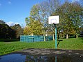
 Basketball Court, Roundshaw Park - geograph.org.uk - 2333835.jpg 640 × 430; 50 KB
-
 Beddington Conference Centre, Beddington - geograph.org.uk - 2674941.jpg 4,288 × 3,216; 5.52 MB
-
 Beddington Corner - geograph.org.uk - 5853001.jpg 3,540 × 2,360; 7.59 MB
-
 Beddington Corner - geograph.org.uk - 6456593.jpg 3,419 × 2,280; 7.63 MB
-
 Beddington Corner - geograph.org.uk - 6456597.jpg 3,737 × 2,492; 7.75 MB
-
 Beddington cricket club - geograph.org.uk - 3101868.jpg 1,024 × 768; 106 KB
-
 Beddington dovecote - geograph.org.uk - 3094378.jpg 1,024 × 768; 213 KB
-
 Beddington Energy Recovery Facility - geograph.org.uk - 6390905.jpg 5,184 × 3,456; 2.86 MB
-
 Beddington Farm Bus Depot - geograph.org.uk - 2674976.jpg 4,288 × 3,216; 4.81 MB
-
 Beddington Farmlands - geograph.org.uk - 6444208.jpg 3,420 × 2,280; 7.71 MB
-
 Beddington Farmlands - geograph.org.uk - 6444230.jpg 3,360 × 2,240; 7.59 MB
-
 Beddington Lane at the junction of Coomber Way - geograph.org.uk - 4038179.jpg 2,560 × 1,920; 2.07 MB
-
 Beddington Lane level crossing - geograph.org.uk - 3914780.jpg 640 × 360; 60 KB
-
 Beddington Lane roundabout - geograph.org.uk - 2959156.jpg 4,000 × 3,000; 4.16 MB
-
 Beddington Lane tram stop - geograph.org.uk - 5278477.jpg 640 × 480; 112 KB
-
 Beddington Lane, near Croydon - geograph.org.uk - 3914773.jpg 640 × 360; 52 KB
-
 Beddington Park - geograph.org.uk - 6444464.jpg 3,420 × 2,280; 7.72 MB
-
 Beddington Park - geograph.org.uk - 6444466.jpg 3,420 × 2,280; 7.81 MB
-
 Beddington Park - geograph.org.uk - 6444470.jpg 3,420 × 2,280; 7.7 MB
-
 Beddington Park - geograph.org.uk - 6470742.jpg 6,016 × 4,512; 3.74 MB
-
 Beddington Park at sunset - geograph.org.uk - 6365457.jpg 1,024 × 768; 292 KB
-
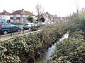
 Beddington, Bridge over a Wandle tributary - geograph.org.uk - 3573355.jpg 3,000 × 2,250; 6.71 MB
-
 Beddington, Entrance to recycling depot - geograph.org.uk - 3575056.jpg 4,320 × 3,240; 7.26 MB
-
 Beddington, Path across Mill Green - geograph.org.uk - 3573289.jpg 3,600 × 2,700; 6.75 MB
-
 Beddington, The 'Queen's Head' (closed) - geograph.org.uk - 3573298.jpg 4,320 × 3,240; 7.74 MB
-
 BedZED - geograph.org.uk - 5853022.jpg 3,420 × 2,280; 7.64 MB
-
 BedZED - geograph.org.uk - 5853025.jpg 3,840 × 2,560; 7.67 MB
-
 BedZED - geograph.org.uk - 5853030.jpg 3,840 × 2,560; 7.68 MB
-
 BedZED - geograph.org.uk - 6456601.jpg 3,657 × 2,439; 7.71 MB
-
 Beeches Walk, Carshalton - geograph.org.uk - 6366327.jpg 1,024 × 768; 252 KB
-
 Beeches Walk, Carshalton Beeches - geograph.org.uk - 6366330.jpg 1,024 × 768; 158 KB
-
 Belmont bus stand - geograph.org.uk - 6366347.jpg 1,024 × 768; 110 KB
-
 Belmont bus teminus - geograph.org.uk - 1339020.jpg 640 × 480; 56 KB
-
 Belmont Park - geograph.org.uk - 3731494.jpg 4,000 × 3,000; 3.98 MB
-
 Belmont, Cuddington Way - geograph.org.uk - 3572825.jpg 3,377 × 2,479; 6.89 MB
-
 Belmont, Golf Side - geograph.org.uk - 3572826.jpg 4,320 × 3,240; 6.57 MB
-
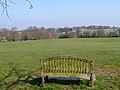 Bench with a view - geograph.org.uk - 4138193.jpg 640 × 480; 97 KB
-
 Bend on Gilhams Avenue - geograph.org.uk - 2892281.jpg 640 × 428; 131 KB
-
 Bestway Cash and Carry, Beddington - geograph.org.uk - 2674955.jpg 4,288 × 3,216; 4.27 MB
-
 Beverley Brook, Worcester Park - geograph.org.uk - 6063857.jpg 1,024 × 768; 282 KB
-
 Beverley Gardens, Worcester Park - geograph.org.uk - 6065696.jpg 1,024 × 768; 135 KB
-

-
 Big Brother is watching us - geograph.org.uk - 4339783.jpg 767 × 1,024; 280 KB
-
 Blackthorn blossom along the bridleway - geograph.org.uk - 4139052.jpg 640 × 480; 184 KB
-
 Blot on the landscape - geograph.org.uk - 2071812.jpg 2,501 × 3,559; 5.79 MB
-
 Boarded houses, Oaks Track - geograph.org.uk - 4138222.jpg 640 × 480; 89 KB
-
 Booze sale, Cornners shop, Sutton - geograph.org.uk - 4753234.jpg 2,304 × 1,728; 1.08 MB
-

-
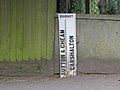
 Boundary marker - geograph.org.uk - 3962765.jpg 1,600 × 1,200; 553 KB
-
 Boundary marker - geograph.org.uk - 3962767.jpg 1,600 × 1,200; 317 KB
-
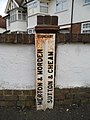 Boundary marker on the corner of Elm Road West - geograph.org.uk - 3320140.jpg 1,536 × 2,048; 1.36 MB
-
 Bourne Way, Cheam - geograph.org.uk - 4518122.jpg 3,959 × 2,639; 7.1 MB
-
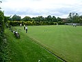 Bowling at The Grove - geograph.org.uk - 2992261.jpg 4,000 × 3,000; 3.9 MB
-
 Bowling Pavilion, Mellows Park - geograph.org.uk - 2329729.jpg 640 × 430; 64 KB
-
 Boys in River Wandle - geograph.org.uk - 5279562.jpg 640 × 480; 219 KB
-
-

-
 Branch of the River Wandle - geograph.org.uk - 2926338.jpg 4,000 × 3,000; 4.09 MB
-
 Bridge over the River Wandle near St Helier - geograph.org.uk - 6363234.jpg 1,024 × 768; 275 KB
-
 Bridge over the River Wandle, Beddington Park - geograph.org.uk - 6365507.jpg 1,024 × 768; 254 KB
-
 Bridge, National Cycle Network 20 - geograph.org.uk - 5657831.jpg 640 × 426; 95 KB
-
 Bridgefield Road, Sutton - geograph.org.uk - 4028197.jpg 2,560 × 1,920; 2.17 MB
-
 Bridle Path, Beddington - geograph.org.uk - 2244710.jpg 1,600 × 1,200; 686 KB
-
 Bridle Path, Beddington - geograph.org.uk - 2244711.jpg 1,600 × 1,200; 596 KB
-
 Bridle Path, Beddington - geograph.org.uk - 2244712.jpg 1,600 × 1,200; 577 KB
-
 Bridleway climbing away from Woodmansterne Lane - geograph.org.uk - 3616885.jpg 1,064 × 1,600; 532 KB
-
 Bridleway continuation of Grove Lane - geograph.org.uk - 4138881.jpg 640 × 480; 204 KB
-
 Bridleway crossing under construction - geograph.org.uk - 4138213.jpg 640 × 480; 125 KB
-
 Bridleway to Grove Lane - geograph.org.uk - 4138832.jpg 640 × 480; 183 KB
-
 Bridleway towards Woodmansterne Road - geograph.org.uk - 4140092.jpg 640 × 480; 194 KB
-
 Brookside Crescent, New Malden - geograph.org.uk - 6063867.jpg 1,024 × 768; 135 KB
-
 Buckhurst Avenue, Hackbridge - geograph.org.uk - 6363248.jpg 1,024 × 768; 159 KB
-
 Budge Lane, Beddington Corner - geograph.org.uk - 3900394.jpg 2,560 × 1,920; 2.26 MB
-
 Budge Lane, Beddington Corner - geograph.org.uk - 3900399.jpg 2,560 × 1,920; 1.99 MB
-
 Buildings in Bandon Hill cemetery - geograph.org.uk - 6288513.jpg 1,024 × 768; 368 KB
-
 Bumblebee and lavender, Mayfield farm - geograph.org.uk - 3616890.jpg 1,600 × 1,064; 391 KB
-
 Burdon Lane - Belmont - geograph.org.uk - 6468625.jpg 6,016 × 4,512; 6.01 MB
-
 Burns Court, Park Hill Road, Wallington - geograph.org.uk - 4339841.jpg 1,024 × 768; 136 KB
-
 Bus stop in Bishopsford Road - geograph.org.uk - 5676971.jpg 640 × 480; 70 KB
-
 Bus stop in Green Wrythe Lane - geograph.org.uk - 5676982.jpg 466 × 640; 44 KB
-
 Bus stop in St Nicholas Way - geograph.org.uk - 6139670.jpg 640 × 480; 59 KB
-
 Bushells Farm Shop,Woodmansterne Rd, Carshalton - geograph.org.uk - 4004151.jpg 1,024 × 603; 554 KB
-
 Bushes, Roundshaw Downs - geograph.org.uk - 2339810.jpg 640 × 430; 64 KB
-
 Bushes, Roundshaw Downs - geograph.org.uk - 2339817.jpg 640 × 430; 49 KB
-
 Busy Night Ahead - geograph.org.uk - 5632160.jpg 3,896 × 2,598; 7.48 MB
-
 Butter Hill Bridge - geograph.org.uk - 5667306.jpg 640 × 426; 95 KB
-
 Butter Hill Mill Sluice - geograph.org.uk - 2870936.jpg 480 × 640; 174 KB
-
 Butter Hill Mill Sluice - geograph.org.uk - 5279774.jpg 640 × 480; 152 KB
-
 Butter Hill Mill Sluice - geograph.org.uk - 5279784.jpg 640 × 480; 183 KB
-
 Butter Hill, Carshalton - geograph.org.uk - 6365450.jpg 1,024 × 768; 148 KB
-
 Buttressed wall - geograph.org.uk - 3101975.jpg 1,024 × 768; 322 KB
-
 B^Q, Sutton - geograph.org.uk - 3531765.jpg 1,600 × 899; 205 KB
-
 B^Q, Sutton, view south from car park - geograph.org.uk - 3532022.jpg 1,600 × 899; 225 KB
-
 Cafe, Mellows Park - geograph.org.uk - 2329725.jpg 640 × 430; 83 KB
-
 Café, Oaks Park - geograph.org.uk - 5860141.jpg 1,024 × 678; 859 KB
-
 Caledon Road, Carshalton - geograph.org.uk - 6365445.jpg 1,024 × 768; 137 KB
-
 Camden Rd - geograph.org.uk - 5662195.jpg 640 × 426; 66 KB
-
 Canine Clips (4117800791).jpg 3,552 × 2,368; 1.11 MB
-
 Car Park - geograph.org.uk - 2968511.jpg 1,600 × 1,200; 352 KB
-
 Car park at Asda, Beddington Lane - geograph.org.uk - 5776953.jpg 1,600 × 1,200; 332 KB
-
 Car park redevelopment, Sutton, London - geograph.org.uk - 4002675.jpg 640 × 423; 267 KB
-
 Car park, Wallington Station - geograph.org.uk - 5784335.jpg 640 × 426; 47 KB
-
 Car Wash on Beddington Lane - geograph.org.uk - 4038599.jpg 2,560 × 1,920; 1.99 MB
-
 Carshalton Beeches, Fields with horses - geograph.org.uk - 3005948.jpg 3,456 × 2,304; 5.9 MB
-
 Carshalton Boys Sports College Entrance - geograph.org.uk - 5100312.jpg 4,608 × 3,456; 6.52 MB
-
 Carshalton Lavender event - summer 2017 - geograph.org.uk - 5496034.jpg 5,200 × 3,900; 4.18 MB
-
 Carshalton Park, dry watercourse - geograph.org.uk - 2876025.jpg 1,024 × 768; 198 KB
-
 Carshalton Road, Woodcote - geograph.org.uk - 3296144.jpg 2,048 × 1,536; 1.54 MB
-
-
 Carshalton Village, Surrey, London Borough of Sutton - Flickr - tonymonblat.jpg 3,937 × 1,683; 5.86 MB
-
 Carshalton, Mutilated sewer vent - geograph.org.uk - 2899628.jpg 2,892 × 2,064; 3.07 MB
-
 Carshalton, Ornamenal sewer vent pipe - geograph.org.uk - 2897609.jpg 2,880 × 2,160; 6.85 MB
-
 Carshalton, Ornamental sewer vent pipe - geograph.org.uk - 2899606.jpg 3,624 × 2,418; 4.56 MB
-
 Carshalton, Ornamental sewer vent pipe - geograph.org.uk - 2899699.jpg 2,304 × 2,952; 3.65 MB
-
 Carshalton, Ruskin Hall - geograph.org.uk - 2901804.jpg 4,090 × 2,861; 6.14 MB
-
 Carshalton, Wallington Green - geograph.org.uk - 2899753.jpg 4,320 × 3,240; 5.18 MB
-
 Carshalton, watercourse - geograph.org.uk - 2876030.jpg 768 × 1,024; 261 KB
-
 Carshalton, Wrythe Green - geograph.org.uk - 2897515.jpg 3,066 × 2,245; 6.38 MB
-
 Cattle enclosure on Roundshaw Downs - geograph.org.uk - 3216218.jpg 4,000 × 3,000; 4.03 MB
-
-
 Cavendish Road, Sutton - geograph.org.uk - 5727377.jpg 2,304 × 1,728; 2 MB
-
 Cemex Croydon Concrete Plant - geograph.org.uk - 6470345.jpg 5,184 × 3,880; 2.57 MB
-
 Cemex plant on Coomber Way - geograph.org.uk - 4038924.jpg 2,560 × 1,920; 1.97 MB
-
 Cemex Readymix - geograph.org.uk - 4936285.jpg 6,000 × 4,000; 6.38 MB
-
 Chapel buildings, Bandon Hill cemetery - geograph.org.uk - 2482604.jpg 640 × 480; 105 KB
-
 Chapel buildings, Bandon Hill cemetery - geograph.org.uk - 6288423.jpg 1,024 × 768; 263 KB
-
 Charlgrove Road junction with Langley Park Road - geograph.org.uk - 6470872.jpg 5,184 × 3,880; 2.66 MB
-
 Charlgrove Road junction with Langley Park Road - geograph.org.uk - 6470876.jpg 6,016 × 4,512; 4.44 MB
-
 Chaucer House, Sutton - geograph.org.uk - 2245125.jpg 1,600 × 1,200; 530 KB
-
 Cheam - Ewell Road - geograph.org.uk - 3370032.jpg 2,560 × 1,278; 1.88 MB
-
 Cheam Library, mid February 2018 - geograph.org.uk - 5682339.jpg 640 × 480; 57 KB
-
 Cheam Park - geograph.org.uk - 5742628.jpg 640 × 426; 57 KB
-
 Cheam Park - geograph.org.uk - 5742631.jpg 640 × 425; 99 KB
-
 Cheam Park - geograph.org.uk - 5742632.jpg 640 × 426; 93 KB
-
 Cheam Park - geograph.org.uk - 5742633.jpg 640 × 426; 53 KB
-
 Cheam Park - geograph.org.uk - 5742793.jpg 640 × 426; 64 KB
-
-
 Cheam Road at the junction of Quarry Park Road - geograph.org.uk - 5727691.jpg 2,304 × 1,728; 834 KB
-
 Cheam Surrey London Borough of Sutton Giddings Design.JPG 4,000 × 3,000; 2.53 MB
-
 Cheam, Surrey, London Borough of Sutton - Love Lane - Flickr - tonymonblat.jpg 2,995 × 2,087; 6.28 MB
-
 Cheam, Surrey, London Borough of Sutton - The Broadway (2) - Flickr - tonymonblat.jpg 3,419 × 2,201; 8.54 MB
-
 Cheam, Surrey, London Borough of Sutton - The Broadway - Flickr - tonymonblat.jpg 4,000 × 2,265; 8.6 MB


_Garendon_Road_-_geograph.org.uk_-_4136178.jpg)


_-_Flickr_-_tonymonblat.jpg)


_-_geograph.org.uk_-_3573298.jpg)


,_Chiltern_Road,_Sutton_-_geograph.org.uk_-_4004180.jpg)


.jpg)


_-_Flickr_-_tonymonblat.jpg)
