Category:Fulford, Staffordshire
English: Fulford is a village and civil parish in the Stafford district, in the county of Staffordshire, England.
village and civil parish in the Stafford district of Staffordshire, England  | |||||
| Upload media | |||||
| Instance of | |||||
|---|---|---|---|---|---|
| Location | Stafford, Staffordshire, West Midlands, England | ||||
 | |||||
Subcategories
This category has the following 2 subcategories, out of 2 total.
B
S
- St Nicholas' Church, Fulford (1 F)
Media in category "Fulford, Staffordshire"
The following 71 files are in this category, out of 71 total.
-

-
 A footpath leading into Stallington - geograph.org.uk - 2816294.jpg 1,142 × 857; 283 KB
-
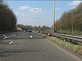
 A50 - Grindley Lane junction (B5029) - geograph.org.uk - 2342333.jpg 640 × 480; 70 KB
-
-
 A50 at Blythe Bridge - geograph.org.uk - 2342346.jpg 640 × 480; 72 KB
-

-
 A50 eastbound at Blythe Bridge - geograph.org.uk - 3593055.jpg 640 × 480; 54 KB
-
 A50 eastbound near Blythe Bridge - geograph.org.uk - 3593053.jpg 640 × 481; 53 KB
-
 B5029 bridge (western) over A50 - geograph.org.uk - 3592775.jpg 1,024 × 695; 99 KB
-
 Barn and silo near Fulford - geograph.org.uk - 199450.jpg 640 × 480; 75 KB
-
 Bird in Hand, Hilderstone - geograph.org.uk - 1868197.jpg 640 × 480; 51 KB
-
 Blacklake Farm - geograph.org.uk - 3936314.jpg 4,210 × 2,461; 4.73 MB
-
 Blythe Bridge, Shoetime - geograph.org.uk - 4515868.jpg 3,264 × 2,448; 1.53 MB
-

-
 Bus Stop outside Fulford Village Hall - geograph.org.uk - 3936303.jpg 4,257 × 2,478; 4.01 MB
-
 Cherry Close, Fulford - geograph.org.uk - 1868236.jpg 640 × 480; 63 KB
-
 Country lane near Fulford - geograph.org.uk - 2816290.jpg 1,306 × 979; 329 KB
-
 Covered reservoir at Fulford - geograph.org.uk - 199453.jpg 640 × 480; 76 KB
-
 Crossroads of lanes NW of Fulford - geograph.org.uk - 2817092.jpg 1,142 × 857; 350 KB
-
 Dairy pasture at Saverley Green - geograph.org.uk - 531771.jpg 640 × 342; 48 KB
-

-
 Entrance to Barlaston ^ Rough Close Common - geograph.org.uk - 5527833.jpg 4,608 × 3,456; 4.05 MB
-
 Farm buildings outside Fulford - geograph.org.uk - 2817395.jpg 1,306 × 979; 363 KB
-
 Farmland off Stallington Lane - geograph.org.uk - 549303.jpg 640 × 480; 84 KB
-
 Fulford Primary School - geograph.org.uk - 199458.jpg 640 × 480; 74 KB
-
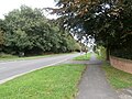
 High View Road, Fulford - geograph.org.uk - 1868242.jpg 640 × 480; 68 KB
-
 House on Hilderstone Road - geograph.org.uk - 3936320.jpg 3,979 × 2,038; 3.22 MB
-
 Housing and play area in Stallington - geograph.org.uk - 2820058.jpg 1,142 × 857; 312 KB
-
 Industrial estate, Blythe Bridge - geograph.org.uk - 5527681.jpg 4,320 × 3,240; 2.7 MB
-
 Junction of the B5029 and Grange Rd - geograph.org.uk - 5527831.jpg 4,608 × 3,456; 4.06 MB
-
 Kingfisher Crescent, Fulford - geograph.org.uk - 199459.jpg 640 × 480; 57 KB
-
 Lane by Spot Acre Spinney - geograph.org.uk - 3936309.jpg 3,121 × 1,977; 2.72 MB
-
 Lower Gorstybirch - geograph.org.uk - 549411.jpg 640 × 480; 88 KB
-
 Marley Hollows Farm - geograph.org.uk - 437319.jpg 640 × 480; 132 KB
-
 Meir Heath Windmill (geograph 7509105).jpg 1,069 × 1,600; 359 KB
-
 Meir Heath Windmill - geograph.org.uk - 3936323.jpg 2,861 × 2,324; 2.98 MB
-
 Meir Heath, windmill - geograph.org.uk - 3172744.jpg 1,024 × 768; 95 KB
-
 Muddy lane at Fulford - geograph.org.uk - 199452.jpg 480 × 640; 102 KB
-
 Old house, Grindley Lane, Blythe Bridge - geograph.org.uk - 5527687.jpg 4,320 × 3,240; 2.89 MB
-
 Portland School and Specialist College, Blythe Bridge - geograph.org.uk - 5527612.jpg 4,320 × 3,240; 2.98 MB
-
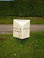 Rough Close milepost - detail - geograph.org.uk - 1403052.jpg 480 × 640; 162 KB
-
 Rough Close, Swynnerton Arms - geograph.org.uk - 5773782.jpg 1,024 × 769; 149 KB
-
 Roundabout where the B5029 crosses the A50 - geograph.org.uk - 5527657.jpg 4,320 × 3,240; 2.91 MB
-
 Saverley Green Road - geograph.org.uk - 3936290.jpg 3,370 × 3,018; 4.24 MB
-
 Severn Trent's pumping station at Fulford - geograph.org.uk - 2817089.jpg 1,306 × 979; 356 KB
-
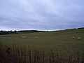 Sheep in pasture fields near Fulford - geograph.org.uk - 2817086.jpg 1,306 × 979; 265 KB
-
 Spotgate Inn - geograph.org.uk - 5001588.jpg 640 × 427; 63 KB
-
 St. Nicholas Church, Fulford - geograph.org.uk - 5995691.jpg 2,972 × 2,227; 4.75 MB
-
 Stallington "Village" - geograph.org.uk - 199454.jpg 640 × 480; 76 KB
-
 Stallington Hall - geograph.org.uk - 2817438.jpg 1,142 × 857; 328 KB
-
 Stallington Hall.jpg 2,468 × 1,852; 3.65 MB
-
 Swynnerton Arms, Rough Close - geograph.org.uk - 4892004.jpg 1,200 × 799; 255 KB
-
 The A50 at its junction with the B5029 - geograph.org.uk - 5527673.jpg 4,320 × 3,240; 2.71 MB
-
 The A50 near Blythe Bridge - geograph.org.uk - 5527662.jpg 4,320 × 3,240; 2.79 MB
-
 The B5029 at its junction with the A50 - geograph.org.uk - 5527677.jpg 4,320 × 3,240; 2.97 MB
-
 The B5029 near its junction with Grange Rd - geograph.org.uk - 5527828.jpg 4,608 × 3,456; 4 MB
-
-
 The Blacklake milepost in its setting - geograph.org.uk - 1805784.jpg 819 × 614; 180 KB
-

-
 The Greyhound Inn - geograph.org.uk - 437289.jpg 640 × 480; 87 KB
-
 The Greyhound Inn - Saverley Green - geograph.org.uk - 3936286.jpg 4,487 × 2,301; 4.51 MB
-
 The Hunter Public House - geograph.org.uk - 3936281.jpg 2,842 × 2,546; 2.23 MB
-
 The northern side of Fulford - geograph.org.uk - 2816292.jpg 1,142 × 857; 283 KB
-
 The Spotgate Inn, Mossgate - geograph.org.uk - 1805805.jpg 922 × 691; 165 KB
-
 The Windmill at Meir Heath - geograph.org.uk - 4891982.jpg 1,200 × 799; 288 KB
-
 The Windmill at Meir Heath - geograph.org.uk - 4891983.jpg 1,200 × 799; 297 KB
-
 The Windmill at Meir Heath - geograph.org.uk - 4891988.jpg 799 × 1,200; 264 KB
-

-
 Westbound A50 near Blythe Bridge - geograph.org.uk - 4241578.jpg 640 × 480; 281 KB
-
 Westbound A50, Blythe Bridge - geograph.org.uk - 4241580.jpg 640 × 480; 310 KB
-
 Windmill at Meir Heath - geograph.org.uk - 4891974.jpg 799 × 1,200; 243 KB


_-_geograph.org.uk_-_2342333.jpg)
_-_geograph.org.uk_-_2342323.jpg)


_over_A50_-_geograph.org.uk_-_3592775.jpg)


.jpg)


_-_geograph.org.uk_-_4241585.jpg)


