Category:Geography of Riverside County, California
Counties of California: Alameda · Alpine · Amador · Butte · Calaveras · Colusa · Contra Costa · Del Norte · El Dorado · Fresno · Glenn · Humboldt · Imperial · Inyo · Kern · Kings · Lake · Lassen · Los Angeles · Madera · Marin · Mariposa · Mendocino · Merced · Modoc · Mono · Monterey · Napa · Nevada · Orange · Placer · Plumas · Riverside · Sacramento · San Benito · San Bernardino · San Diego · San Joaquin · San Luis Obispo · San Mateo · Santa Barbara · Santa Clara · Santa Cruz · Shasta · Sierra · Siskiyou · Solano · Sonoma · Stanislaus ·Sutter · Tehama · Trinity · Tulare · Tuolumne · Ventura · Yolo · Yuba – Consolidated city-county: San Francisco
Wikimedia category | |||||
| Upload media | |||||
| Instance of | |||||
|---|---|---|---|---|---|
| Category combines topics | |||||
| Riverside County | |||||
county in California, United States  Здание суда округа Риверсайд    | |||||
| Instance of | |||||
| Named after | |||||
| Location | California, Pacific States Region | ||||
| Capital | |||||
| Inception |
| ||||
| Population |
| ||||
| Area |
| ||||
| official website | |||||
 | |||||
Subcategories
This category has the following 35 subcategories, out of 35 total.
*
A
C
D
- Diamond Valley Lake (113 F)
E
- Eagle Mountain Iron Mine (5 F)
- Lake Elsinore (lake) (26 F)
L
- Lake Hemet (6 F)
- Lake Mathews (24 F)
M
P
- Picacho Peak Wilderness (empty)
R
- Rice Valley (California) (14 F)
S
- San Timoteo Canyon (53 F)
- Skinner Reservoir (3 F)
T
- Tahquitz (18 F)
V
- Vidal Valley (2 F)
W
Media in category "Geography of Riverside County, California"
The following 55 files are in this category, out of 55 total.
-
 AirportBlvd ThermalCalifornia.jpg 798 × 441; 60 KB
-
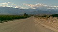
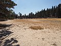
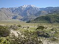
 Anza2005.JPG 1,024 × 768; 654 KB
-
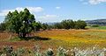 AnzaCaliforniaField2.JPG 1,024 × 542; 565 KB
-
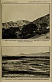
 Artesian Water and Cheap Land in the Great San Jacinto Valley.jpg 1,412 × 1,084; 511 KB
-
 B1 Tahquitz Canyon.jpg 5,472 × 3,648; 6.19 MB
-
 B2 Tahquitz Canyon.jpg 5,472 × 3,648; 6.15 MB
-
 Birdeye, Riverside, California.jpg 2,484 × 399; 317 KB
-
 Box Canyon Road.JPG 1,833 × 1,222; 1.63 MB
-
 Catalina Eddy 2013-02-17.jpg 2,625 × 3,112; 3.01 MB
-
 Coachella Valley.jpg 1,200 × 900; 1.65 MB
-
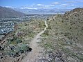 Coming down the Shannon trail.jpg 1,280 × 960; 295 KB
-
 Diamond Valley Reservoir Dam and Spring Greenery.jpg 8,025 × 6,019; 23.7 MB
-
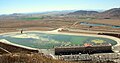
 DiamondValleyLake-1.jpg 800 × 516; 47 KB
-
 DVL-forebay.JPG 4,000 × 2,088; 1.83 MB
-
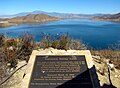 DVLlake.JPG 3,868 × 2,830; 7.33 MB
-
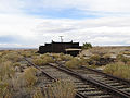 Eagle Mountain Railroad-Ferrum.jpg 2,048 × 1,536; 725 KB
-
 Eden Relief Springs and San Jacinto Relief Springs.jpg 1,650 × 2,565; 1.35 MB
-

-
 FEMA - 43253 - Closed road in California.jpg 4,256 × 2,848; 8.15 MB
-
 French Valley, Hwy 79, Bachelor Mountain.jpg 8,064 × 6,048; 30.26 MB
-
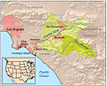
 Inland empire within southern california.png 342 × 308; 160 KB
-
 Joshua-Tree-NP-TF.jpg 4,800 × 2,700; 3.39 MB
-
 Keller Road - French Valley, Menifee, etc. 1.jpg 4,032 × 3,024; 9.73 MB
-
 Keller Road - French Valley, Menifee, etc. 2.jpg 8,064 × 6,048; 17.05 MB
-
 Keller Road - French Valley, Menifee, etc. 3.jpg 8,064 × 6,048; 14.06 MB
-
 Keller Road - Rural Hills.jpg 8,064 × 6,048; 18.08 MB
-
 Lake elsinore view.jpg 1,024 × 768; 727 KB
-
 LakeSkinner1.jpg 1,081 × 608; 178 KB
-
 LakeSkinner2.jpg 1,168 × 657; 194 KB
-
 Looking Towards Diamond Valley Reservoir and Rawson Mountains.jpg 8,064 × 6,048; 30.62 MB
-
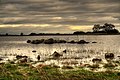
 Margin of Hidden Valley Lake (39429285064).jpg 4,608 × 3,456; 7.46 MB
-
 McCoy Mountains.jpg 800 × 450; 125 KB
-
 Mineral springs in the San Jacinto Basin.jpg 3,221 × 721; 634 KB
-
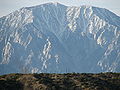
 Mt San Jacinto from North.jpg 3,264 × 2,448; 3.42 MB
-
 Mystic lake2-kmf.JPG 2,272 × 1,704; 2.07 MB
-
 Nuevohills.jpg 717 × 538; 288 KB
-
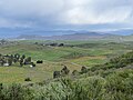
 Ranchosantarosa 055.JPG 4,608 × 3,072; 6.51 MB
-
 Riverside County Indian Hills6.JPG 2,160 × 1,440; 1.35 MB
-
 Saltonseadrainagemap.jpg 782 × 735; 278 KB
-
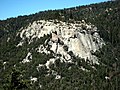
 Santa Rosa and San Jacinto Mountains 283.jpg 1,600 × 1,200; 902 KB
-
 San Jacinto Peak 0675.jpg 2,592 × 1,944; 2.11 MB
-
 Santa-ana-river-new.jpg 2,695 × 2,048; 3.81 MB
-
 SAR Map.jpg 1,230 × 930; 570 KB
-
 Santaanarivermapwithtemescal.jpg 618 × 500; 179 KB
-
 Santarosalightning.jpg 3,454 × 2,303; 6.46 MB
-
 Santarosapond.jpg 3,456 × 2,298; 6.14 MB
-
 SoCal Coast.jpg 720 × 1,084; 374 KB
-
 Suicide Rock Arlyn Asch.jpg 2,640 × 1,980; 1.76 MB
-
 Suicide Rock seen from the Devil's Slide trail.jpg 6,644 × 4,345; 11.13 MB
-
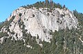
 Tahquitz Falls 678.jpg 2,575 × 3,656; 2.79 MB
-
 TahquitzDAZ.jpg 427 × 640; 101 KB
-
 TP F 001 Wiki.jpg 1,415 × 1,038; 1.21 MB
-
 TP F 012 Wiki.jpg 1,512 × 1,008; 1.28 MB
-
 Winchester Road (Hwy 79) & Scott Road Intersection.jpg 8,064 × 6,048; 24.78 MB
-
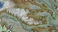
 Wpdms shdrlfi020l colorado desert.jpg 300 × 267; 49 KB


.jpg)


.jpg)


_%26_Scott_Road_Intersection.jpg)
