Category:Geological maps of Oregon
States of the United States: Alabama · Alaska · Arizona · Arkansas · California · Colorado · Connecticut · Delaware · Florida · Georgia · Hawaii · Idaho · Illinois · Indiana · Iowa · Kansas · Kentucky · Louisiana · Maine · Maryland · Massachusetts · Michigan · Minnesota · Mississippi · Missouri · Montana · Nebraska · Nevada · New Hampshire · New Jersey · New Mexico · New York · North Carolina · North Dakota · Ohio · Oklahoma · Oregon · Pennsylvania · Rhode Island · South Carolina · South Dakota · Tennessee · Texas · Utah · Vermont · Virginia · Washington · West Virginia · Wisconsin · Wyoming
Puerto Rico
Puerto Rico
Subcategories
This category has the following 6 subcategories, out of 6 total.
*
G
M
V
Media in category "Geological maps of Oregon"
The following 25 files are in this category, out of 25 total.
-
 Cascade Range geology detail.gif 832 × 828; 144 KB
-
 Cascade Range geology detail.png 416 × 414; 32 KB
-
 Columbia River Flood-Basalt Province.jpg 1,224 × 1,237; 1.48 MB
-
 CRB-Yellowstone mantle plume model.jpg 3,789 × 4,069; 1.84 MB
-
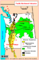
 Geofeatures-PacificNW.png 357 × 450; 180 KB
-

-
-
 HYDROGEOLOGY AND WATER TABLE OF THE WILLAMETTE BASIN.pdf 4,502 × 5,020; 5.36 MB
-
 Lakes-Washington-Oregon-9.GIF 960 × 720; 319 KB
-
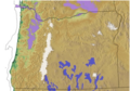
 Map of Washington, Oregon and Idaho geological deposits.jpeg 900 × 634; 315 KB
-
 Mazama general geologic map.gif 744 × 623; 45 KB
-
 Newberry-Yellowstone tracks.png 536 × 326; 19 KB
-
 NPS crater-lake-geologic-map.jpg 3,352 × 4,820; 4.13 MB
-
 NPS crater-lake-hazards-map.jpg 2,565 × 3,814; 2.34 MB
-
 NPS john-day-fossil-beds-geologic-map.jpg 4,588 × 2,676; 2.32 MB
-
 NPS oregon-caves-geologic-map.jpg 3,110 × 1,688; 1.29 MB
-
 Oregon rotation.png 327 × 392; 79 KB
-
 PacificNW volcanics1.png 455 × 700; 28 KB
-
 Portland Hills Fault.png 1,227 × 880; 1.54 MB
-
 SCF-terminus.png 312 × 423; 568 KB
-
 Snake river plain aquifer H058.jpeg 883 × 529; 156 KB
-
 Three Sisters Range geologic map-fr.svg 3,305 × 4,351; 2.91 MB
-
 USGS Shakemap - 1993 Scotts Mills earthquake.jpg 612 × 720; 191 KB
-
 Willamette Lowland basin-fill aquifer extent.gif 387 × 525; 24 KB
-
 Wpdms nasa topo columbia river gorge.jpg 1,710 × 1,704; 322 KB


_in_Oregon.png)


