Category:Germany photographs taken on 2012-10-14
Countries of Europe: Austria · Belarus · Belgium · Bosnia and Herzegovina · Bulgaria · Czech Republic · Estonia · Finland · France‡ · Georgia‡ · Germany · Greece · Hungary · Italy · Latvia · Lithuania · Netherlands‡ · Poland · Portugal‡ · Romania · Russia‡ · Serbia · Slovakia · Spain‡ · Sweden · Switzerland · Turkey‡ · Ukraine · United Kingdom
Specific status: Gibraltar
‡: partly located in Europe
Specific status: Gibraltar
‡: partly located in Europe
| ← | 14 October 2012 | → | ||
| ← | October 2012 | → | ||

Germany photographs taken on 14 October 2012.
Image files should be categorized here automatically using {{taken on}} template. Direct categorisation is also possible, if automatic is impossible.
Subcategories
This category has the following 4 subcategories, out of 4 total.
Media in category "Germany photographs taken on 2012-10-14"
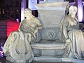
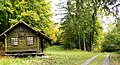
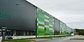
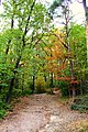
The following 176 files are in this category, out of 176 total.
-
 -31 Upmeyer zu Belzen, Jöllenbeck, Torbogen.jpg 2,761 × 2,630; 4.87 MB
-
 14.10.2012. Seehamersee - panoramio (1).jpg 2,592 × 1,944; 928 KB
-
 14.10.2012. Seehamersee - panoramio (2).jpg 2,592 × 1,944; 979 KB
-
 14.10.2012. Seehamersee - panoramio (3).jpg 2,592 × 1,944; 729 KB
-
 14.10.2012. Seehamersee - panoramio (4).jpg 2,592 × 1,944; 698 KB
-
 14.10.2012. Seehamersee - panoramio.jpg 2,592 × 1,944; 996 KB
-

-
 Sozialgericht Altenburg.jpg 2,244 × 1,728; 1.38 MB
-
 Ausgetrockneter Birkensee - panoramio.jpg 3,072 × 2,304; 3.09 MB
-
 B464 - panoramio.jpg 3,072 × 1,536; 2.7 MB
-
 Bad Säckingen 2012-10-14 Mattes (1).JPG 3,648 × 2,736; 3.74 MB
-
 Bad Säckingen 2012-10-14 Mattes (2).JPG 3,648 × 2,736; 3.86 MB
-
 Bad Säckingen 2012-10-14 Mattes (3).JPG 3,648 × 2,736; 3.61 MB
-
 Bad Säckingen 2012-10-14 Mattes (4).JPG 3,648 × 2,736; 3.9 MB
-
 Bad Säckingen 2012-10-14 Mattes (5).JPG 3,648 × 2,736; 3.84 MB
-
 Bad Säckingen 2012-10-14 Mattes (6).JPG 3,648 × 2,736; 3.87 MB
-
 Bad Säckingen 2012-10-14 Mattes.JPG 3,648 × 2,736; 4.81 MB
-
 Bad Säckingen — Bergseestraße 17.jpg 2,359 × 2,654; 2.44 MB
-

-
 Baum auf einen Feld bei Bertikow - geo.hlipp.de - 29051.jpg 640 × 480; 97 KB
-

-

-

-
-

-
 Berlin - Gerickesteg - geo.hlipp.de - 29399.jpg 640 × 480; 86 KB
-
 Berlin - Lutherbruecke - geo.hlipp.de - 29402.jpg 640 × 480; 90 KB
-
 Berlin - Spreeufer - geo.hlipp.de - 29414.jpg 480 × 640; 58 KB
-
 Berlin - Wasserverkehr (Water Transport) - geo.hlipp.de - 29400.jpg 640 × 480; 84 KB
-
 Berlin-Moabit - Sudhaus - geo.hlipp.de - 29392.jpg 640 × 480; 93 KB
-
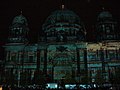
 Berliner Dom (Berlin Cathedral) - geo.hlipp.de - 29412.jpg 640 × 480; 70 KB
-
 Bertikower Kirche - geo.hlipp.de - 29048.jpg 640 × 480; 139 KB
-
 Bertrandt AG, Ehningen - panoramio.jpg 3,072 × 1,478; 2.09 MB
-
 Birkensee - panoramio (1).jpg 3,072 × 2,304; 3.31 MB
-
 Blick auf dem Krebssee - geo.hlipp.de - 29061.jpg 640 × 480; 51 KB
-
 Blick auf den Blankenburger See - geo.hlipp.de - 29055.jpg 640 × 480; 51 KB
-
 Blick über Hildrizhausen bis nach Holzgerlingen - panoramio.jpg 3,072 × 1,459; 1.71 MB
-
 Bromberg, 583 m. ü. NN. - panoramio.jpg 3,072 × 2,304; 3.02 MB
-

-
 Ehemaliges IBM ) SMST ) Philips ) NXP - Gelände - panoramio (1).jpg 3,072 × 1,536; 2.35 MB
-
 Ehemaliges IBM ) SMST ) Philips ) NXP - Gelände - panoramio (2).jpg 3,072 × 2,304; 3.52 MB
-
 Ehemaliges IBM ) SMST ) Philips ) NXP - Gelände - panoramio.jpg 3,038 × 1,536; 1.9 MB
-
 Ehemaliges Zisterzienserkloster Bebenhausen - panoramio (2).jpg 3,072 × 1,791; 2.62 MB
-
 Eiche - panoramio (3).jpg 2,304 × 3,072; 2.81 MB
-
 Eiche am Försterstein - panoramio.jpg 3,072 × 2,304; 2.73 MB
-
 Feld bei Bertikow - geo.hlipp.de - 29046.jpg 640 × 480; 70 KB
-
 Feld bei Bertikow - geo.hlipp.de - 29062.jpg 640 × 480; 40 KB
-
 Feld bei Bertikow - geo.hlipp.de - 29063.jpg 640 × 480; 46 KB
-
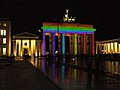
 Festival of Lights - Berlin 2012 - geo.hlipp.de - 29431.jpg 640 × 480; 54 KB
-
-
 Festival of Lights - Bike Taxi - geo.hlipp.de - 29421.jpg 640 × 480; 64 KB
-

-
 Festival of Lights - Deutscher Domturm - geo.hlipp.de - 29424.jpg 480 × 640; 80 KB
-
 Festival of Lights - Europaeisches Haus - geo.hlipp.de - 29435.jpg 640 × 480; 64 KB
-
-
-
 Festival of Lights - Gendarmenplatz - geo.hlipp.de - 29425.jpg 480 × 640; 54 KB
-
 Festival of Lights - Konzerthaus - geo.hlipp.de - 29423.jpg 640 × 480; 80 KB
-
 Festival of Lights - Pariser Platz - geo.hlipp.de - 29432.jpg 480 × 640; 79 KB
-
 Festival of Lights - Pariser Platz 2012 - geo.hlipp.de - 29434.jpg 640 × 480; 63 KB
-
-
-
-
 Forsthütte im Naturpark Schönbuch - panoramio.jpg 3,072 × 1,667; 2.16 MB
-
 Freiwillige Feuerwehr in Blankenburg - geo.hlipp.de - 29054.jpg 640 × 480; 51 KB
-

-
 Friedrichstadt Palast - geo.hlipp.de - 29409.jpg 640 × 480; 86 KB
-
 Fuhlsbuetteler weg - Niendoerp.jpg 4,592 × 3,056; 5.66 MB
-
 Goldersbachtal im Naturpark Schönbuch - panoramio.jpg 3,072 × 2,304; 3.09 MB
-
 Grillplatz bei Bebenhausen - panoramio.jpg 3,072 × 2,304; 2.89 MB
-
 Grillplatz Neue Brücke - panoramio.jpg 3,072 × 2,304; 3.1 MB
-
 GWW und LGI Südwest in der Schickardstrasse in Böblingen - panoramio.jpg 3,072 × 1,536; 2.15 MB
-
 Heide - panoramio (1).jpg 3,456 × 5,184; 15.32 MB
-
 Heide - panoramio (2).jpg 3,456 × 5,184; 15.91 MB
-
 Heide - panoramio.jpg 3,456 × 5,184; 15.64 MB
-
 Hildrizhausen - panoramio (1).jpg 3,072 × 1,536; 2.49 MB
-
 Hildrizhausen - panoramio (2).jpg 3,052 × 1,536; 2.12 MB
-
 Hildrizhausen - panoramio (3).jpg 3,072 × 1,536; 2.49 MB
-
 Hochstand - panoramio (1).jpg 3,072 × 2,304; 4 MB
-
 Humboldt Box - geo.hlipp.de - 29413.jpg 480 × 640; 53 KB
-
 IBM in Ehningen - panoramio.jpg 3,072 × 1,466; 2.01 MB
-
 Imker an seinem Bienenstock im Naturpark Schönbuch bei Bebenhausen - panoramio.jpg 3,072 × 2,304; 3.1 MB
-
 Kaiserlinde von 1893 - panoramio.jpg 3,072 × 2,304; 2.92 MB
-
 Kirche in Blankenburg - geo.hlipp.de - 29053.jpg 640 × 480; 89 KB
-
 Kirnberg 559 m. ü. NN. - panoramio.jpg 3,072 × 2,304; 4.92 MB
-
-
-

-

-
 Kleindenkmal, Hochwasserdenkmal, 8. Juli 1987, errichtet von Förster Kächele - panoramio.jpg 3,072 × 2,304; 3.06 MB
-
 Kleindenkmal, Kächelesstein, 16.8.1995 - panoramio.jpg 3,072 × 2,304; 2.87 MB
-

-

-

-

-

-
 Kloster Bebenhausen - panoramio.jpg 3,072 × 2,304; 3.05 MB
-
 Kohlweiher - panoramio.jpg 3,072 × 1,782; 2.46 MB
-
 Kolkturm - panoramio.jpg 4,304 × 6,574; 19.68 MB
-

-
 Landgasthof Grüner Baum Mauren - panoramio.jpg 3,072 × 2,304; 4.3 MB
-
 Marie-Elisabeth-Lueders-Haus - geo.hlipp.de - 29406.jpg 640 × 480; 78 KB
-
 Mauren - panoramio (1).jpg 3,072 × 1,536; 2.32 MB
-
 Mauren - panoramio.jpg 3,072 × 1,536; 2.53 MB
-
 Moabit - Spreebogen - geo.hlipp.de - 29398.jpg 640 × 480; 103 KB
-
 Moabit - Zur Quelle - geo.hlipp.de - 29394.jpg 640 × 480; 84 KB
-
 Naturpark Schönbuch - panoramio (4).jpg 3,072 × 2,304; 3.51 MB
-
 Naturpark Schönbuch - panoramio (5).jpg 3,072 × 2,304; 2.99 MB
-
 Naturpark Schönbuch - panoramio (6).jpg 3,072 × 2,304; 3.04 MB
-
 Naturpark Schönbuch - panoramio (7).jpg 3,072 × 2,304; 3.14 MB
-

-
 Panorama nach Halle - panoramio (1).jpg 10,819 × 3,242; 22.4 MB
-
 Panorama nach Halle - panoramio.jpg 10,682 × 3,277; 20.04 MB
-
 Panorama nach Neustadt - panoramio.jpg 11,193 × 3,250; 20.73 MB
-
 Panorama zum Petersberg - panoramio.jpg 8,856 × 3,262; 16.96 MB
-
-
 Pegel Bebenhausen, Goldersbach - panoramio.jpg 3,072 × 1,689; 2.28 MB
-
 Pegeluhr Emmerich - Flickr - Maarten Takens.jpg 2,000 × 1,537; 426 KB
-
 Platz der Republik, Berlin, Germany - panoramio.jpg 2,265 × 1,261; 757 KB
-
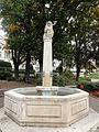
 Playmobil-Brunnen - panoramio.jpg 1,200 × 1,557; 427 KB
-
 Quartiersplatz Theresienhöhe GO-1.jpg 2,592 × 1,944; 1.22 MB
-
 Rheinfelden (28).JPG 1,662 × 2,689; 2.99 MB
-
 Rheinfelden (46).JPG 1,944 × 2,592; 1.62 MB
-
 Rheinfelden (47).JPG 2,592 × 1,944; 2.69 MB
-
 Rheinfelden (48).JPG 1,944 × 2,592; 1.79 MB
-
 Rheinfelden (49).JPG 2,592 × 1,944; 2.94 MB
-
 Rheinfelden (50).JPG 1,944 × 2,592; 2.12 MB
-
 Rheinfelden (51).JPG 1,944 × 2,592; 1.91 MB
-
 Rheinfelden (52).JPG 2,592 × 1,944; 2.54 MB
-
 Rheinfelden (53).JPG 1,944 × 2,592; 1.75 MB
-
 Rheinfelden (Baden) Mattes 2012-10-140.JPG 2,592 × 1,944; 2.79 MB
-
 Rheinfelden (Baden) Mattes 2012-10-141.JPG 2,592 × 1,944; 2.89 MB
-
 Rheinfelden (Baden) Mattes 2012-10-1410.JPG 2,592 × 1,944; 2.58 MB
-
 Rheinfelden (Baden) Mattes 2012-10-1411.JPG 2,592 × 1,944; 2.57 MB
-
 Rheinfelden (Baden) Mattes 2012-10-1412.JPG 1,944 × 2,592; 1.7 MB
-
 Rheinfelden (Baden) Mattes 2012-10-1413.JPG 2,592 × 1,944; 2.49 MB
-
 Rheinfelden (Baden) Mattes 2012-10-1414.JPG 2,592 × 1,944; 2.58 MB
-
 Rheinfelden (Baden) Mattes 2012-10-1415.JPG 2,592 × 1,944; 2.45 MB
-
 Rheinfelden (Baden) Mattes 2012-10-1416.JPG 2,592 × 1,944; 2.53 MB
-
 Rheinfelden (Baden) Mattes 2012-10-1417.JPG 2,592 × 1,944; 2.56 MB
-
 Rheinfelden (Baden) Mattes 2012-10-1418.JPG 2,592 × 1,944; 2.64 MB
-
 Rheinfelden (Baden) Mattes 2012-10-1419.JPG 2,592 × 1,944; 2.85 MB
-
 Rheinfelden (Baden) Mattes 2012-10-143.JPG 1,356 × 2,556; 2.04 MB
-
 Rheinfelden (Baden) Mattes 2012-10-144.JPG 1,944 × 2,592; 1.9 MB
-
 Rheinfelden (Baden) Mattes 2012-10-145.JPG 2,592 × 1,944; 2.5 MB
-
 Rheinfelden (Baden) Mattes 2012-10-146.JPG 1,944 × 2,592; 2 MB
-
 Rheinfelden (Baden) Mattes 2012-10-147.JPG 1,944 × 2,592; 1.76 MB
-
 Rheinfelden (Baden) Mattes 2012-10-148.JPG 1,944 × 2,592; 1.59 MB
-
 Rheinfelden (Baden) Mattes 2012-10-149.JPG 1,944 × 2,592; 1.74 MB
-
 Saber Junction 2012 121014-A-BM744-002.jpg 5,184 × 3,456; 5.08 MB
-
 Saber Junction 2012 121014-A-IR813-025.jpg 5,184 × 3,456; 8.97 MB
-
 Saber Junction 2012 121014-A-KH850-002.jpg 4,288 × 2,848; 6.85 MB
-

-
 Schutzhütte - panoramio (3).jpg 3,072 × 1,842; 2.42 MB
-

-
 Spielplatz 'Im Land der Riesen' - panoramio.jpg 1,200 × 1,600; 421 KB
-

-
 Teich - panoramio (31).jpg 3,072 × 2,304; 4.45 MB
-
 Teich an der Teufelsbrücke im Naturpark Schönbuch - panoramio.jpg 3,072 × 2,304; 3.04 MB
-
 Teich bei Bebenhausen im Goldersbachtal - panoramio.jpg 3,072 × 2,304; 2.83 MB
-

-

-

-
 Verein für Deutsche Schäferhunde (SV) e.V. Ortsgruppe Dagersheim - panoramio.jpg 3,072 × 1,536; 2.82 MB
-
 Waldesruh (Naturlehrpfad Ochsentrog) - panoramio.jpg 3,072 × 2,304; 4.66 MB
-
 Waldweg - panoramio (15).jpg 3,072 × 2,304; 3.48 MB
-
 Wanderweg - panoramio (12).jpg 3,072 × 2,304; 2.83 MB
-
 Wanderweg im Naturpark Schönbuch - panoramio.jpg 3,072 × 2,304; 4.36 MB
-
 Weg bei Berghausen - geo.hlipp.de - 29059.jpg 640 × 480; 63 KB
-
 Weg bei Berghausen - geo.hlipp.de - 29060.jpg 640 × 480; 69 KB
-
 Weg bei Seehausen - geo.hlipp.de - 29058.jpg 640 × 480; 99 KB
-
 Weg in Seehausen - geo.hlipp.de - 29056.jpg 640 × 480; 127 KB
-
 Weg in Seehausen - geo.hlipp.de - 29057.jpg 640 × 480; 127 KB
-
 Weidendammer Bruecke - "Love Bridge" - geo.hlipp.de - 29410.jpg 640 × 480; 105 KB
-
 Westpark München GO-66.jpg 2,592 × 1,944; 1.65 MB
-
 Wildschweingehege beim Saurucken - panoramio.jpg 2,937 × 2,119; 2.53 MB

.jpg)
.jpg)
.jpg)
.jpg)

_-_geo.hlipp.de_-_29395.jpg)


.JPG)
.JPG)
.JPG)
.JPG)
.JPG)
.JPG)


_-_panoramio.jpg)

.jpg)
_-_geo.hlipp.de_-_29403.jpg)
_-_geo.hlipp.de_-_29397.jpg)
_-_geo.hlipp.de_-_29401.jpg)
_-_geo.hlipp.de_-_29404.jpg)


_-_geo.hlipp.de_-_29412.jpg)


.jpg)


_SMST_)_Philips_)_NXP_-_Gel%C3%A4nde_-_panoramio_(1).jpg)
_SMST_)_Philips_)_NXP_-_Gel%C3%A4nde_-_panoramio_(2).jpg)
_SMST_)_Philips_)_NXP_-_Gel%C3%A4nde_-_panoramio.jpg)
.jpg)
.jpg)


_-_geo.hlipp.de_-_29419.jpg)


_-_geo.hlipp.de_-_29415.jpg)
_-_geo.hlipp.de_-_29422.jpg)


_-_geo.hlipp.de_-_29426.jpg)
_-_geo.hlipp.de_-_29420.jpg)
_-_geo.hlipp.de_-_29427.jpg)

_-_geo.hlipp.de_-_29408.jpg)


.jpg)
.jpg)

.jpg)
.jpg)
.jpg)
.jpg)


,_F%C3%B6rster_Eiche,_Darunter_16_F%C3%B6rsternamen_von_1801-2000,_die,_bis_der_Platz_ausging,_immer_wieder_erg%C3%A4nzt_wurden._1907_vom_Forstamtsleiter_Ludwig_Volz_gestiftet,_der_von_19_-_panoramio.jpg)


_-_panoramio.jpg)
_-_panoramio.jpg)


,_K%C3%B6nig_Wilhem_I_(1781-1864)_-_panoramio.jpg)


_-_geo.hlipp.de_-_29407.jpg)


.jpg)


.jpg)
.jpg)
.jpg)
.jpg)
_-_geo.hlipp.de_-_29396.jpg)
_-_geo.hlipp.de_-_29433.jpg)


.JPG)
.JPG)
.JPG)
.JPG)
.JPG)
.JPG)
.JPG)
.JPG)
.JPG)
_Mattes_2012-10-140.JPG)
_Mattes_2012-10-141.JPG)
_Mattes_2012-10-1410.JPG)
_Mattes_2012-10-1411.JPG)
_Mattes_2012-10-1412.JPG)
_Mattes_2012-10-1413.JPG)
_Mattes_2012-10-1414.JPG)
_Mattes_2012-10-1415.JPG)
_Mattes_2012-10-1416.JPG)
_Mattes_2012-10-1417.JPG)
_Mattes_2012-10-1418.JPG)
_Mattes_2012-10-1419.JPG)
_Mattes_2012-10-143.JPG)
_Mattes_2012-10-144.JPG)
_Mattes_2012-10-145.JPG)
_Mattes_2012-10-146.JPG)
_Mattes_2012-10-147.JPG)
_Mattes_2012-10-148.JPG)
_Mattes_2012-10-149.JPG)


.jpg)


_-_geo.hlipp.de_-_29405.jpg)
.jpg)


_e.V._Ortsgruppe_Dagersheim_-_panoramio.jpg)
_-_panoramio.jpg)
.jpg)
.jpg)


_-_geo.hlipp.de_-_29400.jpg)
.jpg)