Category:Germany photographs taken on 2013-09-12
Countries of Europe: Austria · Azerbaijan‡ · Belarus · Belgium · Croatia · Czech Republic · Denmark · Estonia · Finland · France‡ · Germany · Greece · Hungary · Italy · Kazakhstan‡ · Lithuania · Netherlands‡ · Norway · Poland · Portugal‡ · Romania · Russia‡ · Serbia · Slovakia · Slovenia · Spain‡ · Sweden · Switzerland · Turkey‡ · Ukraine · United Kingdom
‡: partly located in Europe
‡: partly located in Europe
| ← | 12 September 2013 | → | ||
| ← | September 2013 | → | ||

Germany photographs taken on 12 September 2013.
Image files should be categorized here automatically using {{taken on}} template. Direct categorisation is also possible, if automatic is impossible.
Subcategories
This category has the following 6 subcategories, out of 6 total.
B
Media in category "Germany photographs taken on 2013-09-12"
The following 51 files are in this category, out of 51 total.
-
 2013 Combined Endeavor 130912-A-OO646-013.jpg 7,219 × 3,961; 4.25 MB
-
 2013 Combined Endeavor 130912-A-OO646-058.jpg 6,532 × 4,701; 4.93 MB
-
 2013 Combined Endeavor 130912-A-OO646-085.jpg 6,867 × 3,908; 2.95 MB
-
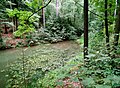
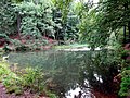 20130912010DR Obernaundorf (Rabenau) Gückelgrund Poisenwald.jpg 3,264 × 2,441; 5.52 MB
-
 20130912020DR Obernaundorf (Rabenau) Gückelgrund Poisenwald.jpg 3,188 × 2,340; 6.42 MB
-
 20130912030DR Obernaundorf (Rabenau) Gückelgrund Poisenwald.jpg 3,264 × 2,337; 5.52 MB
-
 20130912035DR Obernaundorf (Rabenau) Gückelgrund Poisenwald.jpg 3,264 × 2,448; 4.46 MB
-
 20130912040DR Obernaundorf (Rabenau) Gückelgrund Poisenwald.jpg 3,264 × 2,448; 5.33 MB
-
 20130912050DR Obernaundorf (Rabenau) Gückelgrund Poisenwald.jpg 3,264 × 2,439; 5.99 MB
-
 20130912060DR Obernaundorf (Rabenau) Poisenwald Steinerner Tisch.jpg 3,264 × 2,445; 4.89 MB
-
 20130912070DR Obernaundorf (Rabenau) Poisenwald Steinerner Tisch.jpg 2,849 × 2,076; 4.51 MB
-
 40 nations launch Exercise Combined Endeavor 2013 130912-F-TM377-001.jpg 1,400 × 815; 417 KB
-
 40 nations launch Exercise Combined Endeavor 2013 130912-F-TM377-002.jpg 1,500 × 1,115; 681 KB
-
 40 nations launch Exercise Combined Endeavor 2013 130912-F-TM377-003.jpg 1,000 × 666; 376 KB
-
 40 nations launch Exercise Combined Endeavor 2013 130912-F-TM377-004.jpg 1,000 × 666; 262 KB
-
 40 nations launch Exercise Combined Endeavor 2013 130912-F-TM377-005.jpg 1,000 × 627; 219 KB
-
 40 nations launch Exercise Combined Endeavor 2013 130912-F-TM377-007.jpg 1,000 × 680; 207 KB
-
 40 nations launch Exercise Combined Endeavor 2013 130912-F-TM377-008.jpg 1,000 × 530; 316 KB
-
 40 nations launch Exercise Combined Endeavor 2013 130912-F-TM377-009.jpg 1,000 × 666; 299 KB
-
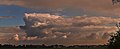 A distant thunderstorm - panoramio.jpg 6,720 × 2,720; 2.48 MB
-

-
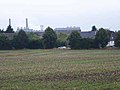 Agriculture and industry - geo.hlipp.de - 41304.jpg 640 × 480; 42 KB
-
 Bad Segeberg Wikivoyage Banner.jpg 3,430 × 491; 218 KB
-
 Beware the hunting season! - geo.hlipp.de - 41303.jpg 640 × 480; 108 KB
-
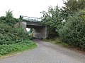 Bridge on the Nord-sud Kohlenbahn - geo.hlipp.de - 41313.jpg 640 × 480; 69 KB
-
 Donut orange.jpg 3,264 × 2,448; 1.72 MB
-
 Fernmeldeturm Bad Segeberg - panoramio.jpg 3,506 × 2,629; 452 KB
-
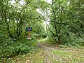
 Forest path - geo.hlipp.de - 41306.jpg 640 × 480; 87 KB
-
 Froschkönig - panoramio (2).jpg 1,920 × 2,560; 1.71 MB
-
 Hallig Hooge Sonnenuntergang.JPG 6,016 × 4,000; 8.86 MB
-
 Imagedrohne.com altes Löschboot - panoramio.jpg 1,292 × 969; 1.2 MB
-
 Imagedrohne.com altes Wohnboot - panoramio.jpg 3,205 × 2,404; 4.97 MB
-
 Kare-san-sui - 日本へのご挨拶 - panoramio.jpg 1,665 × 1,665; 472 KB
-
 Manenhofer Weg - geo.hlipp.de - 41314.jpg 640 × 480; 37 KB
-
 Manenhofer Weg - geo.hlipp.de - 41315.jpg 640 × 480; 89 KB
-
 2013-09-12 Sahra Wagenknecht 370.JPG 1,259 × 1,890; 229 KB
-
 Nord-sud Kohlenbahn - geo.hlipp.de - 41309.jpg 640 × 480; 72 KB
-
 Nord-sud Kohlenbahn - geo.hlipp.de - 41310.jpg 640 × 480; 39 KB
-
 Path alongside the Kaskadenweg - geo.hlipp.de - 41297.jpg 640 × 480; 62 KB
-
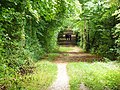
 Rail overbridge in the woods - geo.hlipp.de - 41302.jpg 480 × 640; 110 KB
-
 Rain - panoramio (14).jpg 7,595 × 2,603; 2.84 MB
-
 Rehbergweg, Frechen - geo.hlipp.de - 41305.jpg 640 × 480; 41 KB
-
 Sand quarry at Buschbell - geo.hlipp.de - 41300.jpg 640 × 480; 50 KB
-
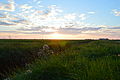
 Sonnenuntergang - panoramio (31).jpg 2,048 × 1,536; 613 KB
-
 Tall trees beside the path - geo.hlipp.de - 41316.jpg 480 × 640; 70 KB
-
 The Buschbell By-pass under construction - geo.hlipp.de - 41298.jpg 640 × 480; 41 KB
-
 The Buschbell By-pass under construction - geo.hlipp.de - 41299.jpg 640 × 480; 41 KB
-
 Track across the sand quarry - geo.hlipp.de - 41307.jpg 640 × 480; 69 KB
-
 Tree nursery near Buschbell - geo.hlipp.de - 41317.jpg 640 × 480; 67 KB
-
 View of Habbelrath across the fields - geo.hlipp.de - 41312.jpg 640 × 480; 32 KB
-
 Wohnhäuser Tann Rhön September 2013.JPG 3,648 × 2,736; 4.06 MB


_G%C3%BCckelgrund_Poisenwald.jpg)
_G%C3%BCckelgrund_Poisenwald.jpg)
_G%C3%BCckelgrund_Poisenwald.jpg)
_G%C3%BCckelgrund_Poisenwald.jpg)
_G%C3%BCckelgrund_Poisenwald.jpg)
_G%C3%BCckelgrund_Poisenwald.jpg)
_Poisenwald_Steinerner_Tisch.jpg)
_Poisenwald_Steinerner_Tisch.jpg)


_-_geo.hlipp.de_-_41176.jpg)


.jpg)


.jpg)


.jpg)