Category:Glossop
town and unparished area in High Peak district of Derbyshire, England  | |||||
| Upload media | |||||
| Instance of | |||||
|---|---|---|---|---|---|
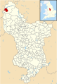
| Location | High Peak, Derbyshire, East Midlands, England | ||||
 | |||||
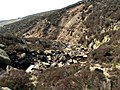
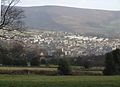
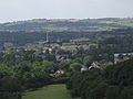
Glossop is a market town in the High Peak, Derbyshire, England, about 15 miles (24 km) east of Manchester, 24 miles (39 km) west of Sheffield and 32 miles (51 km) north of the county town, Matlock. Glossop is near Derbyshire's county borders with Cheshire, Greater Manchester, South Yorkshire and West Yorkshire. It is between 150 and 300 metres (492 and 984 ft) above mean sea level, and lies just outside the Peak District National Park.
Subcategories
This category has the following 19 subcategories, out of 19 total.
B
C
- Old Cross (Glossop) (3 F)
D
G
H
- Harehills Park, Glossop (5 F)
M
- Manor Park, Glossop (11 F)
O
P
- Padfield (65 F)
R
- Reservoirs in Glossop (4 F)
S
- Shelf Brook (15 F)
- Shelf Moor (48 F)
- Simmondley (21 F)
T
W
Media in category "Glossop"
The following 200 files are in this category, out of 393 total.
(previous page) (next page)-
-
 A Boundary Wall on Yellow Slacks - geograph.org.uk - 550746.jpg 640 × 480; 99 KB
-

-
 A Panoramic View from Lees Hall - geograph.org.uk - 3173462.jpg 13,483 × 3,207; 7.06 MB
-

-
 A Watercourse on Yellow Slacks - geograph.org.uk - 1413860.jpg 640 × 480; 94 KB
-
 A wooden bridge over the ford - geograph.org.uk - 779778.jpg 640 × 480; 86 KB
-
 A57 at Queen Street approaching Glossop - geograph.org.uk - 5507024.jpg 1,936 × 2,592; 1.33 MB
-
 A57 High Street West, Glossop - geograph.org.uk - 3820573.jpg 640 × 480; 64 KB
-
 A57 Sheffield Road in Old Glossop - geograph.org.uk - 3820576.jpg 640 × 481; 107 KB
-
 A57 Sheffield Road, Glossop - geograph.org.uk - 1479844.jpg 640 × 480; 85 KB
-
 A6016 - Whitfield - geograph.org.uk - 2509445.jpg 4,000 × 3,000; 4.02 MB
-
 A624 Chunal - looking towards Glossop - geograph.org.uk - 22277.jpg 640 × 480; 93 KB
-
 Above Glossop - geograph.org.uk - 3220355.jpg 1,024 × 768; 218 KB
-
 Above Glossop - geograph.org.uk - 3288562.jpg 1,280 × 853; 212 KB
-
 Above Hobroyd - geograph.org.uk - 3288560.jpg 1,280 × 853; 221 KB
-
 Access Lane leading away from Whitfield Barn Farm - geograph.org.uk - 4766233.jpg 1,600 × 1,067; 562 KB
-
 Across to Moorside - geograph.org.uk - 444888.jpg 640 × 480; 58 KB
-
 All Saints Well - geograph.org.uk - 1586036.jpg 556 × 640; 172 KB
-
 Approaching Whitfield Barn Farm - geograph.org.uk - 4766230.jpg 1,600 × 1,067; 657 KB
-
 Arnfield Clough - geograph.org.uk - 400833.jpg 640 × 480; 114 KB
-
 Arnfield Clough and Moorland - geograph.org.uk - 400883.jpg 640 × 480; 104 KB
-
 Arnfield Moor - geograph.org.uk - 400815.jpg 640 × 471; 104 KB
-
 Ashes Lane, Glossop - geograph.org.uk - 1800430.jpg 1,024 × 768; 124 KB
-
 At Glossop 2023 38.jpg 6,960 × 4,640; 11.3 MB
-
 At Glossop 2023 41.jpg 6,960 × 4,640; 14.84 MB
-
 At Glossop 2023 42.jpg 4,640 × 6,960; 15.95 MB
-
 At Glossop 2023 45.jpg 6,960 × 4,640; 9.82 MB
-
 At Glossop 2023 47.jpg 4,032 × 3,024; 5.88 MB
-
 At Glossop 2023 48.jpg 3,591 × 2,700; 4.67 MB
-
 Bits of a chimney - geograph.org.uk - 5046534.jpg 853 × 1,280; 245 KB
-
 Black Moor - geograph.org.uk - 4901642.jpg 5,184 × 3,456; 1.61 MB
-
 Black Moor - geograph.org.uk - 90538.jpg 640 × 480; 227 KB
-
 Blackshaw Brook - geograph.org.uk - 1588594.jpg 640 × 480; 99 KB
-
 Blake Moor and beyond - geograph.org.uk - 5240339.jpg 610 × 640; 61 KB
-
 Blakemoor Plantation - geograph.org.uk - 4901636.jpg 5,184 × 3,456; 2.03 MB
-
 Blue plaque, Robert Hamnett - geograph.org.uk - 5445077.jpg 1,249 × 1,038; 991 KB
-
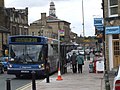
 Bowers Coaches bus 378 (YJ06 FXP), 10 August 2012.jpg 4,000 × 3,000; 4.8 MB
-
 BP Garage, Brookfield - geograph.org.uk - 3216445.jpg 640 × 481; 441 KB
-
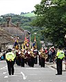 Brass band on High Street, Glossop - geograph.org.uk - 4072223.jpg 1,810 × 2,262; 1.34 MB
-
 Bridge over Troubled Waters - geograph.org.uk - 37871.jpg 640 × 480; 205 KB
-
 Brookside, Glossop - geograph.org.uk - 5898890.jpg 2,848 × 2,136; 1.28 MB
-
 Brownhill Cottage - geograph.org.uk - 4492292.jpg 5,092 × 3,261; 1.49 MB
-
 Burnt Hill - geograph.org.uk - 107471.jpg 640 × 397; 104 KB
-
 By the High Street in Glossop - geograph.org.uk - 2692125.jpg 1,024 × 757; 420 KB
-
 Byway near Mouselow Castle - geograph.org.uk - 3475564.jpg 3,994 × 2,992; 1.51 MB
-
 Calico Court - geograph.org.uk - 5270310.jpg 1,000 × 1,115; 661 KB
-
 Castlehill - geograph.org.uk - 4901632.jpg 3,138 × 4,729; 2 MB
-
 Cemetery Road - geograph.org.uk - 3250353.jpg 640 × 480; 477 KB
-
 Cemetery Road Junction - geograph.org.uk - 3250351.jpg 640 × 480; 458 KB
-
 Cemetery Road towards Hadfield - geograph.org.uk - 5898622.jpg 640 × 480; 100 KB
-
 Cemetery Road, Glossop - geograph.org.uk - 1800459.jpg 1,024 × 768; 122 KB
-
 Cemetery Road-Woodhead Road, Glossop - geograph.org.uk - 1800456.jpg 1,024 × 768; 103 KB
-
 Centrebus bus 226 (V261 HEC), 16 August 2012.jpg 4,320 × 3,240; 4.94 MB
-
 Charlestown.jpg 640 × 375; 34 KB
-
 Chunal Lane (A624) - geograph.org.uk - 5899548.jpg 640 × 480; 97 KB
-
 Church Street, Glossop - geograph.org.uk - 3250328.jpg 640 × 480; 517 KB
-
 Church Walk - geograph.org.uk - 1586211.jpg 640 × 480; 150 KB
-
 Cliffe Road - geograph.org.uk - 4766229.jpg 1,600 × 1,067; 424 KB
-
 Close up of Moorhen's nest - geograph.org.uk - 422730.jpg 640 × 480; 152 KB
-

-
 Coat of Arms of Glossop Borough Council 1919-1974.svg 500 × 515; 117 KB
-
 Cock Hill - panoramio.jpg 1,200 × 800; 432 KB
-
 Cock Hill old Quarries - geograph.org.uk - 614968.jpg 640 × 480; 77 KB
-
 Cock Hill Quarry - geograph.org.uk - 1415868.jpg 640 × 480; 88 KB
-

-
 Coldharbour Moor - geograph.org.uk - 67839.jpg 640 × 480; 67 KB
-
 Cottage on Hague Street - geograph.org.uk - 3174350.jpg 640 × 481; 456 KB
-
 Cottages on Hague Street on a wet day - geograph.org.uk - 4755878.jpg 6,000 × 4,000; 5.2 MB
-
 Cows young and old - geograph.org.uk - 1745396.jpg 2,272 × 1,712; 1.42 MB
-
 Cross Cliffe, Glossop - geograph.org.uk - 4766227.jpg 1,600 × 1,067; 492 KB
-
 Demolition of a Controversial Factory - geograph.org.uk - 1036148.jpg 640 × 427; 192 KB
-
 Demolition of a Controversial Factory - geograph.org.uk - 1038032.jpg 427 × 640; 167 KB
-
 Demolition of a Controversial Factory - geograph.org.uk - 1125754.jpg 427 × 640; 124 KB
-
 Derbyshire Level (Near Shire View Farm) - geograph.org.uk - 3174201.jpg 640 × 480; 388 KB
-
 Derbyshire Level - geograph.org.uk - 3174196.jpg 640 × 480; 407 KB
-
 Derbyshire Level - geograph.org.uk - 4766814.jpg 1,600 × 1,067; 779 KB
-
 Derbyshire UK map highlighting Glossop.svg 888 × 1,308; 2.34 MB
-
 Devil's Dike part of the Pennine Way - geograph.org.uk - 739414.jpg 640 × 480; 90 KB
-
 Digger atop a mound of rubble - geograph.org.uk - 5046548.jpg 1,280 × 853; 203 KB
-
 Dinting Road, Glossop - geograph.org.uk - 1800423.jpg 1,024 × 768; 151 KB
-
 Dinting Road, Glossop - geograph.org.uk - 1800428.jpg 1,024 × 768; 111 KB
-
 Dinting Road, Glossop - geograph.org.uk - 1800442.jpg 640 × 480; 81 KB
-
 Dinting Road, Glossop - geograph.org.uk - 1800449.jpg 1,024 × 768; 177 KB
-
 Dinting Road, Glossop - geograph.org.uk - 1800451.jpg 1,024 × 768; 192 KB
-
 Dinting6219.JPG 2,048 × 1,536; 760 KB
-
 Drinking trough outside the Norfolk Arms, Glossop.jpg 4,000 × 3,000; 1.2 MB
-
 Eating and drinking in Glossop - geograph.org.uk - 5270260.jpg 1,000 × 637; 459 KB
-
 Eating and drinking in Glossop - geograph.org.uk - 5646080.jpg 1,280 × 988; 859 KB
-
 Edward Street, Glossop - geograph.org.uk - 1755055.jpg 640 × 462; 85 KB
-
 Edward Street, Glossop - geograph.org.uk - 2692117.jpg 1,024 × 731; 334 KB
-
 Edward Street, Glossop - geograph.org.uk - 3248728.jpg 4,000 × 3,000; 1.8 MB
-

-
 Elizabeth II postbox on Primrose Lane, Glossop - geograph.org.uk - 5898889.jpg 2,136 × 2,848; 1.25 MB
-
 End of the ride - geograph.org.uk - 1708291.jpg 640 × 504; 62 KB
-
 Entering Glossop on Woodhead Road - geograph.org.uk - 3270192.jpg 800 × 600; 146 KB
-
 Etherow Hollingworth 123047 d5a5762d.jpg 640 × 479; 148 KB
-
 Fancy a swim anyone? - geograph.org.uk - 123049.jpg 640 × 479; 161 KB
-
 Fauvel Road - geograph.org.uk - 1585959.jpg 640 × 480; 144 KB
-
 Ferro Alloys has Gone - geograph.org.uk - 1469615.jpg 640 × 427; 73 KB
-
 Fields and trees near Glossop - geograph.org.uk - 3220364.jpg 1,024 × 768; 203 KB
-
 Five Way Junction - geograph.org.uk - 1585946.jpg 640 × 506; 123 KB
-
 Five Ways Junction, Glossop - geograph.org.uk - 1981733.jpg 1,024 × 768; 145 KB
-
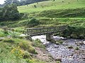 Footbridge over Shelf Brook - geograph.org.uk - 941484.jpg 640 × 480; 173 KB
-
 Footpath by Shire Brook - geograph.org.uk - 1378210.jpg 640 × 558; 183 KB
-
 Footpath off Hague Street - geograph.org.uk - 4755885.jpg 6,000 × 4,000; 7.65 MB
-
 Footpath on Shire Hill - geograph.org.uk - 990329.jpg 640 × 480; 149 KB
-
 Footpath Signpost - geograph.org.uk - 3250343.jpg 640 × 480; 579 KB
-
 Footpath to Philip Howard Road - geograph.org.uk - 5535982.jpg 1,280 × 960; 1.33 MB
-
 Former quarry above Glossop - geograph.org.uk - 4753375.jpg 6,000 × 4,000; 4.26 MB
-

-
 From Brownhill towards Glossop - geograph.org.uk - 944540.jpg 640 × 480; 133 KB
-

-
 Geological sketch-map Holmfirth Glossop.jpg 2,882 × 1,822; 1.76 MB
-
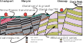 Geologyofglossop.svg 321 × 167; 137 KB
-
 Gladstone Street - geograph.org.uk - 5536524.jpg 1,280 × 935; 801 KB
-
 Gladstone Street - geograph.org.uk - 941674.jpg 640 × 427; 182 KB
-
 Gladstone Street, Glossop.jpg 1,280 × 940; 918 KB
-
 Glossop (30089309935).jpg 2,310 × 1,300; 2.42 MB
-
 Glossop - Firth Rixon Works from Shire Hill - geograph.org.uk - 2029809.jpg 1,600 × 1,200; 435 KB
-
 Glossop - footbridge over Shelf Brook - geograph.org.uk - 2029830.jpg 1,600 × 1,200; 685 KB
-
 Glossop - footpath to Shire Hill - geograph.org.uk - 2029825.jpg 1,200 × 1,600; 683 KB
-
 Glossop - geograph.org.uk - 2443657.jpg 3,931 × 2,808; 3.43 MB
-
 Glossop - geograph.org.uk - 4491978.jpg 5,184 × 3,456; 1.76 MB
-
 Glossop - geograph.org.uk - 5247565.jpg 3,648 × 2,736; 6.38 MB
-
 Glossop - geograph.org.uk - 5790529.jpg 6,032 × 4,014; 6.11 MB
-

-

-
 Glossop - panoramio (1).jpg 1,920 × 1,080; 1.05 MB
-
 Glossop - panoramio - Jorge Franganillo.jpg 2,310 × 1,300; 2.03 MB
-
 Glossop - panoramio.jpg 1,950 × 1,300; 2.22 MB
-
 Glossop - Sheffield Road from Shire Hill - geograph.org.uk - 2029818.jpg 1,600 × 1,200; 440 KB
-
 Glossop - Shelf Brook.JPG 1,704 × 2,272; 1.61 MB
-
 Glossop and Dinting Viaduct - geograph.org.uk - 1901376.jpg 900 × 675; 652 KB
-
 Glossop and District Golf Club - geograph.org.uk - 3174185.jpg 640 × 481; 426 KB
-
 Glossop and Shirebrook Park - geograph.org.uk - 3174284.jpg 640 × 481; 314 KB
-
 Glossop banner.jpg 1,800 × 257; 417 KB
-
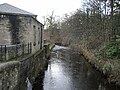
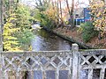 Glossop Brook - geograph.org.uk - 1038020.jpg 640 × 480; 194 KB
-
 Glossop Brook - geograph.org.uk - 1089891.jpg 640 × 480; 158 KB
-
 Glossop Brook - geograph.org.uk - 1469579.jpg 427 × 640; 131 KB
-
 Glossop Brook - geograph.org.uk - 1585343.jpg 640 × 480; 150 KB
-
 Glossop Brook - geograph.org.uk - 1585349.jpg 640 × 480; 188 KB
-
 Glossop Brook - geograph.org.uk - 1755086.jpg 640 × 480; 146 KB
-
 Glossop Brook - geograph.org.uk - 2479146.jpg 1,600 × 1,200; 779 KB
-
 Glossop Brook - geograph.org.uk - 5646514.jpg 1,280 × 960; 1.31 MB
-
 Glossop Brook - geograph.org.uk - 5799037.jpg 1,280 × 960; 530 KB
-
 Glossop Brook joins the River Etherow - geograph.org.uk - 5421855.jpg 3,648 × 2,736; 6.38 MB
-
 Glossop Brook Road - geograph.org.uk - 1949956.jpg 640 × 480; 57 KB
-
 Glossop Cemetery - geograph.org.uk - 3250354.jpg 640 × 480; 574 KB
-
 Glossop Cemetery - geograph.org.uk - 3291771.jpg 800 × 533; 118 KB
-
 Glossop cemetery - geograph.org.uk - 3919873.jpg 1,800 × 1,197; 623 KB
-
 Glossop cemetery. - geograph.org.uk - 5827203.jpg 1,024 × 683; 197 KB
-
 Glossop Cricket and Bowling Club - geograph.org.uk - 3213994.jpg 640 × 480; 457 KB
-
 Glossop Derbyshire UK.jpg 600 × 338; 36 KB
-
 Glossop Derbyshire.jpg 600 × 338; 60 KB
-
 Glossop golf course - geograph.org.uk - 1026433.jpg 640 × 480; 140 KB
-
 Glossop High Street - geograph.org.uk - 5799029.jpg 1,280 × 960; 300 KB
-
 Glossop In The High Peak - geograph.org.uk - 3250335.jpg 640 × 480; 512 KB
-
 Glossop Memorial Garden - geograph.org.uk - 3185612.jpg 640 × 425; 362 KB
-
 Glossop municipal cemetery - geograph.org.uk - 1111596.jpg 640 × 480; 75 KB
-
 Glossop one B road meets two A roads - geograph.org.uk - 4684368.jpg 2,304 × 1,728; 1.05 MB
-
 Glossop Outskirts - geograph.org.uk - 4518347.jpg 5,873 × 3,504; 6.37 MB
-
 Glossop Panorama - geograph.org.uk - 3174296.jpg 6,140 × 1,280; 5.92 MB
-
 Glossop Town Centre - geograph.org.uk - 1479840.jpg 640 × 480; 63 KB
-
 Glossop unparished area UK locator map.svg 920 × 1,305; 549 KB
-
 Glossop Welcome Sign.JPG 690 × 686; 82 KB
-
 Glossop, Fauvel Road - geograph.org.uk - 3213997.jpg 640 × 480; 563 KB
-
 Glossop, Primrose Lane - geograph.org.uk - 3173508.jpg 640 × 481; 615 KB
-
 Glossop-panorama.jpg 640 × 480; 125 KB
-
 Glossop4606c.JPG 2,029 × 1,036; 209 KB
-
 Glossop4787ec.JPG 2,013 × 1,458; 342 KB
-
 Glossop4792.JPG 2,048 × 1,536; 785 KB
-
 Glossop4793.JPG 2,048 × 1,536; 760 KB
-
 Glossop4794.JPG 2,048 × 1,536; 772 KB
-
 Glossop4796.JPG 2,048 × 1,536; 775 KB
-
 Glossop4797.JPG 2,048 × 1,536; 752 KB
-
 Glossop4806.JPG 2,048 × 1,536; 762 KB
-
 Glossop4807.JPG 2,048 × 1,536; 811 KB
-
 Glossop4808.JPG 2,048 × 1,536; 788 KB
-
 Glossop6165.JPG 2,048 × 1,536; 747 KB
-
 Glossop6178.JPG 2,048 × 1,536; 729 KB
-
 Glossop6187.JPG 2,048 × 1,536; 744 KB
-
 Glossop6188.JPG 2,048 × 1,536; 758 KB
-
 Glossop6193.JPG 2,048 × 1,536; 758 KB
-
 Glossop6196.JPG 2,048 × 1,536; 731 KB
-
 Glossop6197.JPG 2,048 × 1,536; 764 KB
-
 GlossopMap.svg 702 × 766; 581 KB
-
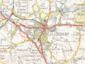 Glossopmap1954.png 1,414 × 1,074; 2.59 MB
-
 GlossopMapBit.png 702 × 766; 211 KB
-
 GlossopSnakePass6273.JPG 2,048 × 1,536; 757 KB
-
 GlossopSnakePass6275.JPG 2,048 × 1,536; 733 KB
-
-
 Hargate Hill Lane - geograph.org.uk - 22036.jpg 640 × 480; 101 KB
-
 Henry Street, Glossop - geograph.org.uk - 2039117.jpg 1,024 × 768; 161 KB
-
 High Lane, Simmondley - geograph.org.uk - 447496.jpg 640 × 480; 117 KB
-
 High Street East, Glossop - geograph.org.uk - 1089861.jpg 640 × 480; 119 KB
-

-
 Hillside above Glossop - geograph.org.uk - 1745569.jpg 2,272 × 1,712; 787 KB
-
 Hose on Gate - geograph.org.uk - 1469595.jpg 427 × 640; 96 KB
-
 Howard Close, Glossop - geograph.org.uk - 1750447.jpg 1,024 × 768; 132 KB


,_10_August_2012.jpg)


,_16_August_2012.jpg)

_-_geograph.org.uk_-_5899548.jpg)


_-_geograph.org.uk_-_3174201.jpg)


.jpg)


.jpg)


