Category:Gnosall Heath
English: Gnosall Heath is a hamlet in the civil parish of Gnosall, in the Stafford district, in the county of Staffordshire, England.
hamlet in Gnosall, Stafford, Staffordshire, England | |||||
| Upload media | |||||
| Instance of | |||||
|---|---|---|---|---|---|
| Location | Gnosall, Stafford, Staffordshire, West Midlands, England | ||||
 | |||||
Subcategories
This category has the following 4 subcategories, out of 4 total.
B
T
- The Boat Inn, Gnosall Heath (10 F)
Media in category "Gnosall Heath"
The following 83 files are in this category, out of 83 total.
-

-
 Allotments at Gnosall Heath - geograph.org.uk - 3129819.jpg 979 × 734; 334 KB
-

-
 Baled straw near Gnosall Heath - geograph.org.uk - 3130564.jpg 1,142 × 857; 341 KB
-
 Barn Bridge Farm near Gnosall Heath, Staffordshire - geograph.org.uk - 6031337.jpg 1,440 × 960; 1.37 MB
-

-

-

-

-
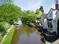 Canal at Gnosall Heath - geograph.org.uk - 182409.jpg 640 × 480; 123 KB
-
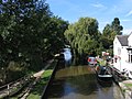
 Canal at Gnosall Heath - geograph.org.uk - 187788.jpg 640 × 427; 92 KB
-
 Canal at Gnosall Heath in Staffordshire - geograph.org.uk - 6031284.jpg 1,280 × 960; 1.45 MB
-
 Canal at Gnosall Heath in Staffordshire - geograph.org.uk - 6031290.jpg 1,440 × 960; 1.39 MB
-
 Canal north-west of Gnosall Heath, Staffordshire - geograph.org.uk - 5286244.jpg 1,280 × 898; 1.03 MB
-
 Canal side housing - geograph.org.uk - 398739.jpg 600 × 450; 240 KB
-

-

-

-

-

-

-
 Former Ebeneezer Chapel - geograph.org.uk - 398771.jpg 600 × 450; 199 KB
-

-

-
 Farmland north-west of Gnosall Heath in Staffordshire - geograph.org.uk - 6031324.jpg 1,440 × 1,080; 1.48 MB
-
 Fields near Gnosall Heath, Staffordshire - geograph.org.uk - 1885849.jpg 640 × 455; 145 KB
-

-
 Gnosall fire station - geograph.org.uk - 607245.jpg 640 × 427; 229 KB
-
 Gnosall Heath - geograph.org.uk - 182424.jpg 640 × 480; 122 KB
-
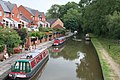
 Good Friday on the Shropshire Union Canal - geograph.org.uk - 398761.jpg 600 × 450; 293 KB
-
 House on High Street, Gnosall Heath - geograph.org.uk - 5868610.jpg 1,024 × 768; 202 KB
-
 Machins Barn Bridge near Gnosall Heat, Staffordshire - geograph.org.uk - 6031339.jpg 1,440 × 960; 1.32 MB
-

-

-
 Red sandstone near Gnosall Heath in Staffordshire - geograph.org.uk - 6030630.jpg 960 × 1,280; 1.98 MB
-
 Royal Oak at Gnosall Heath - geograph.org.uk - 937077.jpg 640 × 378; 49 KB
-
 Royal Oak, Gnosall Heath - geograph.org.uk - 119495.jpg 640 × 480; 136 KB
-
 Shops on Wharf Road, Gnosall Heath - geograph.org.uk - 517364.jpg 640 × 428; 114 KB
-
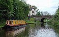
 Shropshire Union Canal at Gnosall Heath - geograph.org.uk - 3381250.jpg 1,500 × 1,125; 1.68 MB
-
 Shropshire Union Canal at Gnosall Heath - geograph.org.uk - 4892798.jpg 1,200 × 799; 527 KB
-
 Shropshire Union Canal at Gnosall Heath - geograph.org.uk - 4892808.jpg 1,200 × 799; 424 KB
-
 Shropshire Union Canal at Gnosall Heath - geograph.org.uk - 5770487.jpg 800 × 601; 192 KB
-

-

-

-

-
-

-

-
-

-

-

-

-

-

-

-

-

-

-

-

-

-

-
 Shropshire Union Canal, Gnosall - geograph.org.uk - 516849.jpg 640 × 428; 117 KB
-
 Shropshire Union Canal, Gnosall - geograph.org.uk - 516913.jpg 640 × 428; 131 KB
-
 Shropshire Union Canal, Gnosall - geograph.org.uk - 517572.jpg 640 × 428; 136 KB
-
 Shropshire Union Canal, Gnosall Heath - geograph.org.uk - 1868261.jpg 640 × 480; 116 KB
-
 Stacey Gardens, Gnosall Heath - geograph.org.uk - 517349.jpg 640 × 428; 112 KB
-
 The Old Corn Mill - geograph.org.uk - 398782.jpg 600 × 450; 210 KB
-

-

-
 The Old Corn Mill, Gnosall Heath - geograph.org.uk - 1585956.jpg 640 × 480; 102 KB
-
 The Royal Oak - geograph.org.uk - 3130549.jpg 1,142 × 857; 313 KB
-
 The Royal Oak Pub, Gnosall - geograph.org.uk - 1835636.jpg 2,048 × 1,536; 567 KB
-
 The Royal Oak, Gnosall Heath - geograph.org.uk - 5671494.jpg 1,280 × 851; 292 KB
-

-

-

-

-

-

-


