Category:Gomshall
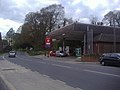
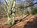
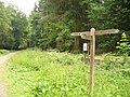
English: The village of Gomshall in the civil parish of Shere, is bisected by the A25 running west to Guildford and east to Dorking. Neighbouring villages include Shere, Albury, Abinger Hammer and Sutton Abinger. The North Downs Way is just north of the village. Gomshall is within the census area called Shere which has a population of 3,359.

village in Surrey, UK  | |||||
| Upload media | |||||
| Instance of | |||||
|---|---|---|---|---|---|
| Location | Shere, Guildford, Surrey, South East England, England | ||||
 | |||||
Subcategories
This category has the following 4 subcategories, out of 4 total.
G
- Gomshall Chapel (6 F)
- Gomshall railway station (25 F)
P
- Pubs in Gomshall (6 F)
Media in category "Gomshall"
The following 113 files are in this category, out of 113 total.
-
 A25, Gomshall - geograph.org.uk - 3033036.jpg 640 × 430; 56 KB
-
 Briary Hill East Arch - geograph.org.uk - 550923.jpg 640 × 480; 154 KB
-
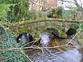
 Bridge at Gomshall, Surrey - geograph.org.uk - 1434773.jpg 640 × 428; 84 KB
-
 Bridge over Tilling Bourne, Gomshall - geograph.org.uk - 3343964.jpg 1,600 × 1,321; 533 KB
-
 Bus Shelter at Gomshall, Surrey - geograph.org.uk - 1435861.jpg 640 × 428; 112 KB
-

-
 Byway on Hackhurst Downs - geograph.org.uk - 668270.jpg 640 × 480; 131 KB
-
 Byway to Hackhurst Downs - geograph.org.uk - 668278.jpg 640 × 480; 126 KB
-

-
 Coach House Antiques, Gomshall - geograph.org.uk - 668394.jpg 640 × 480; 126 KB
-
 Field opposite Gomshall station - geograph.org.uk - 2238555.jpg 1,600 × 1,200; 597 KB
-
 Fields by Shere Road, Gomshall - geograph.org.uk - 2902025.jpg 1,600 × 1,200; 528 KB
-
 Foot Tunnel at Gomshall, Surrey - geograph.org.uk - 1434781.jpg 428 × 640; 102 KB
-
 Gomshall - Footbridge (geograph 5267299).jpg 2,560 × 1,920; 3.43 MB
-
 Gomshall Calling - geograph.org.uk - 577969.jpg 480 × 640; 118 KB
-
 Gomshall fire station - geograph.org.uk - 472216.jpg 640 × 427; 221 KB
-
 Gomshall Mill - geograph.org.uk - 1277869.jpg 640 × 447; 91 KB
-
 Gomshall Mill - geograph.org.uk - 2978804.jpg 4,288 × 3,216; 3.35 MB
-
 Gomshall Mill - geograph.org.uk - 3193509.jpg 640 × 430; 83 KB
-
 Gomshall Mill - geograph.org.uk - 3273323.jpg 640 × 426; 68 KB
-
 Gomshall Mill - geograph.org.uk - 3273331.jpg 640 × 426; 98 KB
-
 Gomshall Mill over the Tilling Bourne - geograph.org.uk - 577950.jpg 480 × 640; 110 KB
-
 Gomshall Post Office - geograph.org.uk - 668405.jpg 640 × 480; 63 KB
-
 Gomshall Post Office and Mill - geograph.org.uk - 577962.jpg 640 × 480; 116 KB
-
 Gomshall Post Office, Surrey - geograph.org.uk - 1433977.jpg 640 × 428; 83 KB
-
 Gomshall Sports Ground - geograph.org.uk - 3273332.jpg 640 × 393; 45 KB
-
 Gomshall station approach - geograph.org.uk - 1503942.jpg 640 × 480; 110 KB
-
 Gomshall02LB.jpg 2,816 × 2,112; 1.85 MB
-
 Goose Green, Gomshall - geograph.org.uk - 577978.jpg 640 × 573; 122 KB
-
 Goose Green, Gomshall, Surrey - geograph.org.uk - 1435855.jpg 428 × 640; 95 KB
-
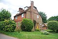 House in Gomshall - geograph.org.uk - 3193486.jpg 640 × 430; 92 KB
-
 Junction of Queen Street and Station Road, Gomshall - geograph.org.uk - 2902015.jpg 1,600 × 1,200; 602 KB
-
 King John House, Gomshall - geograph.org.uk - 668134.jpg 640 × 480; 77 KB
-
 Kissing Gate on Hackhurst Downs - geograph.org.uk - 668264.jpg 480 × 640; 127 KB
-
 Little Kings Wood Viewpoint on North Downs Way.jpg 3,000 × 2,001; 1.79 MB
-
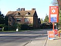
 Murco petrol station, Station Road, Gomshall - geograph.org.uk - 2902000.jpg 1,600 × 1,200; 535 KB
-
 Near Gomshall - geograph.org.uk - 3271215.jpg 640 × 426; 49 KB
-
 Old Houses, Abinger Hammer - geograph.org.uk - 580023.jpg 640 × 480; 120 KB
-
 Open space, Gomshall - geograph.org.uk - 3193472.jpg 640 × 430; 71 KB
-
 Pastureland south of Gomshall - geograph.org.uk - 2336220.jpg 2,816 × 1,880; 2.02 MB
-
 Pavilion, Gomshall - geograph.org.uk - 3193481.jpg 640 × 430; 54 KB
-
 Petrol station, Gomshall - geograph.org.uk - 2778091.jpg 4,320 × 3,240; 3.76 MB
-
 Phone box on A25 Gomshall - geograph.org.uk - 2221457.jpg 1,600 × 1,200; 579 KB
-
 Piney Copse - geograph.org.uk - 668329.jpg 640 × 480; 151 KB
-
 Queen Street, Gomshall - geograph.org.uk - 2902019.jpg 1,600 × 1,200; 609 KB
-
 Shere Road, Gomshall - geograph.org.uk - 2902028.jpg 1,600 × 1,200; 535 KB
-
 Shere Road, Gomshall - geograph.org.uk - 577955.jpg 640 × 480; 109 KB
-
 Station Road, Gomshall - geograph.org.uk - 2085890.jpg 4,320 × 3,240; 3.95 MB
-
 Station Road, Gomshall, Surrey - geograph.org.uk - 1434798.jpg 640 × 428; 83 KB
-
 Station Road, Gomshall, Surrey - geograph.org.uk - 1434807.jpg 640 × 428; 92 KB
-
 Station Road, Gomshall, Surrey - geograph.org.uk - 1435868.jpg 640 × 428; 82 KB
-
 Tanyard Hall, Gomshall - geograph.org.uk - 668119.jpg 640 × 480; 80 KB
-
 The Barn, Abinger Hammer - geograph.org.uk - 580027.jpg 640 × 480; 136 KB
-
 The car park at Farley Heath - geograph.org.uk - 164321.jpg 640 × 480; 131 KB
-
 The edge of Gomshall - geograph.org.uk - 3273344.jpg 640 × 426; 106 KB
-
 The stream at Gomshall - geograph.org.uk - 1503944.jpg 640 × 480; 157 KB
-
 The Tilling Bourne at Wonham Way, Gomshall - geograph.org.uk - 2336200.jpg 2,816 × 1,880; 4 MB
-
 The Tilling Bourne, Gomshall - geograph.org.uk - 2336180.jpg 2,816 × 1,880; 4.43 MB
-
 The Tillingbourne, Gomshall Mill - geograph.org.uk - 3271541.jpg 640 × 487; 86 KB
-
 Tilling Bourne - geograph.org.uk - 668125.jpg 480 × 640; 105 KB
-
 Tilling Bourne, Gomshall, Surrey - geograph.org.uk - 1434832.jpg 428 × 640; 99 KB
-
 Tillings, Gomshall - geograph.org.uk - 3271523.jpg 640 × 426; 68 KB
-
 United Reformed Church - geograph.org.uk - 3271529.jpg 640 × 426; 90 KB
-
 United Reformed Church, Gomshall - geograph.org.uk - 3271531.jpg 640 × 426; 59 KB
-
 View Towards Gomshall, Surrey - geograph.org.uk - 1395325.jpg 640 × 360; 49 KB
-
 View Towards Gomshall, Surrey - geograph.org.uk - 1433799.jpg 640 × 428; 63 KB
-
 Village sign, Gomshall - geograph.org.uk - 3273324.jpg 426 × 640; 43 KB
-
 A25 sign Gomshall - geograph.org.uk - 1088072.jpg 640 × 480; 82 KB
-
 Above Colekitchen Farm - geograph.org.uk - 668177.jpg 640 × 480; 127 KB
-
 Below Hackhurst Downs - geograph.org.uk - 668291.jpg 640 × 480; 137 KB
-

-
 Bridleway to Gomshall - geograph.org.uk - 1504744.jpg 640 × 480; 94 KB
-
 Burrows Cross - geograph.org.uk - 656267.jpg 480 × 640; 132 KB
-
 By Hunters Moon Farm - geograph.org.uk - 668339.jpg 640 × 480; 103 KB
-
 Colekitchen Farm - geograph.org.uk - 668159.jpg 640 × 480; 116 KB
-
 Colekitchen Farm and Lane - geograph.org.uk - 668183.jpg 640 × 480; 98 KB
-
 Colekitchen Farm, by Gomshall - geograph.org.uk - 668198.jpg 640 × 480; 133 KB
-
 Colekitchen Farm, Gomshall - geograph.org.uk - 621829.jpg 640 × 427; 90 KB
-
 Colekitchen Lane - geograph.org.uk - 668146.jpg 640 × 480; 149 KB
-
 Colekitchen, North Downs Scarp - geograph.org.uk - 668190.jpg 640 × 480; 144 KB
-
 Downland Tree - geograph.org.uk - 668307.jpg 480 × 640; 85 KB
-
 Erosion at Troy Bridge - geograph.org.uk - 551095.jpg 640 × 480; 160 KB
-
 Field East of Gomshall - geograph.org.uk - 668316.jpg 640 × 480; 127 KB
-
 Field Near Gomshall, Surrey - geograph.org.uk - 1433745.jpg 640 × 428; 71 KB
-
 Fields east of Hound House Road - geograph.org.uk - 164319.jpg 640 × 480; 91 KB
-
 Francis Corner - geograph.org.uk - 460682.jpg 640 × 480; 161 KB
-
 Gomshall - geograph.org.uk - 72212.jpg 640 × 428; 47 KB
-
 Gomshall Mill - geograph.org.uk - 108765.jpg 429 × 640; 182 KB
-
 Gomshall Railway Bridge - geograph.org.uk - 668384.jpg 640 × 480; 120 KB
-
 Gravelhill Gate, Netley Heath - geograph.org.uk - 668219.jpg 640 × 480; 139 KB
-
 Grazing at Colekitchen Farm - geograph.org.uk - 668151.jpg 640 × 480; 133 KB
-
 Great Kings Wood - geograph.org.uk - 668211.jpg 640 × 480; 166 KB
-
 Hackhurst Downs Viewpoint - geograph.org.uk - 668244.jpg 640 × 480; 116 KB
-
 Hay Bales South of Crocknorth Farm - geograph.org.uk - 551024.jpg 640 × 480; 99 KB
-
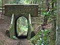
 Hermitage Arch, Lovelace Bridge - geograph.org.uk - 551059.jpg 480 × 640; 124 KB
-
 Jelleys Hollow, Winterfold Heath - geograph.org.uk - 46518.jpg 640 × 427; 112 KB
-
 Junction in Netley Heath - geograph.org.uk - 460669.jpg 640 × 480; 162 KB
-

-
 Land Barn Farm - geograph.org.uk - 633394.jpg 640 × 427; 100 KB
-
 Lawbrook Lane - geograph.org.uk - 656261.jpg 640 × 480; 141 KB
-
 Little Kings Wood - geograph.org.uk - 668228.jpg 640 × 480; 174 KB
-
 Little Kings Wood Viewpoint - geograph.org.uk - 668239.jpg 640 × 480; 98 KB
-
 Netley Heath - geograph.org.uk - 460676.jpg 480 × 640; 134 KB
-
 North Downs Way, Hackhurst Downs - geograph.org.uk - 668252.jpg 640 × 480; 141 KB
-
 Railway Bridge Near Hackhurst Farm - geograph.org.uk - 668321.jpg 640 × 480; 93 KB
-
 Row Lane, Winterfold Heath - geograph.org.uk - 70950.jpg 640 × 480; 157 KB
-
 Sheepwalk Lane - geograph.org.uk - 551069.jpg 640 × 480; 168 KB
-
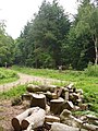
 Timber by Troy Bridge - geograph.org.uk - 551105.jpg 640 × 480; 162 KB
-
 Towards Colekitchen Hole - geograph.org.uk - 668169.jpg 640 × 480; 70 KB
-
 Towerhill Farm - geograph.org.uk - 580028.jpg 640 × 480; 110 KB
-
 Trackway through Winterfold Wood - geograph.org.uk - 46527.jpg 640 × 427; 125 KB
-
 Trackway through Winterfold Wood - geograph.org.uk - 46528.jpg 640 × 427; 143 KB
-
 Willinghurst Farm - geograph.org.uk - 169075.jpg 640 × 426; 43 KB


.jpg)


