Category:Grabow bei Blumenthal
| Object location | | View all coordinates using: OpenStreetMap |
|---|
village in Brandenburg state, Germany _church_2016_NW.JPG) | |||||
| Upload media | |||||
| Instance of |
| ||||
|---|---|---|---|---|---|
| Location | Heiligengrabe, Ostprignitz-Ruppin District, Brandenburg, Germany | ||||
| Area |
| ||||
 | |||||
English: Grabow bei Blumenthal quarter of Heiligengrabe municipality, Ostprignitz-Ruppin district, Brandenburg state, Germany
Deutsch: Ortsteil Grabow bei Blumenthal der Gemeinde Heiligengrabe, Landkreis Ostprignitz-Ruppin, Land Brandenburg, Deutschland.
Français : Quartier de Grabow bei Blumenthal de la commune de Heiligengrabe, arrondissement Prignitz-de-l'Est-Ruppin, état fédéral de Brandebourg, Allemagne
Subcategories
This category has only the following subcategory.
D
Media in category "Grabow bei Blumenthal"
The following 2 files are in this category, out of 2 total.
-
 Gefallenendenkmal Grabow (Blumenthal) 2016.jpg 3,648 × 4,864; 7.86 MB
-
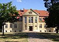 Grabow manor.jpg 1,830 × 1,290; 428 KB
_2016.jpg)
