Category:Graf-Adolf-Platz (Düsseldorf)
Deutsch: Graf-Adolf-Platz in Düsseldorf. Zwischen 1933 und 1945 trug er den Namen „Adolf-Hitler-Platz“.
| Object location | | View all coordinates using: OpenStreetMap |
|---|
public square in Düsseldorf, Germany  | |||||
| Upload media | |||||
| Instance of | |||||
|---|---|---|---|---|---|
| Named after | |||||
| Location | Düsseldorf, Düsseldorf Government Region, North Rhine-Westphalia, Germany | ||||
 | |||||
Subcategories
This category has the following 10 subcategories, out of 10 total.
1
B
- Bergisch-Märkische Bahnhof (6 F)
L
- Lichtsäule (Günther Uecker) (2 F)
O
- Oberpostdirektion Düsseldorf (8 F)
S
U
Media in category "Graf-Adolf-Platz (Düsseldorf)"
The following 21 files are in this category, out of 21 total.
-
 Düsseldorf, Graf-Adolf-Platz 1-2, 2014 (1).jpg 2,451 × 5,463; 811 KB
-
 Düsseldorf, Graf-Adolf-Platz 1-2, 2014 (2).jpg 4,445 × 3,416; 947 KB
-
 Düsseldorf - Graf-Adolf-Platz + LVA 01 ies.jpg 3,744 × 5,616; 6.56 MB
-
 Düsseldorf - Graf-Adolf-Platz 01 ies.jpg 5,616 × 3,744; 10.44 MB
-
 Düsseldorf - Graf-Adolf-Platz 02 ies.jpg 5,616 × 3,744; 7.74 MB
-
 Düsseldorf - Graf-Adolf-Platz 03 ies.jpg 3,744 × 5,616; 9.07 MB
-
 Düsseldorf - Graf-Adolf-Platz-Kasernenstraße 01 ies.jpg 5,616 × 3,744; 8.27 MB
-
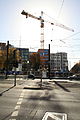
 Düsseldorf 03.JPG 1,630 × 2,556; 1.27 MB
-
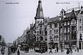
 Düsseldorf, Friedrichstraße, Europäischer Hof, Ende 19. Jahrhundert.jpg 1,278 × 779; 476 KB
-
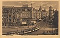
 Düsseldorf, Friedrichstraße, nach 1900.jpg 1,124 × 798; 293 KB
-

-
-
-
 Graf Adolf Platz Dusseldorf Germany October 3 2023.jpg 2,048 × 1,536; 2.28 MB
-

-
 Nebel in Düsseldorf (Leonie).jpg 1,353 × 2,400; 1.75 MB
-
 RBG 2106 and 1697 at Graf Adolf Platz.JPG 2,256 × 1,670; 1.44 MB
-
 RBG 2651 at Graf Adolf Platz.JPG 2,196 × 1,580; 1.37 MB
-
 RBG 2654 at Graf Adolf Platz.JPG 2,288 × 1,712; 811 KB
-
 RBG 2667 at Graf Adolf Platz.JPG 2,288 × 1,712; 826 KB
-
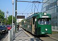
 Rheinbahn 2023 (NF10), Linie 709 ri Düsseldorf Gerresheim (14729781380).jpg 5,472 × 3,648; 6.85 MB
.jpg)
.jpg)


_,_Poststempel_6.7.1911_(Quelle_-_Paul_Wietzorek,_Das_historische_D%C3%BCsseldorf,_D%C3%BCsseldorf_2010).jpg)
.jpg)
.jpg)

,_Neuer_illustrirter_F%C3%BChrer_durch_D%C3%BCsseldorf_und_Umgebung_f%C3%BCr_Einheimische_und_Fremde,_D%C3%BCsseldorf_1898,_Hermann_Michels_Verlag.heinrich_blanckertz.jpg)
.jpg)


,_Linie_709_ri_D%C3%BCsseldorf_Gerresheim_(14729781380).jpg)