Category:Gulval
village in Cornwall, England, United Kingdom  | |||||
| Upload media | |||||
| Instance of |
| ||||
|---|---|---|---|---|---|
| Location | Penzance, Cornwall, South West England, England | ||||
 | |||||
English: Gulval is a village in the former Penwith district of Cornwall, United Kingdom. Although historically a parish in its own right, Gulval was incorporated into the parishes of Penzance, Madron and Ludgvan in 1934, and like Heamoor, is now considered to be a suburb of Penzance. Gulval, however, still maintains its status as an ecclesiastical parish and the village church is of the 12th century.
Subcategories
This category has the following 2 subcategories, out of 2 total.
G
- Gulval War Memorial (3 F)
S
Media in category "Gulval"
The following 50 files are in this category, out of 50 total.
-
 Barn conversion - geograph.org.uk - 112238.jpg 640 × 480; 87 KB
-
 Bleu Bridge early Christian memorial stone.jpg 4,032 × 3,024; 6.69 MB
-
 Bleu Bridge on the Trevaylor Stream.jpg 3,024 × 4,032; 5.71 MB
-
 Bleu Bridge Stone - geograph.org.uk - 1219762.jpg 443 × 591; 67 KB
-
 Cottages at Rosemorran - geograph.org.uk - 118790.jpg 640 × 480; 184 KB
-
 Cross in Gulval churchyard - geograph.org.uk - 2151531.jpg 640 × 511; 134 KB
-
 Four Parish Stone, Cornwall.jpg 3,024 × 4,032; 6.51 MB
-
 Garris Farm - geograph.org.uk - 112246.jpg 640 × 480; 34 KB
-
 Gulval - K6 telephone kiosk.jpg 3,024 × 4,032; 4.87 MB
-
 Gulval - Lych-gate (south side).jpg 2,906 × 3,874; 3.25 MB
-
 Gulval - Mortuary Door.jpg 3,024 × 4,032; 3.04 MB
-
 Gulval - Mortuary.jpg 3,299 × 4,399; 4.55 MB
-
 Gulval Church - geograph.org.uk - 5024214.jpg 640 × 480; 133 KB
-
 Gulval Cornwall - geograph.org.uk - 5024216.jpg 640 × 480; 60 KB
-
 Gulval Methodist church - geograph.org.uk - 4710335.jpg 720 × 540; 123 KB
-
 Gulval Methodist Church.jpg 3,024 × 4,032; 2.46 MB
-
 Gulval Village - geograph.org.uk - 5024212.jpg 640 × 431; 60 KB
-
 Gulval Village - geograph.org.uk - 539364.jpg 640 × 427; 100 KB
-
 Gulval Village - geograph.org.uk - 539383.jpg 640 × 427; 127 KB
-

-
 Low tide in Mounts Bay - geograph.org.uk - 104434.jpg 640 × 480; 97 KB
-
 Mounts Bay Lugger - geograph.org.uk - 44656.jpg 640 × 429; 41 KB
-
 On the edge of town - geograph.org.uk - 1228522.jpg 478 × 588; 99 KB
-
 Penzance Heliport - geograph.org.uk - 31551.jpg 640 × 373; 58 KB
-
 Roadside Footpath. - panoramio.jpg 3,000 × 4,000; 4.9 MB
-
 Rosemorran Footpath Stile. - panoramio.jpg 4,000 × 2,248; 3.91 MB
-
 Rosemorran Gate ^ Stile. - panoramio.jpg 4,000 × 2,248; 3.84 MB
-
 St Gulvals church, Gulval (geograph 3560510).jpg 640 × 442; 480 KB
-
 St. Mary's ^ St Pol De Leon. - panoramio.jpg 4,000 × 2,248; 3.26 MB
-
 Thatched cottage - geograph.org.uk - 112281.jpg 640 × 480; 75 KB
-
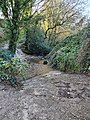 Trevaylor Stream ford.jpg 3,024 × 4,032; 6.01 MB
-

-
 Brassicas and Maize - geograph.org.uk - 539400.jpg 640 × 427; 101 KB
-
 Castle-an-Dinas - geograph.org.uk - 33884.jpg 640 × 480; 56 KB
-
 Chysauster Farm - geograph.org.uk - 54191.jpg 640 × 480; 61 KB
-
 Coming into Penzance - geograph.org.uk - 229299.jpg 640 × 480; 118 KB
-

-
 Farmland at Chysauster - geograph.org.uk - 682516.jpg 640 × 480; 127 KB
-
 Farmland at Trezelah Park Farm - geograph.org.uk - 682499.jpg 640 × 480; 91 KB
-
 Farmland near Chysauster Settlement - geograph.org.uk - 682523.jpg 640 × 480; 127 KB
-
 Fields at Rosemorran - geograph.org.uk - 118788.jpg 640 × 480; 116 KB
-
 Fields near Castle an Dinas - geograph.org.uk - 129660.jpg 640 × 480; 122 KB
-
 From the Railway to Gulval - geograph.org.uk - 539343.jpg 640 × 426; 123 KB
-
 Gorse in Rosemorran Valley - geograph.org.uk - 118785.jpg 640 × 480; 187 KB
-
 Little Chysauster house - geograph.org.uk - 682510.jpg 640 × 480; 101 KB
-
 Looking towards Treassowe and Trencrom - geograph.org.uk - 129655.jpg 640 × 480; 128 KB
-
 Penzance Heliport - geograph.org.uk - 658324.jpg 640 × 421; 45 KB
-
 The path to Chysauster Settlement - geograph.org.uk - 682520.jpg 640 × 480; 109 KB
-
 The road to Boscreege Farm - geograph.org.uk - 682502.jpg 640 × 480; 95 KB
-
 The road to Boscreege Farm ^2 - geograph.org.uk - 682505.jpg 640 × 480; 113 KB


.jpg)


.jpg)


