Category:Cornwall
Ceremonial counties of England: Bedfordshire · Berkshire · Buckinghamshire · Cambridgeshire · Cheshire · Cornwall · Cumbria · Derbyshire · Devon · Dorset · Durham · East Riding of Yorkshire · East Sussex · Essex · Gloucestershire · Greater London · Greater Manchester · Hampshire · Herefordshire · Hertfordshire · Isle of Wight · Kent · Lancashire · Leicestershire · Lincolnshire · Merseyside · Norfolk · North Yorkshire · Northamptonshire · Northumberland · Nottinghamshire · Oxfordshire · Rutland · Shropshire · Somerset · South Yorkshire · Staffordshire · Suffolk · Surrey · Tyne and Wear · Warwickshire · West Midlands · West Sussex · West Yorkshire · Wiltshire · Worcestershire
City-counties: Bristol · City of London
Former historic counties: Cumberland · Huntingdonshire · London · Middlesex · North Riding of Yorkshire · Sussex · West Riding of Yorkshire · Westmorland · Yorkshire
Other former counties: Avon · Cambridgeshire and Isle of Ely · Cleveland · East Suffolk · Hereford and Worcester · Hexhamshire · Humberside · Huntingdon and Peterborough · Isle of Ely · Parts of Holland · Parts of Kesteven · Parts of Lindsey · Soke of Peterborough · West Suffolk
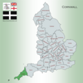
English: Cornwall is an area at the tip of the south-western peninsula of Great Britain, administered as a unitary authority and ceremonial county of England, within the United Kingdom. It is bordered to the north and west by the Atlantic Ocean, to the south by the English Channel, and to the east by the county of Devon, over the River Tamar. Including the Isles of Scilly, Cornwall has a population of 536,000, and covers an area of 3,563 km2 (1,376 sq mi). The administrative centre and only city is Truro.
Brezhoneg: Kontelezh Kernev-Veur (Kernow e kerneveureg, Cornwall e saozneg) zo ur gontelezh e beg mervent Breizh-Veur, en hanternoz da Vor Breizh, dirak aodoù Bro-Leon, er c'hornog d'ar stêr Tamer, dezhi ur gorread a 3 564 km². 536 000 a annezidi a oa o chom enni e 2011.
Deutsch: Cornwall (Kornisch: Kernow [ˈkɛrnɔʊ̯], dt. auch Kornwall oder veraltet Kornwales oder Cornwallis) ist eine Grafschaft und der südwestlichste Landesteil im Vereinigten Königreich im Landesteil England.
Español: Cornualles (Cornwall, en inglés; Kernow en córnico) es un condado administrativo y ceremonial que ocupa gran parte de la península del mismo nombre, constituyendo el extremo suroccidental de Inglaterra.
Français : Les Cornouailles ou la Cornouailles (en cornique Kernow, en anglais Cornwall, en breton Kernev-Veur) sont un comté d'Angleterre situé à l'extrémité sud-ouest du pays. Sa capitale est Truro. Limité à l'est par la rivière Tamar. 3 564 km². 536 000 habitants. Il ne doit pas être confondu avec la Cornouaille, qui se trouve en Bretagne continentale. Il est parfois connu sous le nom de plateau de Cornwall ou de péninsule de Cornwall.
Latina: Cornubia vel Cornwallia (Cornubice: Kernow) est comitatus geographicus Angliae quae ad meridionalem et occidentalem partem spectat.

historic county of England; Celtic nation    | |||||
| Upload media | |||||
| Instance of | |||||
|---|---|---|---|---|---|
| Part of | |||||
| Location |
| ||||
| Capital | |||||
| Heritage designation | |||||
| Population |
| ||||
| Area |
| ||||
| Different from | |||||
| official website | |||||
 | |||||
Subcategories
This category has the following 38 subcategories, out of 38 total.
Pages in category "Cornwall"
The following 2 pages are in this category, out of 2 total.
Media in category "Cornwall"
The following 164 files are in this category, out of 164 total.
-
De-Cornwall.ogg 1.7 s; 16 KB
-
 1. tony plant,mid summers day sunset drawing,bedruthan steps,cornwall (3).jpg 1,939 × 1,250; 646 KB
-
 A Salt-watery Seal Salutation.jpg 3,156 × 2,121; 3.14 MB
-
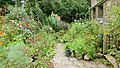 An artist's garden, 1 - geograph.org.uk - 3383164.jpg 1,200 × 676; 437 KB
-
 An artist's garden, 2 - geograph.org.uk - 3383166.jpg 1,200 × 676; 437 KB
-
 Arms of Treen.png 956 × 1,114; 220 KB
-
 Baner an Keffrysyans a Gowethasow Kernow Goth.png 336 × 587; 251 KB
-
 Baner Pan-Celtaidd 2.jpg 1,823 × 1,439; 463 KB
-
 Beautiful Lands end evening view Cornwall.jpg 6,000 × 3,376; 16.22 MB
-
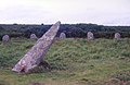 Boscawen-un Stone Circle - geograph.org.uk - 3180751.jpg 1,778 × 1,152; 538 KB
-
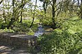
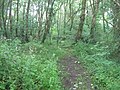 Bridle path through the woods - geograph.org.uk - 3011965.jpg 2,592 × 1,944; 2.35 MB
-
 Bridlepath through Trevelloe Woods (2) - geograph.org.uk - 3181432.jpg 640 × 427; 146 KB
-
 Bridlepath through Trevelloe Woods - geograph.org.uk - 3181416.jpg 427 × 640; 155 KB
-
 Building at Levant Mine, Cornwall.jpg 768 × 1,024; 340 KB
-
 Buildings at Lower Leha - geograph.org.uk - 3011950.jpg 1,600 × 1,200; 415 KB
-
 Calstock Roman Fort.jpg 2,698 × 2,459; 829 KB
-
 Camel trail from Polbrock.jpg 3,024 × 4,032; 7.25 MB
-
 Carluddon Pyramid from Carloggas Downs.jpg 1,536 × 2,048; 904 KB
-
 Chevron fold (7582888918).jpg 3,264 × 1,840; 1.8 MB
-
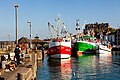
 Cleaning out the engines! Fowey Harbour, Cornwall - UK Feb 16 2014. (12607749825).jpg 3,888 × 2,592; 3.31 MB
-
 Cleaning out the engines! Fowey Harbour, Cornwall - UK Feb 16 2014. (12607767445).jpg 3,888 × 2,592; 3.22 MB
-
 Communication centre near St Buryan - geograph.org.uk - 2991270.jpg 2,592 × 1,944; 1.43 MB
-
 Cornish Countryside (14681356657).jpg 6,016 × 3,819; 12.17 MB
-
 Cornish Valleys (16932330727).jpg 5,623 × 2,588; 12.91 MB
-
 Cornish-Windsor Covered Bridge (50686878712).jpg 1,604 × 1,076; 398 KB
-
 The Cornish riviera (IA cornishriviera00heat).pdf 931 × 1,304, 96 pages; 3.66 MB
-
 Cornish–Windsor Covered Bridge (51052692566).jpg 1,070 × 717; 375 KB
-
 Cornwall Railway.png 1,436 × 925; 82 KB
-
 Cornwall-02-Tamar-River-2004-gje.jpg 3,072 × 2,048; 1.43 MB
-
 Cornwall-04-Baum-Dreirad-2004-gje.jpg 3,072 × 2,048; 1.57 MB
-
 Cornwall-06-Landschaft-2004-gje.jpg 3,072 × 1,736; 1.39 MB
-
 Cornwall-08-Landschaft-2004-gje.jpg 3,072 × 1,767; 1.25 MB
-
 Cornwall-10-Landschaft-2004-gje.jpg 3,072 × 1,687; 1.23 MB
-
 Cornwall-12-Briefkasten-2004-gje.jpg 2,048 × 3,072; 2.12 MB
-
 Cot Valley by Kernow Skies.jpg 4,000 × 2,250; 3.84 MB
-
 Cot Valley from above by Kernow Skies.jpg 8,064 × 4,536; 24.48 MB
-
 Cot Valley from sea by Kernow Skies.jpg 4,621 × 3,461; 3.32 MB
-
 Cot Valley looking out to sea by Kernow Skies.jpg 4,621 × 3,461; 2.9 MB
-
 Cot Valley Porth Nanven by Kernow Skies.jpg 4,000 × 2,250; 4.11 MB
-
 Cross by the roadside - geograph.org.uk - 3443535.jpg 427 × 640; 155 KB
-
 Cudden Point by Kernow Skies.jpg 4,621 × 3,461; 2.94 MB
-
 Delabole-1992-Cornwall-0107.jpg 1,200 × 775; 173 KB
-
 Devon and Cornwall UK PCC election 2024.svg 877 × 598; 1.61 MB
-
 Ding Dong Tin Mine 1 by Kernow Skies.jpg 4,621 × 3,461; 3.15 MB
-
 Ding Dong Tin Mine 2 by Kernow Skies.jpg 4,621 × 3,461; 5.01 MB
-
 Disused path near to the Merry Maidens - geograph.org.uk - 3197552.jpg 2,000 × 1,500; 1.43 MB
-
 Dried by Cornwall winds.jpg 2,945 × 1,963; 5.21 MB
-
 Dry Tree menhir 2.jpg 480 × 640; 187 KB
-
 El poeta y traductor Terence Dooley.jpg 802 × 1,280; 134 KB
-
 Ennis Farm - geograph.org.uk - 3166670.jpg 640 × 427; 96 KB
-
 Entrance to Choone Farm, near St. Buryan - geograph.org.uk - 2398491.jpg 1,600 × 1,200; 600 KB
-
 Falmouth Docks by Kernow Skies.jpg 3,960 × 2,970; 2.28 MB
-
 Falmouth Roads with lots of yachts moored by Kernow Skies.jpg 4,000 × 3,000; 5.73 MB
-
 Fields north of Bosanketh Farm - geograph.org.uk - 3282164.jpg 1,142 × 857; 268 KB
-
 Fishing Boat coming into Newlyn Harbour by Kernow Skies.jpg 4,000 × 3,000; 5.34 MB
-
 Fishing on the rocks (652599214).jpg 2,848 × 2,136; 1.68 MB
-
 Foamy Playground.jpg 4,865 × 3,293; 6.57 MB
-

-
 Former stables and house - geograph.org.uk - 3181463.jpg 640 × 476; 106 KB
-
 Frosty Morning Panorama (8483017601).jpg 4,816 × 1,264; 2.42 MB
-
 Godrievy Lighthouse by Kernow Skies.jpg 3,960 × 2,970; 3.47 MB
-
 Gwithian Beach 3 by Kernow Skies.jpg 4,000 × 3,000; 5.31 MB
-
 Gwithian Beach 4 by Kernow Skies.jpg 4,000 × 3,000; 5.86 MB
-
 Gwithian Beach 5 by Kernow Skies.jpg 4,000 × 3,000; 5.33 MB
-
 Gwithian Beach by Kernow Skies.jpg 4,000 × 2,250; 3.45 MB
-
 Gwithian beach with an empty car park by Kernow Skies.jpg 4,000 × 3,000; 5.09 MB
-
 Half Submerged Seals.jpg 4,573 × 3,175; 1.52 MB
-
 Hayle harbour ASDA by Kernow Skies.jpg 4,000 × 2,250; 4.03 MB
-
 Hayle harbour by Kernow Skies.jpg 4,000 × 2,250; 4.1 MB
-
 Hayle Harbour new development by Kernow Skies.jpg 4,000 × 2,250; 4.62 MB
-
 High above the river (328411469).jpg 2,592 × 1,944; 2.28 MB
-
 Higher Bologgas Farm - geograph.org.uk - 3166694.jpg 640 × 301; 49 KB
-
 Higher Kerris Barn - geograph.org.uk - 3166621.jpg 640 × 427; 99 KB
-
 Higher Kerris Farm - geograph.org.uk - 3166618.jpg 427 × 640; 109 KB
-
 House at Higher Leah Farm - geograph.org.uk - 3011954.jpg 1,600 × 1,200; 378 KB
-
 House at Vellansaga - geograph.org.uk - 3443552.jpg 640 × 427; 149 KB
-
 Jelberts Ice Cream Newlyn from air by Kernow Skies.jpg 4,000 × 3,000; 7.43 MB
-
 Joan The Wad & Polperro Piskey Headquarters.jpg 1,520 × 2,688; 1.28 MB
-
 Jobs Cross.jpg 4,717 × 1,572; 2.17 MB
-
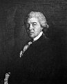
 John Hawkins (1761-1841).jpg 1,042 × 1,546; 341 KB
-
 Lamorna Cove from above by Kernow Skies.jpg 4,000 × 2,250; 3.75 MB
-
 Land's End, Cornwall, England1.jpg 4,368 × 2,912; 1.95 MB
-
 Lands end Cornwall.jpg 6,000 × 3,376; 16.75 MB
-
 Lands end evening view at Cornwall.jpg 6,000 × 3,376; 15.53 MB
-
 Lands end evening view Cornwall.jpg 6,000 × 3,376; 18.16 MB
-
 Lands end located in Cornwall England.jpg 6,000 × 3,376; 12.34 MB
-
 Lands end located in Cornwall.jpg 6,000 × 3,376; 14.31 MB
-
 Landscape at Cornwall Lands End.jpg 6,000 × 3,376; 17.19 MB
-
 Lane to Trewoofe Wartha - geograph.org.uk - 3443574.jpg 640 × 427; 102 KB
-
 Lanivet Coped Stone.jpg 2,736 × 3,648; 2.09 MB
-
 Lansalson Pit (1064606948).jpg 2,848 × 2,136; 3.07 MB
-
 Little cascade in Trevelloe Woods - geograph.org.uk - 3181440.jpg 640 × 427; 118 KB
-
 Logan Rock 1 by Kernow Skies.jpg 3,960 × 2,970; 3.26 MB
-
 Logan Rock 2 by Kernow Skies.jpg 4,000 × 3,000; 5.44 MB
-
 Long Rock by Kernow Skies.jpg 4,621 × 3,461; 3.93 MB
-
 Look Ahead II (43131766675).jpg 2,597 × 3,896; 9.09 MB
-
 Looking back to Tresco by Kernow Skies.jpg 3,960 × 2,970; 3.02 MB
-
 Mackerel Sky Seafood Bar from air by Kernow Skies.jpg 4,000 × 3,000; 7.91 MB
-
 Map showing the traditional, geographical county of Cornwall Kernow, England.png 4,967 × 4,967; 4.19 MB
-
 Marazion Marsh by Kernow Skies.jpg 4,000 × 2,250; 4.01 MB
-
 Men An Tol Cornwall by Kernow Skies.jpg 4,621 × 3,461; 4.24 MB
-
 Minack Theatre from the air by Kernow Skies.jpg 3,960 × 2,970; 3.25 MB
-
 Model Village miniature at Lands end Cornwall.jpg 6,000 × 3,376; 18.19 MB
-
 Model Village miniature Lands end Cornwall.jpg 6,000 × 3,376; 19.78 MB
-
 Montipora capricornis 1.jpg 2,592 × 1,944; 620 KB
-
 Mossy Tree.jpg 4,480 × 6,720; 10.75 MB
-
 Mousehole - Sea Salts and Sail Festival 1 - Kernow Skies.jpg 8,064 × 4,536; 27.94 MB
-
 Mousehole - Sea Salts and Sail Festival 2 - Kernow Skies.jpg 8,064 × 4,536; 28.94 MB
-
 Mousehole - Sea Salts and Sail Festival 3 - Kernow Skies.jpg 8,064 × 4,536; 27.88 MB
-
 Mousehole - Sea Salts and Sail Festival 4 - Kernow Skies.jpg 8,064 × 4,536; 31.63 MB
-
 Mousehole - Sea Salts and Sail Festival 5 - Kernow Skies.jpg 8,064 × 4,536; 27.6 MB
-
 Mousehole - Sea Salts and Sail Festival 6 - Kernow Skies.jpg 8,064 × 4,536; 27.77 MB
-
 Mousehole - Sea Salts and Sail Festival 7 - Kernow Skies.jpg 8,064 × 4,536; 30.03 MB
-
 Mousehole - Sea Salts and Sail Festival 8 - Kernow Skies.jpg 8,064 × 4,536; 31.32 MB
-
 Mousehole - Sea Salts and Sail Festival 9 - Kernow Skies.jpg 8,064 × 4,536; 30.67 MB
-
 New Polzeath waves.jpg 3,692 × 2,077; 835 KB
-
 Newquay Harbor ebb-IMG 7916.jpg 5,616 × 3,744; 16.5 MB
-
 Newquay Harbor-IMG 7887.jpg 5,616 × 3,744; 14.64 MB
-
 Newquay, Cornwall.jpg 1,255 × 706; 316 KB
-
 Old cemetery sign.jpg 4,624 × 3,468; 8.51 MB
-
 Old Quay Newlyn by Kernow Skies.jpg 3,960 × 2,970; 3.34 MB
-
 Old Town Bay (44597497811).jpg 2,048 × 1,237; 682 KB
-
 Old Town Bay (44597506601).jpg 2,048 × 630; 508 KB
-
 Outside Joan The Wad & Polperro Piskey Headquarters.jpg 2,688 × 1,520; 3.42 MB
-
 Padstow (Cornwall).jpg 5,616 × 3,744; 15.92 MB
-
 Padstow harbour.jpg 5,472 × 3,648; 2.72 MB
-
 Pan-Celticism flag.svg 6,000 × 3,600; 571 KB
-
 Penlee Point Rame.jpg 2,592 × 1,944; 442 KB
-
 Penmennor Farm - geograph.org.uk - 3443559.jpg 640 × 427; 123 KB
-
 PENZANCE PANO NOVEMBER 2021editweb.jpg 10,000 × 1,485; 2.9 MB
-
 Philip Rashleigh (1729–1811).jpg 1,158 × 1,432; 218 KB
-
 Pool in the china clay pit on Tredinney Common - geograph.org.uk - 3289733.jpg 1,142 × 857; 281 KB
-
 Port Quin.tif 850 × 442; 1.09 MB
-
 Porthleven Harbour.jpg 6,558 × 4,385; 13.47 MB
-
 Properties at Higher Kerris - geograph.org.uk - 3166624.jpg 640 × 427; 91 KB
-
 Properties at Kerrisvean - geograph.org.uk - 3181452.jpg 640 × 427; 105 KB
-
 Ripple marks, Cornwall, England (7582944250).jpg 3,264 × 1,840; 1.83 MB
-
 Road at Canopus - geograph.org.uk - 3450871.jpg 640 × 427; 107 KB
-
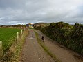
 Road crosses the stream - geograph.org.uk - 3181402.jpg 640 × 395; 118 KB
-
 Road goes over the stream - geograph.org.uk - 3443522.jpg 640 × 427; 142 KB
-
 S W Coast Path Saint Anthony Cornwall United Kingdom (68298477).jpeg 2,048 × 1,365; 1.35 MB
-
 Sailboat Carrick Roads.jpg 5,472 × 3,648; 1.82 MB
-
 SenedhKernow.png 1,021 × 502; 109 KB
-

-
 Soil bedrock contact Cornwall, England (7582948024).jpg 3,264 × 1,840; 2.74 MB
-
 Some of the Merry Maidens - geograph.org.uk - 3197565.jpg 2,000 × 1,500; 967 KB
-
 St Austell Golf Course Third Hole - Feb 2023.jpg 4,032 × 3,024; 3.05 MB
-
 St Tudy Coped Stone.jpg 2,736 × 3,648; 2.12 MB
-
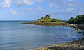
 St. Michael's Mount, Cornwall1.jpg 4,246 × 2,831; 1.64 MB
-
 Stream at Vellansaga - geograph.org.uk - 3443526.jpg 640 × 427; 148 KB
-
 Stream through the woods - geograph.org.uk - 3011978.jpg 2,592 × 1,944; 2.32 MB
-
 Tavaz Lhuyd.png 83 × 32; 1 KB
-
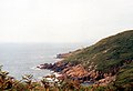
 The Brisons from Sennen Cove - geograph.org.uk - 2392313.jpg 1,600 × 944; 189 KB
-

-
 The Coast and Tater Du - geograph.org.uk - 2807193.jpg 640 × 437; 88 KB
-
 The Land's End Pine Company - geograph.org.uk - 3011953.jpg 1,600 × 1,200; 459 KB
-

-
 The Old Wishing Well.jpg 2,268 × 4,032; 2.57 MB
-
 The tip of Porthguarnon Cove east cliff - geograph.org.uk - 2993818.jpg 2,592 × 1,944; 2.08 MB
-
 The track from Bosanketh Farm - geograph.org.uk - 3282165.jpg 1,142 × 857; 289 KB
-
 Tresvennack Farm - geograph.org.uk - 3166665.jpg 640 × 427; 111 KB
-
 Treverven Farm house - geograph.org.uk - 2993826.jpg 2,592 × 1,944; 1.18 MB
-
 View of St Austell Bay - Sept 2022.jpg 4,032 × 3,024; 2.21 MB
-
 View to Trewoofe Wartha - geograph.org.uk - 3443586.jpg 640 × 427; 97 KB
.jpg)


_-_geograph.org.uk_-_3181432.jpg)


.jpg)
.jpg)

.jpg)
.jpg)
.jpg)
.jpg)


.jpg)


.jpg)


.jpg)


.jpg)


.jpg)


.jpg)

.jpg)


.jpg)


.jpg)


.jpeg)


.jpg)


.jpg)
.jpg)
.jpg)