Category:Rutland
Ceremonial counties of England: Bedfordshire · Berkshire · Buckinghamshire · Cambridgeshire · Cheshire · Cornwall · Cumbria · Derbyshire · Devon · Dorset · Durham · East Riding of Yorkshire · East Sussex · Essex · Gloucestershire · Greater London · Greater Manchester · Hampshire · Herefordshire · Hertfordshire · Isle of Wight · Kent · Lancashire · Leicestershire · Lincolnshire · Merseyside · Norfolk · North Yorkshire · Northamptonshire · Northumberland · Nottinghamshire · Oxfordshire · Rutland · Shropshire · Somerset · South Yorkshire · Staffordshire · Suffolk · Surrey · Tyne and Wear · Warwickshire · West Midlands · West Sussex · West Yorkshire · Wiltshire · Worcestershire
City-counties: Bristol · City of London
Former historic counties: Cumberland · Huntingdonshire · London · Middlesex · North Riding of Yorkshire · Sussex · West Riding of Yorkshire · Westmorland · Yorkshire
Other former counties: Avon · Cambridgeshire and Isle of Ely · Cleveland · East Suffolk · Hereford and Worcester · Hexhamshire · Humberside · Huntingdon and Peterborough · Isle of Ely · Parts of Holland · Parts of Kesteven · Parts of Lindsey · Soke of Peterborough · West Suffolk
- (ang) Roteland
- (br) Rutland
- (ca) Rutland
- (cy) Rutland
- (de) Rutland
- (eo) Rutland
- (es) Rutland
- (eu) Rutland
- (fi) Rutland
- (fr) Rutland
- (he) ראטלנד
- (hi) रटलैंड
- (id) Rutland
- (is) Rutland
- (it) Rutland
- (ja) ルートランド
- (kw) Rutland
- (la) Rutlandia
- (lb) Rutland
- (lv) Ratlenda
- (mk) Ратленд
- (nl) Rutland (Engeland)
- (no) Rutland
- (pl) Rutland (hrabstwo)
- (pt) Rutland
- (ro) Rutland
- (ru) Ратленд (графство)
- (simple) Rutland
- (sk) Rutland (Anglicko)
- (sv) Rutland, Storbritannien
- (uk) Рутленд
- (vo) Rutland
- (zh) 拉特蘭
district in the East Midlands in England, United Kingdom     | |||||
| Upload media | |||||
| Instance of |
| ||||
|---|---|---|---|---|---|
| Location | East Midlands, England | ||||
| Legislative body |
| ||||
| Population |
| ||||
| Area |
| ||||
| Different from | |||||
| Said to be the same as | Rutland (historic county of England, ceremonial county of England, 1844) | ||||
| official website | |||||
 | |||||

Subcategories
This category has the following 35 subcategories, out of 35 total.
*
- Valued images of Rutland (1 F)
A
C
- Campsites in Rutland (1 F)
E
F
- Fords in Rutland (2 F)
G
- Gallery pages of Rutland (1 P)
H
- Horses of Rutland (1 F)
I
L
M
N
- Night in Rutland (1 F)
P
R
- Earthworks in Rutland (5 F)
S
- Sculptures in Rutland (23 F)
T
V
Media in category "Rutland"
The following 3 files are in this category, out of 3 total.
-
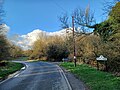 Belton-in-Rutland 01.jpg 4,000 × 3,000; 4.7 MB
-
 Belton-in-Rutland 02.jpg 4,000 × 3,000; 4.53 MB
-
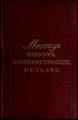 Handbook for travellers in Northamptonshire and Rutland .. (IA handbookfortrave00john 16).pdf 729 × 1,122, 362 pages; 33.19 MB

