Category:Handsacre
English: Handsacre is a village in Staffordshire, England. It is adjacent to the larger village of Armitage.
village in Staffordshire, United Kingdom  | |||||
| Upload media | |||||
| Instance of | |||||
|---|---|---|---|---|---|
| Location | Armitage with Handsacre, Lichfield, Staffordshire, West Midlands, England | ||||
 | |||||
Subcategories
This category has the following 2 subcategories, out of 2 total.
H
- High Bridge, Mavesyn Ridware (8 F)
T
- The Crown Inn, Handsacre (8 F)
Media in category "Handsacre"
The following 68 files are in this category, out of 68 total.
-
 A513, Handsacre - geograph.org.uk - 804679.jpg 640 × 480; 72 KB
-
 A513, Handsacre - geograph.org.uk - 804685.jpg 640 × 480; 59 KB
-
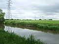 Canal and pylons - geograph.org.uk - 436701.jpg 640 × 480; 63 KB
-
 Canalside houses, Handsacre - geograph.org.uk - 5857939.jpg 1,024 × 768; 162 KB
-
 Canalside housing at Handsacre in Staffordshire - geograph.org.uk - 6011455.jpg 1,600 × 900; 1.39 MB
-
 Cygnets at Handsacre in Staffordshire - geograph.org.uk - 6010512.jpg 960 × 1,280; 1.72 MB
-
 Cygnets at Handsacre in Staffordshire - geograph.org.uk - 6010514.jpg 1,280 × 960; 1.77 MB
-
 Dusk on the canal at Handsacre in Staffordshire - geograph.org.uk - 6011278.jpg 1,280 × 1,280; 1.41 MB
-
 Dusk on the canal at Handsacre in Staffordshire - geograph.org.uk - 6011288.jpg 1,440 × 960; 1.07 MB
-

-
 Farmland east of Handsacre, Staffordshire - geograph.org.uk - 5141490.jpg 1,600 × 1,035; 1.64 MB
-
 Farmland east of Handsacre, Staffordshire - geograph.org.uk - 5141514.jpg 1,440 × 928; 1.6 MB
-
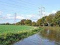
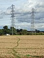 Farmland with pylons east of Handsacre, Staffordshire - geograph.org.uk - 5141501.jpg 1,080 × 1,440; 1.73 MB
-
 Handsacre Methodist Church - geograph.org.uk - 204068.jpg 640 × 480; 84 KB
-
 Handsacre Methodist Church - geograph.org.uk - 4141354.jpg 640 × 427; 74 KB
-
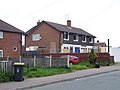
 Houses on Lichfield Road, Handsacre - geograph.org.uk - 5332946.jpg 640 × 480; 78 KB
-
 Housing and businesses near Handsacre, Staffordshire - geograph.org.uk - 5362810.jpg 1,600 × 878; 1.05 MB
-

-
 Michael's Fish Bar in Handsacre, Staffordshire - geograph.org.uk - 6010755.jpg 1,440 × 960; 1.56 MB
-
 Narrow boat - geograph.org.uk - 436705.jpg 640 × 480; 107 KB
-
 New Housing Complex, Handsacre - geograph.org.uk - 2482807.jpg 640 × 428; 67 KB
-
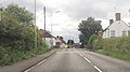 Over bridge into Handsacre - geograph.org.uk - 3013869.jpg 640 × 355; 57 KB
-

-
 Rail engineering works at Handsacre - geograph.org.uk - 298861.jpg 640 × 480; 102 KB
-
 Recent canalside housing at Handsacre, Staffordshire - geograph.org.uk - 1937641.jpg 1,042 × 1,440; 1.61 MB
-
 Rugeley Power Station at sunset, Staffordshire - geograph.org.uk - 5141542.jpg 1,280 × 911; 856 KB
-
 Shops, Tuppenhurst Lane, Handsacre - geograph.org.uk - 804671.jpg 640 × 480; 67 KB
-
-
 Sunset seen from Handsacre, Staffordshire - geograph.org.uk - 5141537.jpg 1,280 × 960; 1.09 MB
-

-

-
 The Crown Inn at Handsacre in Staffordshire - geograph.org.uk - 6010751.jpg 1,280 × 960; 1.27 MB
-
 The Green in Handsacre, Staffordshire - geograph.org.uk - 6010806.jpg 1,440 × 960; 1.71 MB
-
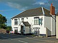
 The Old Peculiar, Handsacre - geograph.org.uk - 804682.jpg 640 × 480; 62 KB
-
 The Olde Peculiar (pub sign) in Handsacre - geograph.org.uk - 6010816.jpg 960 × 1,280; 1.23 MB
-
 The Olde Peculiar - geograph.org.uk - 5566432.jpg 1,280 × 853; 255 KB
-
 The Olde Peculiar in Handsacre, Staffordshire - geograph.org.uk - 5362863.jpg 1,280 × 960; 1.09 MB
-
 The Olde Peculiar in Handsacre, Staffordshire - geograph.org.uk - 5363166.jpg 1,280 × 896; 1.17 MB
-
 The Olde Peculiar in Handsacre, Staffordshire - geograph.org.uk - 5363167.jpg 1,280 × 960; 931 KB
-
 The Olde Peculiar in Handsacre, Staffordshire - geograph.org.uk - 6010811.jpg 1,280 × 960; 1.52 MB
-
 The Olde Peculiar in Handsacre, Staffordshire - geograph.org.uk - 6010815.jpg 1,600 × 900; 1.47 MB
-
 The Olde Peculiar, Handsacre - geograph.org.uk - 5332936.jpg 640 × 480; 63 KB
-
 The Olde Peculiar, Handsacre with Armitage - geograph.org.uk - 4034504.jpg 3,488 × 2,616; 2.13 MB
-
 The Poplars, Handsacre - geograph.org.uk - 804668.jpg 640 × 480; 63 KB
-
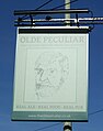
 The sign of The Olde Peculiar - geograph.org.uk - 5566440.jpg 853 × 1,280; 243 KB
-

-

-

-
-

-
-
 Trent and Mersey Canal east of Handsacre, Staffordshire - geograph.org.uk - 1936841.jpg 1,280 × 1,064; 1.41 MB
-
 Trent and Mersey Canal east of Handsacre, Staffordshire - geograph.org.uk - 1936842.jpg 1,440 × 1,024; 1.58 MB
-

-

-

-
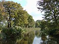
 Trent and Mersey Canal near Handsacre, Staffordshire - geograph.org.uk - 5363180.jpg 1,280 × 816; 1.03 MB
-
 Trent and Mersey canal near Tuppenhurst - geograph.org.uk - 298918.jpg 640 × 480; 144 KB
-
 Trent ^ Mersey Canal and towpath near Handsacre - geograph.org.uk - 4552677.jpg 1,024 × 768; 360 KB
-
 Trent ^ Mersey Canal at Handsacre - geograph.org.uk - 4554001.jpg 1,024 × 697; 204 KB
-
 Trent ^ Mersey Canal in Handsacre - geograph.org.uk - 4554005.jpg 1,024 × 772; 241 KB
-
 Trent ^ Mersey Canal, Handsacre - geograph.org.uk - 3609881.jpg 1,280 × 856; 230 KB
-
 Trent ^ Mersey Canal, Handsacre - geograph.org.uk - 3609985.jpg 1,280 × 856; 347 KB
-
 Trent ^ Mersey Canal, Handsacre - geograph.org.uk - 3609989.jpg 1,280 × 856; 239 KB
-
 Trent ^ Mersey Canal, Handsacre - geograph.org.uk - 5332927.jpg 640 × 480; 81 KB
-
 View from Canal Bridge, Handsacre - geograph.org.uk - 804687.jpg 640 × 480; 79 KB
-
 WCML passing through Handsacre - geograph.org.uk - 3662185.jpg 640 × 430; 53 KB
-
 Yellow Flag Iris - geograph.org.uk - 440940.jpg 480 × 640; 77 KB


_at_Handsacre_in_Staffordshire_-_geograph.org.uk_-_6010819.jpg)


_in_Handsacre_-_geograph.org.uk_-_6010816.jpg)


