Category:Haslemere
town in Surrey, England  | |||||
| Upload media | |||||
| Instance of | |||||
|---|---|---|---|---|---|
| Location | Waverley, Surrey, South East England, England | ||||
| Population |
| ||||
| Area |
| ||||
| Said to be the same as | Haslemere (Wikimedia duplicated page, civil parish) | ||||
| official website | |||||
 | |||||
Subcategories
This category has the following 17 subcategories, out of 17 total.
- History of Haslemere (8 F)
- Buses in Haslemere (3 F)
B
C
G
H
- Haslemere Town Well (16 F)
K
L
- Lodge to Lythe Hill House (6 F)
M
- Maps of Haslemere (2 F)
S
Media in category "Haslemere"
The following 200 files are in this category, out of 1,488 total.
(previous page) (next page)-
 "Fleur de Lys" - geograph.org.uk - 1203595.jpg 640 × 371; 58 KB
-
 "Have a Butcher's" - geograph.org.uk - 5272988.jpg 2,560 × 1,920; 3.01 MB
-
 "Rotten" former pub in Petworth Road - geograph.org.uk - 6431511.jpg 640 × 480; 51 KB
-
 10 High Street and Half Moon House, Haslemere - geograph.org.uk - 3799885.jpg 3,264 × 2,448; 1.84 MB
-
 2016, a year on Geograph (Day 14) - geograph.org.uk - 4792611.jpg 640 × 480; 49 KB
-
 2016, a year on Geograph (Day 206) - geograph.org.uk - 5048197.jpg 480 × 640; 66 KB
-
 2016, a year on Geograph (Day 243) - geograph.org.uk - 5096138.jpg 640 × 480; 61 KB
-
 2016, a year on Geograph (Day 258) - geograph.org.uk - 5117200.jpg 640 × 480; 132 KB
-
 2016, a year on Geograph (Day 264) - geograph.org.uk - 5123778.jpg 640 × 480; 98 KB
-
 2016, a year on Geograph (Day 267) - geograph.org.uk - 5127671.jpg 640 × 480; 66 KB
-
 2016, a year on Geograph (Day 274) - geograph.org.uk - 5138197.jpg 640 × 480; 83 KB
-
 2016, a year on Geograph (Day 282) - geograph.org.uk - 5146725.jpg 640 × 480; 73 KB
-
 2016, a year on Geograph (Day 285) - geograph.org.uk - 5151717.jpg 640 × 480; 96 KB
-
 2016, a year on Geograph (Day 289) - geograph.org.uk - 5154731.jpg 640 × 480; 60 KB
-
 2016, a year on Geograph (Day 296) - geograph.org.uk - 5163803.jpg 640 × 480; 35 KB
-
 2016, a year on Geograph (Day 305) - geograph.org.uk - 5176190.jpg 640 × 480; 112 KB
-
 2016, a year on Geograph (Day 312) - geograph.org.uk - 5185026.jpg 640 × 480; 57 KB
-
 2016, a year on Geograph (Day 327) - geograph.org.uk - 5202336.jpg 640 × 480; 64 KB
-
 2016, a year on Geograph (Day 332) - geograph.org.uk - 5206702.jpg 640 × 480; 109 KB
-
 2016, a year on Geograph (Day 334) - geograph.org.uk - 5209834.jpg 640 × 480; 42 KB
-
 2016, a year on Geograph (Day 338) - geograph.org.uk - 5213750.jpg 640 × 480; 107 KB
-
 2016, a year on Geograph (Day 342) - geograph.org.uk - 5221098.jpg 480 × 640; 57 KB
-
 2016, a year on Geograph (Day 345) - geograph.org.uk - 5221590.jpg 640 × 480; 29 KB
-
 2016, a year on Geograph (Day 346) - geograph.org.uk - 5231766.jpg 640 × 480; 22 KB
-
 2016, a year on Geograph (Day 358) - geograph.org.uk - 5233948.jpg 640 × 480; 50 KB
-
 2016, a year on Geograph (Day 359) - geograph.org.uk - 5233949.jpg 640 × 480; 60 KB
-
 2016, a year on Geograph (Day 360) - geograph.org.uk - 5234491.jpg 640 × 480; 71 KB
-
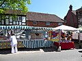
 2018 Haslemere Charter Fair (a) - geograph.org.uk - 5764954.jpg 640 × 480; 90 KB
-
 2018 Haslemere Charter Fair (b) - geograph.org.uk - 5764977.jpg 640 × 480; 77 KB
-
 2018 Haslemere Charter Fair (c) - geograph.org.uk - 5764979.jpg 640 × 480; 80 KB
-
 2018 Haslemere Charter Fair (d) - geograph.org.uk - 5764981.jpg 640 × 480; 105 KB
-
 2018 Haslemere Charter Fair (e) - geograph.org.uk - 5766794.jpg 640 × 480; 89 KB
-
 2018 Haslemere Charter Fair (f) - geograph.org.uk - 5766795.jpg 640 × 480; 94 KB
-
 2018 Haslemere Charter Fair (g) - geograph.org.uk - 5766797.jpg 640 × 480; 103 KB
-
 2018 Haslemere Charter Fair (h) - geograph.org.uk - 5766799.jpg 640 × 480; 111 KB
-
 2018 Haslemere Charter Fair (i) - geograph.org.uk - 5767917.jpg 640 × 480; 97 KB
-
 2018 Haslemere Charter Fair (j) - geograph.org.uk - 5767918.jpg 640 × 480; 100 KB
-
 2018 Haslemere Charter Fair (k) - geograph.org.uk - 5767920.jpg 640 × 480; 107 KB
-
 2018 Haslemere Charter Fair (l) - geograph.org.uk - 5767924.jpg 640 × 480; 98 KB
-
 2018 Haslemere Charter Fair (m) - geograph.org.uk - 5770585.jpg 640 × 480; 97 KB
-
 2018 Haslemere Charter Fair (n) - geograph.org.uk - 5770588.jpg 640 × 480; 105 KB
-
 2018 Haslemere Charter Fair (o) - geograph.org.uk - 5770590.jpg 640 × 472; 70 KB
-
 2018 Haslemere Charter Fair (p) - geograph.org.uk - 5770592.jpg 640 × 480; 96 KB
-
 2018 Haslemere Charter Fair (q) - geograph.org.uk - 5770594.jpg 640 × 480; 80 KB
-
 2018 Haslemere Charter Fair (r) - geograph.org.uk - 5770595.jpg 640 × 480; 113 KB
-
 2018 Haslemere Charter Fair (s) - geograph.org.uk - 5770598.jpg 640 × 480; 85 KB
-
 2018 Haslemere Charter Fair (t) - geograph.org.uk - 5770599.jpg 640 × 480; 72 KB
-
 2018 Haslemere Charter Fair (u) - geograph.org.uk - 5770601.jpg 640 × 480; 112 KB
-
 2018 Haslemere Charter Fair (v) - geograph.org.uk - 5770603.jpg 640 × 480; 94 KB
-
 2018 Haslemere Charter Fair (w) - geograph.org.uk - 5770605.jpg 640 × 480; 84 KB
-
 2018 Haslemere Charter Fair (x) - geograph.org.uk - 5770614.jpg 640 × 480; 114 KB
-
 2018 Haslemere Charter Fair (y) - geograph.org.uk - 5770617.jpg 640 × 480; 80 KB
-
 2018 Haslemere Charter Fair (z) - geograph.org.uk - 5770622.jpg 640 × 480; 99 KB
-
 2019 Haslemere Classic Car Show (a) - geograph.org.uk - 6165744.jpg 640 × 480; 94 KB
-
 2019 Haslemere Classic Car Show (b) - geograph.org.uk - 6165746.jpg 480 × 640; 87 KB
-
 2019 Haslemere Classic Car Show (c) - geograph.org.uk - 6165747.jpg 640 × 502; 103 KB
-
 2019 Haslemere Classic Car Show (d) - geograph.org.uk - 6165749.jpg 640 × 480; 91 KB
-
 2019 Haslemere Classic Car Show (e) - geograph.org.uk - 6165751.jpg 640 × 480; 99 KB
-
 2019 Haslemere Classic Car Show (f) - geograph.org.uk - 6165752.jpg 640 × 480; 101 KB
-
 2019 Haslemere Classic Car Show (g) - geograph.org.uk - 6165757.jpg 640 × 480; 93 KB
-
 2020 vision, Day 100 - geograph.org.uk - 6437139.jpg 640 × 480; 61 KB
-
 2020 vision, Day 101 - geograph.org.uk - 6438321.jpg 640 × 480; 79 KB
-
 2020 vision, Day 102 - geograph.org.uk - 6439247.jpg 480 × 640; 43 KB
-
 2020 vision, Day 103 - geograph.org.uk - 6440400.jpg 480 × 640; 106 KB
-
 2020 vision, Day 21 - geograph.org.uk - 6372870.jpg 640 × 480; 45 KB
-
 2020 vision, Day 39 - geograph.org.uk - 6386864.jpg 640 × 480; 66 KB
-
 2020 vision, Day 40 - geograph.org.uk - 6387428.jpg 640 × 480; 43 KB
-
 2020 vision, Day 5 - geograph.org.uk - 6360862.jpg 640 × 480; 39 KB
-
 2020 vision, Day 6 - geograph.org.uk - 6361726.jpg 640 × 480; 96 KB
-
 2020 vision, Day 62 - geograph.org.uk - 6403933.jpg 640 × 480; 50 KB
-
 2020 vision, Day 64 - geograph.org.uk - 6404800.jpg 640 × 480; 52 KB
-
 2020 vision, Day 67 - geograph.org.uk - 6406782.jpg 640 × 480; 61 KB
-
 2020 vision, Day 71 - geograph.org.uk - 6412110.jpg 640 × 480; 51 KB
-
 2020 vision, Day 73 - geograph.org.uk - 6414236.jpg 640 × 480; 52 KB
-
 2020 vision, Day 80 - geograph.org.uk - 6418558.jpg 640 × 480; 87 KB
-
 2020 vision, Day 81 - geograph.org.uk - 6419201.jpg 480 × 640; 149 KB
-
 2020 vision, Day 82 - geograph.org.uk - 6419930.jpg 640 × 480; 74 KB
-
 2020 vision, Day 83 - geograph.org.uk - 6421153.jpg 480 × 640; 87 KB
-
 2020 vision, Day 84 - geograph.org.uk - 6422113.jpg 640 × 480; 114 KB
-
 2020 vision, Day 85 - geograph.org.uk - 6423591.jpg 640 × 480; 77 KB
-
 2020 vision, Day 86 - geograph.org.uk - 6424242.jpg 640 × 480; 93 KB
-
 2020 vision, Day 87 - geograph.org.uk - 6425169.jpg 640 × 480; 63 KB
-
 2020 vision, Day 89 - geograph.org.uk - 6427345.jpg 640 × 480; 120 KB
-
 2020 vision, Day 90 - geograph.org.uk - 6428292.jpg 480 × 640; 128 KB
-
 2020 vision, Day 91 - geograph.org.uk - 6429509.jpg 640 × 480; 52 KB
-
 2020 vision, Day 92 - geograph.org.uk - 6430354.jpg 640 × 480; 63 KB
-
 2020 vision, Day 93 - geograph.org.uk - 6431123.jpg 640 × 480; 44 KB
-
 2020 vision, Day 94 - geograph.org.uk - 6431662.jpg 480 × 640; 118 KB
-
 2020 vision, Day 95 - geograph.org.uk - 6432767.jpg 640 × 480; 79 KB
-
 2020 vision, Day 96 - geograph.org.uk - 6433943.jpg 640 × 480; 95 KB
-
 2020 vision, Day 97 - geograph.org.uk - 6434442.jpg 480 × 640; 58 KB
-
 2020 vision, Day 98 - geograph.org.uk - 6435748.jpg 640 × 480; 119 KB
-
 2020 vision, Day 99 - geograph.org.uk - 6436570.jpg 640 × 480; 46 KB
-
 3 The Wells Haslemere - geograph.org.uk - 3895534.jpg 1,366 × 1,024; 389 KB
-
 A bench with a view overlooking Coombe Head - geograph.org.uk - 1841459.jpg 2,976 × 3,968; 3.11 MB
-
 A Canal Scene by Philip Norman.jpg 4,471 × 2,500; 913 KB
-

-
 A hairpin walk around Keffolds (a) - geograph.org.uk - 6434574.jpg 640 × 480; 123 KB
-
 A hairpin walk around Keffolds (b) - geograph.org.uk - 6434582.jpg 640 × 480; 104 KB
-
 A hairpin walk around Keffolds (c) - geograph.org.uk - 6434596.jpg 640 × 480; 122 KB
-
 A hairpin walk around Keffolds (m) - geograph.org.uk - 6434686.jpg 640 × 480; 153 KB
-
 A hairpin walk around Keffolds (n) - geograph.org.uk - 6434690.jpg 640 × 480; 149 KB
-
 A hairpin walk around Keffolds (o) - geograph.org.uk - 6434698.jpg 480 × 640; 117 KB
-
 A hairpin walk around Keffolds (p) - geograph.org.uk - 6434822.jpg 640 × 480; 125 KB
-
 A leafy lane (Kingswood Lane) - geograph.org.uk - 2056823.jpg 640 × 430; 191 KB
-

-
 A Robin's Lunch - geograph.org.uk - 2957549.jpg 4,849 × 3,200; 6.57 MB
-
 A splash on Holdfast Lane - geograph.org.uk - 3038513.jpg 640 × 480; 145 KB
-
 A286 at Scotland Lane - geograph.org.uk - 3125372.jpg 640 × 480; 131 KB
-
 A286, Haslemere - geograph.org.uk - 5658285.jpg 640 × 426; 63 KB
-
 A286, Shepherd's Hill - geograph.org.uk - 5658276.jpg 640 × 426; 103 KB
-
 A286, Shepherd's Hill - geograph.org.uk - 5658284.jpg 640 × 426; 82 KB
-
 A287 - geograph.org.uk - 2740850.jpg 640 × 430; 96 KB
-
 A287 - geograph.org.uk - 2740851.jpg 640 × 430; 94 KB
-
 A287 at Beacon Hill - geograph.org.uk - 3125767.jpg 640 × 480; 51 KB
-
 A287 at Nutcombe Lane - geograph.org.uk - 3125389.jpg 640 × 480; 125 KB
-
 A287 near Tyndall's Wood - geograph.org.uk - 3125757.jpg 640 × 480; 97 KB
-
 A287 Sturt Road on the southern edge of Haslemere - geograph.org.uk - 3685725.jpg 3,264 × 2,448; 4.63 MB
-
 A287. Camelsdale - geograph.org.uk - 2512495.jpg 640 × 430; 59 KB
-
 A3 approaching the Hindhead Tunnel - geograph.org.uk - 4260972.jpg 640 × 378; 33 KB
-
 A3 at Hindhead - geograph.org.uk - 3911457.jpg 3,264 × 2,448; 1.63 MB
-
 A3 embankment - geograph.org.uk - 2211157.jpg 640 × 398; 189 KB
-
 A3 embankment - geograph.org.uk - 2211160.jpg 640 × 427; 184 KB
-
 A3 entering Hindhead - geograph.org.uk - 2062382.jpg 640 × 430; 172 KB
-
 A3 Hindhead - geograph.org.uk - 5888487.jpg 3,456 × 2,592; 3.34 MB
-
 A3 near Hindhead - geograph.org.uk - 4785920.jpg 1,600 × 1,200; 665 KB
-
 A3 northbound - geograph.org.uk - 3102223.jpg 640 × 480; 59 KB
-
 A3 northbound - geograph.org.uk - 3102225.jpg 640 × 480; 38 KB
-
 A3 northbound - geograph.org.uk - 3102235.jpg 640 × 471; 53 KB
-
 A3 northbound - geograph.org.uk - 3102239.jpg 640 × 480; 46 KB
-
 A3 northbound - geograph.org.uk - 3102245.jpg 640 × 480; 53 KB
-
 A3 northbound, Hindhead tunnel - geograph.org.uk - 3102251.jpg 640 × 480; 62 KB
-
 A3 northbound, Hindhead tunnel - geograph.org.uk - 3102271.jpg 640 × 480; 35 KB
-
 A3, A287 junction, Hindhead - geograph.org.uk - 2062423.jpg 640 × 430; 154 KB
-
 A3, B3002 junction - geograph.org.uk - 2062375.jpg 640 × 430; 163 KB
-

-
 Access to Frensham Hall Farm - geograph.org.uk - 2085715.jpg 640 × 430; 125 KB
-
 Access to the A3 - geograph.org.uk - 2793112.jpg 640 × 425; 196 KB
-
 Acident in Haslemere town centre - geograph.org.uk - 5183603.jpg 640 × 480; 59 KB
-
 Across the Valley - geograph.org.uk - 2957573.jpg 3,180 × 2,120; 5.44 MB
-
 Aldershot bound bus in Lower Street - geograph.org.uk - 6431618.jpg 640 × 480; 48 KB
-

-
 Almshouse Common - geograph.org.uk - 2493771.jpg 4,000 × 3,000; 3.56 MB
-
 Alpaca encounter - geograph.org.uk - 5719588.jpg 2,741 × 2,058; 3.31 MB
-
 Alpacas with a view - geograph.org.uk - 2860939.jpg 4,000 × 3,000; 3.34 MB
-
 Ambulance in Tanners Lane - geograph.org.uk - 6041481.jpg 640 × 480; 60 KB
-

-

-

-

-

-

-

-

-

-

-

-

-

-

-

-

-

-
 Ancient milestone on the Grayswood Road - geograph.org.uk - 6429315.jpg 480 × 640; 150 KB
-
 And the band played on^ - geograph.org.uk - 6165754.jpg 640 × 480; 104 KB
-

-
 Approaching a bend in Stoatley Rise - geograph.org.uk - 6436777.jpg 640 × 480; 57 KB
-
 Approaching a bend in Wispers Lane - geograph.org.uk - 6438360.jpg 640 × 480; 134 KB
-

-
 Approaching a wall in Stoatley Hollow - geograph.org.uk - 6436800.jpg 480 × 640; 106 KB
-

-
 Approaching Hindhead tunnel - geograph.org.uk - 2795615.jpg 640 × 438; 51 KB
-
 Approaching Hindhead tunnel - geograph.org.uk - 2795616.jpg 640 × 411; 58 KB
-

-

-

-

-
 Approaching the new Hindhead Tunnel - geograph.org.uk - 2545320.jpg 800 × 501; 75 KB
-
 Autumn colours, alley off Bunch Lane, Haslemere.jpg 3,864 × 5,152; 4.47 MB
-
 Autumn in Parsons Close - geograph.org.uk - 1518766.jpg 640 × 480; 104 KB
-
 Autumn in Parsons Green - geograph.org.uk - 1518744.jpg 640 × 480; 78 KB
-
-
 B2131 approaching the A287 at Camelsdale - geograph.org.uk - 3685716.jpg 3,264 × 2,448; 4.81 MB
-
 B2131 nearing the A286 at Haslemere - geograph.org.uk - 2492102.jpg 4,000 × 3,000; 3.4 MB
-
 Baa, He's Making Eyes at Me - geograph.org.uk - 2854228.jpg 4,288 × 3,216; 3.28 MB
-
 Back of Half Moon House - geograph.org.uk - 3896007.jpg 975 × 869; 149 KB
-
 Barn, Sturt Farm - geograph.org.uk - 2512158.jpg 640 × 430; 70 KB
-
 Beacon Hill Road - geograph.org.uk - 5670868.jpg 1,600 × 1,045; 351 KB
-
 Belted Galloways - geograph.org.uk - 5273010.jpg 2,560 × 1,920; 3.78 MB
-
 Bend in Fieldway - geograph.org.uk - 6431567.jpg 640 × 480; 46 KB
-
 Bend in Highercombe Road - geograph.org.uk - 6429231.jpg 640 × 480; 53 KB
-
 Bend in Tilford Road - geograph.org.uk - 932486.jpg 640 × 480; 102 KB
-
 Bend, Nutcombe Lane - geograph.org.uk - 2080377.jpg 640 × 430; 175 KB
-
 Bernay House - geograph.org.uk - 2613485.jpg 640 × 430; 79 KB
-
 Bin day in Chatsworth Avenue - geograph.org.uk - 6041428.jpg 640 × 480; 49 KB
-
 Black Hole of Beacon Hill - geograph.org.uk - 2854141.jpg 4,288 × 3,216; 3.45 MB
-
 Blocked bridleway at Nutcombe - geograph.org.uk - 1160800.jpg 640 × 360; 109 KB
-
 Boarden Door Bottom National Trust sign.jpg 3,096 × 4,128; 6.38 MB
-
 Boarden Hall Bottom - geograph.org.uk - 5238244.jpg 4,000 × 2,666; 7.53 MB
-
 Boundary of Sturt Road and Bell Road - geograph.org.uk - 6185215.jpg 640 × 480; 80 KB


_-_geograph.org.uk_-_4792611.jpg)
_-_geograph.org.uk_-_5048197.jpg)
_-_geograph.org.uk_-_5096138.jpg)
_-_geograph.org.uk_-_5117200.jpg)
_-_geograph.org.uk_-_5123778.jpg)
_-_geograph.org.uk_-_5127671.jpg)
_-_geograph.org.uk_-_5138197.jpg)
_-_geograph.org.uk_-_5146725.jpg)
_-_geograph.org.uk_-_5151717.jpg)
_-_geograph.org.uk_-_5154731.jpg)
_-_geograph.org.uk_-_5163803.jpg)
_-_geograph.org.uk_-_5176190.jpg)
_-_geograph.org.uk_-_5185026.jpg)
_-_geograph.org.uk_-_5202336.jpg)
_-_geograph.org.uk_-_5206702.jpg)
_-_geograph.org.uk_-_5209834.jpg)
_-_geograph.org.uk_-_5213750.jpg)
_-_geograph.org.uk_-_5221098.jpg)
_-_geograph.org.uk_-_5221590.jpg)
_-_geograph.org.uk_-_5231766.jpg)
_-_geograph.org.uk_-_5233948.jpg)
_-_geograph.org.uk_-_5233949.jpg)
_-_geograph.org.uk_-_5234491.jpg)
_-_geograph.org.uk_-_5764954.jpg)
_-_geograph.org.uk_-_5764977.jpg)
_-_geograph.org.uk_-_5764979.jpg)
_-_geograph.org.uk_-_5764981.jpg)
_-_geograph.org.uk_-_5766794.jpg)
_-_geograph.org.uk_-_5766795.jpg)
_-_geograph.org.uk_-_5766797.jpg)
_-_geograph.org.uk_-_5766799.jpg)
_-_geograph.org.uk_-_5767917.jpg)
_-_geograph.org.uk_-_5767918.jpg)
_-_geograph.org.uk_-_5767920.jpg)
_-_geograph.org.uk_-_5767924.jpg)
_-_geograph.org.uk_-_5770585.jpg)
_-_geograph.org.uk_-_5770588.jpg)
_-_geograph.org.uk_-_5770590.jpg)
_-_geograph.org.uk_-_5770592.jpg)
_-_geograph.org.uk_-_5770594.jpg)
_-_geograph.org.uk_-_5770595.jpg)
_-_geograph.org.uk_-_5770598.jpg)
_-_geograph.org.uk_-_5770599.jpg)
_-_geograph.org.uk_-_5770601.jpg)
_-_geograph.org.uk_-_5770603.jpg)
_-_geograph.org.uk_-_5770605.jpg)
_-_geograph.org.uk_-_5770614.jpg)
_-_geograph.org.uk_-_5770617.jpg)
_-_geograph.org.uk_-_5770622.jpg)
_-_geograph.org.uk_-_6165744.jpg)
_-_geograph.org.uk_-_6165746.jpg)
_-_geograph.org.uk_-_6165747.jpg)
_-_geograph.org.uk_-_6165749.jpg)
_-_geograph.org.uk_-_6165751.jpg)
_-_geograph.org.uk_-_6165752.jpg)
_-_geograph.org.uk_-_6165757.jpg)


_-_geograph.org.uk_-_6434574.jpg)
_-_geograph.org.uk_-_6434582.jpg)
_-_geograph.org.uk_-_6434596.jpg)
_-_geograph.org.uk_-_6434686.jpg)
_-_geograph.org.uk_-_6434690.jpg)
_-_geograph.org.uk_-_6434698.jpg)
_-_geograph.org.uk_-_6434822.jpg)
_-_geograph.org.uk_-_2056823.jpg)


_-_A_Sheepfold,_Haslemere_-_NG_1481_-_National_Galleries_of_Scotland.jpg)


_-_geograph.org.uk_-_6172657.jpg)
_-_geograph.org.uk_-_6174362.jpg)
_-_geograph.org.uk_-_6175792.jpg)
_-_geograph.org.uk_-_6175794.jpg)
_-_geograph.org.uk_-_6175795.jpg)
_-_geograph.org.uk_-_6175797.jpg)
_-_geograph.org.uk_-_6175798.jpg)
_-_geograph.org.uk_-_6175799.jpg)
_-_geograph.org.uk_-_6175800.jpg)
_-_geograph.org.uk_-_6172662.jpg)
_-_geograph.org.uk_-_6174300.jpg)
_-_geograph.org.uk_-_6174350.jpg)
_-_geograph.org.uk_-_6174351.jpg)
_-_geograph.org.uk_-_6174354.jpg)
_-_geograph.org.uk_-_6174357.jpg)
_-_geograph.org.uk_-_6174359.jpg)
_-_geograph.org.uk_-_6174360.jpg)


