Category:Hervormde Kerk, Scharwoude
| Object location | | View all coordinates using: OpenStreetMap |
|---|
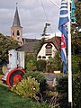
church building in Koggenland, Netherlands  | |||||
| Upload media | |||||
| Instance of | |||||
|---|---|---|---|---|---|
| Location | Scharwoude, Koggenland, North Holland, Netherlands | ||||
| Street address |
| ||||
| Located on street |
| ||||
| Heritage designation |
| ||||
| Religion or worldview | |||||
 | |||||
Inventaris:
|
This is a category about rijksmonument number 38773
|
Kerktoren:
|
This is a category about rijksmonument number 38774
|
| Address |
|
Media in category "Hervormde Kerk, Scharwoude"
The following 9 files are in this category, out of 9 total.
-
 Exterieur - Scharwoude - 20195336 - RCE.jpg 886 × 1,200; 226 KB
-
 Hervormde kerk, Scharwoude.JPG 2,592 × 3,888; 2.7 MB
-
 Interieur naar de preekstoel - Scharwoude - 20195339 - RCE.jpg 960 × 1,200; 212 KB
-
 Interieur naar de torenwand - Scharwoude - 20195340 - RCE.jpg 960 × 1,200; 182 KB
-
 Scharwoude, kerk foto3 2010-06-05 15.16.JPG 2,592 × 3,456; 5.94 MB
-
 Scharwoude.jpg 2,736 × 3,648; 891 KB
-
 Toren hervormde kerk, Scharwoude 01.JPG 2,592 × 3,888; 3.46 MB
-
 Toren hervormde kerk, Scharwoude 02.JPG 2,592 × 3,888; 3.36 MB
-
 Toren van de herv. kerk in Scharwoude, N-H.JPG 768 × 1,024; 297 KB


