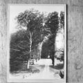
Category:Hilverbeek
| Object location | | View all coordinates using: OpenStreetMap |
|---|
| Upload media | |||||
| Instance of | |||||
|---|---|---|---|---|---|
| Part of | |||||
| Location | 's-Graveland, North Holland, Netherlands | ||||
| Street address |
| ||||
| Located on street |
| ||||
| Owned by |
| ||||
| Occupant |
| ||||
| Heritage designation |
| ||||
 | |||||
|
This is a category about rijksmonumentcomplex number 523475
|
Landhuis
|
This is a category about rijksmonument number 523476
|
Historische aanleg
|
This is a category about rijksmonument number 523706
|
Tuinmanswoning
|
This is a category about rijksmonument number 523707
|
Brug met toegangshek
|
This is a category about rijksmonument number 523816
|
Neogotische Brug
|
This is a category about rijksmonument number 524070
|
Koetshuis annex oranjerie
|
This is a category about rijksmonument number 524071
|
IJskelder
|
This is a category about rijksmonument number 524072
|
Boerderij (Leeuwenlaan 13)
|
This is a category about rijksmonument number 524073
|
boerderijtje (Noordereinde 2)
|
This is a category about rijksmonument number 524074
|
| Address |
|
Subcategories
This category has the following 3 subcategories, out of 3 total.
Media in category "Hilverbeek"
The following 41 files are in this category, out of 41 total.
-
's-Graveland Leeuwenlaan 9 op landgoed Hilverbeek noordzijde.jpg 2,448 × 3,264; 2.84 MB
-
's-Graveland Leeuwenlaan 9 op landgoed Hilverbeek.jpg 2,448 × 3,264; 3.12 MB
-
Achtergevel ca. 1905, Collectie Six - 's-Graveland - 20084331 - RCE.jpg 3,415 × 2,244; 1.98 MB
-
Achtergevel voor 1900 ?, Collectie Six - 's-Graveland - 20084330 - RCE.jpg 3,415 × 2,244; 1.85 MB
-
Achterzijde - 's-Graveland - 20084554 - RCE.jpg 3,321 × 2,210; 1.04 MB
-
Buitenhuizen Diversen - 's-Graveland - 20084506 - RCE.jpg 1,200 × 991; 351 KB
-
Eik Hilverbeek.jpg 617 × 421; 39 KB
-
Exterieur LINKER ZIJGEVEL - 's-Graveland - 20301609 - RCE.jpg 1,192 × 1,200; 437 KB
-
Exterieur OVERZICHT ACHTERGEVEL - 's-Graveland - 20301610 - RCE.jpg 1,192 × 1,200; 262 KB
-
Exterieur OVERZICHT VOORGEVEL, RECHTER ZIJGEVEL - 's-Graveland - 20301606 - RCE.jpg 1,192 × 1,200; 340 KB
-
Exterieur RECHTER ZIJGEVEL - 's-Graveland - 20301607 - RCE.jpg 1,200 × 1,192; 464 KB
-
Exterieur VOORGEVEL, LINKER ZIJGEVEL - 's-Graveland - 20301608 - RCE.jpg 1,197 × 1,200; 376 KB
-
Hilverbeek (3) - WLM 2011 - ednl.jpg 3,648 × 2,736; 3.34 MB
-
Hilverbeek (Leeuwenlaan, 's Graveland).jpg 1,280 × 853; 516 KB
-
INTERIEUR, AQUAREL - 's-Graveland - 20299972 - RCE.jpg 1,188 × 1,200; 268 KB
-
INTERIEUR, SCHILDERIJ - 's-Graveland - 20299973 - RCE.jpg 1,192 × 1,200; 315 KB
-
Overzicht bij voorplein ca.1920, Collectie Six - 's-Graveland - 20084334 - RCE.jpg 1,195 × 1,200; 381 KB
-
Overzicht, 1951, fotoalbum van Tienhoven, - 's-Graveland - 20084344 - RCE.jpg 1,200 × 1,192; 329 KB
-
S-Graveland in 1636.jpg 350 × 480; 124 KB
-
S-Graveland, Hilverbeek hist aanleg park RM523706.jpg 3,672 × 2,768; 10.26 MB
-
S-Graveland, Hilverbeek landhuis RM523476 (1).jpg 3,648 × 2,736; 3.7 MB
-
S-Graveland, Hilverbeek landhuis RM523476 (2).jpg 3,648 × 2,736; 3.14 MB
-
S-Graveland, Hilverbeek landhuis RM523476 (3).jpg 2,736 × 3,648; 4.1 MB
-
Uitbouw - 's-Graveland - 20084556 - RCE.jpg 1,200 × 809; 151 KB
-
Voorzijde - 's-Graveland - 20084553 - RCE.jpg 1,200 × 808; 176 KB


