Category:Hohnekirche, Soest
| Object location | | View all coordinates using: OpenStreetMap |
|---|
church  | |||||
| Upload media | |||||
| Instance of | |||||
|---|---|---|---|---|---|
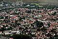
| Location | Soest, Arnsberg Government Region, North Rhine-Westphalia, Germany | ||||
| Architectural style | |||||
 | |||||
Subcategories
This category has the following 3 subcategories, out of 3 total.
Pages in category "Hohnekirche, Soest"
This category contains only the following page.
Media in category "Hohnekirche, Soest"
The following 101 files are in this category, out of 101 total.
-
 12th century unknown painters - The Virgin Enthroned - WGA19727.jpg 1,131 × 770; 172 KB
-

-
 Grundriss Kirche Maria zur Höhe Soest.jpg 1,454 × 981; 302 KB
-
 Kirche Maria zur Höhe Soest, Grundriss.jpg 1,054 × 812; 202 KB
-
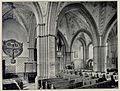 Kirche Maria zur Höhe Soest, Innenansicht nach Nordwesten.jpg 1,699 × 1,287; 702 KB
-
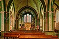
 Kirche Maria zur Höhe Soest, Innenansicht nach Osten.jpg 1,683 × 1,452; 828 KB
-
 Kirche Maria zur Höhe Soest, Längsschnitt nach Süden.jpg 997 × 743; 173 KB
-
 Kirche Maria zur Höhe Soest, Nordseite.jpg 1,018 × 742; 158 KB
-
 Kirche Maria zur Höhe Soest, Ostseite.jpg 838 × 1,086; 172 KB
-
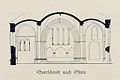 Kirche Maria zur Höhe Soest, Querschnitt nach Osten.jpg 858 × 574; 115 KB
-
 Kirche Maria zur Höhe Soest, Querschnitt nach Westen.jpg 808 × 562; 100 KB
-
 Kirche Maria zur Höhe Soest, Südseite.jpg 1,036 × 748; 155 KB
-
 Kirche St. Maria zur Höhe Soest 20220608 0054.jpg 5,622 × 3,741; 21.32 MB
-
 Kirche St. Maria zur Höhe Soest 20220608 0055.jpg 5,498 × 3,658; 22.54 MB
-
 Kirche St. Maria zur Höhe Soest 20220608 0056.jpg 5,701 × 3,793; 25.44 MB
-
 Kirche St. Maria zur Höhe Soest 20220608 0057.jpg 3,815 × 5,734; 21.63 MB
-
 Kirche St. Maria zur Höhe Soest 20220608 0058.jpg 5,680 × 3,779; 20.38 MB
-
 Kirche St. Maria zur Höhe Soest 20220608 0059.jpg 3,748 × 5,634; 20.81 MB
-
 Kirche St. Maria zur Höhe Soest 20220608 0060.jpg 3,748 × 5,634; 18.51 MB
-
 Kirche St. Maria zur Höhe Soest 20220608 0061.jpg 5,734 × 3,815; 18.29 MB
-
 Kirche St. Maria zur Höhe Soest 20220608 0062.jpg 3,632 × 5,459; 21.25 MB
-
 Kirche St. Maria zur Höhe Soest 20220608 0063.jpg 3,554 × 5,341; 18.6 MB
-
 Kirche St. Maria zur Höhe Soest 20220608 0064.jpg 3,748 × 5,634; 22.38 MB
-
 Kirche St. Maria zur Höhe Soest 20220608 0065.jpg 3,815 × 5,734; 20.44 MB
-
 Kirche St. Maria zur Höhe Soest 20220608 0066.jpg 3,815 × 5,734; 26.19 MB
-
 Kirche St. Maria zur Höhe Soest 20220608 0067.jpg 3,815 × 5,734; 22 MB
-
 Kirche St. Maria zur Höhe Soest 20220608 0068.jpg 5,734 × 3,815; 22.13 MB
-
 Kirche St. Maria zur Höhe Soest 20220608 0069.jpg 3,815 × 5,734; 20.41 MB
-
 Kirche St. Maria zur Höhe Soest 20220608 0070.jpg 5,734 × 3,815; 23.97 MB
-
 Kirche St. Maria zur Höhe Soest 20220608 0071.jpg 3,815 × 5,734; 24.55 MB
-
 Kirche St. Maria zur Höhe Soest 20220608 0072.jpg 3,815 × 5,734; 24.1 MB
-
 Kirche St. Maria zur Höhe Soest 20220608 0073.jpg 3,815 × 5,734; 23.19 MB
-
 Kirche St. Maria zur Höhe Soest 20220608 0074.jpg 5,734 × 3,815; 23.87 MB
-
 Kirche St. Maria zur Höhe Soest 20220608 0075.jpg 5,734 × 3,815; 25.17 MB
-
 Kirche St. Maria zur Höhe Soest 20220608 0076.jpg 5,734 × 3,815; 23.82 MB
-
 Kirche St. Maria zur Höhe Soest 20220608 0077.jpg 3,815 × 5,734; 22.41 MB
-
 Kirche St. Maria zur Höhe Soest 20220608 0078.jpg 5,734 × 3,815; 23.75 MB
-
 Kirche St. Maria zur Höhe Soest 20220608 0079.jpg 3,533 × 6,619; 25.57 MB
-
 Kirche St. Maria zur Höhe Soest 20220608 0080.jpg 3,815 × 5,734; 25.35 MB
-
 Kirche St. Maria zur Höhe Soest 20220608 0081.jpg 5,734 × 3,815; 22 MB
-
 Kirche St. Maria zur Höhe Soest 20220608 0082.jpg 5,734 × 3,815; 23.59 MB
-
 Kirche St. Maria zur Höhe Soest 20220608 0083.jpg 5,734 × 3,815; 25.01 MB
-
 Kirche St. Maria zur Höhe Soest 20220608 0084.jpg 3,815 × 5,734; 22.91 MB
-
 Kirche St. Maria zur Höhe Soest 20220608 0085.jpg 5,734 × 3,815; 22.05 MB
-
 Kirche St. Maria zur Höhe Soest 20220608 0086.jpg 3,825 × 5,749; 23.78 MB
-
 Kirche St. Maria zur Höhe Soest 20220608 0087.jpg 5,857 × 3,897; 25.36 MB
-
 Kirche St. Maria zur Höhe Soest 20220608 0088.jpg 3,785 × 5,689; 20.61 MB
-
 Kirche St. Maria zur Höhe Soest 20220608 0089.jpg 5,734 × 3,815; 23.54 MB
-
 Kirche St. Maria zur Höhe Soest 20220608 0090.jpg 3,905 × 5,870; 20.85 MB
-
 Kirche St. Maria zur Höhe Soest 20220608 0091.jpg 5,868 × 3,904; 22.44 MB
-
 Kirche St. Maria zur Höhe Soest 20220608 0092.jpg 5,623 × 3,741; 21.79 MB
-
 Kirche St. Maria zur Höhe Soest 20220608 0093.jpg 3,815 × 5,734; 29.01 MB
-
 Kirche St. Maria zur Höhe Soest 20220608 0094.jpg 3,815 × 5,734; 26.55 MB
-
 Kirche St. Maria zur Höhe Soest 20220608 0095.jpg 3,815 × 5,734; 29.73 MB
-
 Kirche St. Maria zur Höhe Soest 20220608 0096.jpg 3,903 × 5,866; 31.79 MB
-
 Kirche St. Maria zur Höhe Soest 20220608 0097.jpg 3,947 × 5,932; 28.95 MB
-
 Kirche St. Maria zur Höhe Soest 20220608 0098.jpg 3,705 × 5,569; 18.49 MB
-
 Kirche St. Maria zur Höhe Soest 20220608 0099.jpg 5,667 × 3,770; 27.18 MB
-
 Kirche St. Maria zur Höhe Soest 20220608 0100.jpg 5,549 × 4,334; 25.89 MB
-
 Kirche St. Maria zur Höhe Soest 20220608 0101.jpg 3,748 × 5,634; 19.62 MB
-
 Lichteinfall St. Maria zur Höhe Soest.jpg 3,456 × 4,608; 2.74 MB
-
 Soest (Germany). Hohnekirche (15919716407).jpg 3,000 × 4,000; 5.11 MB
-
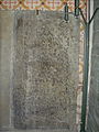
 Soest - Hohnekirche - Grabplatte.jpg 3,256 × 5,312; 7.08 MB
-
 Soest Innenstadt FFSN-450.jpg 1,771 × 1,178; 3.34 MB
-
 Soest Mar.zur Höhe fd (10).JPG 4,320 × 3,240; 5.25 MB
-
 Soest Mar.zur Höhe fd (11).JPG 3,240 × 4,320; 4.19 MB
-
 Soest Mar.zur Höhe fd (12).JPG 4,320 × 3,240; 4.34 MB
-
 Soest Mar.zur Höhe fd (3).JPG 2,560 × 1,920; 1.34 MB
-
 Soest Mar.zur Höhe fd (4).JPG 1,920 × 2,560; 1.12 MB
-
 Soest Mar.zur Höhe fd (6).JPG 4,320 × 3,240; 4.94 MB
-
 Soest Mar.zur Höhe fd (7).JPG 4,320 × 3,240; 4.79 MB
-
 Soest Mar.zur Höhe fd (8).JPG 3,240 × 4,320; 4.71 MB
-
 Soest Mar.zur Höhe fd (9).JPG 4,320 × 3,240; 4.26 MB
-
 Soest Maria zur Hoehe altar.jpg 4,032 × 3,024; 5.33 MB
-
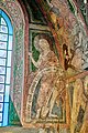
 Soest Maria zur Hoehe choir painting.jpg 4,032 × 3,024; 5.53 MB
-
 Soest Maria zur Hoehe choir window.jpg 1,500 × 2,500; 1.52 MB
-
 Soest Marienkrankenhaus FFSN-420.jpg 1,771 × 1,179; 3.22 MB
-
 Soest, Maria zur Höhe, Altarraum, Detail.jpg 3,000 × 4,000; 4.66 MB
-
 Soest, Maria zur Höhe, Altarraum.jpg 4,000 × 3,000; 4.28 MB
-
 Soest, Maria zur Höhe, Altartafel, Foto von 1903.jpg 572 × 489; 116 KB
-
 Soest, Maria zur Höhe, Deckengewölbe Altarraum.jpg 4,000 × 3,000; 3.79 MB
-
 Soest, Maria zur Höhe, Grabnische Front.jpg 4,000 × 3,000; 4.56 MB
-
 Soest, Maria zur Höhe, Grabnische Links.jpg 3,000 × 4,000; 3.88 MB
-
 Soest, Maria zur Höhe, Grabnische oben.jpg 4,000 × 3,000; 4.12 MB
-
 Soest, Maria zur Höhe, Grabnische Rechts.jpg 3,000 × 4,000; 4.02 MB
-
 Soest, Maria zur Höhe, Grabnische, Foto von 1903.jpg 535 × 626; 203 KB
-
 Soest, Maria zur Höhe, Grabnische.jpg 3,000 × 4,000; 3.88 MB
-
 Soest, Maria zur Höhe, Hauptportal Südfront.jpg 3,000 × 4,000; 3.84 MB
-
 Soest, Maria zur Höhe, Information.JPG 2,976 × 3,968; 4.4 MB
-

-
 Soest, Maria zur Höhe, Innenansicht nach Osten, Foto von etwa 1903.jpg 671 × 562; 203 KB
-

-
 Soest, Maria zur Höhe, Innenansicht nach Westen, Foto von etwa 1903.jpg 675 × 554; 179 KB
-
 Soest, Maria zur Höhe, Malereien 2 in der Grabnische, Foto von 1903.jpg 377 × 773; 184 KB
-
 Soest, Maria zur Höhe, Malereien im Chor, Foto von 1903.jpg 469 × 724; 227 KB
-
 Soest, Maria zur Höhe, Malereien im Chor2, Foto von 1903.jpg 718 × 543; 272 KB
-
 Soest, Maria zur Höhe, Wandmalerei Südseite.jpg 3,000 × 4,000; 4.92 MB
-
 Soest-090816-9890-Parkplatz.jpg 3,872 × 2,592; 6.25 MB
-
 St. Maria zur Höhe in der Stadt Soest im Kreis Soest in Nordrhein-Westfalen.jpg 3,872 × 2,592; 3.32 MB
-
 St. Maria zur Höhe Soest Innenraum.jpg 2,548 × 1,698; 3.47 MB
-


._Hohnekirche_(15919716407).jpg)


.JPG)
.JPG)
.JPG)
.JPG)
.JPG)
.JPG)
.JPG)
.JPG)
.JPG)


